Category Archives: Salt Lake County

Journal of Orson Pratt

Published / by Grace Fahey / Leave a Comment

Pratt, Orson, “Interesting Items Concerning the Journeying of the Latter-day Saints from the City of Nauvoo, Until Their Location in the Valley of the Great Salt Lake (Extracted from the Private Journal of Orson Pratt),”

 July 21st. No frost this morning, but a heavy dew. We resumed our journey, travelled 2 1/2 miles, and ascended a mountain for 1 1/2 miles; descended upon the west side one mile; came upon a swift running creek, where we halted for noon: we called this Last Creek. Brother Erastus Snow (having overtaken our camp from the other camp, which he said was but a few miles in the rear,) and myself proceeded in advance of the camp down Last Creek 4 1/2 miles, to where it passes through a kanyon and issues into the broad open valley below. To avoid the kanyon the wagons last season had passed over an exceedingly steep and dangerous hill. Mr. Snow and myself ascended this hill, from the top of which a broad open valley, about 20 miles wide and 30 long, lay stretched out before us, at the north end of which the broad waters of the Great Salt Lake glistened in the sunbeams, containing high mountainous islands from 25 to 30 miles in extent. After issuing from the mountains among which we had been shut up for many days, and beholding in a moment such an extensive scenery open before us, we could not refrain from a shout of joy which almost involuntarily escaped from our lips the moment this grand and lovely scenery was within our view. We immediately descended very gradually into the lower parts of the valley, and although we had but one horse between us, yet we traversed a circuit of about 12 miles before we left the valley to return to our camp, which we found encamped 1 1/2 miles up the ravine from the valley, and 3 miles in advance of their noon halt. It was about 9 o’clock in the evening when we got into camp. The main body of the pioneers who were in the rear were encamped only 1 1/2 mile up the creek from us, with the exception of some wagons containing some who were sick, who were still behind.

July 22nd. This morning George A. Smith and myself, accompanied by seven others, rode into the valley to explore, leaving the camp to follow on and work the road, which here required considerable labour, for we found that the kanyon at the entrance of the valley, by cutting out the thick timber and underbrush, connected with some spading and digging, could be made far more preferable than the route over the steep hill mentioned above. We accordingly left a written note to that effect, and passed on. After going down into the valley about 5 miles, we turned our course to the north, down towards the Salt Lake. For 3 or 4 miles north we found the soil of a most excellent quality. Streams from the mountains and springs were very abundant, the water excellent, and generally with gravel bottoms. A great variety of green grass, and very luxuriant, covered the bottoms for miles where the soil was sufficiently damp, but in other places, although the soil was good, yet the grass had nearly dried up for want of moisture. We found the drier places swarming with very large crickets, about the size of a man’s thumb. This valley is surrounded with mountains, except on the north: the tops of some of the highest being covered with snow. Every 1 or 2 miles streams were emptying into it from the mountains on the east, many of which were sufficiently large to carry mills and other machinery. As we proceeded towards the Salt Lake the soil began to assume a more sterile appearance, being probably at some season of the year overflowed with water. We found as we proceeded on, great numbers of hot springs issuing from near the base of the mountains. These springs were highly impregnated with salt and sulphur: the temperature of some was nearly raised to the boiling point. We travelled for about 15 miles down after coming into the valley, the latter parts of the distance the soil being unfit for agricultural purposes. We returned and found our wagons encamped in the valley, about 5 1/4 miles from where they left the kanyon.

Source: Orson Pratt, “Interesting Items Concerning the Journeying of the Latter-day Saints from the City of Nauvoo, Until Their Location in the Valley of the Great Salt Lake (Extracted from the Private Journal of Orson Pratt),” digital copy, LDS Church History Library.

see: Big Mountain 

Dudler’s Inn and Dudler’s Wine Cellar

Published / by Brandon Gilligan / 2 Comments on Dudler’s Inn and Dudler’s Wine Cellar

Write-up by Brandon Gilligan

Dudler’s Inn Historical Marker placed by: Canyon Rim Chapter, Sons of Utah Pioneers

Dudler’s Wine Cellar Historical Marker placed by: Jordan River Temple Chapter, Sons of Utah Pioneers

GPS Coordinates: 40º42’40 N 111º48’21 W

Dudler’s Inn Historical Marker text:

Perhaps one of the longest living and prominent residents of the area known as Parley’s Hallow, now officially Parley’s Historic Nature Preserve, was Joseph Dudler. About 1864, he settled in this location. Here he built his home. It was two stories, thirty-six by fifty-six feet in size, with rock foundation walls, the narrow front facing south, and the rest of the first floor dug into the side of the valley. The remains of the rock wall, east of the still existing foundation stones of the original building, is a continuation of the front wall of the lower floor of his Inn. The story above was frame with vertical siding, and it was here that the “Rooms To Let,” dining, and kitchen spaces were provided.

As business improved, in 1870, he built a brewery to the rear and west of the Inn. To provide further for this, he built an addition to the Inn itself, continuing the rock foundations further north sixteen feet with an adobe instead of frame upper story. In addition, he continued the lower floor north, only four feet further in the ground, with what has been called the “Wine Cellar.” Still there, it was a rock-walled room, underground, about fifteen-and-a-half feet wide and twenty feet long with ten-foot high, domed, rock ceiling. It is an ideal place for keeping things cool.

His irrigation water supply was brought to the site in a ditch from Parley’s Canyon Creek, but for drinking water he used a spring on the property northeast of the Inn location which is still flowing.

Dudler operated a saloon or two in town as well as the Inn, and in 1892, added a similar business in Park City where he also continued in the brewing and saloon business. He kept the farm and brewery area going in Parley’s Hallow until his death in October of 1897. His descendants continued using the Inn as a residence, referring to it as the “homestead” until it was destroyed by fire, the work of vandals, the night of the 17th of October, 1952.

Dudler’s Wine Cellar Historical Marker text:

Early in 1870, Joseph Dudler, owner and operator of the Inn which was on the ground level of his house, built a brewery in back of his house here in Parley’s Hallow. To Provide for this, in addition to the brewery proper, located on adjacent property west and north of the Inn, he extended his entire earlier building sixteen feet further into the north side of the valley. To this extension he added what came to be known as the wine cellar. He built this rock-walled, underground cellar for a store room as well as storage for the products of his brewery. The walls and roof of the cellar, which still retain their structural integrity, average two-and-one-half feet thick and the walls were ten-feet high. The labor expended to excavate the basement, the cellar, and to erect the two-and-one-half story building of the house and inn, would have been a tremendous task. There were no backhoes, front-end loaders, no dump trucks or cranes in those days to help in the construction; just back-breaking, muscle-straining, hard work. The structure of the cellar was so well designed that over a half-century later, when crews came to clean up what was left of the burned-out building, this stone work that comprises the cellar, supported the weight of the “Cat” when the ground was leveled.

Just to the west and a little bit north of the cellar was a tall brick chimney on the north end of a small frame building which was the brewery proper. This chimney remained for many years having outlasted the frame brewery building, but it too has long since fallen to the ravages of time as did the brewery building itself much earlier. Joe Dudler was a carpenter by trade and a brewer by profession and the following years would prove his proficiency at both.

When Joe first set up his first brewery at this location, he called it the Philadelphia Brewery. He sold his products not only at the inn, but also a little later at his Philadelphia Brewery Saloon in downtown Salt Lake City. His inn was also known for a time as Dudler’s Summer Resort and simply as Dudler’s Saloon.

In the early 1900’s his son Frank and daughter Retta ran the saloon at Parley’s Hollow while their father set up a saloon and ran his famous business in Park City. Joseph Dudler died in 1897.

Extended Research:

Joseph Dudler

Joseph Dudler and his family settled in Parley’s Canyon in Salt Lake City, Utah in 1864 after moving from Appleton, Wisconsin. Upon arrival he began to build a home in Parley’s Canyon. Joseph was a carpenter by training and was very capable in building and crafting. Parley’s Canyon was a highly trafficked area for travelers going to or through Salt Lake City. Dudler quickly took advantage of the potential business opportunity and between 1865 and 1870 he added to his home an additional story, as well as a large brewery and a cellar to house the products of the brewery. The brewery was capable of producing approximately 900 barrels of beer in a year. This would have made Dudler’s brewery on this site among the largest in Utah in the 1860’s. The addition to the home allowed for a saloon in the basement and rooms for let. Dudler’s Inn was often referred to as Dudler’s Saloon or Dudler’s Summer Resort. The supply of beer produced by the brewery quickly outgrew the small basement saloon and in 1870 Dudler opened the Philadelphia Brewery Saloon on 200 South Street in Salt Lake City. There were probably two other saloons at various times in Salt Lake City that Dudler operated. In 1884, Dudler opened another successful saloon in Park City called the California Brewery Saloon. The brewery in Parley’s Canyon continued operation until Joseph’s death in 1897. In the years before his death, Dudler attempted another brewery and saloon business in Vernal, Utah. This was an unsuccessful and short lived endeavor.

Loretta Schaer

After Joseph Dudler’s death, his son Ron and daughter Loretta ran the the saloon in Parley’s Canyon. After the turn of the century commercial operations on the site ceased. The land soon became the primary residence of Loretta Dudler Schaer and her husband Harold Schaer, who were married in 1907. Loretta, often called Retty or Mary, suffered from depression and anxiety. These conditions were exasperated after the death of her second son, Charles, who died at the age of 19 months. At this time there were few effective treatments for such disorders. Loretta’s older son moved away to make his own life, and her husband had abandoned her by 1918. Loretta struggled with poverty and depression on the land in Parley’s Canyon for the next 34 years. She did prove to have a keen legal mind and was able to keep control of the land in the face of water rights disputes, tax difficulties, and various other problems with the local government. The home became increasingly isolated. Loretta’s odd behavior and isolation earned her the titles of Crazy Mary, and Parley’s Witch. The home fell into disrepair in the 1940’s and was subjected to theft and vandalism. In 1952, the entire structure was burned by vandals. Loretta died five years later at the age of 80.

After the fire, a demolition crew came to clear the debris. The cellar was too well constructed to be easily removed and was left. The stone walls of the basement and the cellar remain. Descendants of Joseph Dudler owned some of the land until 1982 when the remaining nine acres were sold to the city of Salt Lake. The area now called Parley’s Hallow or Parley’s Historic Nature Preserve is currently used for recreation. A bicycle path runs right past the ruins of Dudler’s Inn. The bulk of the canyon is used as an off leash dog area with hiking trails along the creek. There are three other historical markers near the Dudler’s Inn site in Parley’s Canyon,

For Further Reference:

Primary Sources:

Minutes of the Great Salt Lake City Council Meetings, August 9, 1870.

“Local News.” Deseret News, September 2, 1885.

“Dudler Case on Trial.” Deseret Evening News. February 14, 1899.

“Mrs. Dudler Wins in Water Suit.” Deseret Evening News. April 1, 1899.

Secondary Sources:

Fluehe, Richard. Dudler’s of Parley’s Canyon: A History. Salt Lake City: Utah State Historical Society, 1990.

Vance, Del. Beer in the Beehive: A history of brewing in Utah. Great Salt Lake City: Dream Garden Press, 2006.

Youngberg, Florence C. Parley’s Hallow: Gateway to the Valley. Salt Lake City: Custom Printing Inc. and Graphic Design, 1991.

First Settlers of Holladay

Published / by Scott Shields / 1 Comment on First Settlers of Holladay

Write-up by Scott Shields

Placed by:  Holladay Chapter, National Society Sons of Utah Pioneers, No. 65

GPS Coordinates: 40 ° 39”56” N 111 ° 49’17” W

Historical Marker Text:

John. D. Holladay, a leader of the Mississippi Company of Mormon Pioneers entered the Salt Lake Valley on July 29, 1947.

John Holladay’s group explored the valley of the Great Salt Lake and its tributary canyons with an eye towards irrigation, wild hay for their animals, and water power for mills.  Most of the Mississippi Company stayed together and by fall had planned their farms and community in the area of a free-flowing, spring-fed stream issuing from the base of Mt. Olympus.  Thus the village of Spring Creek, as the stream was then called, was the first to be established away from Great Salt Lake City itself.

As soon as John Holladay was named the Branch President, the village took upon itself the name of Holladay’s settlement or Holladay’s Burgh.

In February of 1849 the first surveyed plots of land were issued to the settlers.

Historical Marker Text (2): Original Land Owners

Historical Marker Text (3):  Original Lot locations


 Historical Marker Address:  4778 Holladay Boulevard (west side)

Extended Research:

Sometime in the spring of 1848, the very first Holladay settlers-to-be came to this area and established a community. The location was soon called Holladay’s Burgh after its founding pioneer captain, John D. Holladay.   The name was later shortened to Holladay.  One member of the original group of settlers was William Decatur Kartchner, born in Pennsylvania and later a resident of Illinois.  He wrote in his journal: “Spring arrived; we were to farm as we had traveled, by tens, fifties, and hundreds. The land our ten drew was on a high bench six miles southeast of the city and our captain, John Holladay Sr. He asked permission from his captain to locate three miles further south at a large spring. It was granted, and soon we moved out there, built a row of small houses and fenced a field.”  1 These “ten” that William referred to were members of the Mississippi Company of Pioneers that had traveled together to Salt Lake City.

For these new settlers, life in this area was hard in those early years.  Despite mental toughness, hard work and cleverness, hunger was common.  William Kartchner wrote what it was like that first 1848 spring and summer in Holladay:  “During this time our breadstuff gave out. We had our last ox killed, an old favorite of mine. I could not kill it myself, it would be like killing one of my family.”2   His neighbor took pity on him and killed it for him but it was “poor beef” and William had to boil it with thistle roots to make it better.

Sharing food was a way of life in order for the group to survive.  William only brought a “few kernels of corn” with him across the plains so he waited until May to plant them.  He planted Spanish corn kernels which sprouted, grew and produced enough corn to make enough flour for “sufficient bread for three families.”  He also planted wheat which grew and he was able to share with the group captain and his family.   When Brother Holladay came to William and asked ‘Brother William, what under heavens are we to do for bread?   William pointed to his ripening wheat and replied “there is bread”.  Hunger served to remind William of how critical farming became in this desert environment.  He wrote:  “At that time I had not tasted of bread or any substance of grain for nearly two months.”3

Despite the hard won survival of the first few years, most of these original settlers did not stay long.  It was not because they did not like the area but because of another call for settlers to move to California.  In order to spread out and create new settlements, LDS church leadership asked for church members to establish a community in California.  The promise of a warmer climate interested many Southerners – including John D. Holladay.  So in the spring of 1851, just three years after arriving in Holladay, many of the original Mississippi group of ten and others packed up and traveled 700 miles to San Bernardino. 4

About these Mississippi Mormons who were the first settlers of Holladay, The historian Leonard Arrington offered this assessment :  “Intelligent and resourceful, [the] southern women accomplished miracles in establishing homes and rearing their families. . . . Mostly small landowners, stockmen, and frontiersmen, [the men]…became Brigham Young’s trusted associates in managing men and resources for the development of Mormon settlements”. 5

Primary Source:

  1. William Kartchner, Journal in Kate B. Carter, Our Pioneer Heritage, vol 2  (Salt Lake City: Daughters of Utah Pioneers, Utah Printing Company, 1959), 443.
  2. Carter, Our Pioneer, 444.
  3. Ibid.

Secondary Sources:

  1. http://mormontrails.org/Tours/Holladay/Background.htm
  2. Leonard J. Arrington, “Mississippi Mormons,”  Ensign, June 1977, 46.

Holladay Historical Commission Papers, Official minutes, correspondence, and other papers from the work of the Commission, Includes information on historical sites and landmarks 2000-2001, Marriott Library Special Collections, University of Utah, Salt Lake City, Utah.

Elizabeth Newman Hutchinson, Holladay, Salt Lake County, Utah, 1971, Marriott Library Special Collections, University of Utah, Salt Lake City, Utah.

For further reference:

  1. Journal History, July 29, 1847, LDS Church Historical Department.
  2. “Manuscript History of the Big Cottonwood Ward,” LDS Church Historical Department.
  3. William E. Parrish, “The Mississippi Saints,“ In The Historian: A Journal of History, 50:489, August 1988.

Chief Wasatch

Published / by Zak Erickson / Leave a Comment

Placed by: Mayor Larell D. Muir and Park and Operation Superintends Lynn F. Pett and Bill D. Crocker

GPS Coordinates:  40°39’37.7748”N 111°53’16.7136”W

Historical Marker Text

“Chief Wasatch”

To raise the nation’s conscience to the plight of the first American so they won’t be forgotten, but will be remembered in our minds and in our hearts.  This statue is sculpted out of a giant cottonwood tree in honor of Utah Native Americans – Southern and Northern Ute, Sothern Shoshone, Goshutes, Paiute, and Navajo.  Creator Peter “Wolf” Toth, is sculpturing statues for all 50 states.

Dedicated: November 23, 1985

Mayor: Larell D. Muir

Park & Operation Superintendents: Lynn F. Pett and Bill D. Crocker

Extended Research:

In 1985, the mayor of Murray, Utah, Larell D. Muir, commissioned Peter “Wolf” Toth to sculpt a statue of “Chief Wasatch”. It continues to greet visitors at the entrance of Murray Park to this day. The statue may prompt people to think that “Chief Wasatch” was a great leader of one of the Native American tribes in Utah. However, this was not the case; in fact, “Chief Wasatch” was not an actual person. The statue was not created to honor a specific individual, but rather to honor the many Native Americans who lived in Utah long before fur traders, explores, and Euro-American settlers came to Utah. In this regard, “Chief Wasatch” stands in for all Utah Native Americans and represents their history and legacy.

There is not much known about the earliest Native American inhabitants of Utah.  This is because they did not have a written language and did not come into contact with groups that did. The little bit that we do know is from artifacts such as worn sandals, food caches, stone houses, silk weed nets, and even human droppings[1].  After the Desert Archaic, the Fremont Indians made the transition out of caves and started to build their own shelters.  They also learned how to farm but it is not known where they learned this skill.  With farming, they also started to build granaries to protect what they grew[2].  They would build several homes and granaries near each other to create a sort of village. This marked a transition from a nomadic lifestyle to a more stationary one.  The Fremont also spread throughout the region until there were  many different  Fremont sites across the area that would become Utah.

The Fremont were eventually displaced by or absorbed by the Ute, Goshute, Shoshone, and Southern Paiute. Each of these tribes thought that the land they lived on was sacred and that their God intended for them to live there. Creation narratives instilled in tribal members a sacred connection between the land and the people. With this in mind, it is easier to understand why there was sometimes tension between the Ute, Goshute, Southern Paiute, Shoshone and the Mormon pioneers. Mormon settlers came into the Great Basin and built homes and communities on lands that the Native Americans considered sacred.  This tension lead to many conflicts and sadly the eventual removal of the Native Americans to reservations.

It is because of this removal that Mayor Larell D. Muir arranged for a sculpture of “Chief Wasatch” at Murray Park. Muir wanted to honor and make sure that Utah’s Native Americans would not be forgotten.  Now when people enter Murray Park or drive past the park on State Street they can see “Chief Wasatch” and remember the Native Americans of Utah.

[1] Dean L. May, Utah: A People’s History (Salt Lake City: University of Utah Press, 1987), 12.

[2] May, 14.

For Further Reference:

Primary Source:

Acts, Resolutions, and Memorials, Passed by the First Annual, and Special Sessions, of the Legislative Assembly of the Territory of Utah, Begun and held at Great Salt Lake City, on the 22nd day of September, A. D., 1851(Great Salt Lake City, Utah Territory: Brigham H. Young, Printer, 1852), 91-93.

Secondary Sources:

Clifford Duncan, “The Northern Utes of Utah,” in A History of Utah’s American Indians, ed.

Forrest S. Cuch, (Salt Lake City:  Utah Division of Indian Affairs and Utah Division of State History, 2000), 167-8.

“The Deseret News.” Google News Archive Search. Accessed April 19, 2017. https://news.google.com/newspapers safe=strict&nid=336&dat=19851112&id=a9lUAAAAIBAJ&sjid=8oMDAAAAIBAJ&pg=4787%2C6022654&hl=en.

Iverson, Kristen. “Living History: How the giant Chief Wasatch came to Murray Park.” The Salt Lake Tribune. September 22, 2011. Accessed April 19, 2017. http://archive.sltrib.com/story.php?ref=%2Fsltrib%2Fnews%2F52624885-78%2Ftoth-murray-chief-park.html.csp.

May, Dean L. “Man and Desert.” Utah: A People’s History. Salt Lake City: U of Utah Press,

  1. 1-19.

Thomas G. Alexander, Utah, The Right Place:  The Official Centennial History (Salt Lake City:

Gibbs Smith Publisher, 1995), 29-30.

W.Paul Reeve, Making Space on the Western Frontier:  Mormons, Miners, and Southern

Paiutes (Urbana and Chicago:  University of Illinois Press, 2006), 12.

Lone Cedar Tree

Published / by Sam Florence / Leave a Comment

By Sam Florence

Placed By: Daughters of Utah Pioneers, 1930.

Latitude/Longitude: 40.7625˚N, 111.873889˚ W

Plaque A: “LONE CEDAR TREE Although willows grew along the banks of the streams a Lone Cedar Tree near this spot became Utah’s first famous landmark. Someone in a moment of thoughtlessness cut it down, leaving only the stump which is a part of this monument. ‘In the glory of my prime I was the pioneer’s friend.’”

Plaque B: “THE CEDAR TREE SHRINE Erected July 24, 1933 by Daughters of Salt Lake County The street to the north was originally Emigration Road- the only approach from the east. Over this road the pioneers of 1847 and subsequent years entered the valley of the Great Salt Sea. They found growing near this site a lone cedar and paused beneath its shade. Songs were sung and prayers of gratitude offered by those early pilgrims. Later the cedar tree became a meeting place for the loggers going to the canyons. Children played beneath its branches. Lovers made it a trysting place. Because of its friendly influence on the lives of these early men and women we dedicate this site to their memory.”

Extended Research: According to Utah lore, Mormon pioneers arrived in the summer of 1847 to find the Salt Lake valley completely devoid of trees, save for one cedar tree toward the very north end of the valley. This legend is indeed interesting, but the controversy surrounding the tree (which was likely a juniper tree rather than a cedar tree) that arose during the twentieth and twenty-first centuries are perhaps more intriguing than the remains of the tree itself.

From the outset, it seems highly unlikely that this tree was the only one in the valley; in an extract from letters written by John R. Young, pioneer of 1847, to his grandson, the former writes: “From our cabin in the mouth of City Creek canyon, in 1847, one could see a lone cedar tree on the plain southeast of us, and on the south fork of the creek, about where Main and Third South Streets intersect, stood seven, wind swept, scraggy cottonwood trees. On the north side of City Creek stood a large oak tree. No other trees were visible in the valley.”[1] Here it seems that while there may not have been many trees in the valley, there were at least a handful in the central area of what would become downtown Salt Lake City. The tree stood alive in its original spot, serving as a meeting place and welcome shelter from the high desert sun, until it eventually died and was moved to the middle of 600 East by the Daughters of Utah Pioneers in 1933. On July 4 of that year, the Daughters built a monument to the tree with a protective structure over it; the monument originally included a large portion of the trunk of the tree. Plaque B is the original plaque that was laid in 1933 by the Daughters. On September 21, 1958, vandals chopped down and stole a considerable portion of the tree from the monument, leaving only the stump of the Lone Cedar Tree remaining. The vandals were never found, and there was no extensive effort to search for the stolen remains of the tree.[2] In 1960, the existing memorial was expanded upon and plaque A was added to explain the vandalism and why there was a monument to a tree that didn’t really exist anymore.

Though the narrative of a lone cedar tree sheltering the pioneers and offering a signal from God that they had finally arrived at the right spot is compelling, the majority of available evidence suggests that the legend was fabricated. As mentioned above, several pioneers noted in journal entries the existence of other trees not just in the valley, but in the general vicinity of Lone Cedar tree. In his article “One Hundred Years at the Utah State Historical Society,” historian and author Gary Topping takes a critical view of the Lone Cedar tree myth, raising several points contradictory to some of the assertions made on the plaques at the location. Topping notes “it is botanically unreasonable, in view of the stands of box elder and cottonwood trees along modern stream banks, that only one lone juniper would have existed there in 1847.” He also remarks that if the tree had actually been the only one in the valley, it would have been a rather conspicuous place for ‘trysting lovers’ to meet.[3]

Topping also explores the consequences that belittling the Lone Cedar Tree myth had on the former director of the Utah Historical Society, Russ Mortensen. Shortly after the trunk of the tree was cut down by vandals, a Deseret News reporter phoned Mortensen to ask for his thoughts on the vandalism, then changed the tone of the conversation by asking if Mortensen believed that the tree was the only one in the valley in pioneer times. Mortensen sealed his fate by confidently responding “Hell no, do you?” The reporter responded by publishing an excoriating article about Mortensen, claiming that the tree “symbolized the willingness of the pioneers ‘to suffer, even to die, for the accomplishment of holy purposes,’ the editor added that the tree ‘represented kindness, shelter, hospitality—all given freely and withheld from none, redmen or white.’”[4] This excerpt seems to generally sum up the justifications provided for the myth of the Cedar Tree: regardless of the veracity of the myth, the tree is a symbol of pioneer heritage and proof that the Salt Lake valley was God’s chosen habitat for the Mormons.

We need not view the story of the tree as inscribed on the plaque as literal truth, but an idyllic metaphor for the hardships endured by the pioneers as they foraged their way out west. The original plaque laid by the Daughters of Utah Pioneers showcases the tree as a welcome reprieve from the hardships of pioneer life, and a meeting point where happy memories were made – and that is how the tree should be remembered.


[1] Young, John R. “Reminiscences of John R. Young.”

[2] Dates and account of vandalism from archive.sltrib.com

[3] Topping, Gary. “The Lone Cedar Tree Controversy.”

[4] Topping, Gary. “The Lone Cedar Tree Controversy.”


Secondary Sources

Jeffries, Paula N. “Monument to Lone Tree Keeps Memory of Pioneers Alive.” The Salt Lake   Tribune. N.p., 27 Oct. 2005. Web. 20 Feb. 2017. <http://archive.sltrib.com/article.php?   id=3157525&itype=NGPSID>.

Thayne, Dawna D. “My View: ‘Lone Cedar Tree’ Is Not a Myth.” DeseretNews.com. Deseret       News, 24 July 2006. Web. 20 Feb. 2017. <http://www.deseretnews.com/article/640196952/Lone-Cedar-Tree-is-not-a-myth.html>.

Topping, Gary. “The Lone Cedar Tree Controversy.” Utah Historical Quarterly 65, no. 3 (Summer 1997): 199-315. Accessed March 20, 2017. http://digitallibrary.utah.gov/awweb/awarchive?type=file&item=34957.

Primary Sources

Bullock, Thomas. “Bullock, Thomas, Journals 1843-1849, Fd. 1-4.” Mormon Pioneer Overland Travel (1849): n. pag. Church of Jesus Christ of Latter Day Saints. Web. 20 Feb. 2017. <https://history.lds.org/overlandtravel/sources/4546/bullock-thomas-journals-1843-1849-fd-1-4>.

Young, John R. “Reminiscences of John R. Young.” Utah Historical Quarterly 3, no. 3 (July 1930): 63-96. Accessed March 20, 2017. https://www.google.com/url?sa=t&rct=j&q=&esrc=s&source=web&cd=5&cad=rja&uact=8&ved=0ahUKEwiwtq7mjf3SAhVKz2MKHc2hBTUQFggvMAQ&url=http%3A%2F%2Futahhistory.sdlhost.com%2Fapi%2F000000009000017%2Fasset%2F000000011020147%2Foriginal%2Ffile&usg=AFQjCNFcw1eDZn2aKoM42NeKWE3ZO3YUwQ&sig2=VwUlpn_GWL-v4FbF4hiUcg.

Cathedral of the Madeleine

Published / by Stephanie Gladwin / Leave a Comment

Cathedral of the Madeleine

Write up and Photos by: Stephanie Gladwin


Historical Marker Transcription: Cathedral of the Madeleine: Begun the land purchase in 1889 dedicated 1909. Architects C.M. Neuhausen, B.O. Mecklenburg, John Comes. Built under leadership of Bishop Lawrence Scanlan with monies from the pius fund, mining philanthropists, and parishoners.

The Historical Marker was originally placed by: the Utah State Historical Society

Cathedral of the Madeleine Marker Coordinates: 

40.7696° N, 111.8817° W

Extended Research:

Land to build the Cathedral of the Madeleine was purchased in 1890 by Utah’s first Catholic Bishop, Lawrence Scanlan. Construction of the Cathedral started in 1900, was completed in 1909, and was dedicated the same year on August 16th.[1]

The Salt Lake Herald  covered the grand dedication of the Cathedral of St. Mary Magdalen. The Herald called the cathedral “One of the most magnificent Temples of Worship in the entire West” [2] and described it as a “Monument of the progress of the West and of America.” [3]

Bishop Lawrence Scanlan requested at the time of the dedication that the choir sing his favorite hymn, “Home Sweet Home,”[4] a song enjoyed by the thousands of parishioners who attended the grand event. At the time of the dedication, there were 10,000 Utah Catholics.[5]

Father Scanlan wanted the cathedral to serve many purposes. He thought it could serve as a home for Utah Catholics but also to serve as a representation that although Catholics in Utah were “small in number, [they] were rooted and powerful around the world.”[6] The Cathedral was double the size and cost than was originally planned. [7]  It was modeled after traditional Romanesque architecture on the exterior and Gothic on the interior. The traditional shape of the Cathedral represented the power of the Holy Roman Church throughout world history.[8]

Renaming of the Cathedral from St. Mary Magdalen to Madeleine came from Utah’s Second Bishop Joseph Glass, a very traditional Catholic. Glass had spent time in Europe before his death in 1926. He remodeled the interior of the Cathedral to better reflect the traditional Holy Roman Catholic Church, especially through art and interior design. He also renamed the Cathedral as the Cathedral of the Madeleine, with a French spelling to remind him of his time in France before his death.[9] Both Father Scanlan and Father Glass have been canonized within the Salt Lake City Catholic Diocese for their leadership on the construction of the Cathedral and the fiscal responsibility that came with it. They were not only able to pay off the debts of the Cathedral, but did so during the Great Depression.[10]

Since the Catholic community in Salt Lake City is still active in community affairs, it is important to not only recognize its historical importance in Utah but also the role that it plays in the 21st century. The Latino community is especially still impacted by the Catholic diocese and Cathedral today.[11] The Cathedral serves as a place for celebration, tradition, education, and culture for the growing Latino Community in Salt Lake City. The Salt Lake City Diocese served 291,000 Catholics in 2014.[12]

Since the 2008 U.S. presidential election, the Catholic leadership and Latter-day Saint leadership in Utah have worked hand in hand to promote a “moral” vision and maintain a conservative political stance. In a speech given by Chicago Bishop Frances George visiting Salt Lake City, he said,

“One of the high points of the centennial celebrations of the Catholic Cathedral of the Madeleine in Salt Lake City was the presence of LDS President Thomas S. Monson at a multi-faith service on August 10, 2009, honoring the cathedral’s civic engagements. At the service, President Monson spoke eloquently about the enduring friendships that Catholics and Latter-day Saints have forged by together serving the needs of the poor and the most troubled of society. Through such shared dedication, he noted, we will ‘eliminate the weakness of one standing alone and substitute, instead, the strength of many working together.’”[13]

This speaks to the modern relationship between the Catholic Community in the Latter-day Saint dominated state of Utah. The Cathedral still serves as a hub for Utah Catholicism and now functions as a place for public outreach and interfaith dialogue..

Footnotes:

[1] Productions, Third Sun, The Cathedral of the Madeleine: History of the Cathedral (Salt Lake City, Utah: Cathedral of the Madeleine,2013), 1.

 [2] “Dedication, St. Mary’s Cathedral,” Salt Lake Herald, August 16, 1909.

[3] “Dedication,” Salt Lake Herald, August 16, 1909.

[4] “Dedication,” Salt Lake Herald, August 16, 1909.

[5] Kristen Moulton, “Cathedral of the Madeleine: A Century of Faith Set in Stone” Salt Lake Tribune, August 7, 2009.

[6]  Moulton, “A Century of Faith Set in Stone.“

[7] Productions Third Sun, History of the Cathedral.

[8] Moulton, “A Century of Faith Set in Stone.”

[9] Moulton, “A Century of Faith Set in Stone.”

[10] Moulton, “A Century of Faith Set in Stone.”

[11] Productions Third Sun, History of the Cathedral.

[12] Productions Third Sun, History of the Cathedral.

[13] Francis George, “Catholics and Latter-Day Saints: Partners in the Defense of Religious Freedom” (Provo, UT: Brigham Young University Speeches, 2009-2010), 2.

Secondary Sources:

Primary Sources:

See http://utcotm.org/about/history#prettyPhoto image gallery for primary source photographs taken of the 1909 dedication.

Ensign Peak

Published / by Jake Bardsley / Leave a Comment

Ensign Peak

Write-up by Jake Bardsley

Placed by: Pioneer Trails and Assoc.

GPS Coordinates: 40.7944° N, 111.8905° W


Historical Marker Text (1): 

Plaque A: (on S. side of monument, replica of original PTLA 43) ENSIGN PEAK July 26, 1847, two days after the Mormon Pioneers entered this valley Brigham Young and party climbed to this point and with the aid of field glasses made a careful survey of the mountains, canyons and streams. In the group were Heber C. Kimball, Wilford Woodruff, George A. Smith, Ezra T. Benson, Willard Richards, Albert Carrington and William Clayton. Wilford Woodruff, first to ascend the Peak, suggested it as a fitting place to “set up an ensign” (Isaiah 11:12). It was then named Ensign Peak, subsequently the stars and stripes were raised here.

Historical Marker Text (2): 

Plaque B: Free-standing concrete slab, NE of monument 1.5’W 2.5’H 8″D (drawing of flag raising) THE SUMMIT Before he left Nauvoo, Brigham Young said that Joseph Smith, the deceased prophet, had appeared to him in a vision and shown him a place where the banner of liberty should wave. When he viewed this peak as he entered the Salt Lake Valley on July 24, 1847, Brigham reportedly said, “This is the place,” adding “I want to go there.” Two days later, still weak from fever, he insisted on climbing the summit. Eight others made the hike with him where they spent several hours in prayer and counsel. They gazed over the valley and made plans for a new city. They wanted their new home to become the “ensign for the nations” of which Isaiah had prophesied in the Bible, hence the name Ensign Peak. No ensign, or flag, was flown on that occasion, but perhaps a yellow bandanna, tied to a cane, was raised as a symbolic gesture. Within a few weeks, an American flag was hoisted on the summit. Elevation 5,416 feet the elevation of Ensign Peak is 5,416 feet. This is 1,085 feet above the southeast corner of the temple block where the Salt Lake Baseline and Meridian were established on August 2, 1847 while Orson Pratt was laying out the city. At that point, the city was 4,331 feet above sea level.

Historical Marker Text (3): 

Plaque C: Free-standing concrete, E of monument 1.5’W 2.5’H 8″D (just to S. of B) FLAGS ON ENSIGN PEAK (Drawing of flag flying on peak, smaller drawings of American Flag, Joel Hills Johnson, Utah State flag, Ebenezer Beesley) Ensign Peak has been a place for much flag-flying. Shortly after the coming of the Mormons in 1847, an American flag was flown from the summit. Early settlers have also flown their special “flag of the kingdom” here. This “kingdom flag” was never formalized into an exact pattern, but likely had twelve blue and white stripes and one or more blue stars. It was likely flown from Ensign Peak as part of the first Pioneer Days Celebration in 1849. In 1897, the Salt Lake Herald, a local newspaper, erected the first flag pole on Ensign Peak, and the summit was designated by Utah leaders as an official place to display the American and State flags. Fifty years later, volunteers carried a seven-hundred-pound pole to the top of Ensign Peak where it was erected. The pole was later damaged by vehicles and removed to the Council Hall near the State Capitol.

Historical Marker Text (4): 
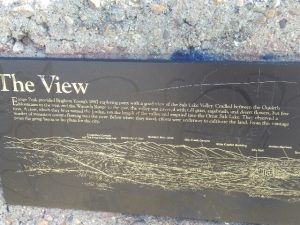
Plaque D: Free-standing concrete 3’W 3’H 6″D (Drawing of Salt Lake Valley) THE VIEW Ensign Peak provided Brigham Young’s 1847 exploring party with a good view of the Salt Lake Valley. Cradled between the Oquirrh Mountains to the west and the Wasatch Range to the east, the valley was covered with tall grass, sagebrush, and desert flowers but few trees. A river, which they later named the Jordan, ran the length of the valley and emptied into the Great Salt Lake. They observed a number of mountain streams flowing into the river. Below where they stood, efforts were underway to cultivate the land. From this vantage point the group began to lay plans for the city. Beyond the State Capitol Building lies State Street, stretching long and straight until it disappears from view in the distance. The Salt Lake Temple, now practically surrounded by tall buildings, once dominated the landscape. The small communities that formerly dotted the valley have grown to the point that it is often hard to tell where one ends and another begins.

Small Plaque below: 

Construction of this plaza and restoration of the monument have been made possible by the generous contribution of the family of David Aurelius Robinson (1905-1986). HIGH ON THE MOUNTAIN TOP Ensign Peak inspired pioneer poet Joel Hills Johnson, to write the verses of the popular hymne “High on the Mountain Top.” A fitting tune was written by Ebenezer Beesley. The peak has been the subject of many other poems and stories.” “Markers and Monuments Database.”

Extended Research:

In 1869, Mormon Apostle George A. Smith reported that Joseph Smith, the deceased founder of the Church of Jesus Christ of Latter-day Saints (LDS Church), appeared to Brigham Young in vision sometime after Smith’s death and Smith showed Young a peak where the Saints should settle.  On July 24, 1847, when Young entered the Salt Lake Valley for the first time he reportedly recognized Ensign Peak as the place he had seen in a vision.[1]

Throughout the 19th and 20th centuries Ensign Peak was utilized in many ways. In 1847 the “Peak” symbolically and literally represented a gathering place for the members of the Church of Jesus Christ of Latter-day Saints. According to historian Ronald Walker, Young proposed several flags to represent “the gathering” and to create an identity for the occupants of Salt Lake City. Some suggested that the most fitting flag should be an American flag to fly on Ensign Peak, despite tensions between the Federal Government and the Mormon settlers. Mormons felt alienated but still maintained an American ideology.[2]

Apart from flying flags, members of the LDS church received and performed temple endowments on the peak while the Salt Lake City Temple was under construction. The temple endowment is a ceremony where members make covenants with God in order to receive promised blessings in return. Addison Pratt prior to his LDS mission received his endowment on July 21, 1849 on Ensign Peak.[2] During the Utah War (1857-1858) members of the Utah militia used the peak as a lookout spot for federal troops. Militiamen used smoke to signal during the day, and fire light to signal at night.[3]

In the 20th Century several people proposed different uses for the peak. Lon J. Haddock, a member of the Salt Lake City Manufacturers and Merchants Association ,with the support of Senator Reed Smoot, promoted the peak as a park.[4] Smoot and Haddock, however, did not gain enough support for their idea and it did not bear fruit. In the early 1900s, automobile dealers drove their cars to the top of the peak as an advertising opportunity. In 1910 the first automobile reached the top and other drivers followed, generally as publicity stunts.[5] In 1916, LDS Presiding Bishop, Charles W. Nibley proposed that a stone cross be built on Ensign Peak. Nibley suggested that the cross would represent the sacrifices of early Mormon pioneers, and also signal to the world that Mormons were in fact Christians.[6] Nibley’s proposal created controversy and the community ultimately rejected it. A year later advocates proposed a monument in honor of the Mormon Battalion (a military unit in the US war with Mexico comprised of around five hundred Mormons), but it also did not gain support.

In the fall of 1924 the Klu Klux Klan held a demonstration and used the peak for its own purposes. The 1920s marked a resurgence of the Klu Klux Klan nationwide. In Utah the Klan held a demonstration on the same day as LDS General Conference–a meeting for Mormons from around the world to gather and listen to their leaders. During the conference proceedings, the Klan burned a large cross at the top of the peak in a show of force for the KKK in Utah.[7]

The monument that sits atop Ensign Peak today was built on July 26, 1934. Standing at eighteen feet high, the Utah Pioneer Trails and Landmarks Association are responsible for its construction. Speakers and leaders of all faiths participated in the celebration.[8] In 1996, Ensign Peak was renovated and the construction of a permanent park began. [9]

[1] George A. Smith, “Historical Discourse,” 20 June 1869, Journal of Discourses (London: Latter-day Saints’ Book Depot, 1854–1886), 13:85.

[2] Ronald W. Walker, “A Banner Is Unfurled,” Dialogue 26, no. 4(1993): 71-91: https://www.dialoguejournal.com/wp-content/uploads/sbi/articles/Dialogue_V26N04_89.pdf

[2] William S. Harwell and Fred C. Collier, eds., Manuscript History of Brigham Young (Salt Lake City: Collier’s Publishing Company, 1997), 224–25.

[3] B. H. Roberts, A Comprehensive History of the Church of Jesus Christ of Latter-day Saints (Salt Lake City: Deseret News, 1912), 4:507.

[4] “Ensign Peak,” Deseret Evening News, August 8, 1908, 4.

[5] “Velie Automobile Climbs Ensign Peak,” Salt Lake Tribune, March 10, 1910, 4.

[6] “To Erect Cross on Ensign Peak,” Deseret Evening News, May 5, 1916; “Ensign Peak Cross! Never! Cries Lund in Protest,” Salt Lake Telegram, May 7, 1916.

[7] Larry R. Gerlach, Blazing Crosses in Zion: The Ku Klux Klan in Utah (Logan: Utah State University Press, 1982) ,105–110.

[8] “Ensign Peak Monument to Be Unveiled,” Deseret News, July 24, 1934, 9.

[9] R. Scott Lloyd, “Park at Ensign Peak Dedicated,” Deseret News, August 3, 1996, 3, 13.

Primary Sources

George A. Smith, “Historical Discourse,” 20 June 1869, Journal of Discourses (London: Latter-day Saints’ Book Depot, 1854–1886), 13:85.

“Ensign Peak,” Deseret Evening News, August 8, 1908, 4.

“Velie Automobile Climbs Ensign Peak,” Salt Lake Tribune, March 10, 1910, 4.

“To Erect Cross on Ensign Peak,” Deseret Evening News, May 5, 1916

“Ensign Peak Monument to Be Unveiled,” Deseret News, July 24, 1934, 9.

Scott Lloyd,“Park at Ensign Peak Dedicated,” Deseret News, August 3, 1996, 3, 13.

Secondary Sources

William S. Harwell and Fred C. Collier, eds., Manuscript History of Brigham Young (Salt Lake City: Collier’s Publishing Company, 1997).

Brigham H. Roberts, A Comprehensive History of the Church of Jesus Christ of Latter-day Saints (Salt Lake City: Deseret News, 1912), 4:507.

Larry R. Gerlach, Blazing Crosses in Zion: The Ku Klux Klan in Utah (Logan: Utah State University Press, 1982).

Ronald W. Walker, “A Banner Is Unfurled,” Dialogue 26, no. 4(1993): 71-91: https://www.dialoguejournal.com/wp-content/uploads/sbi/articles/Dialogue_V26N04_89.pdf

Ronald W. Walker, “A Gauge of the Times: Ensign Peak in the Twentieth Century,” Utah Historical Quarterly 62, no. 1 (1994): 4–25.

Dennis A. Wright and Rebekah E. Westrup, “Ensign Peak: A Historical Review,” in Salt Lake City: The Place Which God Prepared, ed. Scott C. Esplin and Kenneth L. Alford (Provo, UT: Religious Studies Center, Brigham Young University; Salt Lake City: Deseret Book, Salt Lake City, 2011), 27–46.
Trolley Square

Published / by Alex Alba / Leave a Comment

Writeup by Alex alba

Placed By: Division of State History

GPS Coordinates: 40° 45′ 25.2″ N,  -111° 52′ 17.4″ W

Historical Marker Text 1:

Site of LDS Tenth Ward Square until 1888 when it was purchased and used as a territorial fairgrounds through 1901. Car Barns and Repair shops built 1908-1910 under the direction of E.H. Harriman for Utah Light and Railway Company. Barns housed Salt Lake City Buses until 1970. Renovation 1972.

Historical Marker Text 2:

Salt Lake City was one of the first cities in the U.S. to introduce a trolley car system, electrifying its first line in 1889. Railroad magnate E.H. Harriman purchased a controlling interest in Utah Light Railway Company with plans to build a state-of-the-art trolley system as a model for the world. He invested $3.5 million in this site, constructing the unusual mission-style car barn complex during 1908-10. The largest building was used as the berth for the trolleys. The middle building served as a machine or “rip” shop and blacksmith shop. The north building was the paint and carpenter shop. The smaller east building was the sand house. The water tower was designed to hold 50,000 gallons of water in case of fire.

The railway venture operated out of this location until August 19, 1945, after which the Salt Lake City buses were housed here until 1970. Trolley Square was one of the first large-scale adaptive reuse projects in the country when the historic buildings were converted into a festival marketplace. Relics from around the West were rescued and installed as accent pieces. Trolley Square opened in June of 1972.

Extended Research:

E.H. Harriman, Railway Tycoon

Trolley Square was initially the site of the LDS Tenth Ward, designated by Brigham Young in 1847. Salt Lake City purchased the site in 1888 and used it as a fairground until Edward H. Harriman, a railway tycoon, purchased it in 1908. In 1907, shortly before Harriman’s purchase of the Trolley Square area, he was called into the Supreme Court. Harriman’s stake in the railroad system throughout the United States and specifically Utah had raised the concern of the Interstate Commerce Commission. Harriman was charged with holding a great deal of questionably acquired stake in a number of railroad companies incorporated in Utah. Harriman appealed this in 1908 shortly after his purchase of Trolley Square, but the court ordered him to testify and answer questions he previously refused to answer.1 He was, at the time, attempting to build a railroad empire and was in the process of acquiring the Trolley Square area in order to create the Salt Lake City streetcar system.

Harriman also purchased the Utah Light and Railway Company, in which he invested around $3.5 million. Harriman wanted to create an electric light rail system for the rest of the world to use as a model for inexpensive public transportation. In the following years Harriman oversaw the construction of car barns, a 50,000-gallon water tower, and maintenance buildings while also investing in the construction of a light rail system in the Salt Lake City area. This investment was only a small portion of his involvement in railroads in the western United States, as Harriman is primarily known for his involvement in the Union Pacific Railroad Company.

The car barns and other maintenance buildings that Harriman constructed were used for their intended purpose for only a little over a decade. The trolley system was short lived in Utah due to the introduction of gasoline-powered buses that did not require tracks to be run throughout the city. Harriman succeeded in making the Salt Lake City Trolley system incredibly successful, if only for a short time. By 1914 more than 144 cars were in operation, and this system served as a model for similar systems throughout the United States.

Car Barns Circa 1910

Though the trolley system spread throughout the Salt Lake Valley and was largely successful, it began to be phased out in 1920 as a result of the incorporation of gasoline powered city buses. These buses cost less money to operate and could travel around the valley more efficiently as they did not need tracks or electricity. The last trolley car was retired in 1945, and after that Trolley Square was used as a bus depot. As time went on the buildings fell into disrepair, housing run down and broken buses as well as other industrial garbage and waste. The buildings were going to be demolished in 1969, but developer Wallace A. Wright Jr. purchased the site and renovated it into a shopping center. It has remained a shopping center since it opened its doors in 1971, and in 1996 it was added to the National Register of Historic Places.2


1- Taken in part from Harriman v. ICC, 211 US 407 – Supreme Court 1908. Accessible at: https://scholar.google.com/scholar_case?case=2190642344080570832&q=Edward+H.+Harriman+vs.+The+Interstate+Commerce+Commission&hl=en&as_sdt=6,45

2-Taken in part from Zacharia Razavi’s article “Trolley Square- A Salt Lake City Icon” in Utah Stories Magazine November 6, 2008

Images taken from trolleysquare.com

For Further Reference:

Secondary Sources:

Razavi, Zacharia. “Trolley Square- A Salt Lake City Icon.” Utah Stories Magazine, November 6, 2008.

“Trolley Square: A Brief History.” The Salt Lake Tribune, February 13, 2007. Accessed February 18, 2017. http://archive.sltrib.com/story.php?ref=/news/ci_5216391.

“The History.” Trolley Square. Accessed February 18, 2017. http://www.trolleysquare.com/history/.


Primary Sources:

Edward H. Harriman vs. The Interstate Commerce Commission. October Term, 1907. Case No. 662. Page 159

Harriman v. ICC, 211 U.S. 407, 29 S. Ct. 115, 53 L. Ed. 253 (1908).