Category Archives: early 19th century

Donner Hill

Published / by William Root / 2 Comments on Donner Hill

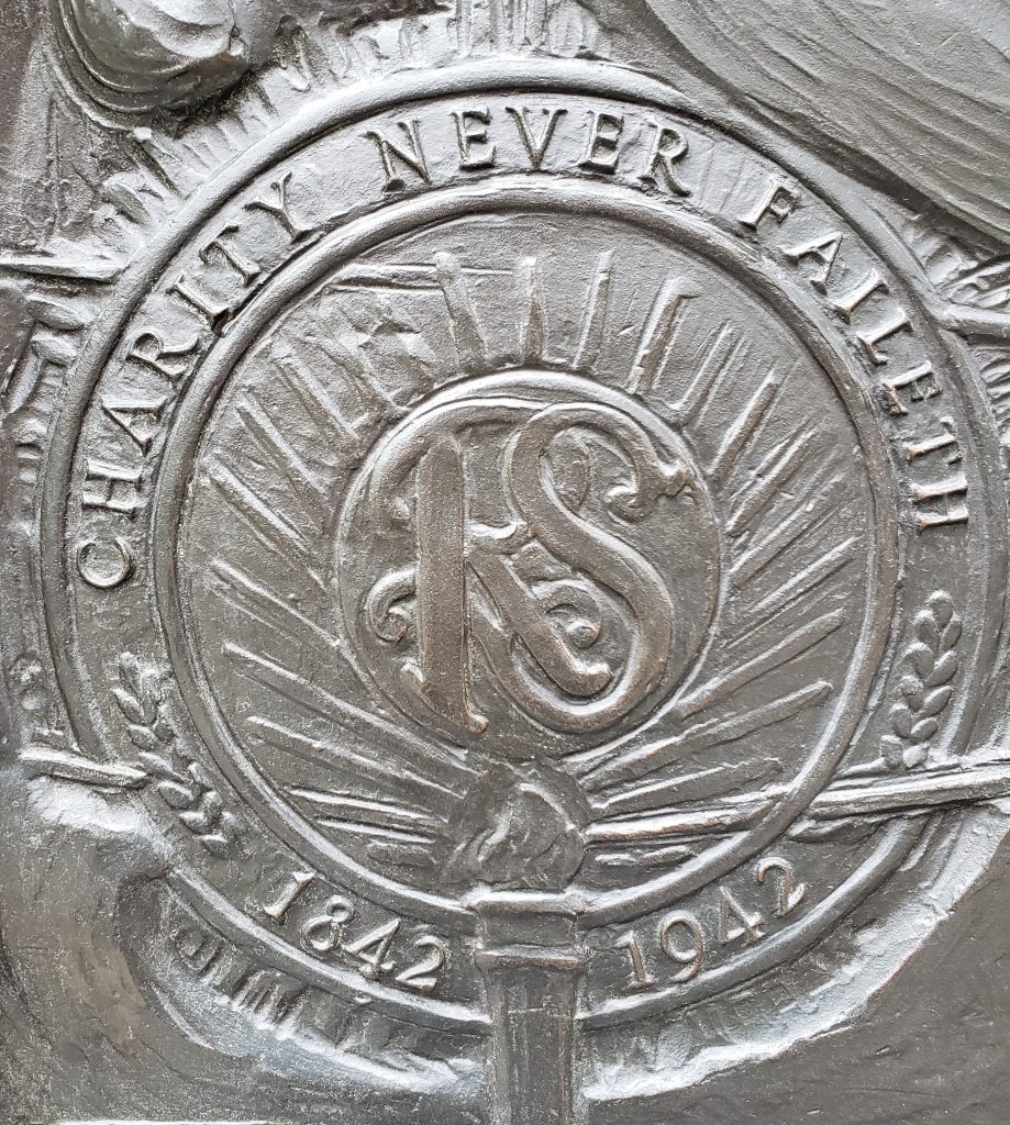
Placed by: LDS 38th North Ward Priests[1]

GPS Coordinates: 40° 45’5.76″N, 111° 48’3.28″W

Historical Marker Text:
Lured by Lansford Hasting’s assurance that his shortcut from the well-known trail to Oregon and California would save 250 miles and weeks of travel, the ill-fated Donner-Reed party reached this place August 23, 1846, after spending 16 days to hack out a 36-mile road through the Wasatch Mountains. Here at this narrow mouth of the canyon, they were stopped by what seemed impenetrable brush and boulders. Bone-weary of that kind of labor, they decided instead to goad the oxen to climb the hill in front of you. Twelve-year-old Virginia Reed, later recalled that nearly every yoke of oxen was required to pull each of the party’s twenty-three wagons up the hill. After this ordeal, the oxen needed rest, but there was no time. The party pushed on to the Salt Flats, where many of the oxen gave out. This caused delays, which led to disaster in the Sierra Mountains.

A year later, July 22, 1847, Brigham Young’s Pioneer Party, following the Donners and benefitting from their labor, reached this spot. William Clayton recorded their decision: “We found the road crossing the creek again to the south and then ascending a very steep, high hill. It is so very steep as to be almost impossible for heavy wagons to ascend…Colonel Markham and another man went over the hill and returned up the canyon to see if a road cannot be cut through and avoid this hill. Brother Markham says a good road can soon be made through the bushes some ten or fifteen rods. A number of men went to work immediately to make the road…After spending about four hours of labor the brethren succeeded in cutting a pretty good road along the creek and the wagons proceeded on.”

Donner Hill looking east towards Emigration Canyon

Among the lesson learned that day was one stated succinctly by Virginia Reed in a letter to prospective emigrants back home: “Hurry along as fast as you can, and never take no shortcuts.”

Extended Research:

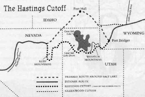
In 1846 a wagon party led by George Donner departed Independence, Missouri and began a perilous journey from the United States towards Alta California in Mexico. The wagons were late in reaching the Sierra Nevada mountain range and disaster awaited the 88 members of the Donner Party. Extreme suffering and starvation followed, with 41 members of the group dying and eventually the incident drew national attention over reports that some members of the ill-fated party resorted to cannibalism in order to survive.[2] The Donner Party originally planned to travel to California via Oregon, but real estate speculator Lansford Hastings promoted an alternate route published in his famous Emigrants Guide to Oregon and California in 1845, and the Donner Party opted to try it.³

Hastings was not certain if he should promote the cutoff from Fort Bridger through the Salt Lake Valley and westward following John C. Fremont’s expedition in 1845, but he received support in favor of the cutoff from Fremont and Jim Bridger. Hastings thus advised the Donner-Reed party that they would save some 350-400 miles if they took his “cutoff.” One of his partners, James Clyman, however became convinced that the route was not suited for wagons and therefore tried to dissuade members of Donner-Reed Party from taking the cutoff. Joseph R. Walker, who successfully guided the first wagons over the California Trail by way of Fort Hall, also thought the route an unproven risk.[3]

Other migrant groups, which included the Bryant-Russell Party and Harlan-Young wagons, left Fort Bridger in mid-July 1848, following the Bear River into East Canyon where they passed through Devil’s Gate with difficulty along the Weber River. Hastings subsequently directed a group of German migrants from the Heinrich Lienhard party on a direct route through Echo Canyon into Devil’s Gate, where they caught up with the Harlan-Young party near the Jordan River. The Donner Party departed Fort Bridger two weeks later on July 31 and Hastings talked them out of going via Weber Canyon and Devil’s Gate, instead telling them to blaze a new path over to what would come to be called Emigration Canyon. On August 7, 1846, James Reed began carving a trail for the wagon train, chopping down bushes and trees in the Wasatch Mountains towards the canyon. Reed was joined by the remaining members of the wagon party who continued to hack and dig their way for 35 miles from present-day Henefer, Summit County, to Salt Lake City.²

Emigration Creek along Donner Hill

The Bryant-Russell, Harlan-Young and Lienhard parties would successfully pass through the Sierra Nevada Mountains into California, while the time the Donner Party spent trailblazing in Utah foreshadowed later events. After the three week trek through the Wasatch Mountains, the oxen were already exhausted and their supplies began to run low.

After entering the Salt Lake Valley, the first member of the party died of tuberculosis near the Great Salt Lake. A site near Grantsville, Utah provided temporary relief with underground water springs, their last source of water until reaching the Humboldt River. In the Salt Flats, Reed’s thirsty oxen ran off and were never seen again. Upon reaching Iron Hill, a fight broke out between one of Reed’s teamsters and John Snyder, a driver for the Graves wagon. Reed stabbed Snyder in the chest and was banished by the Donners after Snyder died. Reed thus avoided being pinned down by the early winter storms which trapped the rest of the party. His departure in October towards Sutter’s Fort allowed him to organize a rescue party in Sacramento that arrived in February 1847. Along the Humboldt River a band of Paiute Indians killed 21 of the Donner Party’s oxen and stole another 18, with more than 100 of the party’s cattle now gone. Two Indian guides assisted the Donner Party in reaching the summit of the Sierra Nevada, but turned back with the first sign of snowfall in early November.1

Donner-Reed Party burial remains discovered in the Salt Lake Desert

The delayed timing and trek through the west desert led to the party becoming snowbound in the Sierras. Malnutrition was a common cause of death, and Irish immigrant Patrick Breen wrote in his journal on Christmas Eve that he was living in a “Camp of Death”. 1 Some of the members of the party camped along the banks of Alder Creek and frozen Truckee Lake, now Donner Lake, where most of the cannibalism occurred. The first rescuers arrived at Truckee Lake in February 1847, composed of soldiers from the U.S. Army stationed in California during the U.S.-Mexican War, among them were members of the Mormon Battalion. One week after rescuers arrived, other isolated camp sites were still using the corpses of the dead for food. Breen wrote in his diary on February 26:

Martha’s jaw swelled with the toothache: hungry times in camp; plenty hides, but the folks will not eat them. We eat them with a tolerable good apetite. Thanks be to Almighty God. Amen. Mrs Murphy said here yesterday that [she] thought she would Commence on Milt. & eat him. I don’t [think] that she has done so yet; it is distressing. The Donners, 4 days ago, told the California folks that they[would] commence to eat the dead people if they did not succeed, that day or next, in finding their cattle.1

Patrick Breen’s diary entry describing the routine cannibalism in the encampment

Three additional relief efforts occurred in April in an attempt to find members who had become separated while camping along Truckee Lake. In the last effort they found only one survivor, Louis Keesberg, who was surrounded by half-eaten corpses. As the survivors departed with the rescuers, members of the Mormon Battalion were ordered to bury the dead bodies inside the main cabin on what is today Donner Pass and then set fire to the cabin.[4]

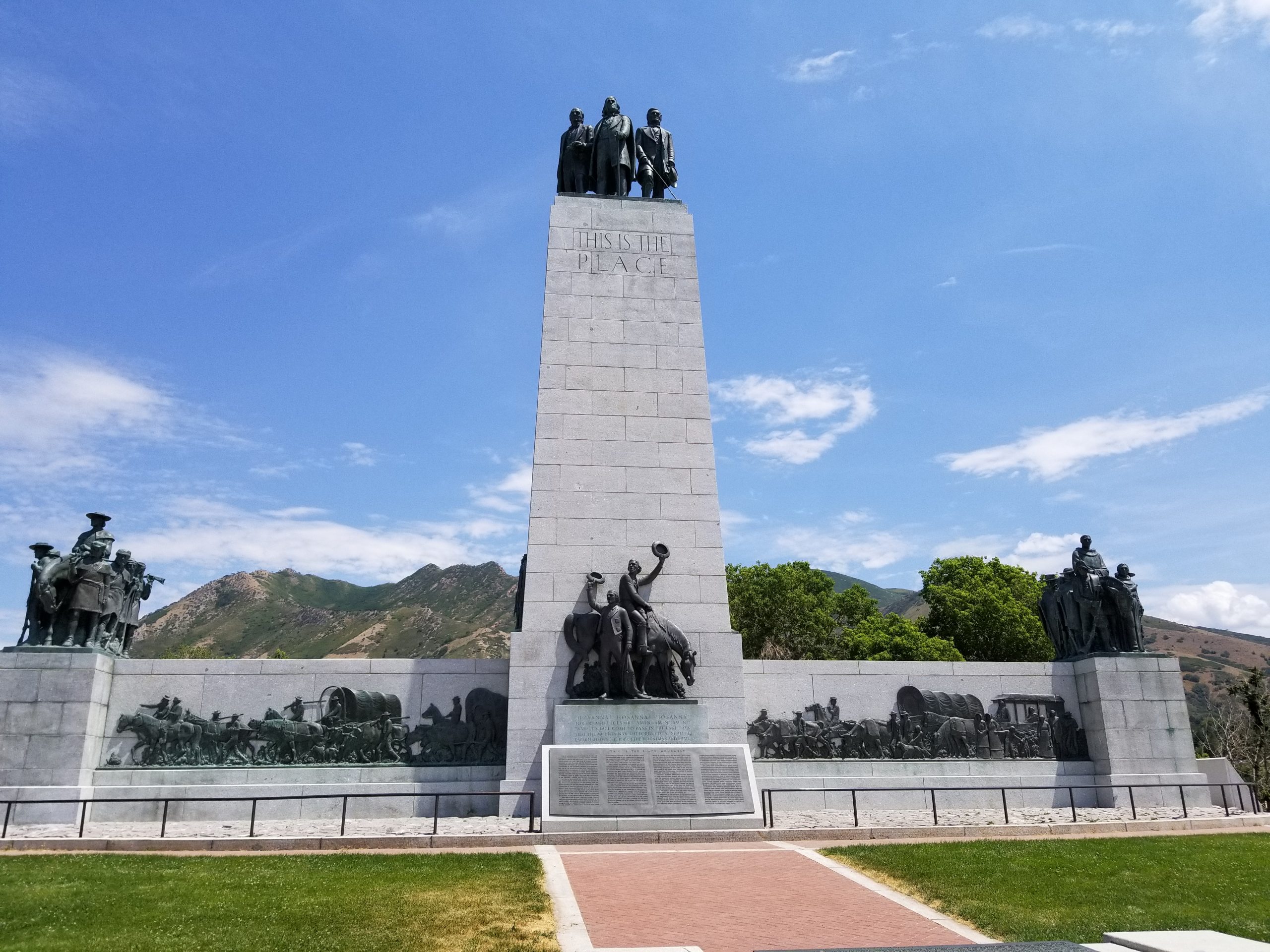
The Donner Party, in essence, blazed the trail into the Salt Lake Valley which Brigham Young and the Mormon Pioneers used the following year. Young left Winter Quarters, Nebraska with his encampment and passed through the mouth of Echo Canyon by mid-July 1847; he then picked up the Donner-Reed trail and followed it into the Salt Lake Valley. Instead of three weeks, it took Young’s party one week, a matter of great importance since it enabled the Mormons to plant wheat and potato crops in time for their first harvest in the fall. In the last quarter-mile, rather than hauling their wagons over Donner Hill, the Mormons decided to hack through the brush and go around Donner Hill. The Mormons emerged four hours later at what is now This is the Place State Park.[5]

For Further Reference:

Primary Sources:

Breen, Patrick. Diary of Patrick Breen of the Donner Party, 1846-7. Berkeley: University  of         California Bancroft Library, 1910.

Secondary Sources:

Campbell, Eugene. “The Mormons and the Donner Party.” BYU Studies Quarterly, Vol. 11 no. 3 (1971).

Miller, David. “The Donner Road through the Great Salt Lake Desert.” Pacific Historical Review, Vol. 27, no. 1 (February 1958): 39-44


[1] Originally installed by “Mormon Explorers” Y.M.M.I.A. In 2010, the original plaque was stolen and re-erected in 2016 by the LDS 38th North Ward High Priests

[2] Campbell, “The Mormons and the Donner Party.”

[3] Miller, “The Donner Road through the Great Salt Lake Desert,” 39-44

1 Breen, 18

1 Breen, 28

[5] Campbell, “The Mormons and the Donner Party.”

Nauvoo Bell Tower & Relief Society Memorial

Published / by Amy Shaw / 1 Comment on Nauvoo Bell Tower & Relief Society Memorial

Write-up by Amy Shaw

Placed by:

The Relief Society – Woman’s Benevolent Organization of the Church of Jesus Christ of Latter – Day Saints

            Latitude: 40.76996655

            Longitude: -111.89330947

Historical Marker Text (1) – Sign:

The Nauvoo Bell originally hung in the temple that Church members built in Nauvoo, Illinois, in the 1840’s. The Saints removed the bell in 1846 when they were forced to leave Illinois because of persecution. Following instructions from Brigham Young, the second company of pioneers carried the bell to the Salt Lake Valley. During their journey, they rang the bell to signal daybreak and departure and to warn that night sentries were on duty. The bell is now rung hourly as a symbol of religious freedom and is heard on KSL Radio.

This monument honors the Relief Society, an organization founded on 17 March 1842 for women of the Church. The bell tower was built with donations from Relief Society members to mark the organization’s centennial.

Historical Marker Text (2) – East Side:  RELIEF SOCIETY CENTENNIAL MEMORIAL

Here in the shadow of the temple, on this spot hallowed by the tread of pioneer feet, the Relief Society – woman’s benevolent organization of the Church of Jesus Christ of Latter-day Saints erects this monument.

It stands as an expression of appreciation for the wondrous opportunities for soul growth that have come to womankind since the time one hundred years ago when in 1842 the Relief Society was organized in Nauvoo, Illinois, by the prophet Joseph Smith, who said :

“I now turn the key in your behalf in the name of the Lord and this society shall rejoice, and knowledge and intelligence shall flow down from this time henceforth… let kindness charity and love crown your works.”

In this tower hangs the famed Nauvoo temple bell whose lifetime spans a century of church history. A sentinel in the sacred temple at Nauvoo, the bell in vibrant tones rang out the changing moods of faithful saints as they experienced first peace and joy, and later the anguish of parting from all that they had toiled to build. Immediately following the original pioneers with Brigham Young at their head, came the second company in the great exodus to the west. Heading this veritable host of Israel, the bell played well its part in the westward trek. It awakened the herdsman at dawn, called the Saints from their wagons to kneel in morning prayer, rang again to start the day’s march, and in the solemn stretches of the night, it quieted the fears of the people as it warned stray Indians that the sentry was at his post.

It is with gratitude that this monument is dedicated to the thousands of unsung Relief Society heroines who over a period of one hundred years have stimulated intellectual development and given compassionate service without thought of honor or reward. These valiant women have nourished the hungry, clothed the needy, nursed the sick, buoyed up the discouraged and disconsolate, and tenderly prepared the dead for burial.

Relief Society General Presidents 

                        1842 – 1942

            Emma Smith                                     Emmeline B. Wells

            Eliza R. Snow                                   Clarissa S. Williams

            Zina D. H. Young                             Louise Y. Robinson

            Bathsheba W. Smith                       Amy Brown Lyman

Historical Marker Text (3) – South Side:

BENEVOLENCE

Through Love Serve One Another

Historical Marker Text (4) – North Side: EDUCATION

The Glory of God is Intelligence

Historical Marker Text (5) – West Side:

PIONEERING

No Toil Nor Labor Fear

Extended Research:

In July of 1845, a letter from Brigham Young was published in the Millennial Star, asking the saints in Britain to donate money that would fund the making of a bell to be placed in the Nauvoo temple. Wilford Woodruff, who was the president of the British Mission was charged with encouraging the Saints to raise the funds and collect the money.1 The British Saints raised 535 pounds.2

There is some confusion as to whether the bell was purchased in England or America. Due to a letter to Woodruff, from Young which states, “I wrote you in my last letter that we intended to purchase the bell in this country and desired you to transmit the money collected for that purpose by the first safe opportunity,” it is believed that the bell must have been bought and constructed in America. However, there are accounts from others recalling “a large bell some of the brethren (missionaries) had sent from England by ship to New Orleans, thence by river steamer up the Mississippi River to Nauvoo, where it was hung, with some difficulty, in the steeple of the Temple.” There are no records of the bell’s purchase to back up either account.3

The Nauvoo Bell. Courtesy of LDS Historical Dept.

It is believed that the bell was completed and arrived in the city of Nauvoo in early June of 1846, where it was hung for a short time in the belfry of the Nauvoo Temple. In the time it was there, the bell was used to sound the alarm for anti-Mormon mob attacks. One such attack was the Battle of Nauvoo which took place in June 1846, when Hancock County settlers drove remaining Mormons from their homes at Nauvoo. The temple was eventually surrendered to the mobs, and the Saints were forced to flee. It is reported that as the mob marched through the temple, they rang the bell as a preacher shouted “Peace, Peace, Peace to all the inhabitants of the earth, now the Mormons are driven.” One man, John R. Young, as he and the other Saints were fleeing, stopped to write:

 “The silvery notes of the temple bell

That we loved so deep and well;

And a pang of grief would swell the heart,

And the scalding tears in anguish start

As we silently gazed on our dear old homes” 4

It is here that the history of the Nauvoo Bell becomes murky. According to  Edith Smith Eliot, the great-granddaughter of Wilford Woodruff, the bell was stolen from the temple and taken to a protestant church, where the Lamoreaux family stole it back for the LDS Church. The tale goes that “one stormy night the men gathered in secret and without horses pulled the wagon to the Church and lowered the Bell, pushed and pulled the wagon by hand to the edge of the Mississippi River and carefully concealed it in the water. Andrew Lamoreaux and his brother, David, were chosen to bring the Bell to Utah with their families, concealing the Bell in their wagon with their provisions.”5 This story, however, is most likely not about the Nauvoo Bell but actually about Hummer’s Bell, a bell made for a Presbyterian church under the direction of Michael Hummer in 1844. Somehow the history of these two bells have gotten mixed up.6

What is actually believed to have happened to the Nauvoo Bell is that in September, when Brigham Young heard that the Saints were forced out of their homes in Nauvoo, he wrote to the trustees of the Church property saying, “Since you will have no further use of the Temple Bell, we wish you to forward it to us by the first possible chance, we have much need of it at this place.” Reports from Joshua Hawkes tell us that he and a Latter-day Saint by the name of James Houton then took the bell across the Mississippi River, where it fell under the charge of Joseph P. Heywood. Heywood then took the bell to Winter Quarters.7

It is believed that the bell arrived in Winter Quarters in Nebraska Territory in December of 1846. Here, the bell was placed in the public square and was used to call members to worship services and other meetings.8

Then, in June of 1847, a wagon company led by Charles C. Rich transported the bell to the Salt Lake Valley.1 During the journey, it was attached to a wagon so that it could be rung to awaken the company each morning, signal morning prayer, to start each day’s march, and to warn the company of any Indian attacks.9

The company arrived in Salt Lake in September of 1847. The bell was then placed in a fort in the city for a short time until it was moved to the bowery on Temple Square. It remained there until the winter of 1849 -1850 when it cracked. This resulted in the bell being melted down and recast.10 The recast bell measures 23 1/2 inches tall, 33 inches wide at its base, and 2 1/2 inches thick.11 It was then placed in Brigham Young’s schoolhouse located just east of the Beehive house, in 1860.12 It remained there until 1902 when it was presented to the Utah State Historical Society, and placed in the LDS Church museum. It remained on display there for many years.13

In 1941, John Taylor announced that the bell would be permanently placed in a tower on the grounds of the Tabernacle before the observance of the centennial of the National Relief Society, in 1942.14 However, due to World War II breaking out, the tower’s erection was postponed to 1966. The tower was designed by Lorenzo S. Young, grandson of Brigham Young.15 It stands 35 feet high and is located between the Assembly Hall and Tabernacle on Temple Square.16 The bronze artwork at the base of the tower was done by renowned sculptor Avard T. Fairbanks.17 The first sculpture is of the monogram RS (for Relief Society) and a picture of the Nauvoo temple. The next two sides depict the twofold work of the Relief society, education, and benevolence. And the last sculpture  commemorates the Church’s pioneering spirit.18

It is believed by some that the Nauvoo Bell Tower is a response to a prophecy made by Brigham Young in which he said: “Right west of the temple … we shall build a tower and put a bell on it. … This plan was shown to me in a vision when I first came onto the ground.”

Today, the Nauvoo Bell serves as an hourly time signal for KSL TV and radio. This began in 1961 with President of the LDS church, David O. McKay presiding at the ceremonies at KSL TV.19 The tolling of the bell marks the top of each hour on KSL by use of a microphone on Temple Square. There is a 7-second delay from the sounding of the bell to the listener’s ear on the radio.20

Footnotes:

[1] Ronald G. Watt, “A Tale of Two Bells: Nauvoo Bell and Hummer’s Bell,” Mormonhistoricsites.org, accessed March 17, 2019, http://mormonhistoricsites.org/wp-content/uploads/2013/05/NJ11.2_Watt.pdf.

[2] Don F. Colvin, “Religious Studies Center,” 11. The Fate of the Temple | Religious Studies Center, 2002, accessed March 17, 2019, https://rsc.byu.edu/archived/nauvoo-temple-story-faith/11-fate-temple.

[3] Colvin, “Religious Studies Center,” 11.

[4] David R. Crockett, “The Nauvoo Temple: “A Monument of the Saints”,” http://mormonhistoricsites.org, accessed March 17, 2019, http://mormonhistoricsites.org/wp-content/uploads/2013/05/NJ11.2_Crockett.pdf.

[5] “I’ve Heard There Is a Story behind the Bell on Temple Square. Can You Relay It?” Ensign, February 1981, accessed March 30, 2019, https://www.lds.org/study/ensign/1981/02/i-have-a-question/what-is-the-story-behind-the-bell-on-temple-square?lang=eng.

[6] Watt, “A Tale of Two Bells.”

[7] Colvin, “Religious Studies Center,” 11.

[8] Watt, “A Tale of Two Bells.”

[9] “I’ve Heard There Is a Story.”

[10] Watt, “A Tale of Two Bells.”

 [11] Colvin, “Religious Studies Center,” 11.

[12] Watt, “A Tale of Two Bells.”

[13] Colvin, “Religious Studies Center,” 11.

[14] “Church Prizes Only Relic, Leader Asserts,” Salt Lake Telegram, 3 October 1941, page 10, Utah Digital Newspapers.

[15] Connie Lamb, “Symbols of the LDS Relief Society,” Mormonhistoricsites.org,  accessed March 17, 2019, http://mormonhistoricsites.org/wp-content/uploads/2013/08/Symbols-of-the-LDS-Relief-Society.pdf.

[16] “Nauvoo Bell’s ‘clang’ Is Back on KSL Radio,” Deseret News, June 23, 2005, accessed March 17, 2019, https://www.deseretnews.com/article/600143553/Nauvoo-Bells-clang-is-back-on-KSL-Radio.html.

[17] Athelia T. Woolley, “Art to Edify: The Work of Avard T. Fairbanks,” accessed March 17, 2019, https://www.lds.org/study/ensign/1987/09/art-to-edify-the-work-of-avard-t-fairbanks?lang=eng.

[18] Lamb, “Symbols.”

[19] “I’ve Heard There Is a Story.”

[20] “Nauvoo Bell’s ‘clang’ Is Back.”

For Further Reference:

Primary Sources:

“Church Prizes Only Relic, Leader Asserts”. Salt Lake Telegram, 3 October 1941. page 10. Utah Digital Newspapers.

Secondary Sources:

“A Visit to Temple Square.” Lds.org. Accessed March 17, 2019. https://www.lds.org/study/liahona/1991/10/a-visit-to-temple-square?lang=eng.

Bennett, Richard E. “Winter Quarters: Church Headquarters, 1846–1848.” Lds.org. Accessed March 17, 2019. https://www.lds.org/study/ensign/1997/09/winter-quarters-church-headquarters-1846-1848?lang=eng.

Colvin, Don F. “Religious Studies Center.” 11. The Fate of the Temple | Religious Studies Center. 2002. Accessed March 17, 2019. https://rsc.byu.edu/archived/nauvoo-temple-story-faith/11-fate-temple.

Crockett, David R. “The Nauvoo Temple: “A Monument of the Saints”.” http://mormonhistoricsites.org. Accessed March 17, 2019. http://mormonhistoricsites.org/wp-content/uploads/2013/05/NJ11.2_Crockett.pdf.

“I’ve Heard There Is a Story behind the Bell on Temple Square. Can You Relay It?” Ensign, February 1981. Accessed March 30, 2019. https://www.lds.org/study/ensign/1981/02/i-have-a-question/what-is-the-story-behind-the-bell-on-temple-square?lang=eng.

Lamb, Connie. “Symbols of the LDS Relief Society.” Mormonhistoricsites.org. Accessed March 17, 2019. http://mormonhistoricsites.org/wp-content/uploads/2013/08/Symbols-of-the-LDS-Relief-Society.pdf.

“Nauvoo Bell’s ‘clang’ Is Back on KSL Radio.” Deseret News. June 23, 2005. Accessed March 17, 2019. https://www.deseretnews.com/article/600143553/Nauvoo-Bells-clang-is-back-on-KSL-Radio.html.

Searle Assistant, Don L. “Nauvoo: A Temple Reborn.” Accessed March 17, 2019. https://www.lds.org/study/ensign/2002/07/nauvoo-a-temple-reborn?lang=eng.

Watt, Ronald G. “A Tale of Two Bells: Nauvoo Bell and Hummer’s Bell.” Mormonhistoricsites.org. Accessed March 17, 2019. http://mormonhistoricsites.org/wp-content/uploads/2013/05/NJ11.2_Watt.pdf.

Woolley, Athelia T. “Art to Edify: The Work of Avard T. Fairbanks.” Accessed March 17, 2019. https://www.lds.org/study/ensign/1987/09/art-to-edify-the-work-of-avard-t-fairbanks?lang=eng.

Pleasant Green Ward

Published / by Alejandro Pastor / 1 Comment on Pleasant Green Ward

Write-up by Alejandro Pastor

Placed by: Daughters of the Utah Pioneers, No. 467

GPS Coordinates:

  1. Long/Lat:         N 40.71121° , W 112.09832°
  2. MGRS:              12T VL 07224 07278
  3. Elevation          4293 ft

Historical Marker Text:

Settlers came to this part of the valley around 1850 to farm and stock range.  It was known as Pleasant Green and was part of the Brighton Ward of the Salt Lake Stake.

Traveling so far to meetings presented a problem, so members met in private homes.  The Pleasant Green Branch was organized July 29, 1877, with John Hirst as presiding elder.  A small adobe chapel, 40 feet by 24 feet, was built on this site, and the first meeting was held December 30, 1877.  The building also served as a public school.  Hirst died September 7, 1878, and Levi Nephi Hardman became presiding elder.

The Pleasant Green Ward was organized October 1, 1882, with Hardman as the first bishop.  The ward also included the Hunter Precinct within its boundaries.  A much larger chapel, 60 feet by 30 feet, was built in 1897, with Hiram T. Spencer as bishop.  Later the small adobe chapel was dismantled.  In 1898 the ward had 70 families with 340 members.

        In 1904 the ward became part of Pioneer Stake.  An amusement hall with spring wooden floor was begun in 1912.  Oquirrh Stake was organized from Pioneer Stake in 1923, and this building also served as its stake house for thirty-two years.  In 1961 a new building was completed, and this building was no longer used by The Church of Jesus Christ of Latter-day Saints.

        Pleasant Green is the mother ward of all the wards in this area.

 [1]

Extended Research:

The information that exists today on the Pleasant Green Ward has been preserved because of the forethought of the Church of Jesus Christ of Latter-day Saints. 

“Elder Andrew Jensen visited Pleasant Green Nov. 23, 1894, in the interest of Church history, and met in a special meeting with the following residents of the ward, who imparted historical information: Bishop Hiram T. Spencer, John Hirst Jr., Peter LeCheminant, William Jenkins, George W. Perkins, Samuel B Taylor, James Bertoch,  Lehi N. Hardman, George A. Heid and Edward Lambert.”[2]

The information preserved by Elder Jensen’s notes and the Pleasant Green Ward’s minutes are the main sources of knowledge on the historic Pleasant Green Ward.

The eventual construction of a chapel for members of the Church of Jesus Christ of Latter-day Saints in the Pleasant Green area was an outgrowth of settlement in the western part of the Salt Lake Valley beginning in the 1850s. The area around the Pleasant Green Ward building was first settled in 1853 by William G. Young who located a ranch about 2.5 miles northwest of the current building’s location.[3]

Initially settlers traveled considerable distances on Sundays to attend worship services. Attending meetings with the Brighton congregation proved difficult for people from Pleasant Green due to its distance, roughly twelve miles away. In 1872, after John Hirst settled in the Pleasant Green area, the Bishop of the Brighton Ward, Alonzo H. Raleigh,  granted Hirst permission to hold meetings in Pleasant Green. These Latter-day Saint meetings were initially held in people’s homes. As time went on the meetings became more frequent and were held about once a month in a small log home built by Josiah Lees. Regular sabbath meetings were held in Lees’ log home until 1877 when the Pleasant Green meeting house was built.[4]

On July 29th, 1877 local LDS leaders reorganized the Brighton Ward and created the Pleasant Green Branch to better serve the needs of Pleasant Green settlers. John Hirst was ordained a High Priest at the same time. Later that year residents built a roughly 1,000 square foot meeting house, at a cost of $1,000. On October 1, 1882, Brigham Young Jr,  an apostle of the Church of Jesus Christ of Latter-day Saints, attended meetings at Pleasant Green and organized the branch as a ward. Lehi H. Hardman was selected as the first bishop of the ward.[5]

[6]

The Pleasant Green Ward  building would serve as the meeting house in Pleasant Green until 1897. With continued growth in the area the LDS Church built another chapel directly east of the meeting house. The new building was bigger, roughly 1,800 square feet, was made of brick, and could hold up to 350 people. It cost about $2,400 to build and provided additional room for the burgeoning congregation.[7]

The area surrounding Pleasant Green Ward continued to grow with new settlers; by December 31, 1900 the ward had 383 members. With rapid settlement the ward had to divide several times to better accommodate larger groups. On February 27, 1916 the ward was divided into the Pleasant Green Ward and the Magna Ward. With continued growth, the Pleasant Green Ward split into Pleasant Green 1st Ward and Pleasant Green 2nd Ward, on March 16, 1952. The Church would eventually divide the ward once again and relocate to a larger chapel. The old Peasant Green building still stands as a place of worship, but it is now under the ownership of Christ Presbyterian Church.[8]

For Further Reference:

Primary Sources

Fellows, Barbara G. Pleasant Green Meeting House p.1. Feb. 1941. Utah State Historical Society Classified Photo Collection, Utah State Historical Society, Magna, Utah. Accessed Apr. 7, 2019.

Pleasant Green Ward, Oquirrh Stake. Pleasant Green Ward General Minutes, 1867-1951, microfilm, LR 6996 11 reel 1,Church History Library, The Church of Jesus Christ of Latter-Day Saints, Salt Lake City, Utah.

Pleasant Green Ward, Oquirrh Stake. Pleasant Green Ward Manuscript History and Historical Reports, 1855-1951, microfilm,LR 6996 2 reel 1, Church History Library, The Church of Jesus Christ of Latter-Day Saints, Salt Lake City, Utah.

Pleasant Green Ward, Oquirrh Stake. Pleasant Green Ward Manuscript History and Historical Reports, 1855-1951, microfilm,LR 6996 2 reel 2, Church History Library, The Church of Jesus Christ of Latter-Day Saints, Salt Lake City, Utah.


[1] Barbara G. Fellows, Pleasant Green Meeting House p.1. Feb. 1941. Utah State Historical Society Classified Photo Collection, Utah State Historical Society, Magna, Utah.

[2] Oquirrh Stake Pleasant Green Ward, Pleasant Green Ward Manuscript History and Historical Reports, 1894, microfilm, LR 6996 2, reel 1,Church History Library, The Church of Jesus Christ of Latter-Day Saints, Salt Lake City, Utah.

[3]  Oquirrh Stake, Pleasant Green Ward Manuscript History and Historical Reports, LR 6996 2 reel 1

[4] Oquirrh Stake, Pleasant Green Ward Manuscript History and Historical Reports, LR 6996 2 reel 1

[5] Oquirrh Stake, Pleasant Green Ward Manuscript History and Historical Reports, LR 6996 2 reel 1

[6] Oquirrh Stake, Pleasant Green Ward Manuscript History and Historical Reports, LR 6996 2 reel 1

[7] Oquirrh Stake, Pleasant Green Ward, Pleasant Green Ward General Minutes, microfilm, LR 6996 11 reel 1, Church History Library, The Church of Jesus Christ of Latter-Day Saints, Salt Lake City, Utah.

[8] Oquirrh Stake Pleasant Green Ward, Pleasant Green Ward Manuscript History and Historical Reports, microfilm, LR 6996 2 reel 2, Church History Library, The Church of Jesus Christ of Latter-Day Saints, Salt Lake City, Utah.

Battle Creek

Published / by Brittney Carter / Leave a Comment

Write up by Brittney Carter

GPS COORDINATES

40°21’48” N 111°42’2” W

Elevation 5260

Marker originally placed by: Jared Warburton, 1997

Battle Creek monument text

Marker Text:

“This monument is in memory of the first armed engagement between the Mormon pioneers and the Native Americans that inhabited Utah Valley, and serves as a reminder of the extreme sacrifice given by both people. This skirmish at the mouth of Battle Creek Canyon gave it its name.”

Extended Research

Kiwanis Park at Battle Creek

Battle Creek, which is now known as Pleasant Grove, was the site of the first battle between Native Americans and Utah pioneers. Mormon (LDS) leaders in Salt Lake City ordered militiamen to investigate reports in Utah Valley that Indians were killing cattle and that they had stolen Brigham Young’s horses. The accusation of horse theft proved untrue. As a result, the militiamen received new orders from Salt Lake City “stating that as the horses were not stolen . . . we need not spend any more time in search of them.” They were, however, directed to continue the expedition to investigate the killing of cattle. As Hosea Stout, one of the militiamen recalled, “the nature of our expedition was not in the least changed.”(1).

Battle Creek Marker

After a few days of travel, the militiamen made it to what is now American Fork and rested over night with a band of Ute Indians. Hosea Stout wrote, “the Company [got] an early start and traveled south to the Provo, a fine large stream and well timbered in the valley. This is a beautiful farming country. Here we found the Utahs, who . . . received us friendly but were much excited being evidently afraid of us. After spending an hour or so with them and learning what we could, respecting those we were in pursuit of and also explaining the object of our visit we traveled on. Little Chief accompanied us about three miles up the Provo where we encamped for the night”(1).

The militiamen split into two groups after they came upon a few Native Americans at Battle Creek Canyon who were still sleeping. When the Indians awoke and saw that they were surrounded by white men they tried to flee farther up the canyon, only to find another group of militiamen waiting for them. Before fighting began, an interpreter from among the militia tried to get the Native Americans to surrender.

As Hosea Stout recalled: “Our interpreters talked to them and told them our errand, and asked them to give themselves up. They refused. Our guide talked to them and reasoned with them, but all to no purpose, fight they would unless we went away, then they said they would come out. The guide told them they must come out then or die. . . . The first one shot was their leader. Then such a howling and crying, I think white men never heard before” (1).

After fighting broke out there were several casualties according to Oliver B. Huntington:

“All the bodies we could find were carried together to one place for burial: seven great, fat stout men. . . . When we got back to where we left the dead, there was neither dead nor living anywhere to be found. We did not think them worth hunting for anymore, and started home.” (2).

Mormon pioneers soon settled the land in Utah Valley because of the richness of the soil that militiamen witnessed on this expedition. Brigham Young had already planned to expand further south. As one history of Provo recounted, “Initial Mormon settlement thus was on the site of Salt Lake City. Nevertheless, Young planned to explore all valleys, and, when opportunity permitted, establish settlements in those sufficiently well-watered” (3). Mormon leaders selected Utah Valley as one area for settlement which led to further conflict with Ute Indians in the region.

Battle Creek falls

Battle Creek remained the name of the area until years later when Mormon pioneers decided to change it to Pleasant Grove. The monument that is left at the base of Battle Creek Canyon, which leads to Battle Creek Falls, stands as a reminder of the first battle fought between Mormon pioneers and Native Americans. It also serves as a reminder that Mormon settlement came at a significant cost to Native Americans, in loss of life, land, and culture.


SOURCES

  1. On the Mormon Frontier, The Diary of Hosea Stout, 1844–1861, Vol. 2, Edited by Juanita Brooks, (Salt Lake City: University of Utah Press, 1964), 344-347.
  2. Diary of Oliver B. Huntington, 1847–1900, Vol. 2, L. Tom Perry Special Collections, Harold B. Lee Library, Brigham Young University, Provo, Utah, 47–55, 331-341.
  3. Writers Program, Provo, Pioneer Mormon City (Portland, Oregon : Binfords & Mort1942), 36-44.

For Further Reference

Primary Sources

On the Mormon Frontier, The Diary of Hosea Stout, 1844–1861, Vol. 2, Edited by Juanita Brooks, (Salt Lake City: University of Utah Press, 1964).

Diary of Oliver B. Huntington, 1847–1900, Vol. 2, L. Tom Perry Special Collections, Harold B. Lee Library, Brigham Young University, Provo, Utah.

Secondary Sources

Jared Farmer, On Zion’s Mount: Mormons, Indians, and the American Landscape (Cambridge: Mass: Harvard University Press, 2008).

Writers Program, Provo, Pioneer Mormon City (Portland, Oregon : Binfords & Mort1942).

1853 Holladay Fort

Published / by Ben Hopes / Leave a Comment

By Ben Hopes, Masters of Education Graduate Student

GPS Coordinates: 40˚ 37’ 4.84” N, 111˚ 49’ 36.21”

Holladay Historical Marker

Extended Research About Holladay:

In July of 1847, Holladay became the first village established independent of Salt Lake City. At the time, Latter Day Saints Prophet Brigham Young sent out members of his congregation to colonize different parts of Utah, particularly areas rich in natural resources. Led by John Brown, the pioneers of the Mississippi Company founded the village, flourishing with an abundance of natural resources. A free flowing stream fed through the Holladay area, and provided the rich and fertile lands for farming and planting[1]. The area was known as Cottonwood or the Mississippi Ward, but would be named Holladay after a particularly influential bishop, John D. Holladay. The settlement would grow to include schools, churches, and the creation of a fort in 1853, intended as protection against Native American raids but instead became a place for the settlers to gather.

Marker at Approximate Location of Southeast Corner of Holladay Fort

The Mississippi Company itself had known hardship; they had existed in the Southern States Mission, where they were often met with vitriol and physical harm[2]. They had moved west nearly a full year before the Mormon exodus of 1847, wintering at Pueblo, Colorado. Many of its members volunteered to join the Mormon Battalion, formed to aid the United States’ incursion into Mexico: The men and their families knew sacrifice. The struggles that they encountered in trying to fulfill their Prophet’s, and ultimately their God’s, vision created in them a firm belief that they were truly a chosen people destined for eternal greatness. According to various accounts, the Saints of this era met each challenge with the strength of their convictions and the willingness to work together, united in their goals[3]. Pioneers saw obstacles, such as hunger or physical hardship on the trail, as trials to be conquered with the aid of an almighty God. The Mississippi Company acted admirably in much the same way.

The Mormon colonization efforts were remarkable. Because of their strong, central leadership and the complete cooperation of their congregations, a community infrastructure could be quickly established that led to economically competent planning, ensuring a town’s immediate survival. One can see the precision of the Mormon colonization machine in the fact that Holladay was founded only a month after the Brigham Young’s famous incursion into the Salt Lake Valley. The tenacity of their efforts would further be reflected in the founding of the San Bernadino Mission in California (1851) by some of the members of the Mississippi Company.

Six years after the Mormon migration of 1847, Chief Walker of the Ute tribe declared war on the Mormons in the valley, in immediate retaliation for the death of a Ute Indian in a small conflict in Utah Valley, and for the larger reason that the Mormon people had encroached on his tribe’s lands and did not seem to have any intention of letting up in their colonization efforts. While this is called the Walker War, there was not much conflict: it was mainly a series of Indian raids and small Mormon reprisals. There were no great battles and a peace would be declared in May of 1854, with few conciliatory negotiations to resolve the ideological conflicts between the two groups.[4]

About the Holladay Fort:

However, the fear of Indian attacks led to the creation of the Holladay Fort in 1853 (it is very likely that it was never completely finished). Built from adobe mud and straw, it provided some protection but the Indian threat (the attacks were focused mainly in central Utah) was not enough to convince Holladay’s 161 inhabitants to move in. A house within its walls would serve as the meeting place for school and church functions in the area, until a new school/church would be built on the fort grounds in 1861.

In 1873, a new church, separate from the school, was built on the grounds. This church would serve LDS needs until 1972. In 1876, a new school was constructed on the fort site, accommodating school children until 1893, when another school was constructed just south. This 2-story, 4-room school would become a gymnasium for the 3-story, newly renamed Irving Junior High School, created in 1905. Irving Junior High was built to the west of the 1893 building (the gymnasium) and would be renamed Olympus Junior High in 1943.

Approximate Location of the 1853 Holladay Fort (Now a Field for Olympus Junior High)

Olympus Junior High would be torn down in 2002 to make way for a new school, moved slightly to the west of the original site. Today the grounds of the fort roughly encompass the entirety of the field used by the school, in addition to a small business and the LDS seminary building that Olympus Junior students regularly attend. Despite resistance to the westward move[5], the new building has become a community landmark and important facet of family life in Holladay itself.

The creation of the Holladay Fort in 1853, while not initially significant, set aside an area that would become culturally and socially important to the community for nearly the next 100 years. Out of regional fears, the fort was designed to keep raiding Utes out and yet it proved to be a joyful place where the community gathered to celebrate their own culture and to continually devote themselves to their religion. By housing the educational and spiritual centers of Holladay, the fort provided the means for Mormon culture to survive and grow, fed by Spring Creek in the shadow of Mount Olympus.

Marker Placed by: The City of Holladay, Jay M. Todd (constructed in July 1996), surveyed by Kate Wacker (Utah State Historical Society)

 Secondary Sources:

  • Arrington, Leonard J. “The Mississippi Mormons.” Ensign June 1977: N.p. Web. 29 Mar. 2017
  • Bigler, David L., and Bagley, Will.Army of Israel: Mormon Battalion Narratives. 2000. Print. Kingdom in the West ; v. 4.
  • Christy, Howard A.The Walker War: Defense and Conciliation as Strategy.  Print.
  • Parrish, William E. “The Mississippi Saints.”Historian 4 (1988): 489-506.
  • Van Leer, Twila. “School Construction Gets F From Residents.” Deseret News, 23 Aug. 2002. Web. 30 Mar. 2017.
  • “City of Holladay.” City of Holladay. N.p., 2016. Web. 29 Mar. 2017. http://cityofholladay.com/community/about/history/

Primary Sources:

  • Bullock, Thomas.The Pioneer Camp of the Saints: The 1846 and 1847 Mormon Trail Journals of Thomas Bullock. Vol. 1. Arthur H Clark, 1997. Print.
  • Olsen, Alice M., Olsen, R. L, and Lewis, Ira Allen. Mount Olympus & Holladay, Early Years (1920-30) : Featuring the Photographic Art Taken 1920-1930+ by Ira Allen Lewis (b. 1877 Holladay, Utah-d. 1948 Holladay, Utah), Some of the Old Homes of Holladay, Mount Olympus, Cottonwood Creek & Holladay (photographed from 1940-2010 by Alice McDonald Olsen). Print.

[1] “City of Holladay.” City of Holladay. N.p., 2016. Web. 29 Mar. 2017.

[2] Arrington, Leonard J. “The Mississippi Mormons.” Ensign June 1977: N.p. Web. 29 Mar. 2017

[3] Bullock, Thomas. The Pioneer Camp of the Saints: The 1846 and 1847 Mormon Trail Journals of Thomas Bullock. Vol. 1. Arthur H Clark, 1997.

[4] Christy, Howard A. The Walker War : Defense and Conciliation as Strategy. 1979. Web. 30 Mar. 2017.

[5] Van Leer, Twila. “School Construction Gets F From Residents.” Deseret News, 23 Aug. 2002. Web. 30 Mar. 2017.

Big Mountain

Published / by Grace Fahey / Leave a Comment

-Write up by: Grace Fahey

Placed By: Sons of Utah Pioneers

GPS Coordinates:  N 40° 49.683 W 111° 39.217

Historical Marker Text 1:

“On 19 July 1847, scouts Orson Pratt and John Brown climbed the mountain and became the first Latter-Day Saints to see the Salt Lake Valley. Due to illness, the pioneer camp had divided into three small companies. On 23 July, the last party led by Brigham Young reached the Big Mountain. By this time most of the first companies were already in the valley and planting crops. Mormons were not the first immigrant group to use this route into the Salt Lake Valley. The ill-fated Donner Party blazed the original trail one year earlier. They spent thirteen days cutting the trails from present day Henefer into the valley. That delay proved disastrous later on when the party was caught in a severe winter storm in the Sierra Nevada Mountains. The Mormons traveled the same distance in only six days. Until 1861, this trail was also the route of California gold seekers, Overland Stage, Pony Express, original telegraph line, and the other Mormon immigrant companies, after which Parley’s Canyon was used. This monument, erected and dedicated 25 August 1984, by South Davis Chapter, Sons of Utah Pioneers, replaces the original plaque erected 23 July 1933, by Utah Pioneer Trails and Landmarks Association and the Vanguard Association of the Salt Lake County, Boy Scouts of America”.

Nearby Markers: Little Mountain

Historical Marker Text 2:

“This is the last summit in the Wasatch Mountains along the pioneer trail. From this point the trail descends northwest until it reaches Emigration Creek. As William Clayton’s emigrants guide warns, “The descent is very steep all the way.”

The Donner Party passed over the summit August 21, 1846 and the Mormons on July 21, 1847.

Salt Lake City Chapter Son of Utah Pioneers

Extended Research:

Big Mountain is a landmark on the Utah section of the Mormon trail. The journey from Nauvoo, Illinois to Salt Lake City, Utah is now known as The Great Mormon Migration[1]. The Mormons embarked on this journey after facing violent religious persecution in both Missouri and Illinois. After their prophet and leader, Joseph Smith was killed in 1844, Brigham Young became the new leader of the main body of Saints and decided to flee persecution and seek a new home in the West.[2] As early as September 1845, Young favored the Salt Lake Valley as a potential new home for his followers.[3]

The Great Basin was attractive to the Mormons because of its isolation. At the time it was still a part of Mexico and largely unsettled. The Great Basin presented an opportunity for the Mormons to escape the religious persecution which they had endured in the United States. Brigham Young liked the idea that it was isolated and not under firm Mexican control, because he hoped no one else would want to settle there. The Mormon migration was thus a journey to escape persecution and find religious freedom.[4]

The Mormon migration began in February of 1846. During the first leg of the journey, Mormons suffered a loss of over 400 people. In response, they decided to stop in Omaha, Nebraska, for the winter. Then, in April 1847, the Mormons continued to the Rocky Mountains. Brigham Young led 142 men, 3 women, 2 children, 72 wagons, and cattle into the Great Basin. The steep, rocky conditions of the last portion of the trail made the migration treacherous.[5] At Fort Bridger, the Mormons took the Donner-Reed trail through the Rocky Mountains and into the Great Basin. The final leg of the trek was the most challenging yet. [6]

After months of climbing steep and rocky terrain, the journey soon came to an end. On 21 July, pioneers Orson Pratt and John Brown saw the Salt Lake Valley for the first time. Orson Pratt was enthusiastic in his assessment:

“After issuing from the mountains among which we had been shut up for many days, and beholding in a moment such an extensive scenery open before us, we could not refrain from a shout of joy which almost involuntarily escaped from our lips the moment this grand and lovely scenery was within our view.”[7]

One day later, after months of hardship and traveling, the advanced party of Mormon pioneers finally looked out over the Great Basin from atop what is now called, Big Mountain. Pioneer Thomas Bullock wrote that they viewed

“the Salt Lake in the distance with its bold hills on its islands towering up in bold relief behind the silvery lake —a very extensive valley burst upon our view, dotted in 3 or 4 places with Timber. I should expect the valley to be about 30 miles long & 20 miles wide. I could not help shouting ‘hurra, hurra, hurra, heres my home at last’—the Sky is very clear, the air delightful & altogether looks glorious; the only drawback appearing to be the absence of timber—but there is an Ocean of Stone in the mountains, to build Stone houses, & Walls for fencing. if we can only find a bed of Coal we can do well; & be hidden up in the Mountains unto the Lord.”[8]

On July 22nd 1847, after a final trek down the canyon, the first emigrant group camped in the Salt Lake Valley.[9]

Brigham Young, sick from Mountain Fever, followed behind and reached Big Mountain the next day. On July 23, his history records,

“I ascended and crossed over the Big Mountain, when on its summit I directed Elder Woodruff, who had kindly tendered me the use of his carriage, to turn the same half way round so that I could have a view of a portion of Salt Lake Valley. The spirit of light rested upon me and hovered over the valley, and I felt that there the Saints would find protection and safety. We descended and encamped at the foot of the Little Mountain.”[10]

Young and his group entered the valley on July 24th and joined the members of the advanced camp who were already plowing the land and planting crops.

Big Mountain is more than just a landmark on the Mormon Trail. Big Mountain marks the first time that the Mormon pioneers witnessed their destination stretched out before them.

Photo of Emigration Canyon from Big Mountain, 2017, by Grace Fahey

[1]Mormon Trail HistoryUtah.com, accessed March 27, 2017.

[2]Brigham Young; 1801-1877” PBS.org; New Perspectives on the West, accessed March 27th, 2017.

[3] Council of Fifty, Minutes, Sep. 9, 1845, in Matthew J. Grow, Ronald K. Esplin, Mark Ashurst-McGee, Gerrit J. Dirkmaat, and Jeffrey D. Mahas, eds., Council of Fifty, Minutes, March 1844–January 1846, first volume of the Administrative Records series of The Joseph Smith Papers, ed. Ronald K. Esplin, Matthew J. Grow, and Matthew C. Godfrey (Salt Lake City: Church Historian’s Press, 2016), 472.

[4] This is the place’: The Mormon PioneersNational Historic Trails Auto Tour Route Interpretive Guide; Utah- Crossroads of the West, National Park Services, Salt Lake City, UT, September 2010.

[5]Mormon PioneerNational Parks Service, accessed March 29, 2017.

[6] Stanley B, Kimball, “The Mormon Pioneer Trail, 1846-1847”. The Church of Jesus Christ of Latter-day Saints. Accessed March 27, 2017

[7] Orson Pratt, “Interesting Items Concerning the Journeying of the Latter-day Saints from the City of Nauvoo, Until Their Location in the Valley of the Great Salt Lake (Extracted from the Private Journal of Orson Pratt),” digital copy, LDS Church History Library, Church of Jesus Christ of Latter-day Saints, Salt Lake City, Utah.

[8] Thomas Bullock Journals, Vol. 4, 1843-1849, LDS Church History Library, digital copy, Church of Jesus Christ of Latter-day Saints, Salt Lake City, Utah.

[9] ‘This is the place’: The Mormon Pioneers” National Historic Trails Auto Tour Route Interpretive Guide; Utah- Crossroads of the West, National Park Services, Salt Lake City, UT, September 2010

[10] Brigham Young history, 23 July 1847, in Richard E. Turley Jr. and Lael Littke, Wagons West: Brigham Young and the First Pioneers (Salt Lake City: Deseret Book, 2016), 142.

For Further Research:

Primary Sources:

LDS Overland Trails Datatbase: Brigham Young Pioneer Company 

Thomas Bullocks Journal Entry 

Orson Pratt’s Journal Entry 

Secondary Sources:

Mormon Trail HistoryUtah.com, accessed March 27, 2017.

Brigham Young; 1801-1877PBS; New Persectives on the West, accessed March 27th, 2017.

Mormon PioneerNationalParksService, accessed March 29, 2017.

‘This is the place’: The Mormon Pioneers” National Historic Trails Auto Tour Route Interpretive Guide; Utah- Crossroads of the West, National Park Services, Salt Lake City, UT, September 2010

Will Bagley, The Pioneer Camp of the Saints: The 1846 and 1847 Mormon Trail Journals of Thomas Bullock (Logan: Utah State University Press, 2001).

Richard E. Turley Jr. and Lael Littke, Wagons West: Brigham Young and the First Pioneers (Salt Lake City: Deseret Book, 2016).

Journal of Orson Pratt

Published / by Grace Fahey / Leave a Comment

Pratt, Orson, “Interesting Items Concerning the Journeying of the Latter-day Saints from the City of Nauvoo, Until Their Location in the Valley of the Great Salt Lake (Extracted from the Private Journal of Orson Pratt),”

 July 21st. No frost this morning, but a heavy dew. We resumed our journey, travelled 2 1/2 miles, and ascended a mountain for 1 1/2 miles; descended upon the west side one mile; came upon a swift running creek, where we halted for noon: we called this Last Creek. Brother Erastus Snow (having overtaken our camp from the other camp, which he said was but a few miles in the rear,) and myself proceeded in advance of the camp down Last Creek 4 1/2 miles, to where it passes through a kanyon and issues into the broad open valley below. To avoid the kanyon the wagons last season had passed over an exceedingly steep and dangerous hill. Mr. Snow and myself ascended this hill, from the top of which a broad open valley, about 20 miles wide and 30 long, lay stretched out before us, at the north end of which the broad waters of the Great Salt Lake glistened in the sunbeams, containing high mountainous islands from 25 to 30 miles in extent. After issuing from the mountains among which we had been shut up for many days, and beholding in a moment such an extensive scenery open before us, we could not refrain from a shout of joy which almost involuntarily escaped from our lips the moment this grand and lovely scenery was within our view. We immediately descended very gradually into the lower parts of the valley, and although we had but one horse between us, yet we traversed a circuit of about 12 miles before we left the valley to return to our camp, which we found encamped 1 1/2 miles up the ravine from the valley, and 3 miles in advance of their noon halt. It was about 9 o’clock in the evening when we got into camp. The main body of the pioneers who were in the rear were encamped only 1 1/2 mile up the creek from us, with the exception of some wagons containing some who were sick, who were still behind.

July 22nd. This morning George A. Smith and myself, accompanied by seven others, rode into the valley to explore, leaving the camp to follow on and work the road, which here required considerable labour, for we found that the kanyon at the entrance of the valley, by cutting out the thick timber and underbrush, connected with some spading and digging, could be made far more preferable than the route over the steep hill mentioned above. We accordingly left a written note to that effect, and passed on. After going down into the valley about 5 miles, we turned our course to the north, down towards the Salt Lake. For 3 or 4 miles north we found the soil of a most excellent quality. Streams from the mountains and springs were very abundant, the water excellent, and generally with gravel bottoms. A great variety of green grass, and very luxuriant, covered the bottoms for miles where the soil was sufficiently damp, but in other places, although the soil was good, yet the grass had nearly dried up for want of moisture. We found the drier places swarming with very large crickets, about the size of a man’s thumb. This valley is surrounded with mountains, except on the north: the tops of some of the highest being covered with snow. Every 1 or 2 miles streams were emptying into it from the mountains on the east, many of which were sufficiently large to carry mills and other machinery. As we proceeded towards the Salt Lake the soil began to assume a more sterile appearance, being probably at some season of the year overflowed with water. We found as we proceeded on, great numbers of hot springs issuing from near the base of the mountains. These springs were highly impregnated with salt and sulphur: the temperature of some was nearly raised to the boiling point. We travelled for about 15 miles down after coming into the valley, the latter parts of the distance the soil being unfit for agricultural purposes. We returned and found our wagons encamped in the valley, about 5 1/4 miles from where they left the kanyon.

Source: Orson Pratt, “Interesting Items Concerning the Journeying of the Latter-day Saints from the City of Nauvoo, Until Their Location in the Valley of the Great Salt Lake (Extracted from the Private Journal of Orson Pratt),” digital copy, LDS Church History Library.

see: Big Mountain 

Adobe Rock

Published / by Ben Kiser / 1 Comment on Adobe Rock

Written by Benjamin Kiser, MA History Student, University of Utah

Placed By:  Tooele County Company of the Daughters of Utah Pioneers

GPS Coordinates: 40°39’36.2″N 112°17’18.4″W

Historical Marker Text:

DUP Marker Jan 22, 2017

DAUGHTERS OF UTAH PIONEERS No 103

ERECTED JULY 27, 1947.

ADOBE ROCK

On July 27, 1847, three horsemen from the scouting party sent out by Brigham Young, obtained an excellent view of the surrounding valley, from the top of this rock.  In 1849, Captain Howard Stansbury of the United States Topographical Engineers built a small adobe house by this rock, for his herders, hence the name “Adobe Rock”.  The near by highway follows the same route as the old pioneer trail used by explorers, trappers, emigrants and gold seekers.A spring near by made this a favorite camp site.

Extended Research:

Adobe Rock Jan 22, 2017

Adobe Rock is a large stone promontory in the northeast corner of Tooele Valley.  Early explorers of the Great Basin, California-bound pioneers, and Mormon residents of the valley saw Adobe Rock, a collection of three individual boulders, as a prominent landmark.  According to the Daughters of Utah Pioneers historical marker that was placed on the rock in 1947, three men from Brigham Young’s scouting party surveyed the valley from atop the rock. [1]  Unfortunately, a written account of this much-referenced incidence is nowhere to be found. However, Mormons weren’t the first to distinguish the rock as a significant spot in the valley’s landscape.  Though no written record exists, Goshutes who occupied the Tooele area were well acquainted with the valley’s geologic landmarks.  The first Euro-Americans to describe Adobe Rock and the surrounding area were overland migrants who took Hastings Cutoff in 1846 on their way to California.  Edwin Bryant, a California immigrant with a book deal to publish his expedition’s journal, recounts that on July 31, 1846 “we passed several remarkable rocks rising in tower-like shapes from the plain, to the height of sixty or eighty feet.”[2]   A few short weeks later, Henrich Lienhard, a Swiss emigrant to California, recorded his entrance to the Tooele Valley, camping at a spring that modern historians interpret to be near Adobe Rock.[3]

Perhaps the most prolific character to venture near Adobe Rock was U.S. Army Captain Howard Stansbury.  In an 1849 expedition around the Great Salt Lake to study its environs and the geology of the mountains bordering it, Stansbury entered the Tooele Valley from the west, exiting toward Salt Lake to the east near Black Rock.[4]  A variety of secondary sources, including the DUP marker on Adobe Rock, reference the construction of an adobe hut near the rock for Stansbury’s herdsman to occupy while wintering cattle in the “Tuilla” Valley.[5]  However, in Stansbury’s report, no reference is made to Adobe Rock or the construction of a hut for his herdsman. In fact, Stansbury does not even include Adobe Rock on the map he attaches to his report.[6]  References are made to herds wintering in the valley, but there is no specific mention of the adobe hut.

Regardless of whether or not reports on the construction of a herdsman hut are accurate, Adobe Rock was a striking feature on the landscape for overland travelers who took Hastings Cutoff, government explorers, and Mormon pioneers.  The boulder remains an iconic Tooele County landmark as State Route 36, the main highway to Tooele, passes nearby to the west.

Howard Stansbury’s Map of the Great Salt Lake and Adjacent Country in the Territory of Utah
Courtesy of Utah State Historical Society


[1] Tooele County Daughters of Utah Pioneers, History of Utah’s Tooele County: From the Edge of the Great Basin Frontier (Tooele, UT: Transcript Bulletin Publishing, 2012), 169-170.

[2] Edwin Bryant, “The Journal of Edwin Bryant,” in Utah Historical Quarterly 19 (1951), ed. J. Roderic Korns, 78.

[3] Heinrich Lienhard “The Journal of Heinrich Lienhard,” in Utah Historical Quarterly 19 (1951), ed. J. Roderic Korns, 138.

[4] Howard Stansbury, Exploration and Survey of the Valley of the Great Salt Lake of Utah, Including a Reconnaissance of a New Route Through the Rocky Mountains (Washington, D.C.: Robert Armstrong, 1853), 117-199, accessed March 29, 2017, https://babel.hathitrust.org/cgi/pt?id=mdp.39015073282918;view=1up;seq=146.

[5] Ouida Blanthorn, comp., A History of Tooele County (Salt Lake City: Utah State Historical Society, 1998), 55.

DUP, History of Utah’s Tooele County, 161-162.

[6]  Howard Stansbury, Exploration and Survey of the Valley of the Great Salt Lake of Utah, Including a Reconnaissance of a New Route Through the Rocky Mountains (Philadelphia: Lippincott, Grambo, and Co., 1852), 3, accessed March 29, 2017, https://babel.hathitrust.org/cgi/pt?id=mdp.39015070221182;view=1up;seq=9;size=400.

For Further Reference:

Primary Sources

Edwin Bryant, “The Journal of Edwin Bryant,” in Utah Historical Quarterly 19 (1951), ed. J. Roderic Korns.

Heinrich Lienhard “The Journal of Heinrich Lienhard,” in Utah Historical Quarterly 19 (1951), ed. J. Roderic Korns.

Howard Stansbury, Exploration and Survey of the Valley of the Great Salt Lake of Utah, Including a Reconnaissance of a New Route Through the Rocky Mountains (Washington, D.C.: Robert Armstrong, 1853), accessed March 29, 2017, https://babel.hathitrust.org/cgi/pt?id=mdp.39015073282918;view=1up;seq=146.

Howard Stansbury, Exploration and Survey of the Valley of the Great Salt Lake of Utah, Including a Reconnaissance of a New Route Through the Rocky Mountains (Philadelphia: Lippincott, Grambo, and Co., 1852), accessed March 29, 2017, https://babel.hathitrust.org/cgi/pt?id=mdp.39015070221182;view=1up;seq=9;size=400.

Secondary Sources

Tooele County Daughters of Utah Pioneers, History of Utah’s Tooele County: From the Edge of the Great Basin Frontier (Tooele, UT: Transcript Bulletin Publishing, 2012.)

Ouida Blanthorn, comp., A History of Tooele County (Salt Lake City: Utah State Historical Society, 1998.)