Category Archives: Trails

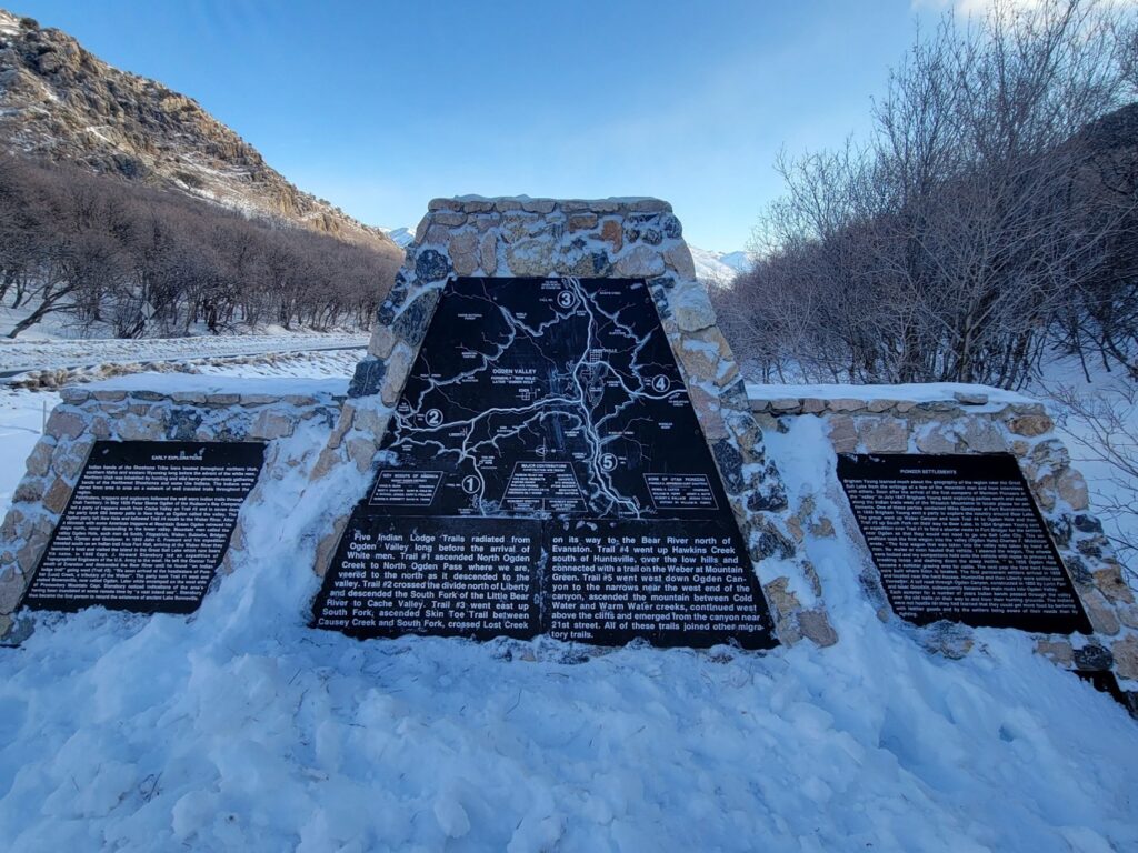
Indian Trails Monument

Published / by Colbie Hymas / Leave a Comment

Write-up by Colbie Hymas

Placed by: The Sons of Utah Pioneers

GPS Coordinates: N 41 degrees 19.227 W 111 degrees 53.922

Historical Marker Text (1):

Early explorations:

Indian bands of the Shoshone tribe were located throughout northern Utah, southern Idaho, and western Wyoming long before the advent of the white men. Northern Utah was inhabited by hunting and wild berry – pine nuts – roots gathering bands of the Northwest Shoshones and some Ute Indians. The Indians wandered from area to area on a network of well-traveled trails throughout the region. 

    Pathfinders, trappers, and explorers followed the well-worn Indian trails through Utah territory. In May 1825 Peter Skene Ogden of the Hudson’s Bay Company led a party of trappers south from Cache Valley on trail #2 and in seven days the party took 585 beaver pelts in New Hole as Ogden called the valley. The Ogden party left from New Hole and followed trail #4 south to the Weber River. After skirmish with some American trappers at Mountain Green Ogden retraced his steps North, never descending to the lower valley. Mountain men called the valley Ogden Hole, such men as Smith, Fitzpatrick, Weber, Sublette, Bridger, Russell, Clyman, and Goodyear. In 1843 John C. Fremont and his expedition traveled south on an Indian trail from Fort Hall, arriving at the Weber River they launched a boat and visited the island in the Great Salt Lake which now bears his name. In 1849 Capt. J. Howard Stansbury led an expedition of Topographical Engineers of the U.S. Army to the west. He left the Donner Trail south of Evanston and descended the Bear River until he found “an Indian lodge trail” going west (Trail #3). “We soon arrived at the headwaters of Pumbar (Lost) Creek, a tributary of the Weber”. The party took Trail #1 west and visited Brownsville, now called Ogden. Later while encamped on the west side of Promontory Mountain Capt. Stansbury noticed indications of the area’s having been inundated at some remote time by “a vast inland sea”. Stansbury thus became the first person to record the existence of an ancient Lake Bonneville. 

Historical Marker Text (2):

Five Indian Lodge Trails radiated from Ogden Valley long before the arrival of White men. Trail #1 ascended North Ogden Creek to North Ogden Pass where we are, veered to the North as it descended to the valley. Trail #2 crossed the divide north of Liberty and descended the South Fork of the Little Bear River to Cache Valley. Trail #3 went east up South Fork, ascended Skin Toe Trail between Causey Creek and South Fork, crossed Lost Creek on its way to the Bear River north of Evanston. Trail #4 went up Hawkins Creek south of Huntsville, over the low hills and connected with a trail on the Weber at Mountain Green. Trail #5 went west down Ogden Canyon to the narrows near the west end of the canyon, ascended the mountain between Cold Water and Warm Water creeks, continued west above the cliffs and emerged from the canyon near 21st street. All of these trails joined other migratory trails. 

Historical Marker Text (3):

Pioneer Settlements:

Brigham Young learned much about the geography of the region near the Great Salt Lake from the writings of a few of the mountain men and from interviews with others. Soon after the arrival of the first company of Mormon Pioneers in the “valley” in July 1847 Brigham Young sent exploring parties north and south along the Indian trails west of the Wasatch Mountains to locate places for settlements. One of these parties contacted Mills Goodyear at Fort Buenaventura. In 1848 Brigham Young sent a party to explore the country around Bear Lake. The group went up Weber Canyon and took Trail #4 to Ogden Hole and then Trail #3 up South Fork on their way to Bear Lake. In 1854 Brigham Young sent an expedition over Trail #1 to find a shorter route to Fort Bridger for the settlers near Ogden so that they would not need to go via Salt Lake City. This expedition took the first wagon into the valley in (Ogden Hole). Charles F. Middleton wrote, “The first wagon that was taken into the valley was taken by hand of man. No mules or oxen hauled that vehicle. I steered the wagon. The wheels were locked, and my companions held onto the vehicle with ropes to prevent its breaking loose and dashing down the steep incline.) In 1856 Ogden Hole became a summer grazing area for cattle. The next year the first herd houses were built where Eden is located. The first permanent settlers arrived in 1858 and located near the herd houses. Huntsville and then Liberty were settled soon thereafter. A toll road through Ogden Canyon constructed in 1860 by Lorin Farr and Isaac Goodale, subsequently became the main route into Ogden Valley. Each summer for a number of years Indian bands passed through the valley over the old trails on their way to and from their hunting grounds. The Indians were not hostile for they had learned that they could get more food by bartering with leather goods and by the settlers being aware of their needs than by fighting. 
Extended Research:

The Indian Trails Monument stands in the North Ogden Canyon and showcases a series of trails created by the movements of early Native American tribes, primarily the Northwestern band of Shoshone. The monument was placed by the Sons of Utah Pioneers and benefited from the research of people such as Mae Parry who was a very impactful Native American leader in Weber County, Utah.[1] Parry and others established a commitment to Native American history in the area, as it had largely been forgotten. The monument not only traces five Indian trails, but also gives a brief history of the early peoples who used these trails, such as Native Americans, early mountain men, and Mormon pioneers.

Long before white men arrived in the areas now known as Huntsville, Liberty, Eden, Ogden, and Cache Valley, Utah, they were inhabited by the Northwest band of Shoshone Indians. The Native Americans who lived there called the area “Opecarry,” which translated to “stick in the head.”[2] The Shoshone Indians were spread out around Utah and Idaho, however, the Indian Trails Monument in North Ogden Utah, specifically documents the trails established and used by the Northwestern band. These native peoples were nomadic hunters and gatherers who moved from place to place in search of water, edible vegetation, and wild game. They traveled with the seasons and learned over time the best places to obtain the greatest amounts of resources at the most opportune times. This took the Northwestern band into Northern and Eastern Nevada where they would harvest pine nuts, into southeastern Idaho where they found hot springs in the winter, and many other places throughout the year.[3]

Older Shoshone Indians used the term “So-So-Goi” to describe themselves, the term translates to “those that travel on foot.”[4] Before horses were introduced to the Northwestern band, this is exactly how they traveled, and from the young to the old, everyone was expected to pull their weight. The concept of sharing what one had, even with a stranger, was deeply engrained in the Northwestern band, and the concept of personal property did not exist. Helping neighbors and receiving help from neighbors was a way of survival for these early Indians, and therefore, they were constantly moving between different encampments of Shoshone and other nearby native groups for means of trading, socializing, and establishing kinship networks.

            After years and years of travel between encampments, and areas known to harbor significant amounts of resources, the Shoshone established well-worn trails. These trails could be followed to get to several places in Northern Utah. The trails not only traversed large areas of Northern Utah, but they also connected to other migratory trails, and could be followed into places such as Fort Hall and other important sites in early Utah. As a result of their useability and effectiveness, early trappers in Utah also utilized these trails. The monument discusses the paths and trails early trappers such as Peter Skene Ogden, John C. Fremont, and Captain Howard Stansbury traversed in the area.

After coming into the area and having success trapping beaver, Peter Skene Ogden of the Hudson Bay Company would name this area “Ogden Hole.”[5] Some of these trails and expeditions even led John C. Fremont to the Great Salt Lake where he would discover the island that now bears his name and record other important scientific information about the Great Salt Lake. Many other early trappers and mountain men used these trails to move from area to area trapping and trading goods and interacting with Native tribes.[6]

            The Mormon pioneers followed the same pattern and utilized the Native American trails for their own purposes. When the Mormons began arriving in the area, Chief Sagwitch led the Northwestern band of Shoshone. Contrary to the mountain men who often had good relationships with native tribes and integrated themselves into their culture and societies, the early Mormons often clashed with native tribes. When Chief Sagwitch learned of a group of Mormon pioneers coming their way, he went to meet their leader, Brigham Young, to offer peace and communication, as well as discuss stewardship over the land. Due to Brigham Young being ill, the Shoshone chief instead met with Heber C. Kimball who told him that the land belonged to the Lord, and the Mormons planned to cultivate and plant it. This is not what the Shoshone chief hoped to hear, but due to the peaceful and neighborly nature of the Northwestern band, Chief Sagwitch and his tribe continued to offer peace and assistance to the Mormon pioneers for years to come.[7]

            The Mormon pioneers continued to use these trails for several reasons. As more saints continued to arrive in the Mormon settlements, farmland became scarce, and Brigham Young sent out scouts to find new land to settle. These scouts would undoubtably have used these well-worn trails as they moved through the area looking for promising ground. Furthermore, Brigham Young sent missionaries to find native tribes and assimilate them into Mormon society. Native Americans were thought to be descendants of the Lamanites, an important group of people in the Book of Mormon, which is the leading spiritual text of the Mormon faith. Therefore, missionaries would seek out native tribes to teach them of their importance to the Mormon faith and attempt to convert them. This was successful with many native tribes, especially the Northwestern band of Shoshone.[8] Many Shoshone converted and continued to share this land with their new neighbors.

            The trails blazed by early Native Americans were important for many people occupying the area throughout the years. By traversing these trails, Native Americans were able to thrive in Northern Utah by migrating with the seasons and working with the land. The trails later made it significantly easier for mountain men to gain access to the frontier and trap animals and make early trading connections with native tribes. Furthermore, the Mormon pioneers would have had limited success moving throughout the area to settle and convert Native Americans had it not been for these trails that literally acted as a “golden brick rode” to the most resource rich areas, and native tribes.

The trails continue to be used today for recreational purposes and are favorite hiking trails for many residing in or near these areas. The history of these trails makes hiking them even more fascinating for many people, and through the work of the Sons of Utah Pioneers, and people such as Mae Parry and Darren Parry, author of The Bear River Massacre, the history of Native Americans and their homelands is being preserved and shared to the greater public.

For Further Reference:

Primary Sources:

Stansbury, Howard. An Expedition to the Valley of the Great Salt Lake of Utah. Philadelphia, PA: Lippincott, Grambo & CO, 1855.

Miller, David E. “Journal of Peter Skene Ogden; Snake Expedition, 1825.” Peter Skene Ogden’s Journal of his Expedition to Utah, 1825. Accessed March 1, 2022. https://user.mission.com/drudy/mtman/html/ogdenjrl.html.

Secondary Sources:

The Church of Jesus Christ of Latter-Day Saints. “Lamanite Identity.” Accessed March 2, 2022. https://www.churchofjesuschrist.org/study/history/topics/lamanite-identity?lang=eng.

North Ogden City. “About North Ogden.” Accessed February 18, 2022. https://www.northogdencity.com/community/page/about-north-ogden.

Parry, Darren. The Bear River Massacre: A Shoshone History. Salt Lake City, UT: Common Consent Press, 2019.

Roberts, Richard, and Richard W. Sadler. A History of Weber County. Salt Lake City, UT: Utah State Historical Society, 1997.


[1] Richard C. Roberts, and Richard W. Sadler, A History of Weber County (Salt Lake City, UT: Utah State Historical Society, 1997), 396.  

[2] “About North Ogden,” North Ogden City, accessed February 19, 2022, https://www.northogdencity.com/community/page/about-north-ogden.

[3] Darren Parry, The Bear River Massacre: A Shoshone History (Salt Lake City, UT: Common Consent Press, 2019), 12.

[4] Parry, Bear River Massacre, 13.

[5] “About North Ogden,” North Ogden City, accessed February 19, 2022, https://www.northogdencity.com/community/page/about-north-ogden.

[6] Ibid, About North Ogden.

[7] Parry, Bear River Massacre, 28-29.

[8] “Lamanite Identity,” The Church of Jesus Christ of Latter-Day Saints, accessed February 27, 2022, https://www.churchofjesuschrist.org/study/history/topics/lamanite-identity?lang=eng.
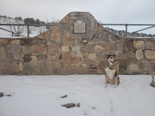
Aunt Libby’s Dog Cemetery

Published / by Shannon Gebbia / 2 Comments on Aunt Libby’s Dog Cemetery

write-up by Shannon Gebbia

Placed by: Utah Pioneer Trails and Landmarks Associations, No 95

GPS Coordinates: N 40° 07.123, W 112° 34.660

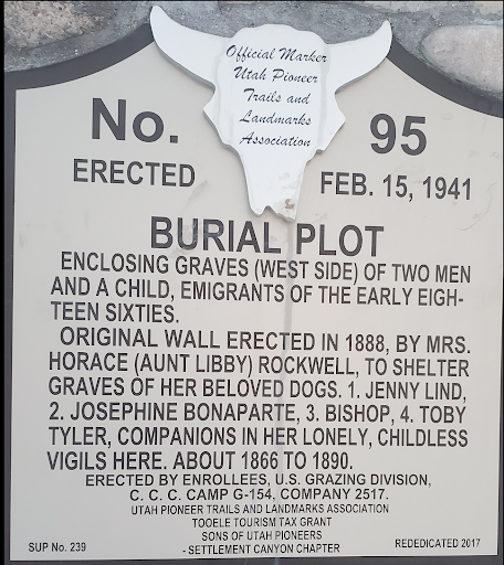
Historical Marker Text:

BURIAL PLOT

Enclosing graves (west side) of two men and a child emigrants of the early eighteen sixties.

Original wall erected in 1888, By Mrs. Horace (Aunt Libby) Rockwell to shelter graves of her beloved dogs. 1. Jenny Lind, 2. Josephine Bonaparte, 3. Bishop, 4. Toby Tyler, Companions in her lonely, childless vigils here about 1866 to 1890.

Erected by enrollees U.S. grazing division C.C.C camp g-154, company 2517.

Utah pioneer trails and landmarks association Tooele tourism tax grant

Sons of Utah pioneers

-settlement canyon chapter

SUP No. 239     Rededicated 2017

Extended Research:

Sometime between 1860 and 1870, Horace Rockwell and his wife Elizabeth “Libby” Rockwell moved to Skull Valley, a 40-mile long valley in what is now Tooele County, Utah. They operated the Pony Express station known as Point Lookout then continued living on the property in a log cabin built by stage workers after the station had closed.[1] They became horse and cattle ranchers and garnered a reputation as “rough frontiers folk” and “two strange characters.”[2], [3] Over time, the pair came to be known affectionately as Uncle Horace and Aunt Libby.

Uncle Horace and Aunt Libby owned one of the only sources of water along their stretch of the Overland Trail and charged travelers a fee to access it. Many riders and locals remembered Aunt Libby for smoking a pipe and treating her dogs better than her hired men.[4] Her “colony of dogs” were described as black and tan, short-haired, possibly of the “Fiste” breed (perhaps a misspelling of Feist, a small hunting terrier).[5] Aunt Libby liked to name some of her dogs after popular characters of the time, both fictional and real. Her variety of name choices reveals a wide range of interests in music, history, and popular literature: Jenny Lind, the “Swedish Nightingale” of the mid- to late-19th century opera scene; Josephine Bonaparte, the first Empress of France; and Toby Tyler, the 10-year-old protagonist of the children’s novel, Toby Tyler; or, Ten Weeks with a Circus.[6]

Photo of the site in August, 1941, prior to restoration by the UPTLA.

 As testament to her devotion for her dogs, Dr. W. M. Stookey, a member of the Utah Pioneer Trails and Landmarks association, recalls an instance when Aunt Libby called upon Tooele’s Dr. William Bovee Dods to tend to one of her dogs, which had fallen ill. When Dr. Dods refused, Libby forced one of her workers, Elijah Perkins, to play sick, thus tricking Dods into paying a visit to the cabin. Once there, he reluctantly tended to the dog, and she paid him $100. Aunt Libby’s trick only worked once—the next time a dog got sick, the Rockwells had to travel roughly 70 miles to Salt Lake City.[7]

Photo of the site in August, 1941, prior to restoration by the UPTLA.

When one dog died en route for treatment in Salt Lake City, Aunt Libby brought him back to Point Lookout and buried him near a collection of three graves belonging to immigrants who had died while passing through Skull Valley.[8] She then hired a stone worker, Gustave E. Johnson, to build a wall around the small graveyard.[9] As her beloved dogs passed on over the years, Aunt Libby buried each one in her cemetery.

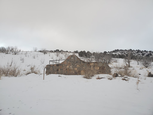
The Rockwells moved to California sometime after May 25, 1890 and lived there for the remainder of their lives.[10] Aunt Libby’s Dog Cemetery is the only structure still standing on the property known as Point Lookout.

View from Hwy 36 Pony Express Road

The historical significance of this cemetery seems to be centered around its location among the Pony Express stations along Utah’s section of the Overland Trail. Unlike Horace’s brother, Orrin Porter Rockwell, Horace and Libby Rockwell were not major figures in Utah or Mormon history—monuments haven’t been built in their name, we don’t learn about them in history lessons. But one story about a rough, pipe-smoking woman who tricked a Tooele doctor into treating her sick dog has survived the test of time and given historical value to this cemetery. Dr. Stookey explains that the reason for including the cemetery as an “extra in the line, both in design and significance,” was due to a “growing increase in its unique history,” and perhaps because it is one of the only remaining structures along this section of the Overland Trail.[11] Regardless of the reasoning, by including the cemetery among Utah’s historical markers, the UPTLA created an avenue for Aunt Libby’s stories to be retold forever. Within the chasm between the details of each recollection, we find the personality of that “strange character” Aunt Libby. According to most of the people who described her over the years, she was a rough, childless, pipe-smoking woman, unafraid of outlaw Porter.[12] But by way of the legacy of pet cemetery and the stories about her dogs, we see a giving, loving, motherly woman whose cultural knowledge reached far beyond the secluded scope of the Wild West.

For Further Reference:

Primary Sources

“Fatally Burned.”  Los Angeles Times. March 26, 1901. Accessed February 24, 2020. https://www.newspapers.com/image/380059910/?terms=Mrs%2BRockwell.

Sharp Manuscript: Stories published by James P. Sharp. Compiled by Shirley Sharp Pitchford and Susan Sharp Hutchinson. Utah State Division of History Archives.

Sharp, James P. “The Pony Express Stations.” Improvement Era (February 1945): 76–77.

https://archive.org/details/improvementera4802unse/page/n21/mode/2up

Stookey, W. M. “They Died But Lived Again! Aunt Libby Rockwell’s Doggone Dogs and Their Lonely Cemetery Beside the Historic Overland.” Salt Lake Tribune. August 31, 1941. Accessed February 24, 2020. https://www.newspapers.com/image/598747615/?terms=libby%2Brockwell

Utah Pioneer Trails and Landmarks Association marker records, ca. 1930–1990s. MSS B 1457, box 1. Utah State Division of History Archives.

Secondary Sources:

Bluth, John F. “The South Central Overland Trail in Western Utah, 1850- 1900.” U. S. Bureau of Land Management. https://ecos.fws.gov/ServCat/DownloadFile/101963?Reference=61466

Bluth, John F. “Supplementary Report on Pony Express Overland Stage Sites in Western Utah.” https://ecos.fws.gov/ServCat/DownloadFile/101965?Reference=61468.

Fike, Richard E. and John W. Headley. “The Pony Express Stations of Utah in Historical Perspective.” Cultural Resources Series Monograph 2. Bureau of Land Management of Utah, 1979.

https://archive.org/details/ponyexpressstati00fike/mode/2up

Jessop, J. D. “The Ghost of Aunt Libby May Be Nearby.” Tooele Transcript Bulletin, October 2, 2014. http://tooeleonline.com/the-ghost-of-aunt-libby-may-be-nearby/.


[1]Bluth, John F. “The South Central Overland Trail in Western Utah, 1850-1900” (U. S. Bureau of Land Management), p. 4. (accessed February 10, 2020) https://ecos.fws.gov/ServCat/DownloadFile/101963?Reference=61466; Jessop, J. D. “The Ghost of Aunt Libby May Be Nearby.” Tooele Transcript Bulletin – News in Tooele, Utah, October 2, 2014. (accessed January 29, 2020) http://tooeleonline.com/the-ghost-of-aunt-libby-may-be-nearby/; Stookey, W. M. “They Died But Lived Again! Aunt Libby Rockwell’s Doggone Dogs and Their Lonely Cemetery Beside the Historic Overland.” The Salt Lake Tribune, August 31, 1941. (accessed February 24, 2020). The exact date is unknown as several accounts differ, but they all agree the Rockwells lived at this location until sometime in 1890.

[2] Stookey.

[3] Sharp, James P., “The Pony Express Stations ,” Improvement Era, (February, 1945), 76-77. (accessed Feburay 10, 2020) https://archive.org/details/improvementera4802unse/page/n21/mode/2up

[4] Stookey.

[5] Sharp.

[6] Jessop, Stookey.

[7] Stookey, Jessop. Several newspaper stories reported this story, but the accounts differ as to which dog was ill, who called for Dods, and the amount he charged.

[8] Stookey, Bluth. Three unknown emigrating travelers died and were buried here.

[9] Stookey.

[10] Jessop; Stookey; Los Angeles Times, “Fatally Burned.” March 26, 1901. (accessed February 24, 2020) https://www.newspapers.com/image/380059910/?terms=Mrs%2BRockwell. Again, much is contested about the date, but one fact stands out: Aunt Libby burned in her house after falling asleep smoking her pipe.

[11] Stookey’s article explains the UPTLA’s haste in using the nearby CCC camps to help place markers and monuments along the difficult terrain, and that most Pony Express stations had “little or nothing remaining of the originals.” The survival of this cemetery and its story provide a picture of life along the trail.

[12]Lloyd, Erin. “Colors of Life Paint Rich Past in Rush Valley.” Tooele Transcript-Bulletin, 9 Dec. 1998, pp. 25–27. The article states Porter Rockwell owed $500 to his brother Horace, and Libby vowed to cut off Porter’s hair if the debt remained. LDS history states Porter’s hair long hair held significance to his faith. https://www.newspapers.com/image/545721374/?terms=libby%2Brockwell

Donner Hill

Published / by William Root / 2 Comments on Donner Hill

Placed by: LDS 38th North Ward Priests[1]

GPS Coordinates: 40° 45’5.76″N, 111° 48’3.28″W

Historical Marker Text:
Lured by Lansford Hasting’s assurance that his shortcut from the well-known trail to Oregon and California would save 250 miles and weeks of travel, the ill-fated Donner-Reed party reached this place August 23, 1846, after spending 16 days to hack out a 36-mile road through the Wasatch Mountains. Here at this narrow mouth of the canyon, they were stopped by what seemed impenetrable brush and boulders. Bone-weary of that kind of labor, they decided instead to goad the oxen to climb the hill in front of you. Twelve-year-old Virginia Reed, later recalled that nearly every yoke of oxen was required to pull each of the party’s twenty-three wagons up the hill. After this ordeal, the oxen needed rest, but there was no time. The party pushed on to the Salt Flats, where many of the oxen gave out. This caused delays, which led to disaster in the Sierra Mountains.

A year later, July 22, 1847, Brigham Young’s Pioneer Party, following the Donners and benefitting from their labor, reached this spot. William Clayton recorded their decision: “We found the road crossing the creek again to the south and then ascending a very steep, high hill. It is so very steep as to be almost impossible for heavy wagons to ascend…Colonel Markham and another man went over the hill and returned up the canyon to see if a road cannot be cut through and avoid this hill. Brother Markham says a good road can soon be made through the bushes some ten or fifteen rods. A number of men went to work immediately to make the road…After spending about four hours of labor the brethren succeeded in cutting a pretty good road along the creek and the wagons proceeded on.”

Donner Hill looking east towards Emigration Canyon

Among the lesson learned that day was one stated succinctly by Virginia Reed in a letter to prospective emigrants back home: “Hurry along as fast as you can, and never take no shortcuts.”

Extended Research:

In 1846 a wagon party led by George Donner departed Independence, Missouri and began a perilous journey from the United States towards Alta California in Mexico. The wagons were late in reaching the Sierra Nevada mountain range and disaster awaited the 88 members of the Donner Party. Extreme suffering and starvation followed, with 41 members of the group dying and eventually the incident drew national attention over reports that some members of the ill-fated party resorted to cannibalism in order to survive.[2] The Donner Party originally planned to travel to California via Oregon, but real estate speculator Lansford Hastings promoted an alternate route published in his famous Emigrants Guide to Oregon and California in 1845, and the Donner Party opted to try it.³

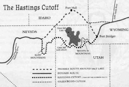
Hastings was not certain if he should promote the cutoff from Fort Bridger through the Salt Lake Valley and westward following John C. Fremont’s expedition in 1845, but he received support in favor of the cutoff from Fremont and Jim Bridger. Hastings thus advised the Donner-Reed party that they would save some 350-400 miles if they took his “cutoff.” One of his partners, James Clyman, however became convinced that the route was not suited for wagons and therefore tried to dissuade members of Donner-Reed Party from taking the cutoff. Joseph R. Walker, who successfully guided the first wagons over the California Trail by way of Fort Hall, also thought the route an unproven risk.[3]

Other migrant groups, which included the Bryant-Russell Party and Harlan-Young wagons, left Fort Bridger in mid-July 1848, following the Bear River into East Canyon where they passed through Devil’s Gate with difficulty along the Weber River. Hastings subsequently directed a group of German migrants from the Heinrich Lienhard party on a direct route through Echo Canyon into Devil’s Gate, where they caught up with the Harlan-Young party near the Jordan River. The Donner Party departed Fort Bridger two weeks later on July 31 and Hastings talked them out of going via Weber Canyon and Devil’s Gate, instead telling them to blaze a new path over to what would come to be called Emigration Canyon. On August 7, 1846, James Reed began carving a trail for the wagon train, chopping down bushes and trees in the Wasatch Mountains towards the canyon. Reed was joined by the remaining members of the wagon party who continued to hack and dig their way for 35 miles from present-day Henefer, Summit County, to Salt Lake City.²

Emigration Creek along Donner Hill

The Bryant-Russell, Harlan-Young and Lienhard parties would successfully pass through the Sierra Nevada Mountains into California, while the time the Donner Party spent trailblazing in Utah foreshadowed later events. After the three week trek through the Wasatch Mountains, the oxen were already exhausted and their supplies began to run low.

After entering the Salt Lake Valley, the first member of the party died of tuberculosis near the Great Salt Lake. A site near Grantsville, Utah provided temporary relief with underground water springs, their last source of water until reaching the Humboldt River. In the Salt Flats, Reed’s thirsty oxen ran off and were never seen again. Upon reaching Iron Hill, a fight broke out between one of Reed’s teamsters and John Snyder, a driver for the Graves wagon. Reed stabbed Snyder in the chest and was banished by the Donners after Snyder died. Reed thus avoided being pinned down by the early winter storms which trapped the rest of the party. His departure in October towards Sutter’s Fort allowed him to organize a rescue party in Sacramento that arrived in February 1847. Along the Humboldt River a band of Paiute Indians killed 21 of the Donner Party’s oxen and stole another 18, with more than 100 of the party’s cattle now gone. Two Indian guides assisted the Donner Party in reaching the summit of the Sierra Nevada, but turned back with the first sign of snowfall in early November.1

Donner-Reed Party burial remains discovered in the Salt Lake Desert

The delayed timing and trek through the west desert led to the party becoming snowbound in the Sierras. Malnutrition was a common cause of death, and Irish immigrant Patrick Breen wrote in his journal on Christmas Eve that he was living in a “Camp of Death”. 1 Some of the members of the party camped along the banks of Alder Creek and frozen Truckee Lake, now Donner Lake, where most of the cannibalism occurred. The first rescuers arrived at Truckee Lake in February 1847, composed of soldiers from the U.S. Army stationed in California during the U.S.-Mexican War, among them were members of the Mormon Battalion. One week after rescuers arrived, other isolated camp sites were still using the corpses of the dead for food. Breen wrote in his diary on February 26:

Martha’s jaw swelled with the toothache: hungry times in camp; plenty hides, but the folks will not eat them. We eat them with a tolerable good apetite. Thanks be to Almighty God. Amen. Mrs Murphy said here yesterday that [she] thought she would Commence on Milt. & eat him. I don’t [think] that she has done so yet; it is distressing. The Donners, 4 days ago, told the California folks that they[would] commence to eat the dead people if they did not succeed, that day or next, in finding their cattle.1

Patrick Breen’s diary entry describing the routine cannibalism in the encampment

Three additional relief efforts occurred in April in an attempt to find members who had become separated while camping along Truckee Lake. In the last effort they found only one survivor, Louis Keesberg, who was surrounded by half-eaten corpses. As the survivors departed with the rescuers, members of the Mormon Battalion were ordered to bury the dead bodies inside the main cabin on what is today Donner Pass and then set fire to the cabin.[4]

The Donner Party, in essence, blazed the trail into the Salt Lake Valley which Brigham Young and the Mormon Pioneers used the following year. Young left Winter Quarters, Nebraska with his encampment and passed through the mouth of Echo Canyon by mid-July 1847; he then picked up the Donner-Reed trail and followed it into the Salt Lake Valley. Instead of three weeks, it took Young’s party one week, a matter of great importance since it enabled the Mormons to plant wheat and potato crops in time for their first harvest in the fall. In the last quarter-mile, rather than hauling their wagons over Donner Hill, the Mormons decided to hack through the brush and go around Donner Hill. The Mormons emerged four hours later at what is now This is the Place State Park.[5]

For Further Reference:

Primary Sources:

Breen, Patrick. Diary of Patrick Breen of the Donner Party, 1846-7. Berkeley: University  of         California Bancroft Library, 1910.

Secondary Sources:

Campbell, Eugene. “The Mormons and the Donner Party.” BYU Studies Quarterly, Vol. 11 no. 3 (1971).

Miller, David. “The Donner Road through the Great Salt Lake Desert.” Pacific Historical Review, Vol. 27, no. 1 (February 1958): 39-44


[1] Originally installed by “Mormon Explorers” Y.M.M.I.A. In 2010, the original plaque was stolen and re-erected in 2016 by the LDS 38th North Ward High Priests

[2] Campbell, “The Mormons and the Donner Party.”

[3] Miller, “The Donner Road through the Great Salt Lake Desert,” 39-44

1 Breen, 18

1 Breen, 28

[5] Campbell, “The Mormons and the Donner Party.”

Adobe Rock

Published / by Ben Kiser / 1 Comment on Adobe Rock

Written by Benjamin Kiser, MA History Student, University of Utah

Placed By:  Tooele County Company of the Daughters of Utah Pioneers

GPS Coordinates: 40°39’36.2″N 112°17’18.4″W

Historical Marker Text:

DUP Marker Jan 22, 2017

DAUGHTERS OF UTAH PIONEERS No 103

ERECTED JULY 27, 1947.

ADOBE ROCK

On July 27, 1847, three horsemen from the scouting party sent out by Brigham Young, obtained an excellent view of the surrounding valley, from the top of this rock.  In 1849, Captain Howard Stansbury of the United States Topographical Engineers built a small adobe house by this rock, for his herders, hence the name “Adobe Rock”.  The near by highway follows the same route as the old pioneer trail used by explorers, trappers, emigrants and gold seekers.A spring near by made this a favorite camp site.

Extended Research:

Adobe Rock Jan 22, 2017

Adobe Rock is a large stone promontory in the northeast corner of Tooele Valley.  Early explorers of the Great Basin, California-bound pioneers, and Mormon residents of the valley saw Adobe Rock, a collection of three individual boulders, as a prominent landmark.  According to the Daughters of Utah Pioneers historical marker that was placed on the rock in 1947, three men from Brigham Young’s scouting party surveyed the valley from atop the rock. [1]  Unfortunately, a written account of this much-referenced incidence is nowhere to be found. However, Mormons weren’t the first to distinguish the rock as a significant spot in the valley’s landscape.  Though no written record exists, Goshutes who occupied the Tooele area were well acquainted with the valley’s geologic landmarks.  The first Euro-Americans to describe Adobe Rock and the surrounding area were overland migrants who took Hastings Cutoff in 1846 on their way to California.  Edwin Bryant, a California immigrant with a book deal to publish his expedition’s journal, recounts that on July 31, 1846 “we passed several remarkable rocks rising in tower-like shapes from the plain, to the height of sixty or eighty feet.”[2]   A few short weeks later, Henrich Lienhard, a Swiss emigrant to California, recorded his entrance to the Tooele Valley, camping at a spring that modern historians interpret to be near Adobe Rock.[3]

Perhaps the most prolific character to venture near Adobe Rock was U.S. Army Captain Howard Stansbury.  In an 1849 expedition around the Great Salt Lake to study its environs and the geology of the mountains bordering it, Stansbury entered the Tooele Valley from the west, exiting toward Salt Lake to the east near Black Rock.[4]  A variety of secondary sources, including the DUP marker on Adobe Rock, reference the construction of an adobe hut near the rock for Stansbury’s herdsman to occupy while wintering cattle in the “Tuilla” Valley.[5]  However, in Stansbury’s report, no reference is made to Adobe Rock or the construction of a hut for his herdsman. In fact, Stansbury does not even include Adobe Rock on the map he attaches to his report.[6]  References are made to herds wintering in the valley, but there is no specific mention of the adobe hut.

Regardless of whether or not reports on the construction of a herdsman hut are accurate, Adobe Rock was a striking feature on the landscape for overland travelers who took Hastings Cutoff, government explorers, and Mormon pioneers.  The boulder remains an iconic Tooele County landmark as State Route 36, the main highway to Tooele, passes nearby to the west.

Howard Stansbury’s Map of the Great Salt Lake and Adjacent Country in the Territory of Utah
Courtesy of Utah State Historical Society


[1] Tooele County Daughters of Utah Pioneers, History of Utah’s Tooele County: From the Edge of the Great Basin Frontier (Tooele, UT: Transcript Bulletin Publishing, 2012), 169-170.

[2] Edwin Bryant, “The Journal of Edwin Bryant,” in Utah Historical Quarterly 19 (1951), ed. J. Roderic Korns, 78.

[3] Heinrich Lienhard “The Journal of Heinrich Lienhard,” in Utah Historical Quarterly 19 (1951), ed. J. Roderic Korns, 138.

[4] Howard Stansbury, Exploration and Survey of the Valley of the Great Salt Lake of Utah, Including a Reconnaissance of a New Route Through the Rocky Mountains (Washington, D.C.: Robert Armstrong, 1853), 117-199, accessed March 29, 2017, https://babel.hathitrust.org/cgi/pt?id=mdp.39015073282918;view=1up;seq=146.

[5] Ouida Blanthorn, comp., A History of Tooele County (Salt Lake City: Utah State Historical Society, 1998), 55.

DUP, History of Utah’s Tooele County, 161-162.

[6]  Howard Stansbury, Exploration and Survey of the Valley of the Great Salt Lake of Utah, Including a Reconnaissance of a New Route Through the Rocky Mountains (Philadelphia: Lippincott, Grambo, and Co., 1852), 3, accessed March 29, 2017, https://babel.hathitrust.org/cgi/pt?id=mdp.39015070221182;view=1up;seq=9;size=400.

For Further Reference:

Primary Sources

Edwin Bryant, “The Journal of Edwin Bryant,” in Utah Historical Quarterly 19 (1951), ed. J. Roderic Korns.

Heinrich Lienhard “The Journal of Heinrich Lienhard,” in Utah Historical Quarterly 19 (1951), ed. J. Roderic Korns.

Howard Stansbury, Exploration and Survey of the Valley of the Great Salt Lake of Utah, Including a Reconnaissance of a New Route Through the Rocky Mountains (Washington, D.C.: Robert Armstrong, 1853), accessed March 29, 2017, https://babel.hathitrust.org/cgi/pt?id=mdp.39015073282918;view=1up;seq=146.

Howard Stansbury, Exploration and Survey of the Valley of the Great Salt Lake of Utah, Including a Reconnaissance of a New Route Through the Rocky Mountains (Philadelphia: Lippincott, Grambo, and Co., 1852), accessed March 29, 2017, https://babel.hathitrust.org/cgi/pt?id=mdp.39015070221182;view=1up;seq=9;size=400.

Secondary Sources

Tooele County Daughters of Utah Pioneers, History of Utah’s Tooele County: From the Edge of the Great Basin Frontier (Tooele, UT: Transcript Bulletin Publishing, 2012.)

Ouida Blanthorn, comp., A History of Tooele County (Salt Lake City: Utah State Historical Society, 1998.)