Category Archives: Categories

Irish Railroad Workers

Published / by Amy Brown / Leave a Comment

Write-up by Amy Brown

Placed by the Hibernian Society of Utah on March 17, 1996 dedicated May 10, 1996

The GPS Coordinates: 41°37’03.6″N 112°33’03.0″W

Historical Marker Text: To the Irish who toiled on the Transcontinental Railroad uniting our nation

Extended Research:

In 1862 Congress passed the Pacific Railroad Act[1] providing federal land and funding for the building of a transcontinental railroad from Omaha, Nebraska to Sacramento, California. The project was an engineering feat never seen before. Construction began in 1863 and it was completed on May 10, 1869 at Promontory Point, Utah. The excitement to build a transcontinental railroad created a competition between two railroad companies. The Central Pacific Railroad built East from Sacramento, and the Union Pacific Railroad built West from Omaha, eventually meeting in Utah Territory. Upon completion, travel time across the country dropped to only seven days, a significant reduction from the four to five months it took via wagons. The transcontinental railroad also sped trade, communication, and helped to unite the nation. The building of the first transcontinental railroad required 6 years to complete and thirty-thousand workers who were primarily immigrants.[2] Without the hard work and sacrifice of both Chinese and Irish immigrants the historic completion of the transcontinental railroad would not have been possible.

The Union Pacific Railroad company employed mainly Irish immigrants who were unmarried veterans of the Civil War, both Confederate and Union, who sought opportunity and work. The work was challenging and it consisted of digging, grading, and track laying across the Great Plains for long hours at a time through challenging conditions. The style of labor was very military[3] like with project managers cursing and barking out orders which workers were expected to obey like soldiers. Workers were paid three dollars a day with food and lodging provided. They worked from sun up to sundown with only three breaks a day for meals, which included large breakfast and lunch portions and smaller dinner portions. Harsh winter storms, Indian raids on worker camps and lack of supplies such as firewood made track laying difficult and slow. The Irish workers also suffered dysentery which was a constant problem because they frequently drank impure water from springs or lakes. They were expected to lay two to three miles of track a day.[4]

Irish immigrants faced discrimination and were sometimes viewed as dirty drunks who were not afraid to go on strike. Even still the railroad companies relied on their labor and they were valued as hard workers on the railroad and good track layers. As they approached the meeting of the rails in 1869 the Central Pacific workers were able to lay ten miles of track in a single day with the help of eight Irish immigrants. It was a feat and record never seen before. After the work on the transcontinental railroad was complete many of the Irish immigrants continued to work for the railroad or found mining jobs throughout the West.  This marker honors their contribution in uniting the nation as well as their work and sacrifice.


[1] Congress of the United States, The Pacific Railroad Act, (Washington D.C. 1862)  https://www.ourdocuments.gov/document_data/pdf/doc_032.pdf

[2] Stephen E. Ambrose, Nothing like It in the World: The Men Who Built the Transcontinental Railroad, 1863-1869 (New York: Simon & Schuster, 2000), 17.

[3] Ryan Dearinger, The Filth of Progress (Oakland: University of California Press, 2015).

[4] Beatty, http://www.irishcentral.com/roots/genealogy/the-impact-of-the-irish-on-the-american-railwaysystem

Primary Sources: 

Congress of the United States, The Pacific Railroad Act, (Washington 1862)  https://www.ourdocuments.gov/document_data/pdf/doc_032.pdf

Secondary Sources:

Ambrose, Stephen E. 2000. Nothing like It in the World: The Men Who Built the Transcontinental Railroad, 1863-1869. New York: Simon & Schuster.

Dearinger, Ryan. 2015. The Filth of Progress. Oakland: University of California Press. Accessed      March 29, 2017. ProQuest Ebook Central.

https://www.nps.gov/parkhistory/online_books/blm/ut/8/sec1.htm

http://www.irishcentral.com/roots/genealogy/the-impact-of-the-irish-on-the-american-railway-system


First Settlers of Holladay

Published / by Scott Shields / 1 Comment on First Settlers of Holladay

Write-up by Scott Shields

Placed by:  Holladay Chapter, National Society Sons of Utah Pioneers, No. 65

GPS Coordinates: 40 ° 39”56” N 111 ° 49’17” W

Historical Marker Text:

John. D. Holladay, a leader of the Mississippi Company of Mormon Pioneers entered the Salt Lake Valley on July 29, 1947.

John Holladay’s group explored the valley of the Great Salt Lake and its tributary canyons with an eye towards irrigation, wild hay for their animals, and water power for mills.  Most of the Mississippi Company stayed together and by fall had planned their farms and community in the area of a free-flowing, spring-fed stream issuing from the base of Mt. Olympus.  Thus the village of Spring Creek, as the stream was then called, was the first to be established away from Great Salt Lake City itself.

As soon as John Holladay was named the Branch President, the village took upon itself the name of Holladay’s settlement or Holladay’s Burgh.

In February of 1849 the first surveyed plots of land were issued to the settlers.

Historical Marker Text (2): Original Land Owners

Historical Marker Text (3):  Original Lot locations


 Historical Marker Address:  4778 Holladay Boulevard (west side)

Extended Research:

Sometime in the spring of 1848, the very first Holladay settlers-to-be came to this area and established a community. The location was soon called Holladay’s Burgh after its founding pioneer captain, John D. Holladay.   The name was later shortened to Holladay.  One member of the original group of settlers was William Decatur Kartchner, born in Pennsylvania and later a resident of Illinois.  He wrote in his journal: “Spring arrived; we were to farm as we had traveled, by tens, fifties, and hundreds. The land our ten drew was on a high bench six miles southeast of the city and our captain, John Holladay Sr. He asked permission from his captain to locate three miles further south at a large spring. It was granted, and soon we moved out there, built a row of small houses and fenced a field.”  1 These “ten” that William referred to were members of the Mississippi Company of Pioneers that had traveled together to Salt Lake City.

For these new settlers, life in this area was hard in those early years.  Despite mental toughness, hard work and cleverness, hunger was common.  William Kartchner wrote what it was like that first 1848 spring and summer in Holladay:  “During this time our breadstuff gave out. We had our last ox killed, an old favorite of mine. I could not kill it myself, it would be like killing one of my family.”2   His neighbor took pity on him and killed it for him but it was “poor beef” and William had to boil it with thistle roots to make it better.

Sharing food was a way of life in order for the group to survive.  William only brought a “few kernels of corn” with him across the plains so he waited until May to plant them.  He planted Spanish corn kernels which sprouted, grew and produced enough corn to make enough flour for “sufficient bread for three families.”  He also planted wheat which grew and he was able to share with the group captain and his family.   When Brother Holladay came to William and asked ‘Brother William, what under heavens are we to do for bread?   William pointed to his ripening wheat and replied “there is bread”.  Hunger served to remind William of how critical farming became in this desert environment.  He wrote:  “At that time I had not tasted of bread or any substance of grain for nearly two months.”3

Despite the hard won survival of the first few years, most of these original settlers did not stay long.  It was not because they did not like the area but because of another call for settlers to move to California.  In order to spread out and create new settlements, LDS church leadership asked for church members to establish a community in California.  The promise of a warmer climate interested many Southerners – including John D. Holladay.  So in the spring of 1851, just three years after arriving in Holladay, many of the original Mississippi group of ten and others packed up and traveled 700 miles to San Bernardino. 4

About these Mississippi Mormons who were the first settlers of Holladay, The historian Leonard Arrington offered this assessment :  “Intelligent and resourceful, [the] southern women accomplished miracles in establishing homes and rearing their families. . . . Mostly small landowners, stockmen, and frontiersmen, [the men]…became Brigham Young’s trusted associates in managing men and resources for the development of Mormon settlements”. 5

Primary Source:

  1. William Kartchner, Journal in Kate B. Carter, Our Pioneer Heritage, vol 2  (Salt Lake City: Daughters of Utah Pioneers, Utah Printing Company, 1959), 443.
  2. Carter, Our Pioneer, 444.
  3. Ibid.

Secondary Sources:

  1. http://mormontrails.org/Tours/Holladay/Background.htm
  2. Leonard J. Arrington, “Mississippi Mormons,”  Ensign, June 1977, 46.

Holladay Historical Commission Papers, Official minutes, correspondence, and other papers from the work of the Commission, Includes information on historical sites and landmarks 2000-2001, Marriott Library Special Collections, University of Utah, Salt Lake City, Utah.

Elizabeth Newman Hutchinson, Holladay, Salt Lake County, Utah, 1971, Marriott Library Special Collections, University of Utah, Salt Lake City, Utah.

For further reference:

  1. Journal History, July 29, 1847, LDS Church Historical Department.
  2. “Manuscript History of the Big Cottonwood Ward,” LDS Church Historical Department.
  3. William E. Parrish, “The Mississippi Saints,“ In The Historian: A Journal of History, 50:489, August 1988.

Chief Wasatch

Published / by Zak Erickson / Leave a Comment

Placed by: Mayor Larell D. Muir and Park and Operation Superintends Lynn F. Pett and Bill D. Crocker

GPS Coordinates:  40°39’37.7748”N 111°53’16.7136”W

Historical Marker Text

“Chief Wasatch”

To raise the nation’s conscience to the plight of the first American so they won’t be forgotten, but will be remembered in our minds and in our hearts.  This statue is sculpted out of a giant cottonwood tree in honor of Utah Native Americans – Southern and Northern Ute, Sothern Shoshone, Goshutes, Paiute, and Navajo.  Creator Peter “Wolf” Toth, is sculpturing statues for all 50 states.

Dedicated: November 23, 1985

Mayor: Larell D. Muir

Park & Operation Superintendents: Lynn F. Pett and Bill D. Crocker

Extended Research:

In 1985, the mayor of Murray, Utah, Larell D. Muir, commissioned Peter “Wolf” Toth to sculpt a statue of “Chief Wasatch”. It continues to greet visitors at the entrance of Murray Park to this day. The statue may prompt people to think that “Chief Wasatch” was a great leader of one of the Native American tribes in Utah. However, this was not the case; in fact, “Chief Wasatch” was not an actual person. The statue was not created to honor a specific individual, but rather to honor the many Native Americans who lived in Utah long before fur traders, explores, and Euro-American settlers came to Utah. In this regard, “Chief Wasatch” stands in for all Utah Native Americans and represents their history and legacy.

There is not much known about the earliest Native American inhabitants of Utah.  This is because they did not have a written language and did not come into contact with groups that did. The little bit that we do know is from artifacts such as worn sandals, food caches, stone houses, silk weed nets, and even human droppings[1].  After the Desert Archaic, the Fremont Indians made the transition out of caves and started to build their own shelters.  They also learned how to farm but it is not known where they learned this skill.  With farming, they also started to build granaries to protect what they grew[2].  They would build several homes and granaries near each other to create a sort of village. This marked a transition from a nomadic lifestyle to a more stationary one.  The Fremont also spread throughout the region until there were  many different  Fremont sites across the area that would become Utah.

The Fremont were eventually displaced by or absorbed by the Ute, Goshute, Shoshone, and Southern Paiute. Each of these tribes thought that the land they lived on was sacred and that their God intended for them to live there. Creation narratives instilled in tribal members a sacred connection between the land and the people. With this in mind, it is easier to understand why there was sometimes tension between the Ute, Goshute, Southern Paiute, Shoshone and the Mormon pioneers. Mormon settlers came into the Great Basin and built homes and communities on lands that the Native Americans considered sacred.  This tension lead to many conflicts and sadly the eventual removal of the Native Americans to reservations.

It is because of this removal that Mayor Larell D. Muir arranged for a sculpture of “Chief Wasatch” at Murray Park. Muir wanted to honor and make sure that Utah’s Native Americans would not be forgotten.  Now when people enter Murray Park or drive past the park on State Street they can see “Chief Wasatch” and remember the Native Americans of Utah.

[1] Dean L. May, Utah: A People’s History (Salt Lake City: University of Utah Press, 1987), 12.

[2] May, 14.

For Further Reference:

Primary Source:

Acts, Resolutions, and Memorials, Passed by the First Annual, and Special Sessions, of the Legislative Assembly of the Territory of Utah, Begun and held at Great Salt Lake City, on the 22nd day of September, A. D., 1851(Great Salt Lake City, Utah Territory: Brigham H. Young, Printer, 1852), 91-93.

Secondary Sources:

Clifford Duncan, “The Northern Utes of Utah,” in A History of Utah’s American Indians, ed.

Forrest S. Cuch, (Salt Lake City:  Utah Division of Indian Affairs and Utah Division of State History, 2000), 167-8.

“The Deseret News.” Google News Archive Search. Accessed April 19, 2017. https://news.google.com/newspapers safe=strict&nid=336&dat=19851112&id=a9lUAAAAIBAJ&sjid=8oMDAAAAIBAJ&pg=4787%2C6022654&hl=en.

Iverson, Kristen. “Living History: How the giant Chief Wasatch came to Murray Park.” The Salt Lake Tribune. September 22, 2011. Accessed April 19, 2017. http://archive.sltrib.com/story.php?ref=%2Fsltrib%2Fnews%2F52624885-78%2Ftoth-murray-chief-park.html.csp.

May, Dean L. “Man and Desert.” Utah: A People’s History. Salt Lake City: U of Utah Press,

  1. 1-19.

Thomas G. Alexander, Utah, The Right Place:  The Official Centennial History (Salt Lake City:

Gibbs Smith Publisher, 1995), 29-30.

W.Paul Reeve, Making Space on the Western Frontier:  Mormons, Miners, and Southern

Paiutes (Urbana and Chicago:  University of Illinois Press, 2006), 12.

Simpson Springs Pony Express Station

Published / by Paul McKnight / 1 Comment on Simpson Springs Pony Express Station

Simpson Springs Pony Express Station

Write up by Paul McKnight

Placed by enrollees U.S. grazing division C.C.C camp 8-184, Company 2517, No. 87

GPS coordinates: 40°2′16″N 112°47′11″W.


Historical Marker Text (1):

NO. 87

                        Erected AUG 23, 1940

Simpson’s Spring- Pony Express Station

            One of the important desert stations on the Pony Express and overland stage route between ST. Joseph, Missouri and Sacramento, California. From this point, water was carried for west-bound travelers and animals. The Spring was discovered by Captain J.H. Simpson, U.S. Army. In 1858, the first east-bound Pony Express courier halted here about 5 P.M. April 7, and west-bound about 2 A.M. April 10, 1860. The Last riders passed about October 22,1861. The coming of the overland telegram made it inadvisable to continue the Pony Express.

            This monument constructed by enrollees U.S. grazing division C.C.C camp 8-184, Company 2517.


Historical Marker Text (2):

The Station

A number of structures have been built and destroyed in the vicinity of Simpson Springs over the years, and it isn’t known for sure which served as the station for the mail route and the Pony Express. The nearby restored cabin is located at the approximate site of the original station and closely resembles the original.

George Chorpenning did not benefit from the effort and money spent in building the mail stations. In 1859 financial troubles struck. Chorpenning’s government mail contracts were suddenly reduced; no money reached route employees during the fall. Chorpenning’s animals were “attached” and sold for back wages. William Russel acquired the new mail contract. Chorpenning notes that Russel “stepped in, took possession of my stations, provisions, improvements…” Thanks to Chorpenning, the Pony Express was in business.

Historical Marker Text (3):

Stone Cabin

Alvin Anderson used stone from the abandoned Pony Express station when he built this cabin in 1893. It was intended for his wife, who died in childbirth before she could live in it.

Extended Research:

The Pony Express was established in April of 1860. The idea behind the Pony Express was to establish an overland mail route between Joseph Missouri and Sacramento California. During this time, transporting mail and information from one side of the U.S. to the other proved too time consuming. The mail and other information was placed on a boat which sailed around to California. This could take weeks if not months. By the time the news arrived, it was too old to even matter. Therefore, the Pony Express was considered to be a better alternative to a long voyage.

William H. Russel, Alexander Majors and William B. Waddell started what at the time was known as the Leavenworth & Pike’s Peak Express Company. The postmaster general, Joseph Holt requested their services. The people who rode the Pony Express could achieve 1800 miles between Joseph, Missouri and Sacramento, California in just ten days. This definitely cut down the time it took for a ship to sail around the world. While the information transported was still not very current, it sure was more up to date than the news which came to California by ship.

Travel for many of the riders on the trail was often hazardous. As can be illustrated by this first-hand account by Buffalo Bill Cody, who was most famous for his Wild West Show. When Buffalo Bill joined the Pony Express, he was only 15 years old. This was not uncommon to see in the Pony Express at this time. Buffalo Bill shared his account of some of the events which happened to him while on the trail with these words:


“. . .The next day he [Mr Slade,the manger of Cody’s Pony Express station] assigned me to duty on the road from Red Buttes on the North Platte, to the Three Crossings of the Sweetwater – a distance of seventy-six miles – and I began riding at once.

One day when I galloped into Three Crossings, my home station, I found that the rider who was expected to take the trip out on my arrival had got into a drunken row the night before and had been killed; and that there was no one to fill his place. I did not hesitate for a moment to undertake an extra ride of eighty-five miles to Rocky Ridge, and I arrived at the latter place on time. I then turned back and rode to Red Buttes, my starting place, accomplishing on the round trip a distance of 322 miles.

Slade heard of this feat of mine, and one day as he was passing on a coach he sang out to me, ‘My boy, you’re a brick, and no mistake. That was a good run you made when you rode your own and Miller’s routes, and I’ll see that you get extra pay for it.’

Slade, although rough at times and always a dangerous character – having killed many a man – was always kind to me. During the two years that I worked for him as pony-express-rider and stage-driver, he never spoke an angry word to me.

As I was leaving Horse Creek one day, a party of fifteen Indians ‘jumped me’ in a sand ravine about a mile west of the station. They fired at me repeatedly, but missed their mark. I was mounted on a roan California horse – the fleetest steed I had. Putting spurs and whip to him, and lying flat on his back, I kept straight on for Sweetwater Bridge – eleven miles distant – instead of trying to turn back to Horse Creek. The Indians came on in hot pursuit, but my horse soon got away from them, and ran into the station two miles ahead of them. The stock-tender had been killed there that morning, and all the stock had been driven off by the Indians, and as I was therefore unable to change horses, I continued on to Ploutz’s Station – twelve miles further – thus making twenty-four miles straight run with one horse. I told the people at Ploutz’s what had happened at Sweetwater Bridge, and with a fresh horse went on and finished the trip without any further adventure.”

On June 16, 1860 congress approved the construction of a telegraph line which would connect the west coast with other lines in Missouri. Thus, in October of 1861 the Pony Express was deemed obsolete and unnecessary. The travel was dangerous, the rides were long. The Pony Express station at Simpson Springs was just one of many stations along the route to California. Riders would arrive at this station and either another rider would continue the ride or the same rider would switch horses and continue riding to the next station. The arrival of the telegraph put an end to the hazardous transfer of information. This station at Simpson Springs served as one of many stations used by members of the Pony Express such as Buffalo Bill. Such stations provided security, food, and fresh horses for incoming riders.

Primary Source:

  • “Pony Express Rider, 1861” EyeWitness to History, www.eyewitnesstohistory.com (2008).

Secondary source:

https://www.nps.gov/poex/learn/historyculture/index.htm


Lone Cedar Tree

Published / by Sam Florence / Leave a Comment

By Sam Florence

Placed By: Daughters of Utah Pioneers, 1930.

Latitude/Longitude: 40.7625˚N, 111.873889˚ W

Plaque A: “LONE CEDAR TREE Although willows grew along the banks of the streams a Lone Cedar Tree near this spot became Utah’s first famous landmark. Someone in a moment of thoughtlessness cut it down, leaving only the stump which is a part of this monument. ‘In the glory of my prime I was the pioneer’s friend.’”

Plaque B: “THE CEDAR TREE SHRINE Erected July 24, 1933 by Daughters of Salt Lake County The street to the north was originally Emigration Road- the only approach from the east. Over this road the pioneers of 1847 and subsequent years entered the valley of the Great Salt Sea. They found growing near this site a lone cedar and paused beneath its shade. Songs were sung and prayers of gratitude offered by those early pilgrims. Later the cedar tree became a meeting place for the loggers going to the canyons. Children played beneath its branches. Lovers made it a trysting place. Because of its friendly influence on the lives of these early men and women we dedicate this site to their memory.”

Extended Research: According to Utah lore, Mormon pioneers arrived in the summer of 1847 to find the Salt Lake valley completely devoid of trees, save for one cedar tree toward the very north end of the valley. This legend is indeed interesting, but the controversy surrounding the tree (which was likely a juniper tree rather than a cedar tree) that arose during the twentieth and twenty-first centuries are perhaps more intriguing than the remains of the tree itself.

From the outset, it seems highly unlikely that this tree was the only one in the valley; in an extract from letters written by John R. Young, pioneer of 1847, to his grandson, the former writes: “From our cabin in the mouth of City Creek canyon, in 1847, one could see a lone cedar tree on the plain southeast of us, and on the south fork of the creek, about where Main and Third South Streets intersect, stood seven, wind swept, scraggy cottonwood trees. On the north side of City Creek stood a large oak tree. No other trees were visible in the valley.”[1] Here it seems that while there may not have been many trees in the valley, there were at least a handful in the central area of what would become downtown Salt Lake City. The tree stood alive in its original spot, serving as a meeting place and welcome shelter from the high desert sun, until it eventually died and was moved to the middle of 600 East by the Daughters of Utah Pioneers in 1933. On July 4 of that year, the Daughters built a monument to the tree with a protective structure over it; the monument originally included a large portion of the trunk of the tree. Plaque B is the original plaque that was laid in 1933 by the Daughters. On September 21, 1958, vandals chopped down and stole a considerable portion of the tree from the monument, leaving only the stump of the Lone Cedar Tree remaining. The vandals were never found, and there was no extensive effort to search for the stolen remains of the tree.[2] In 1960, the existing memorial was expanded upon and plaque A was added to explain the vandalism and why there was a monument to a tree that didn’t really exist anymore.

Though the narrative of a lone cedar tree sheltering the pioneers and offering a signal from God that they had finally arrived at the right spot is compelling, the majority of available evidence suggests that the legend was fabricated. As mentioned above, several pioneers noted in journal entries the existence of other trees not just in the valley, but in the general vicinity of Lone Cedar tree. In his article “One Hundred Years at the Utah State Historical Society,” historian and author Gary Topping takes a critical view of the Lone Cedar tree myth, raising several points contradictory to some of the assertions made on the plaques at the location. Topping notes “it is botanically unreasonable, in view of the stands of box elder and cottonwood trees along modern stream banks, that only one lone juniper would have existed there in 1847.” He also remarks that if the tree had actually been the only one in the valley, it would have been a rather conspicuous place for ‘trysting lovers’ to meet.[3]

Topping also explores the consequences that belittling the Lone Cedar Tree myth had on the former director of the Utah Historical Society, Russ Mortensen. Shortly after the trunk of the tree was cut down by vandals, a Deseret News reporter phoned Mortensen to ask for his thoughts on the vandalism, then changed the tone of the conversation by asking if Mortensen believed that the tree was the only one in the valley in pioneer times. Mortensen sealed his fate by confidently responding “Hell no, do you?” The reporter responded by publishing an excoriating article about Mortensen, claiming that the tree “symbolized the willingness of the pioneers ‘to suffer, even to die, for the accomplishment of holy purposes,’ the editor added that the tree ‘represented kindness, shelter, hospitality—all given freely and withheld from none, redmen or white.’”[4] This excerpt seems to generally sum up the justifications provided for the myth of the Cedar Tree: regardless of the veracity of the myth, the tree is a symbol of pioneer heritage and proof that the Salt Lake valley was God’s chosen habitat for the Mormons.

We need not view the story of the tree as inscribed on the plaque as literal truth, but an idyllic metaphor for the hardships endured by the pioneers as they foraged their way out west. The original plaque laid by the Daughters of Utah Pioneers showcases the tree as a welcome reprieve from the hardships of pioneer life, and a meeting point where happy memories were made – and that is how the tree should be remembered.


[1] Young, John R. “Reminiscences of John R. Young.”

[2] Dates and account of vandalism from archive.sltrib.com

[3] Topping, Gary. “The Lone Cedar Tree Controversy.”

[4] Topping, Gary. “The Lone Cedar Tree Controversy.”


Secondary Sources

Jeffries, Paula N. “Monument to Lone Tree Keeps Memory of Pioneers Alive.” The Salt Lake   Tribune. N.p., 27 Oct. 2005. Web. 20 Feb. 2017. <http://archive.sltrib.com/article.php?   id=3157525&itype=NGPSID>.

Thayne, Dawna D. “My View: ‘Lone Cedar Tree’ Is Not a Myth.” DeseretNews.com. Deseret       News, 24 July 2006. Web. 20 Feb. 2017. <http://www.deseretnews.com/article/640196952/Lone-Cedar-Tree-is-not-a-myth.html>.

Topping, Gary. “The Lone Cedar Tree Controversy.” Utah Historical Quarterly 65, no. 3 (Summer 1997): 199-315. Accessed March 20, 2017. http://digitallibrary.utah.gov/awweb/awarchive?type=file&item=34957.

Primary Sources

Bullock, Thomas. “Bullock, Thomas, Journals 1843-1849, Fd. 1-4.” Mormon Pioneer Overland Travel (1849): n. pag. Church of Jesus Christ of Latter Day Saints. Web. 20 Feb. 2017. <https://history.lds.org/overlandtravel/sources/4546/bullock-thomas-journals-1843-1849-fd-1-4>.

Young, John R. “Reminiscences of John R. Young.” Utah Historical Quarterly 3, no. 3 (July 1930): 63-96. Accessed March 20, 2017. https://www.google.com/url?sa=t&rct=j&q=&esrc=s&source=web&cd=5&cad=rja&uact=8&ved=0ahUKEwiwtq7mjf3SAhVKz2MKHc2hBTUQFggvMAQ&url=http%3A%2F%2Futahhistory.sdlhost.com%2Fapi%2F000000009000017%2Fasset%2F000000011020147%2Foriginal%2Ffile&usg=AFQjCNFcw1eDZn2aKoM42NeKWE3ZO3YUwQ&sig2=VwUlpn_GWL-v4FbF4hiUcg.

Cathedral of the Madeleine

Published / by Stephanie Gladwin / Leave a Comment

Cathedral of the Madeleine

Write up and Photos by: Stephanie Gladwin


Historical Marker Transcription: Cathedral of the Madeleine: Begun the land purchase in 1889 dedicated 1909. Architects C.M. Neuhausen, B.O. Mecklenburg, John Comes. Built under leadership of Bishop Lawrence Scanlan with monies from the pius fund, mining philanthropists, and parishoners.

The Historical Marker was originally placed by: the Utah State Historical Society

Cathedral of the Madeleine Marker Coordinates: 

40.7696° N, 111.8817° W

Extended Research:

Land to build the Cathedral of the Madeleine was purchased in 1890 by Utah’s first Catholic Bishop, Lawrence Scanlan. Construction of the Cathedral started in 1900, was completed in 1909, and was dedicated the same year on August 16th.[1]

The Salt Lake Herald  covered the grand dedication of the Cathedral of St. Mary Magdalen. The Herald called the cathedral “One of the most magnificent Temples of Worship in the entire West” [2] and described it as a “Monument of the progress of the West and of America.” [3]

Bishop Lawrence Scanlan requested at the time of the dedication that the choir sing his favorite hymn, “Home Sweet Home,”[4] a song enjoyed by the thousands of parishioners who attended the grand event. At the time of the dedication, there were 10,000 Utah Catholics.[5]

Father Scanlan wanted the cathedral to serve many purposes. He thought it could serve as a home for Utah Catholics but also to serve as a representation that although Catholics in Utah were “small in number, [they] were rooted and powerful around the world.”[6] The Cathedral was double the size and cost than was originally planned. [7]  It was modeled after traditional Romanesque architecture on the exterior and Gothic on the interior. The traditional shape of the Cathedral represented the power of the Holy Roman Church throughout world history.[8]

Renaming of the Cathedral from St. Mary Magdalen to Madeleine came from Utah’s Second Bishop Joseph Glass, a very traditional Catholic. Glass had spent time in Europe before his death in 1926. He remodeled the interior of the Cathedral to better reflect the traditional Holy Roman Catholic Church, especially through art and interior design. He also renamed the Cathedral as the Cathedral of the Madeleine, with a French spelling to remind him of his time in France before his death.[9] Both Father Scanlan and Father Glass have been canonized within the Salt Lake City Catholic Diocese for their leadership on the construction of the Cathedral and the fiscal responsibility that came with it. They were not only able to pay off the debts of the Cathedral, but did so during the Great Depression.[10]

Since the Catholic community in Salt Lake City is still active in community affairs, it is important to not only recognize its historical importance in Utah but also the role that it plays in the 21st century. The Latino community is especially still impacted by the Catholic diocese and Cathedral today.[11] The Cathedral serves as a place for celebration, tradition, education, and culture for the growing Latino Community in Salt Lake City. The Salt Lake City Diocese served 291,000 Catholics in 2014.[12]

Since the 2008 U.S. presidential election, the Catholic leadership and Latter-day Saint leadership in Utah have worked hand in hand to promote a “moral” vision and maintain a conservative political stance. In a speech given by Chicago Bishop Frances George visiting Salt Lake City, he said,

“One of the high points of the centennial celebrations of the Catholic Cathedral of the Madeleine in Salt Lake City was the presence of LDS President Thomas S. Monson at a multi-faith service on August 10, 2009, honoring the cathedral’s civic engagements. At the service, President Monson spoke eloquently about the enduring friendships that Catholics and Latter-day Saints have forged by together serving the needs of the poor and the most troubled of society. Through such shared dedication, he noted, we will ‘eliminate the weakness of one standing alone and substitute, instead, the strength of many working together.’”[13]

This speaks to the modern relationship between the Catholic Community in the Latter-day Saint dominated state of Utah. The Cathedral still serves as a hub for Utah Catholicism and now functions as a place for public outreach and interfaith dialogue..

Footnotes:

[1] Productions, Third Sun, The Cathedral of the Madeleine: History of the Cathedral (Salt Lake City, Utah: Cathedral of the Madeleine,2013), 1.

 [2] “Dedication, St. Mary’s Cathedral,” Salt Lake Herald, August 16, 1909.

[3] “Dedication,” Salt Lake Herald, August 16, 1909.

[4] “Dedication,” Salt Lake Herald, August 16, 1909.

[5] Kristen Moulton, “Cathedral of the Madeleine: A Century of Faith Set in Stone” Salt Lake Tribune, August 7, 2009.

[6]  Moulton, “A Century of Faith Set in Stone.“

[7] Productions Third Sun, History of the Cathedral.

[8] Moulton, “A Century of Faith Set in Stone.”

[9] Moulton, “A Century of Faith Set in Stone.”

[10] Moulton, “A Century of Faith Set in Stone.”

[11] Productions Third Sun, History of the Cathedral.

[12] Productions Third Sun, History of the Cathedral.

[13] Francis George, “Catholics and Latter-Day Saints: Partners in the Defense of Religious Freedom” (Provo, UT: Brigham Young University Speeches, 2009-2010), 2.

Secondary Sources:

Primary Sources:

See http://utcotm.org/about/history#prettyPhoto image gallery for primary source photographs taken of the 1909 dedication.

Ensign Peak

Published / by Jake Bardsley / Leave a Comment

Ensign Peak

Write-up by Jake Bardsley

Placed by: Pioneer Trails and Assoc.

GPS Coordinates: 40.7944° N, 111.8905° W


Historical Marker Text (1): 

Plaque A: (on S. side of monument, replica of original PTLA 43) ENSIGN PEAK July 26, 1847, two days after the Mormon Pioneers entered this valley Brigham Young and party climbed to this point and with the aid of field glasses made a careful survey of the mountains, canyons and streams. In the group were Heber C. Kimball, Wilford Woodruff, George A. Smith, Ezra T. Benson, Willard Richards, Albert Carrington and William Clayton. Wilford Woodruff, first to ascend the Peak, suggested it as a fitting place to “set up an ensign” (Isaiah 11:12). It was then named Ensign Peak, subsequently the stars and stripes were raised here.

Historical Marker Text (2): 

Plaque B: Free-standing concrete slab, NE of monument 1.5’W 2.5’H 8″D (drawing of flag raising) THE SUMMIT Before he left Nauvoo, Brigham Young said that Joseph Smith, the deceased prophet, had appeared to him in a vision and shown him a place where the banner of liberty should wave. When he viewed this peak as he entered the Salt Lake Valley on July 24, 1847, Brigham reportedly said, “This is the place,” adding “I want to go there.” Two days later, still weak from fever, he insisted on climbing the summit. Eight others made the hike with him where they spent several hours in prayer and counsel. They gazed over the valley and made plans for a new city. They wanted their new home to become the “ensign for the nations” of which Isaiah had prophesied in the Bible, hence the name Ensign Peak. No ensign, or flag, was flown on that occasion, but perhaps a yellow bandanna, tied to a cane, was raised as a symbolic gesture. Within a few weeks, an American flag was hoisted on the summit. Elevation 5,416 feet the elevation of Ensign Peak is 5,416 feet. This is 1,085 feet above the southeast corner of the temple block where the Salt Lake Baseline and Meridian were established on August 2, 1847 while Orson Pratt was laying out the city. At that point, the city was 4,331 feet above sea level.

Historical Marker Text (3): 

Plaque C: Free-standing concrete, E of monument 1.5’W 2.5’H 8″D (just to S. of B) FLAGS ON ENSIGN PEAK (Drawing of flag flying on peak, smaller drawings of American Flag, Joel Hills Johnson, Utah State flag, Ebenezer Beesley) Ensign Peak has been a place for much flag-flying. Shortly after the coming of the Mormons in 1847, an American flag was flown from the summit. Early settlers have also flown their special “flag of the kingdom” here. This “kingdom flag” was never formalized into an exact pattern, but likely had twelve blue and white stripes and one or more blue stars. It was likely flown from Ensign Peak as part of the first Pioneer Days Celebration in 1849. In 1897, the Salt Lake Herald, a local newspaper, erected the first flag pole on Ensign Peak, and the summit was designated by Utah leaders as an official place to display the American and State flags. Fifty years later, volunteers carried a seven-hundred-pound pole to the top of Ensign Peak where it was erected. The pole was later damaged by vehicles and removed to the Council Hall near the State Capitol.

Historical Marker Text (4): 
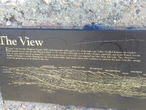
Plaque D: Free-standing concrete 3’W 3’H 6″D (Drawing of Salt Lake Valley) THE VIEW Ensign Peak provided Brigham Young’s 1847 exploring party with a good view of the Salt Lake Valley. Cradled between the Oquirrh Mountains to the west and the Wasatch Range to the east, the valley was covered with tall grass, sagebrush, and desert flowers but few trees. A river, which they later named the Jordan, ran the length of the valley and emptied into the Great Salt Lake. They observed a number of mountain streams flowing into the river. Below where they stood, efforts were underway to cultivate the land. From this vantage point the group began to lay plans for the city. Beyond the State Capitol Building lies State Street, stretching long and straight until it disappears from view in the distance. The Salt Lake Temple, now practically surrounded by tall buildings, once dominated the landscape. The small communities that formerly dotted the valley have grown to the point that it is often hard to tell where one ends and another begins.

Small Plaque below: 

Construction of this plaza and restoration of the monument have been made possible by the generous contribution of the family of David Aurelius Robinson (1905-1986). HIGH ON THE MOUNTAIN TOP Ensign Peak inspired pioneer poet Joel Hills Johnson, to write the verses of the popular hymne “High on the Mountain Top.” A fitting tune was written by Ebenezer Beesley. The peak has been the subject of many other poems and stories.” “Markers and Monuments Database.”

Extended Research:

In 1869, Mormon Apostle George A. Smith reported that Joseph Smith, the deceased founder of the Church of Jesus Christ of Latter-day Saints (LDS Church), appeared to Brigham Young in vision sometime after Smith’s death and Smith showed Young a peak where the Saints should settle.  On July 24, 1847, when Young entered the Salt Lake Valley for the first time he reportedly recognized Ensign Peak as the place he had seen in a vision.[1]

Throughout the 19th and 20th centuries Ensign Peak was utilized in many ways. In 1847 the “Peak” symbolically and literally represented a gathering place for the members of the Church of Jesus Christ of Latter-day Saints. According to historian Ronald Walker, Young proposed several flags to represent “the gathering” and to create an identity for the occupants of Salt Lake City. Some suggested that the most fitting flag should be an American flag to fly on Ensign Peak, despite tensions between the Federal Government and the Mormon settlers. Mormons felt alienated but still maintained an American ideology.[2]

Apart from flying flags, members of the LDS church received and performed temple endowments on the peak while the Salt Lake City Temple was under construction. The temple endowment is a ceremony where members make covenants with God in order to receive promised blessings in return. Addison Pratt prior to his LDS mission received his endowment on July 21, 1849 on Ensign Peak.[2] During the Utah War (1857-1858) members of the Utah militia used the peak as a lookout spot for federal troops. Militiamen used smoke to signal during the day, and fire light to signal at night.[3]

In the 20th Century several people proposed different uses for the peak. Lon J. Haddock, a member of the Salt Lake City Manufacturers and Merchants Association ,with the support of Senator Reed Smoot, promoted the peak as a park.[4] Smoot and Haddock, however, did not gain enough support for their idea and it did not bear fruit. In the early 1900s, automobile dealers drove their cars to the top of the peak as an advertising opportunity. In 1910 the first automobile reached the top and other drivers followed, generally as publicity stunts.[5] In 1916, LDS Presiding Bishop, Charles W. Nibley proposed that a stone cross be built on Ensign Peak. Nibley suggested that the cross would represent the sacrifices of early Mormon pioneers, and also signal to the world that Mormons were in fact Christians.[6] Nibley’s proposal created controversy and the community ultimately rejected it. A year later advocates proposed a monument in honor of the Mormon Battalion (a military unit in the US war with Mexico comprised of around five hundred Mormons), but it also did not gain support.

In the fall of 1924 the Klu Klux Klan held a demonstration and used the peak for its own purposes. The 1920s marked a resurgence of the Klu Klux Klan nationwide. In Utah the Klan held a demonstration on the same day as LDS General Conference–a meeting for Mormons from around the world to gather and listen to their leaders. During the conference proceedings, the Klan burned a large cross at the top of the peak in a show of force for the KKK in Utah.[7]

The monument that sits atop Ensign Peak today was built on July 26, 1934. Standing at eighteen feet high, the Utah Pioneer Trails and Landmarks Association are responsible for its construction. Speakers and leaders of all faiths participated in the celebration.[8] In 1996, Ensign Peak was renovated and the construction of a permanent park began. [9]

[1] George A. Smith, “Historical Discourse,” 20 June 1869, Journal of Discourses (London: Latter-day Saints’ Book Depot, 1854–1886), 13:85.

[2] Ronald W. Walker, “A Banner Is Unfurled,” Dialogue 26, no. 4(1993): 71-91: https://www.dialoguejournal.com/wp-content/uploads/sbi/articles/Dialogue_V26N04_89.pdf

[2] William S. Harwell and Fred C. Collier, eds., Manuscript History of Brigham Young (Salt Lake City: Collier’s Publishing Company, 1997), 224–25.

[3] B. H. Roberts, A Comprehensive History of the Church of Jesus Christ of Latter-day Saints (Salt Lake City: Deseret News, 1912), 4:507.

[4] “Ensign Peak,” Deseret Evening News, August 8, 1908, 4.

[5] “Velie Automobile Climbs Ensign Peak,” Salt Lake Tribune, March 10, 1910, 4.

[6] “To Erect Cross on Ensign Peak,” Deseret Evening News, May 5, 1916; “Ensign Peak Cross! Never! Cries Lund in Protest,” Salt Lake Telegram, May 7, 1916.

[7] Larry R. Gerlach, Blazing Crosses in Zion: The Ku Klux Klan in Utah (Logan: Utah State University Press, 1982) ,105–110.

[8] “Ensign Peak Monument to Be Unveiled,” Deseret News, July 24, 1934, 9.

[9] R. Scott Lloyd, “Park at Ensign Peak Dedicated,” Deseret News, August 3, 1996, 3, 13.

Primary Sources

George A. Smith, “Historical Discourse,” 20 June 1869, Journal of Discourses (London: Latter-day Saints’ Book Depot, 1854–1886), 13:85.

“Ensign Peak,” Deseret Evening News, August 8, 1908, 4.

“Velie Automobile Climbs Ensign Peak,” Salt Lake Tribune, March 10, 1910, 4.

“To Erect Cross on Ensign Peak,” Deseret Evening News, May 5, 1916

“Ensign Peak Monument to Be Unveiled,” Deseret News, July 24, 1934, 9.

Scott Lloyd,“Park at Ensign Peak Dedicated,” Deseret News, August 3, 1996, 3, 13.

Secondary Sources

William S. Harwell and Fred C. Collier, eds., Manuscript History of Brigham Young (Salt Lake City: Collier’s Publishing Company, 1997).

Brigham H. Roberts, A Comprehensive History of the Church of Jesus Christ of Latter-day Saints (Salt Lake City: Deseret News, 1912), 4:507.

Larry R. Gerlach, Blazing Crosses in Zion: The Ku Klux Klan in Utah (Logan: Utah State University Press, 1982).

Ronald W. Walker, “A Banner Is Unfurled,” Dialogue 26, no. 4(1993): 71-91: https://www.dialoguejournal.com/wp-content/uploads/sbi/articles/Dialogue_V26N04_89.pdf

Ronald W. Walker, “A Gauge of the Times: Ensign Peak in the Twentieth Century,” Utah Historical Quarterly 62, no. 1 (1994): 4–25.

Dennis A. Wright and Rebekah E. Westrup, “Ensign Peak: A Historical Review,” in Salt Lake City: The Place Which God Prepared, ed. Scott C. Esplin and Kenneth L. Alford (Provo, UT: Religious Studies Center, Brigham Young University; Salt Lake City: Deseret Book, Salt Lake City, 2011), 27–46.
Trolley Square

Published / by Alex Alba / Leave a Comment

Writeup by Alex alba

Placed By: Division of State History

GPS Coordinates: 40° 45′ 25.2″ N,  -111° 52′ 17.4″ W

Historical Marker Text 1:

Site of LDS Tenth Ward Square until 1888 when it was purchased and used as a territorial fairgrounds through 1901. Car Barns and Repair shops built 1908-1910 under the direction of E.H. Harriman for Utah Light and Railway Company. Barns housed Salt Lake City Buses until 1970. Renovation 1972.

Historical Marker Text 2:

Salt Lake City was one of the first cities in the U.S. to introduce a trolley car system, electrifying its first line in 1889. Railroad magnate E.H. Harriman purchased a controlling interest in Utah Light Railway Company with plans to build a state-of-the-art trolley system as a model for the world. He invested $3.5 million in this site, constructing the unusual mission-style car barn complex during 1908-10. The largest building was used as the berth for the trolleys. The middle building served as a machine or “rip” shop and blacksmith shop. The north building was the paint and carpenter shop. The smaller east building was the sand house. The water tower was designed to hold 50,000 gallons of water in case of fire.

The railway venture operated out of this location until August 19, 1945, after which the Salt Lake City buses were housed here until 1970. Trolley Square was one of the first large-scale adaptive reuse projects in the country when the historic buildings were converted into a festival marketplace. Relics from around the West were rescued and installed as accent pieces. Trolley Square opened in June of 1972.

Extended Research:

E.H. Harriman, Railway Tycoon

Trolley Square was initially the site of the LDS Tenth Ward, designated by Brigham Young in 1847. Salt Lake City purchased the site in 1888 and used it as a fairground until Edward H. Harriman, a railway tycoon, purchased it in 1908. In 1907, shortly before Harriman’s purchase of the Trolley Square area, he was called into the Supreme Court. Harriman’s stake in the railroad system throughout the United States and specifically Utah had raised the concern of the Interstate Commerce Commission. Harriman was charged with holding a great deal of questionably acquired stake in a number of railroad companies incorporated in Utah. Harriman appealed this in 1908 shortly after his purchase of Trolley Square, but the court ordered him to testify and answer questions he previously refused to answer.1 He was, at the time, attempting to build a railroad empire and was in the process of acquiring the Trolley Square area in order to create the Salt Lake City streetcar system.

Harriman also purchased the Utah Light and Railway Company, in which he invested around $3.5 million. Harriman wanted to create an electric light rail system for the rest of the world to use as a model for inexpensive public transportation. In the following years Harriman oversaw the construction of car barns, a 50,000-gallon water tower, and maintenance buildings while also investing in the construction of a light rail system in the Salt Lake City area. This investment was only a small portion of his involvement in railroads in the western United States, as Harriman is primarily known for his involvement in the Union Pacific Railroad Company.

The car barns and other maintenance buildings that Harriman constructed were used for their intended purpose for only a little over a decade. The trolley system was short lived in Utah due to the introduction of gasoline-powered buses that did not require tracks to be run throughout the city. Harriman succeeded in making the Salt Lake City Trolley system incredibly successful, if only for a short time. By 1914 more than 144 cars were in operation, and this system served as a model for similar systems throughout the United States.

Car Barns Circa 1910

Though the trolley system spread throughout the Salt Lake Valley and was largely successful, it began to be phased out in 1920 as a result of the incorporation of gasoline powered city buses. These buses cost less money to operate and could travel around the valley more efficiently as they did not need tracks or electricity. The last trolley car was retired in 1945, and after that Trolley Square was used as a bus depot. As time went on the buildings fell into disrepair, housing run down and broken buses as well as other industrial garbage and waste. The buildings were going to be demolished in 1969, but developer Wallace A. Wright Jr. purchased the site and renovated it into a shopping center. It has remained a shopping center since it opened its doors in 1971, and in 1996 it was added to the National Register of Historic Places.2


1- Taken in part from Harriman v. ICC, 211 US 407 – Supreme Court 1908. Accessible at: https://scholar.google.com/scholar_case?case=2190642344080570832&q=Edward+H.+Harriman+vs.+The+Interstate+Commerce+Commission&hl=en&as_sdt=6,45

2-Taken in part from Zacharia Razavi’s article “Trolley Square- A Salt Lake City Icon” in Utah Stories Magazine November 6, 2008

Images taken from trolleysquare.com

For Further Reference:

Secondary Sources:

Razavi, Zacharia. “Trolley Square- A Salt Lake City Icon.” Utah Stories Magazine, November 6, 2008.

“Trolley Square: A Brief History.” The Salt Lake Tribune, February 13, 2007. Accessed February 18, 2017. http://archive.sltrib.com/story.php?ref=/news/ci_5216391.

“The History.” Trolley Square. Accessed February 18, 2017. http://www.trolleysquare.com/history/.


Primary Sources:

Edward H. Harriman vs. The Interstate Commerce Commission. October Term, 1907. Case No. 662. Page 159

Harriman v. ICC, 211 U.S. 407, 29 S. Ct. 115, 53 L. Ed. 253 (1908).


Newspaper Rock

Published / by Laura Angell / 3 Comments on Newspaper Rock

Written by Laura Angell, BA History Student at the University of Utah

Placed By: Unknown

Sign Information:

This sign is not a historical marker, it was placed to document the area and provide some brief information about the site. The sign was placed by the Bureau of Land Management.

Sign Text:

Newspaper Rock is a petroglyph panel etched in sandstone that record approximately 2,000 years of early human activity. Prehistoric peoples, probably from the Archaic, Basketmaker, Fremont and Pueblo cultures, etched on the rock from B.C. time to A.D. 1300. In historic times, Ute and Navajo people, as well as European Americans made their contributions.

In interpreting the figures on the rock, scholars are undecided as to their meaning or have yet to decipher them. In Navajo, the rock is called “Tse’Hane’” (Rock that tells a story).

Unfortunately, we do not know if the figures represent storytelling, doodling, hunting magic, clan symbols, ancient graffiti or something else. Without a true understanding of the petroglyphs much is left for individual interpretation.

Newspaper Rock is listed in the National Register of Historic Places.

Please continue to preserve it.

GPS Coordinates: 37°59’6.6″N 109°31’05.1″W

Newspaper Rock Feb. 2017

Extended Research:

Utah’s territory has been shaped by the presence of early Americans throughout the territory. Newspaper Rock is one of the few pieces that remains as evidence of the Native American activity in the area. The site was rediscovered by early pioneers and was given the name Newspaper Rock due to the abundance of petroglyphs on the large sandstone canvas. The various artists responsible for this artwork are not known, however, historians and archaeologists believe that different Native American cultural groups who have lived in the four corners area have contributed to the artwork on the rock over several thousand years. The artwork was etched on the rock face that contains a black coloring, known as “desert varnish,” which gets its color from a combination of iron deposits and bacteria that forms when rain falls on the exposed sandstone. The artists who created the petroglyphs used the technique of chiseling away at the top layer of the sandstone to reveal the red rock underneath. The petroglyphs date back from about 2,000 years ago to as recent as the 20th century.

One of the individuals responsible for one of the more recent markings is Ramón González’s son, J. P. González. Ramón González and his family moved from New Mexico to Monticello and permanently settled there in March of 1900. The family created a homestead in the Indian Creek area on land that included the Newspaper Rock site. J. P. González carved his name on the far left corner of the rock.[1] The inscription reads “J.P. Gonzalez 1902” and just below, another inscription says “C.D. Gonsales 6/3/54,” which was left by J.P.’s son. Other recent inscriptions include, “Jean,” written with a backwards N and “JER.”

Newspaper Rock has been recognized as a state historical monument since its dedication in 1961. During this year, control of the site went from the Bureau of Land Management to the State Park and Recreation Commission. The Commission stated its goal for the site was to make improvements by building a fence around the monument, build a parking lot, a picnicking site, and camping facilities. These improvements began in the Spring of 1962 and a portion of the funding for the project was provided by Sunset Magazine.

An image of a woman pointing towards the artwork. Part of the Al Watkins Morton Photograph Collection, 1940-1950. Courtesy the Utah Department of Heritage and Arts.[2]

The monument has become a tourist destination in the 20th and 21st centuries. Over the years the site has continued to garner attention. Many individuals found the vast artwork of interest and took pictures of their interactions with the site. Documentation about the site has continued to assist in the increase of visitation to the area.


The Times Independent newspaper has documented the amount of visitors that the site has received over the years. Gordon W. Topham, a ranger during the time, states that the sizable differences in numbers may have been due to “the fact that many vacation plans were canceled in 1974 due to the price of gas” and during one of the months, the sign for the monument was in Salt Lake City for repairs, and many people passed the monument.

Statistics provided by Gordon W. Topham, Utah State Division of Parks and Recreation. Courtesy Times Independent 1975, 1976.[3]

Statistics provided by Gordon W. Topham, Utah State Division of Parks and Recreation. Courtesy Times Independent 1975, 1976.[3]


In 2017, a trip to the site proved that the conservation efforts of the State Park and Recreation Commission and Bureau of Land Management have been beneficial for the preservation of the site. Although the background and meaning of the artwork remains a mystery, the monument continues to represent the early American presence in Utah and the importance of artwork to their culture.


[1] Gonzalez, William H. and Padilla, Genaro M., “Monticello, the Hispanic Cultural Gateway to Utah,” Utah Historical Quarterly, 52(Winter 1984): 9-28.

[2] Morton, Alton Watkins, “Woman points to what is known now as Newspaper Rock State Historical Monument,” 470, 1940-1950.

[3] “State Commission Announced Plans to Develop ‘Newspaper Rock,'” Times Independent, 12/28/1961.

[3] “Newspaper Rock State Park Visitor Increase Noted,” Times Independent, 1/09/1975.

[3] “Newspaper Rock Visitation is Way Up,” Times Independent, 6/12/1975.

[3] “29% Increase in Visits Noted at Newspaper Rock,” Times Independent, 1/8/1976.

[3] “Visitation Down at Newspaper Rock,” Times Independent, 2/12/1976.

For Further Reference:

Primary Sources

Morton, Alton Watkins, “Woman points to what is known now as Newspaper Rock State Historic Monument.” 470, 1940-1950. http://heritage.utah.gov/apps/history/findaids/C00468/C0468.xml

“State Commission Announced Plans to Develop ‘Newspaper Rock,'” Times Independent, 12/28/1961. https://newspapers.lib.utah.edu/details?id=20373525&facet_paper=&q=title_t%3A%28Newspaper+Rock%29#t_20373525

“Newspaper Rock State Park Visitor Increase Noted,” Times Independent, 1/09/1975. https://newspapers.lib.utah.edu/details?id=20445223&facet_paper=&q=title_t%3A%28Newspaper+Rock%29#t_20445223

“Newspaper Rock Visitation is Way Up,” Times Independent, 6/12/1975. https://newspapers.lib.utah.edu/details?id=20430965&facet_paper=&q=title_t%3A%28Newspaper+Rock%29#t_20430965

“29% Increase in Visits Noted at Newspaper Rock,” Times Independent, 1/8/1976. https://newspapers.lib.utah.edu/details?id=20449383&facet_paper=&q=title_t%3A%28Newspaper+Rock%29#t_20449383

“Visitation Down at Newspaper Rock,” Times Independent, 2/12/1976. https://newspapers.lib.utah.edu/details?id=20462238&facet_paper=&q=title_t%3A%28Newspaper+Rock%29#t_20462238

Secondary Sources

Castleton, K. B., 1979. Petroglyphs and Pictographs of Utah. Salt Lake City.

Gonzalez, William H. and Padilla, Genaro M., “Monticello, the Hispanic Cultural Gateway to Utah,” Utah Historic Quarterly, 52(Winter 1984): 9-28.

Bureau of Land Management (BLM) Lands. Newspaper Rock Recreation Site. http://www.utahscanyoncountry.com/blm.html

National Park Service Petrified Forest. Newspaper Rock. https://www.nps.gov/pefo/learn/historyculture/newspaper-rock.htm

Utah Parks. Petroglyphs Near Moab Utah. http://www.myutahparks.com/petroglyphs-moab/

Garfield and Lake Point Resorts

Published / by Ben Kiser / 2 Comments on Garfield and Lake Point Resorts

Written by Benjamin Kiser, MA History Student, University of Utah

Placed By:  Daughters of Utah Pioneers Tooele County Company

GPS Coordinates:  40°42’57.0″N 112°14’21.9″W

Historical Marker Text:

Garfield and Lake Point Resorts Marker

DAUGHTERS OF UTAH PIONEERS No. 115

ERECTED 1954

GARFIELD & LAKE POINT RESORTS

            From 1881 to 1893 Garfield Beach was the most famous and finest recreation resort on the shores of the Great Salt Lake, with its railroad station, lunch stand, restaurant, bath houses and pier leading to the dance pavilion, and with the pioneer steamboat “City of Corinne” exhibited at anchor.  Lake Point was located 1 miles west.  A three story hotel erected there by Dr. Jeter Clinton became a stopping place for overland stages.  The boulder used for this shaft was taken from “Old Buffalo Ranch” one half mile west.

TOOELE COUNTY

Extended Research:

Marker with Great Salt Lake on Right, I-80 and Oquirrh Mountains on Left

From the beginning of Euro-American settlement in Utah, Utahns have enjoyed recreation.  Before the rise of Wasatch Mountain ski resorts, hiking, and biking trails, residents turned to the Great Salt Lake for their recreational pursuits.[1]  The late 1800s were the heyday of Great Salt Lake resorts.  Two of the earliest resorts were at Garfield Beach and Lake Point.  Dr. Jeter F. Clinton, Mormon physician and Salt Lake City alderman turned resort promoter, founded Lake Point resort, also known as Clinton’s Landing, in 1870, building a large “Lake House” near the beach at the northwest point of the Oquirrh Mountains.  The resort remained small until 1875 when the Utah Western railroad completed a branch out to the area.  Expansion began leading to the construction of a multitude of bathhouses along the beach.[2]  Bathers came to Lake Point to experience the Great Salt Lake’s saline water, described by one local booster as “so buoyant; never chilling, it is so warm, free from danger, recreating and invigorating, a tonic for all, a healing for many ills, health restoring and strength renewing.”[3]  Lake Point was also a hub for the renowned steamboat “City of Corinne” which would transport passengers across the lake to Corinne, a railroad town on the Bear River.  Eventually, Black Rock and Garfield Resorts would eclipse Lake Point in grandeur and visitation.[4]

Lake Point Illustration from the Great Salt Lake
Courtesy Utah State Historical Society

Lake Point also served as a backdrop to an interesting incidence in the Utah Territory.  A breakaway from Mormonism, a group called the Morrisites under leader Joseph Morris, formed in the early 1860s.  Conflict quickly ensued between the dominant Mormon population and the newly formed sect.  In 1862, the territorial militia was called out to subdue the Morrisites, ultimately leading to the death of Joseph Morris.  A member of the Morrisite presidency, John Banks, was mortally wounded in the skirmish.  Dr. Jeter Clinton attended to Banks but he ultimately succumbed to his injuries.  Shortly after Banks’s death, some Morrisites began spreading rumors that Clinton killed Banks while tending to him.  Authorities largely left the rumors unheeded until 1877 when they arrested Clinton at his Lake Point home, indicting him for the murder of John Banks.  While ultimately exonerated of the crime, the Deseret News reported the 1877 case as an example of “shameful abuse” of a “prominent Mormon” in which “the bigotry, intolerance and persecuting spirit of our opponents…have been among the bitterest and most unprincipled.”[5]  Taken in the context of increased federal weakening of Mormon control over the territory through the 1874 Poland Act, the Clinton case provides a curious commentary on how Mormons perceived one instance of judicial persecution in the territory.

Garfield Beach Resort Pavilion and Bathers
Courtesy Utah State Historical Society

Garfield Beach resort, located approximately 1.5 miles to the east of Lake Point, opened its doors in 1875, remaining the premier Great Salt Lake destination until the opening of Saltair in 1893.  A product of the Utah Western Railway’s expansion into Tooele County, Garfield Beach wowed visitors with a 165 by 62 feet dance pavilion over the lake.  The resort cost $70,000.  Six trains a day serviced Garfield bringing 80,000 people to the beach in 1888.  The “City of Corinne” docked at Garfield, as well, where it furnished steamboat rides on the lake for 25 cents.[6]  The great resort dwindled after Saltair’s opening, as it experienced a reduction in visitors and beach degradation due to the pesky nature of the Great Salt Lake’s fluctuating levels.  Garfield Beach resort ultimately succumbed to a fire in 1904.[7]

Garfield Beach Advertisement
Courtesy Utah State Historical Society

A 2017 trip to the southern shores of the Great Salt Lake reveals a landscape greatly changed from the high point of lake recreation from the 1870s to the 1890s.  An interstate highway runs where both resorts once stood.  Little evidence remains of the great pavilions, lunch bars, railroad stations, and dance halls that were the highlight of a trip to Utah in the late nineteenth century.  Though a reconstructed Saltair remains, the specters of Lake Point and Garfield are long gone, eclipsed in a recreational shift from the Great Salt Lake to the Wasatch Mountains.

Garfield Beach from the Foothills of the Oquirrh Mountains
Courtesy Utah State Historical Society

[1] Jared Farmer, On Zion’s Mount: Mormons, Indians, and the American Landscape (Cambridge, MA: Harvard University Press, 2009).

[2] Dale L. Morgan, The Great Salt Lake (Albuquerque: University of New Mexico Press, 1973 [1949]), 355-356.

[3] Ovando James Hollister, The Resources and Attractions of the Territory of Utah (Omaha: Omaha Republican Publishing House, 1879), 66, accessed March 29, 2017, https://archive.org/details/resourcesattract00holl.

[4] Tooele County Daughters of Utah Pioneers, History of Utah’s Tooele County: From the Edge of the Great Basin Frontier (Tooele, UT: Transcript Bulletin Publishing, 2012), 177-179.

[5] “The Infamous Proceedings against Dr. Clinton,” Deseret News, April 30, 1879, retrieved on February 16, 2017, https://newspapers.lib.utah.edu/details?id=2661652&q=jeter+clinton&page=3&rows=50&fd=title_t%2Cpaper_t%2Cdate_tdt%2Ctype_t&sort=date_tdt+asc&gallery=0&facet_paper=%22Deseret+News%22#t_2661652.

[6] Marcus E. Jones, Resources and Attractions of Salt Lake City (Salt Lake City: Salt Lake Real Estate Board, 1889), 46-48, accessed on March 29, 2017, https://archive.org/details/saltlakecity1889eng.

[7] Ouida Blanthorn, comp., A History of Tooele County (Salt Lake City: Utah State Historical Society, 1998), 154-158.

For Further Reference:

Primary Sources

Ovando James Hollister, The Resources and Attractions of the Territory of Utah (Omaha: Omaha Republican Publishing House, 1879), accessed March 29, 2017, https://archive.org/details/resourcesattract00holl.

“The Infamous Proceedings against Dr. Clinton,” Deseret News, April 30, 1879, retrieved on February 16, 2017, https://newspapers.lib.utah.edu/details?id=2661652&q=jeter+clinton&page=3&rows=50&fd=title_t%2Cpaper_t%2Cdate_tdt%2Ctype_t&sort=date_tdt+asc&gallery=0&facet_paper=%22Deseret+News%22#t_2661652.

Marcus E. Jones, Resources and Attractions of Salt Lake City (Salt Lake City: Salt Lake Real Estate Board, 1889), accessed on March 29, 2017, https://archive.org/details/saltlakecity1889eng.

Secondary Sources

Jared Farmer, On Zion’s Mount: Mormons, Indians, and the American Landscape (Cambridge, MA: Harvard University Press, 2009.)

Dale L. Morgan, The Great Salt Lake (Albuquerque: University of New Mexico Press, 1973 [1949].)

Tooele County Daughters of Utah Pioneers, History of Utah’s Tooele County: From the Edge of the Great Basin Frontier (Tooele, UT: Transcript Bulletin Publishing, 2012.)

Ouida Blanthorn, comp., A History of Tooele County (Salt Lake City: Utah State Historical Society, 1998.)