Write-up and photos by Cooper Bolton
Placed by: Iosepa Historical Society
GPS Coordinates: 40°32’31.5″N 112°44’00.7″W

Historical Marker Text (1):
This hallowed place was dedicated on August 28, 1890 by President Wilford Woodruff for all the nations in the isles of the seas, the Polynesian pioneers, their descendants and the faithful church leaders who left their home in the mid 1800’s and migrated to this gathering place in Zion to be married in the holy temple for time and eternity.
For 28 years (1889 – 1917) Iosepa was their home. In spite of the climate, isolation, loneliness, sickness, hardship, and death, their faith and courage never faltered. They overcame the cold winter, the summer heat, enjoyed the new life of spring and the bounteous harvest of the fall.
Their native songs and dances filled this beautiful valley, which they made “bloom as a rose” with love and aloha. A few remained in Utah, some on this consecrated spot, while the rest returned home to their beloved isles of the sea. The seeds of our Polynesian pioneers bore fruit in Hawaii – the Laie Temple, Brigham Young University – Hawaii, and the Polynesian Cultural Center. Holy temples stand firm in New Zealand, Western Samoa, Tonga, and Tahiti as monuments to the testimonies of the faithful Polynesian pioneers. We close this memory with their song of love:
Iosepa kuu home aloha
Iosepa kuahiwi ika nani
Iosepa ka home no ka’oi
Iosepa my home of love
Iosepa with it’s beautiful mountains
Iosepa my best home
DONORS
THE FIRST PRESIDENCY OF THE CHURCH OF JESUS CHRIST OF LATTER-DAY SAINTS PRESIDENT EZRA TAFT BENSON • GORDON B. HINCKLEY • THOMAS S. MONSON • PRINCESS ABIGAIL KEKAULIKE KAWANANAKOA • POLYNESIAN CULTURAL CENTER LAIE, HAWAII – BOARD OF DIRECTORS & EMPLOYEES • IOSEPA HISTORICAL SOCIETY LAIE, HAWAII • IOSEPA HISTORICAL ASSN, SALT LAKE CITY, UTAH • AL HARRINGTON FAMILY & FOUNDATION • RIVERTON 6TH WARD A.P.Y.M. + Y.W. 1988-89 • SKULL VALLEY RANCH CO. & EMPLOYEES • ZIONS SECURITIES CORP., LAIE, HAWAII • SALT LAKE MONUMENT CO. – MIKE ELLERBECK + FAMILY • MONTEREY SCULPTURE CENTER – CHARLES L. FISCHER • SCULPTOR–DR. JAN G. FISHER • HISTORIAN – DR. DENNIS ATKINS • ELDON P. & RUTH J. MORRELL • NORMAN & NANCY SWALLIE & CHILDREN RALPH & BETTY A. MAUGHAN & FAMILY • BERNICE W. THOMAS • IRMA W. MACDONALD MALU & CUMA S. HOOPIIAINA • JOSIAH, GEORGE, WILLIAM & CAROLINE HUBBELL & OHANA • ANDREW, FLORENCE, LOTTIE + JOHN KAMAUOHA & OHANA • EDWIN LEROY & TUSIPEPA KAMAUOHA & CHILDREN • LEROY PUKAHI + MALEKA MAHIAI + CHILDREN • LU & SCULLY ROGERS • GEORGE, WILLARD, BARBARA & CLIFFORD KEKAUOHA OHANA • WILLIAM AH QUIN & MABEL POEPOE & CHLN. • ANNIE KANAHELE TAUA & CHLN. • MARGARET K. LOPES VANAMAN + CHLN. • ELWOOD K. ALAPA & CECELIA HO’A • DESCENDANTS OF CLARENCE H. ALAPA, EDITH L. ALAPA, TUIA (OUR MOTHER) OHANA OF KUAHUA & KAAU A. FRANK & LA VINH MOELLER • CRAIG PETERSON • MARIE, MATILDA & STAN ALAPA OHANA • RALPH AND EMMA MAKAIAU & CHILDREN • LUCY PUKAHI AND WALTER TASHIRO & CHILDREN • MAGGIE BROAD & WILLIAM WALLACE OHANA • JOHN NAUAHI • LARRY AU + W. M. J. HART • CHARLES & HANNAH HALLIWELL & OHANA • WILLIAM J. AND PATRICIA CLARK • REP. LEE & BERNICE ALLEN
National Register
Utah Historic Site
IOSEPA SETTLEMENT CEMETERY
The Iosepa Community developed after Polynesian converts to the Mormon faith were employed as laborers by the Iosepa Agriculture and Stock Company in 1889. After numerous hardships, including bouts with leprosy, the colony attained a degree of financial independence and its population reached 228. In 1915 when the L.D.S. Church began to build the Hawaiian Temple, the need for “gathering” subsided. The Iosepa project was allowed to end and most of the settlers and their children returned to the Islands by 1917.
Division of State History N-38

Historical Marker Text (2):
ADMINISTRATION
HARVEY H. CLUFF 1889-1890 & 1893-1900
WILLIAM KING 1890-1892
THOMAS A. WADDOUPS 1901-1917
ORIGINAL SETTLERS
HARVEY H. CLUFF • FREDERICK A. MITCHELL • ELIHUE BARELL • FRANK W. MARCHANT • FRANCIS M. LYMAN, JR. • JOHN W. KAULAINAMOKU • KAPUKINI KAULAINAMOKU • JOHN MAKAULA • MARIA MAKAULA • KAPELA • CHARLES NAAU • JANE NAAU • EMILY S. NAAU • HAIKI • MOKE KALIMA • OLIVA ALAPA • JOSEPH KEKUKU • MILIAMA KEKUKU • HATTIE KEKUKU • IVY KEKUKU • VIOLA KEKUKU • EDWIN KEKUKU • PETER KEALAKAIHOUNA • PELEKANE KEALAKAIHOUNA • KAHAIANA KEALAKAIHOUNA • PETEROPIO KEALAKAIHOUNA • PIIPIILANI SOLAMONA • MOSES SOLAMONA • MAKAOPIOPIO • WILLIAM COLES • JOHN MAHUALII • ELIZABETH MAHUNALII • KALAWAI • KAPAINUI • JOHN K. N. MAHOE • HANAH MAHOE • LUCY MAHOE • DAVID MOKUILIMA • HOOKAIA MOKUILIMA • MARY MOKUILIMA • DAVID MOKUILIMA JR. • JOHN MAKAKAO • LUCY E. MAKAKAO • JOSEPH KEKUKU • WILLIAM K. HALEMANY • ELLEN HALEMANU • JAMES HALEMANU • JONATHAN NAPELA • MOCHAHO NAPELA • H. NAPELA • GEORGE KAMAKANIAU • V. MAHUNALII • KEALOHANIO KAMAKANIAU • GEORGE W. NIAU • HARVEY ALAPA • N. POMARIKAI
Here lie the honored Polynesian pioneers who have sealed their testimonies in the dust, that God lives, Jesus is the Christ, all the presidents of the church are prophets of God, and the Church of Jesus Christ of Latter-day Saints is true.
There are 79 graves in the cemetery. Only the names listed below are recorded. The rest are unknown, honored souls.
HARVEY O. ALAPA • MARY KAHOOHIG ALAPA • JOE ANTONE DRUMONDA • WILLIAM S. FREESTONE • PETER N. GEORGE • DORA KAILIAHI HALEMANU • EDWIN IOBA HALEMANY • EMMA PURCELL HALEMANU • GEORGE DELAWARE HALEMANU • MARIAH IHUNA HALEMANU • MATILDA KAMEHAILILANI HALEMANU • WILLIAM NIEWALANI HALEMANU • LEVI HANAKAEA • NAPAPALE HALEKAEU • CLARA KALIMAHII MAHOE HOOPIIAINA • CONNIE HOOPIIAINA • JOHN HOOPIIAINA • DAVID HALEAKALA HUBBELL • ELIZABETH KAAHU HAILI HUBBELL • JULIA KAAHU KAWAHINEKAWAI HUBBELL • EDWARD APUA IMAIKALANI • HARVEY K. IMAIKALANI • MARY POMAIKAI IMAIKALANI • JOSEPH K. O. KAIHIWAI • MARJORIE LAIE KAILIKEA • JOHN K. KAINI • KAPAINUI KALAVAO • JOHN KAMAUOHA • JOHN W. KAULEINAMOKU • EMILY KEALAKAIHOUNA • KEALAULA KEALOHA PAUOLA • HOSEA NAHINU OPIO KEKAUOHA JR. • MAKAOPIOPIO • JOHN. H. MAKAULA • MARIA K. MAKAULA • MOSES NAKUAAU • NAPAPALE • CECELIA NAWAHINI • ISAAC KEAHI NAWAHINI • MARTHA KAHOKUWAHILANI NAWAHINI • LEHI PAAHAO • BESSIE PETERS • ANNIE HULIA PUKAHI • SAMUEL KAUIHOU PUKAH • MARIA PAKAIAH MAKAIAU • KALEHUA MAKANOE • KEEPA MAKEHAU
PROJECT COORDINATOR – EDWIN L. KAMAUOHA
BUILT BY WILLING HANDS AND LOVING HEARTS

Historical Marker Text (3):
IOSEPA
HISTORICAL
SOCIETY
TIME CAPSULE
OPEN 28 AUGUST 1990
OPEN 28 AUGUST 2015
OPEN 28 AUGUST 2040
OPEN 28 AUGUST 2065
OPEN 28 AUGUST 2090
OPEN 28 AUGUST 2115

Historical Marker Text (4):
This lonely fire hydrant serves as a landmarker for the townsite of Iosepa, Utah, located on the desert floor between Cedar Mountain & the Stansbury Range in Skull Valley. Iosepa was named after Joseph F. Smith, 6th. President of the L.D.S. church. About 50 Hawaiians left Salt Lake City via Garfield by train, then by 20 wagons, to Grantsville, spent the night, arriving in Iosepa August 28, 1889.
The public square consisted of 16.9 acres, with 4 center streets, 132 ft. wide on four sides of the town park. A row of trees were planted in the center of each street. All the other streets were 66 feet wide and the blocks were divided into 4 lots, each containing ¾ acres.
All the streets had Hawaiian names. The original purchase consisted of 1,920 acres, of which 200 were under cultivation, the next two years accumulated to 5,273 acres. The water came from five streams collected in an open ditch put into a concrete conduit that furnished culinary water to each home. A fire hydrant and irrigation ditch went with each lot. The cemetery, about ½ acre, is located a mile northeast of the settlement. Iosepa won the state prize in 1911 for the best kept town and most progressive city in the state of Utah.
Only the Hoopiiaina family and J. Palikapee Nawahine remained in Utah. The rest returned home to Hawaii to settle and help build the Laie temple (1917-1919). Iosepa returned to dust, leaving a heritage of the faithful Polynesian pioneers, and closed a chapter in the great western American history.
IOSEPA HISTORICAL SOCIETY
EDWIN L. KAMAUOHA OHANA
PLAQUE & MARKER DONATED BY REX & PHYLLIS CROSLAND MAY 28, 1990
HOOPIIAINA OHANA
MALU, CUMA, WILFORD, CLIFFORD, CORY
Extended Research:
The Iosepa settlement was established by and for the Polynesian (mainly Hawaiian) members of the Church of Jesus Christ of Latter-day Saints which wished to live in Utah. It was founded with the arrival of 56 settlers to the site on August 28, 1889 and was abandoned by 1917.1 The town was settled out of a desire to relocate Polynesians in Salt Lake City to somewhere outside of the city. This was spurred on growing animosity towards Polynesians which was largely the result of controversy over Polynesian applications for American citizenship as well as fears over a rumored leprosy outbreak among native Hawaiians.2

Photo Credit: Utah State Historical Society (accessed on 3.2.22)
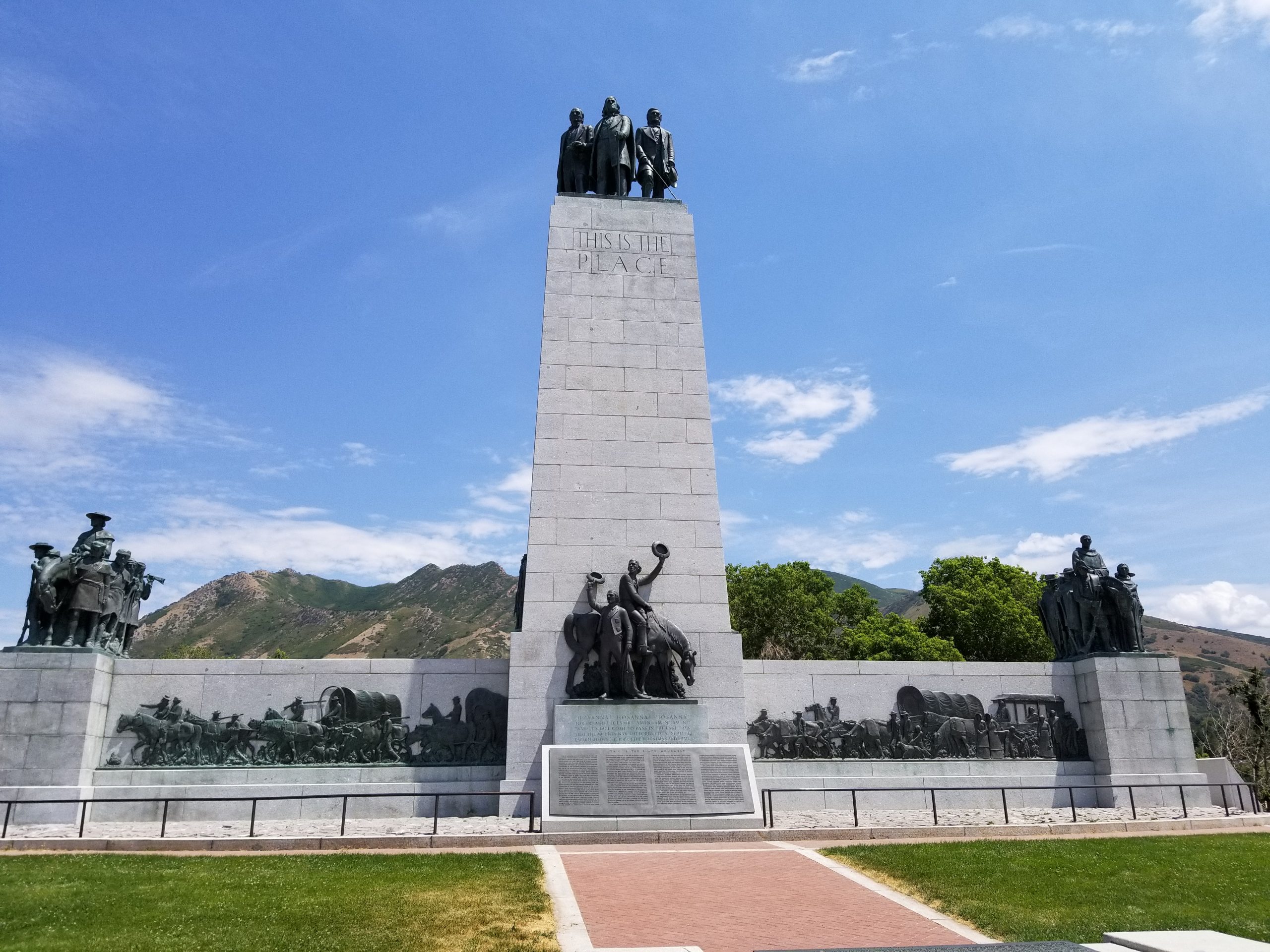
The colony was originally settled as a joint stock company incorporated as the Iosepa Agriculture and Stock Company, being owned by the L.D.S. Church. Harvey H. Cluff was the president of the corporation and manager of the company, while a person by the name of I. W. Kauleinamoku was the leader of the Polynesian Mormons. The land was dedicated by then L.D.S. Church President Wilford Woodruff on August 28, 1890, exactly one year after colonization, as a “gathering place for the natives of the islands of the sea.” Contrary to the story told on the marker, Iosepa was not self-sustaining and relied heavily on the L.D.S. Church to cover expenses, likely due to its isolation (The closest settlement to Iosepa, Milton, was about 40 miles away. After 1906, Timpie Station, a station at which trains stopped only if signaled to do so, was established, but it was still roughly 15 miles north of Iosepa). Furthermore, the colony saw a number of crop failures due to the climate of the region. This, combined with the scorching heat of summer, the freezing cold of winter, and disease took a massive toll on the settlers.3

Photo Credit: Utah State Historical Society (accessed on 3.2.22)
Despite these setbacks, life in Iosepa was reportedly pleasant. The L.D.S. Church was incredibly important to the colony and as such, the residents followed a schedule of annual holidays, including their own version of Pioneer Day, celebrated on August 28, and Church leaders visited the colony often. The diversity of cultures in the settlers could be seen especially in their festivities. Settlers prepared traditional Hawaiian food which was eaten alongside Euro-American food and eventually, the practices of the colony became unique in Utah while differing greatly from their Polynesian origins.

The people of Iosepa also made the education of all residents a priority, eventually hiring a teacher from outside the town. Additionally, the town was designed to provide enough space for everyone as well as to make freshwater available in every home.4 This can be seen in the townsite plat that was filed at the Tooele County Courthouse on July 31, 1908 based on the original townsite survey conducted by Frederick A. Mitchell and Francis M. Lyman.5
The historical marker within the Iosepa cemetery was dedicated on August 28, 1989, 100 years after the town’s founding, by then L.D.S. Church President Gordon B. Hinckley. All that remains of the settlement is the cemetery and a fire hydrant. The settlement reached a peak population of 228 in 1915 but was gradually depopulated as the L.D.S. Church began to build the Laie Temple in Hawaii and most of Iosepa’s residents chose to return to Oahu to assist in the Temple’s construction.6
[1] Dennis H. Atkins, “A History of Iosepa, the Utah Polynesian Colony,” 1958
[2] Matthew Kester, “Race, Religion, and Citizenship in Mormon Country: Native Hawaiians in Salt Lake City, 1869-1889,” Western Historical Quarterly 40, no. 1 (2009), 52; Matthew Kester, Remembering Iosepa: History, Place, and Religion in the American West (New York: Oxford University Press, 2013).
[3] David L. Schirer, “Iosepa,” Utah History Encyclopedia, 1994
[4] Dennis H. Atkins, “A History of Iosepa, the Utah Polynesian Colony,” 1958
[5] “Big Event for Iosepa Colony,” Deseret Evening News, September 1, 1908, 5.
[6] Scott Lloyd, “Iosepa Memorial Honors Utah’s Hawaiian Settlers,” Deseret News, August 29, 1989; Dennis H. Atkins, “A History of Iosepa, the Utah Polynesian Colony,” 1958
For Further Reference:
Primary Sources:
Diary of Harvey H. Cluff. Digital scan of original manuscript. 1889. Digital Collections, Special Collection Miscellaneous 3. BYU Library. https://cdm15999.contentdm.oclc.org/digital/collection/p15999coll24/id/30510
Secondary Sources:
Atkin, Dennis H. “A History of Iosepa, the Utah Polynesian Colony,” 1958. https://scholarsarchive.byu.edu/cgi/viewcontent.cgi?article=5488&context=etd.
“Big Event for Iosepa Colony.” Deseret Evening News. September 1, 1908. https://chroniclingamerica.loc.gov/lccn/sn83045555/1908-09-01/ed-1/seq-5/.
“Iosepa Memorial Honors Utah’s Hawaiian Settlers.” Deseret News. August 29, 1989. https://www.deseret.com/1989/8/29/18821578/iosepa-memorial-honors-utah-s-hawaiian-settlers.
Kester, Matthew. “Race, Religion, and Citizenship in Mormon Country: Native Hawaiians in Salt Lake City, 1869-1889.” Western Historical Quarterly 40, no. 1 (2009): 51–76. http://www.jstor.org/stable/40505603.
Kester, Matthew. Remembering Iosepa : History, Place, and Religion in the American West. New York: Oxford University Press, 2013. https://utah-primoprod.hosted.exlibrisgroup.com/permalink/f/dtufc4/UUU_ALMA51536031950002001
Schirer, David L. “Iosepa.” In Utah History Encyclopedia, edited by Allen Kent Powell. Accessed March 2, 2022. https://www.uen.org/utah_history_encyclopedia/i/IOSEPA.shtml.


