Write-Up by Leah Kershisnik
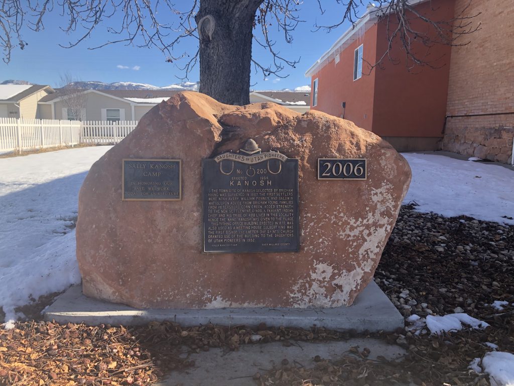
Placed By: Daughters of the Utah Pioneers, Sally Kanosh Camp, 1954
GPS Coordinates: 43°38’19.39″N 116°14’28.86″W
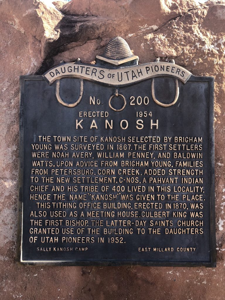
Historical Marker Text:
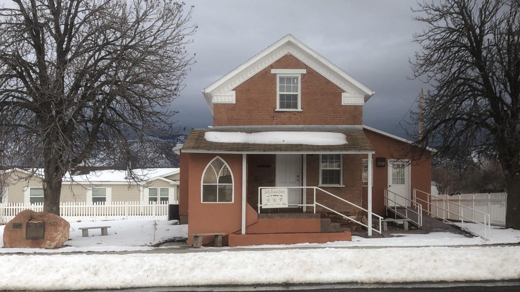
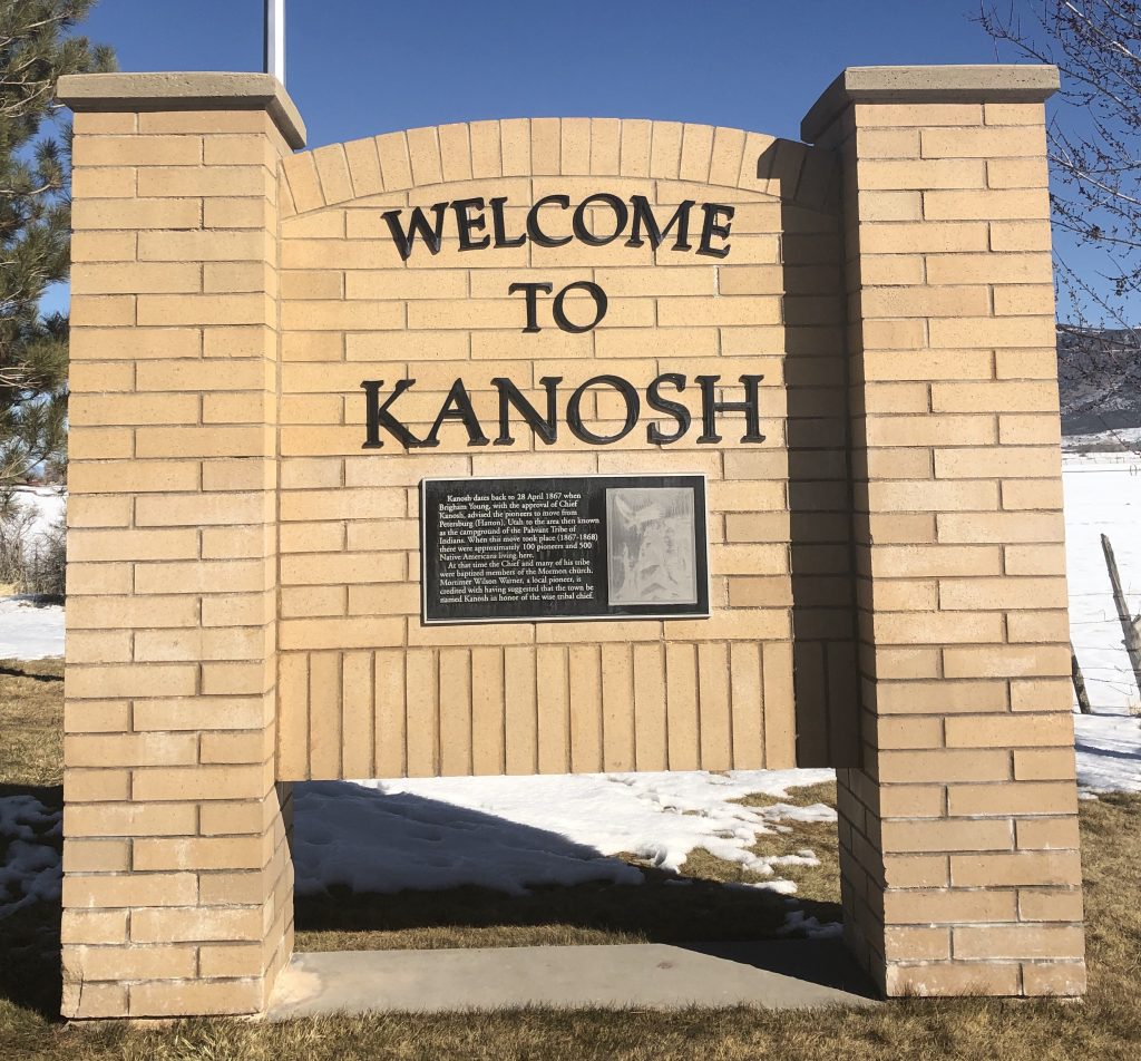
The town site of Kanosh selected by Brigham Young was surveyed in 1867. The first settlers were Noah Avery, William Penney, and Baldwin Watts. Upon advice from Brigham Young, families from Petersburg, Corn Creek, added strength to the new settlement. C-nos, a Pahvant Indian chief and his tribe of 400 lived in this locality, hence the name “Kanosh” was given to the place. This tithing office building, erected in 1870, was also used as a meeting house. Culbert King was the first bishop. The Latter-Day Saints Church granted use of the building to the Daughters of the Utah Pioneers in 1952
Extended Research:
In 1849 Brigham Young dispatched the Southern Expedition under LDS Apostle Parley P. Pratt to explore Southern Utah and investigate possible settlement locations. The expedition spent time in the Pahvant Valley in Southern Utah and there likely met Chief Kanosh, the young leader of the Pahvant Indians who occupied Corn Creek, named for the corn cultivated by the Indians along the creek. Pratt reported an extremely friendly reception from the Native Americans in the area, news which encouraged Brigham Young to establish settlements in Southern Utah.[1]
Chief Kanosh was born around 1828 to one of the wives of Kash-ee-bats, a Timpanogos Ute chief. Kash-ee-bats was assassinated in the early 1840s while Kanosh was wintering in California with his mother. Kanosh returned to Utah and over the next few years rose to the position of head chief of the Pavahnt Ute band.[2]
From his earliest contact with the Mormons, Chief Kanosh was interested in maintaining peace and fostering friendly relations. Kanosh adopted some aspects of European attire in the late 1850s and was baptized into the LDS church in 1858, though after his conversion he continued to practice many aspects of his native religion, like Shamanism and ritual hunts.[3]
Kanosh’s people had practiced horticulture long before white settlers arrived in the Pahvant Valley, growing “corn, beans, pumpkins, squashes, potatoes, &c” and showed interest in permanently adopting a settled, agricultural lifestyle. A Deseret News article from December 1851 recounts the Pahavant Chief’s desire to stop “roaming,” preferring “to be instructed in tilling the soil.”[4] In the 1850s Brigham Young established a farm for the Pahvant Indians at Upper Corn Creek.
Fillmore (18 miles northeast of present-day Kanosh) was established in 1852. In 1859 two Fillmore residents, Peter Robison and Peter Boyce, left Fillmore and established Petersburg at Lower Corn Creek, three miles southwest of the Kanosh Indian village. They were joined by Charles Hopkins, a member of the 1849 Southern Expedition party. Petersburg grew steadily until 1867 when Brigham Young spoke at a Sunday meeting on April 28 encouraging those in Petersburg to move to Upper Corn Creek, to the site that would come to be called Kanosh.[5]
Unlike many towns, the townsite of Kanosh was surveyed in 1867 and completely plotted out before settlement began. Families received plots of land through a lottery system. By 1869 about 100 families lived in Kanosh. Mortimer W. Warner is credited with suggesting the town be named after Chief Kanosh.[6] Most families in Kanosh had small farms where they grew wheat, alfalfa, and sugar cane (processed into molasses) for family consumption. Families kept pigs and chickens, and many ran summer dairy operations in nearby canyons. The main sources of income were beef, wool and mutton.[7]
Upper Corn Creek had been occupied by Chief Kanosh and his people, but they had moved toward Meadow by the time Mormons began settling the area. In 1869 (after grasshoppers destroyed their crop in 1868) Kanosh would temporarily relocate his people to the Uintah Reservation, which had been created by President Abraham Lincoln in 1861.[8] Up until this point Kanosh had resisted relocating his people to the reservation.
Chief Kanosh married four times. His first wife was thought to be possessed by an evil spirit and executed. His third wife was executed after murdering his second wife. Finally, Chief Kanosh married Sally Young Kanosh, a Bannock Indian woman who had been raised in the home of Brigham Young’s wife, Clara Decker Young. Sally, the daughter of a chief, had been taken captive as a child by a rival Indian group and tortured before being sold to Charles Decker, Brigham Young’s brother-in-law. [9]
In his final years, Chief Kanosh lived with his wife Sally in a log house in Kanosh that had been gifted to him. He died in December of 1881 and was buried in the first Kanosh cemetery, which site is now lost. Sally Young Kanosh died two years later. In 1934 the Sally Kanosh Camp of the DUP worked with the Civilian Conservation Corps camp stationed in Kanosh to erect a monument to Chief Kanosh in the city’s new cemetery.[10] The Kanosh Reservation was organized in 1929, expanded in 1935 and 1937, and would be the last reservation established in Utah until 1984.[11]
Chief Kanosh was revered by Mormons and Indians alike, and the harmony that existed between Mormon settlers and Native Americans in the area was due in large part to Kanosh. Chief Kanosh consistently chose a path of compromise with the white Mormon settlers. This willingness to be flexible allowed Kanosh and his band to foster good relations with the incoming settlers while still maintaining autonomy and independence.[12]
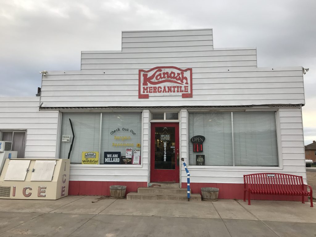
The earliest route between Salt Lake City and Los Angeles wound through the town of Kanosh. In the early 20th century, as traffic increased and the automobile became popular, this route became known as the Arrowhead Trail. In the 1920s the Arrowhead Trail became U.S. Highway 91, Southern Utah’s first paved interstate. This artery brought traffic to Kanosh, and businesses flourished. Then, in 1973, Interstate-15 replaced Highway 91. Though it followed some sections of 91, I-15 bypassed Kanosh. The rerouting of the freeway brought about the end of most businesses in Kanosh. The business sector has never recovered. The only remaining supplier of general groceries in town is Kanosh Mercantile. Most residents travel to Fillmore for necessary services and shopping.[13]
Kanosh remains a predominantly agricultural community. According to the 2010 census, the population of Kanosh was 474 and the estimated population for 2017 was 548.
[1] Edward Leo Lyman, Linda King Newell, and Utah State Historical Society, A History of Millard County, (Utah Centennial County History Series, 1999), 34-38.
[2] Edward Leo Lyman, “Chief Kanosh: Champion of Peace and Forbearance.” Journal of Mormon History 35, no. 1 (2009): 161.
[3] Hyrum S. Lewis, “Kanosh and Ute Identity in Territorial Utah,” Utah Historical Society, Volume 71, Number 1-4, (2003): 340.
[4] “Sketch of a trip to Pauvan [sic] Valley.” Deseret (Weekly) News. December, 13, 1851, 3
[5] Leavitt Christensen, Birth of Kanosh (1996), 15.
[6] Edward Leo Lyman, Linda King Newell, and Utah State Historical Society, A History of Millard County (Utah Centennial County History Series. 1999), 115.
[7] Christensen, Birth of Kanosh, 67.
[8] Forrest S. Cuch, David Begay, Utah State Historical Society, and Utah. Division of Indian Affairs, A History of Utah’s American Indians (Salt Lake City: Utah State Division of Indian Affairs : Utah State Division of History, 2000), 192.
[9] E. L. Black, “Life Story of Indian Chief Kanosh,” 1-2.
[10] Christensen, Birth of Kanosh, 55-56.
[11] “An Act To reserve nine hundred and twenty acres on the public domain for the use and benefit of the Kanosh Band of Indians residing in the vicinity of Kanosh, Utah” (1929); “An act to reserve eighty acres on the public domain for the use and benefit of the Kanosh Band of Indians in the State of Utah” (1935); “An Act To reserve certain lands in the State of Utah for the Kanosh Band of Paiute Indians” (1937); Cuch, Begay, Utah State Historical Society, and Utah. Division of Indian Affairs, A History of Utah’s American Indians,142.
[12]Lewis, “Kanosh and Ute Identity,” 342-346.
[13] Christensen, Birth of Kanosh, 74.
For Further Reference:
Secondary Sources:
Christensen, Leavitt. Birth of Kanosh. 1996.
Cuch, Forrest S., Begay, David, Utah State Historical Society, and Utah. Division of Indian Affairs. A History of Utah’s American Indians. Pbk. ed. Salt Lake City: Utah State Division of Indian Affairs : Utah State Division of History, 2000.
Lewis, Hyrum S. “Kanosh and Ute Identity in Territorial Utah.” Utah Historical Society, Volume 71, Number 1-4, (2003): 332-347
Lyman, Edward Leo. “Chief Kanosh: Champion of Peace and Forbearance.” Journal of Mormon History 35, no. 1 (2009): 157-207.
Lyman, Edward Leo, Newell, Linda King, and Utah State Historical Society. A History of Millard County. Utah Centennial County History Series. 1999.F
http://digital-desert.com/historic-roads/arrowhead-trail/
https://factfinder.census.gov/faces/nav/jsf/pages/community_facts.xhtml?src=bkmk
http://wchsutah.org/roads/arrowhead-trail.php
https://www.blm.gov/visit/search-details/16460/2
https://www.findagrave.com/memorial/168719452/sally-kanosh
https://www.recreation.gov/camping/gateways/16457
For more information on roads, environment, and memory, see Rogers, Jedediah Smart. Roads in the Wilderness : Conflict in Canyon Country. 2013.
Primary Sources:
“An Act To reserve nine hundred and twenty acres on the public domain for the use and benefit of the Kanosh Band of Indians residing in the vicinity of Kanosh, Utah” (1929)
“An act to reserve eighty acres on the public domain for the use and benefit of the Kanosh Band of Indians in the State of Utah” (1935)
“An Act To reserve certain lands in the State of Utah for the Kanosh Band of Paiute Indians” (1937)
Black, E. L. “Chief Kanosh and Kanosh Town.” Utah Humanities Research Foundation 1905-04-13
Black, E. L. “Life Story of Indian Chief Kanosh.” Utah Humanities Research Foundation. 1945.
Callister, Thomas. “Correspondence.” Deseret News. August, 11, 1869, 2.
“Sketch of a trip to Pauvan [sic] Valley.” Deseret (Weekly) News. December, 13, 1851, 3.
Wood, Lyman S. “Correspondence.” Deseret News. December, 26, 1855, 5.
Your GPS coordinates for Kanosh are way off. Recheck them.
GPS Coordinates: 43°38’19.39″N 116°14’28.86″W is up near Boise.
Should be some N38°