Category Archives: Pioneer Settlement

Tooele County Town Hall and Courthouse

Published / by Michael Anderson-McEwan / 2 Comments on Tooele County Town Hall and Courthouse

Write-up by Michael Anderson-McEwan

Placed by: Daughters of Utah Pioneers, No. 84, Utah American Revolution Bicentennial Commission and Tooele City Corporation, and The National Register of Historic Places

GPS coordinates: Latitude: 40.530757  Longitude: -112.297398

Photo Credit: picryl.com (Accessed 3.14.19)

Historical Marker Text (1):

Erected in 1867 as a county court house. Active in construction were James Hammond, William Broad, Isaac Lee, W.C. Gollaher, John Gillespie, George Atkin and John Gordon. The building was used for court house, city hall and amusement center, until 1941, when the new city hall on Main Street was completed. Later the building was turned over to the daughters of Utah pioneers for use as an amusement and meeting hall. Rock used in building was taken from settlement canyon in Tooele County.

Historical Marker Text (2):

Dedicated to the Two Hundredth Anniversary of the United States of America and sponsored by the Utah American Revolution Bicentennial Commission and Tooele City Corporation. Built in 1867 as a meeting hall, this building also served as County Courthouse and City Hall, with a jail in the rear. In 1941, the building was given to the Daughters of Utah Pioneers who have maintained it as a museum. They and Tooele City have renovated the building.


Historical Marker Text (3):

This Greek Revival temple-form building was constructed in 1867 using local stone. The belfry, added sometime after 1874, is picturesque in style and has lathe-turned posts accentuated by scroll brackets, a distinctive spindle band, and a slightly bellcast pyramid roof. The hall was built, according to a newspaper article of the time, by the citizens of Tooele “for a dancing hall, for dramatic representations and other social and intellectual purposes.” It was leased to William C. Foster and Thomas Craft but was also used for holding court and other city and country business. Live entertainment, however, proved financially unsuccessful, and by 1871 the hall was utilized primarily as a courthouse. In 1899 a new courthouse was constructed, and the building became solely the city hall. In 1942, with the construction of a new city hall, it was authorized for use as a museum by the Daughters of the Utah Pioneers. Marker placed in 1991.

Extended research:

The Tooele County Courthouse and City Hall was constructed in 1867 thanks to the combined efforts and planning of James Hammond, William Broad, Isaac Lee, William Culbertson Gollaher, John Gillespie, George Atkin, and John Gordon (Atkin and Gillespie would later serve on one of Tooele City’s first city councils; see image). Using stone sourced from nearby Settlement Canyon, they constructed the only extant temple-form city hall in Utah (and the oldest known to date)¹ with the total cost for the initial construction and furnishing of the hall adding up to $600² ($10,884.91 adjusted for the 2018 inflation rate).³

Tooele City council featuring George Atkin and John Gillespie (3rd and 6th from the right) (Photo credit: Utah State Historical Society)

The hall was meant to be used as both a social and governmental space, but due to the lack of money in the territory⁴, few Tooele residents were able to scrape together the necessary $400 to rent out the building. The hall’s managers soon found themselves unable to make ends meet and they were forced to use the building and its furnishings as collateral to pay off overdue rent to the city, in April of 1871. From then on, it was used predominantly as the county’s city hall, jail, and courthouse⁵ and was used as such until the county built a new courthouse in 1899 and a new city hall in 1941.⁶

After city officials moved to the new city hall in 1942, they granted the Daughters of Utah Pioneers a 50-year lease on the property, which they converted into a museum of local history.⁷ An addition to the building in 1975 connected it to the adjacent Sons of Utah Pioneers Museum (formerly Carnegie library), creating what is today known as Pioneer Plaza. These two museums possess a wide array of artifacts from local history, including an entire log cabin (originally built in 1855) which occupies the lot next door to the courthouse where a fire station formerly stood.⁸

[1]National Register of Historic Places Inventory-Nomination Form page 2

[2]Information from an interview I conducted on site with one of the Hall’s current docents, Judy Schneider

[3]“The Inflation Calculator,” Morgan Friedman, accessed March 15, 2019

[4]George W. Tripp, Early Tooele A Documented Chronology 1867-1874. Vol. II, 5, Accessed April 5, 2019.

[5]NRHP nomination form page 4

[6]Ouida Nuhn Blanthorn, A History of Tooele County (Salt Lake City, UT: Utah State Historical Society, 1998), 86-87, accessed March 14, 2019.

[7]NRHP Nomination form page 6

[8]Interview with Judy Schneider

For Further reference:

Primary sources:

Tooele City Council. 1850-1870. Utah State Historical Society Classified Photo Collection, Utah State Historical Society, Tooele. In Tooele City Council. UT: Utah State Historical Society, 2013. Accessed March 14, 2019.

Secondary sources:

Blanthorn, Ouida Nuhn. A History of Tooele County. Salt Lake City, UT: Utah State Historical Society, 1998. Accessed March 14, 2019.

Friedman, Morgan. The Inflation Calculator. Accessed March 15, 2019.

Schneider, Judy. “On the History of Tooele County Courthouse and City Hall.” Interview by author. March 1, 2019.

Tripp, George W. Early Tooele A Documented Chronology 1867-1874. Vol. II. Accessed April 5, 2019.

United States. United States Department of the Interior Heritage Conservation and Recreation Service. Tooele County Courthouse and City Hall. By UDSH Staff. National Park Service. 1-6. Accessed March 14, 2019.

Salt Lake Temple

Published / by Matthew Berrett / 2 Comments on Salt Lake Temple

Written by Matthew Berrett

Placed by: The Church of Jesus Christ of Latter-day Saints.

Geographic Coordinates: 40°46’14” N 111°53’29” W

Marker Transcription:

“The temple is used by Church members for marriages and other sacred ordinances designed to strengthen families, both now and for eternity. Begun in 1853, it was completed 40 years later. Granite rock used in its construction was hauled 23 miles by ox-drawn wagons from Little Cottonwood Canyon. The walls are nine feet thick at the ground level and narrow to six feet thick at the top. The east center tower is 210 feet high and is topped by the statue of an angel heralding the restoration to earth of the gospel of Jesus Christ in the latter days.”

Extended Research

Photo Credit: Church History Library. Wilford Woodruff Journal page dated July 28th 1847.

Four days after Brigham Young entered the Salt Lake Valley, he took members of the church’s governing Quorum of Twelve Apostles with him to a site for a new temple. The original idea for a temple block included forty acres, perfectly placed so the city would grow and develop in all directions from its central location: North, South, East, and West. The location of the temple was not merely a religious center, but as Young envisioned it. It would serve as the geographic center for the entire Salt Lake Valley.[1]

The construction of the Salt Lake Temple also parallels the events that led to the development of the territory and eventually to statehood for Utah. The Salt Lake Temple’s long forty year construction process reflects the political strain that developed between The Church of Jesus Christ of Latter-day Saints and the U.S government.

Beginning of Construction

After the initial selection of a temple block in 1847 the actual construction of the temple began in 1852 when workers completed a wall surrounding ten square acres, a scaled down version of the forty acres Young originally envisioned. The groundbreaking and eventual cornerstone ceremony took place on 6 April 1853. The temple cornerstones were cut out of what is now known as Red Butte Canyon, located just east of the University of Utah.[2]

Design of the temple had started long before the actual dedication of the cornerstones. Truman O. Angell was the chief architect on the temple under the supervision of Church leaders including, Brigham Young, John Taylor, and Wilford Woodruff.[3] Young would often visit Angell and give instruction on how the temple should be constructed but would leave the interpretation of what he said up to Angell and the other architects. One of Young’s visits was documented as follows:

Sketch of temple spires.

“Brigham Young drew upon a slate in the architect’s office a sketch, and said to Truman O, Angell: “there will be three towers on the east, representing the President and his two counselors; also three towers on the west representing the Presiding Bishop and his two counselors; the towers on the east, the Melchizedek Priesthood, those on the west the Aaronic Priesthood. The centre towers will be higher than those on the sides, and the west towers a little lower than those on the east end. The body of the building will be between these and pillars will be necessary to support the floors.”[4]

Photo Credit: Church History Library. Truman Angell journal page of payments for workers.

The Romanesque and Gothic design can be attributed to Brigham Young and his missions to England. Young, served missions in England from 1839-1841 and fell in love and even obsessed over English history and architecture.[5] Young was especially enamored with Westminster Abbey in London. He even purchased an architectural guide to the Abbey itself.[6] Young sent Angell to Europe to study English and European architecture. Angell eventually returned with a negative attitude toward European architecture, but he used what he learned from his trip and developed his own style. Angell, for example, relied more on the design of the Nauvoo Temple than what he had learned in England and Europe.[7] Upon returning, Angell became more and more involved in the temple construction process. Angell kept meticulous details of the dimensions of each room, as well as the payments to each stonecutter who worked on the temple.[8] His journals reveal the commitment that Angell had to the construction process of the temple. A similar devotion was found among all of the workers of the temple.

The Utah War

The construction of the temple came to a halt in 1857 when word reached Salt Lake City that the U.S military was on their way to “subdue an alleged rebellion” in the territory of Utah.[9] In response the workers buried the foundation of the temple so as to keep the sacred ground from becoming desecrated by the incoming army. Young also charged all Latter-day Saints to evacuate the city and to be prepared to burn it to the ground if the army invaded.[10] Fortunately the army marched peacefully through an abandoned city in 1858, and construction on the temple resumed thereafter. After uncovering the buried foundation the workers discovered that the sandstone cornerstones had cracked under the weight of the dirt of the reburial. The workers thus knew that stronger cornerstones needed to be found and the old sandstone cornerstones needed to be completely replaced.

Post War Construction

Photo Credit: churchofjesuschrist.org

Heber C. Kimball, first councilor to Brigham Young, asked his fellow Saints after the discovery of the cracked sandstone: “Shall we have the Temple built of stone from Red Butte, adobes, rock or the best stone the mountains afford?” He insisted that the Latter-day Saints “build a Temple of the best materials that can be obtained in the mountains of North America.”[11] The ‘best material’ was found in the Cottonwood canyons located nineteen miles southeast of the city center, where large caches of granite rock were located and were the perfect stone from which to build a temple.[12] By 1860 teams were hauling large granite stones from little Cottonwood canyon to the temple block.[13] The granite blocks were so large and heavy a team of four oxen took three to four days to travel from the canyon to the city center with one large boulder. The construction process thus took longer than expected.[14] The first showings of the walls from the deep foundation of the temple were not seen above ground until the end of the 1867 building season.

The Transcontinental Railroad

Photo Credit: templesquare.com

The completion of the transcontinental railroad in May 1869 both delayed construction on the temple and hastened its completion. Brigham Young initially asked that all able men, even those who were working on the temple, stop and help complete the transcontinental railroad. The railroad offered paying jobs and proved a boost to Utah’s economy.[15] Young also recognized that with the development of the main rail line, smaller lines would eventually reach the Salt Lake valley and from there they would extend towards Little Cottonwood Canyon where large amounts of granite could be loaded and brought back to the temple block. The first railroad branches reached Cottonwood canyon in 1873.[16]

The Capstone

Photo Credit: chruchofjesuschrist.org

After the passing of Brigham Young in 1877, his successors oversaw the slow pace of temple construction. By the time Wilford Woodruff became Church president in 1887, the temple walls were still being built. By 1892 the three spires on the West and the East ends of the temple were completed and the famous golden statue of the Angel Moroni was set in place. The Angel Moroni is an important figure in Mormonism, believed by members of the Church of Jesus Christ of Latter-day Saints, to be the messenger sent from God to the faith’s founder, Joseph Smith to direct him where to find the golden plates, which Smith then claimed to translate into the Book of Mormon.The angel Moroni statue measures twelve and a half feet high, and was designed and sculpted by C.E. Dallin.[17]

Following the addition of the angel, Woodruff announced that the interior of the temple would be completed in one year’s time. The dedication date for the completed structure was then set for the 6th of April 1893, making it forty years to the day of the original cornerstone dedication in 1853.

The Dedication, April 6th 1893

Just as promised, the first dedicatory session of the Salt Lake Temple started on Wednesday, 6 April 1893. The interior paint of the temple must have still been drying when the first session began, given that the interior workers finished the day before the dedication. The first session was attended by the First Presidency, Quorum of the Twelve Apostles, and other authorities of the Church and their families. Within the Church of Jesus Christ of Latter-day Saints all temple dedications involve a prayer to sanctify and protect the temple.[18] After the dedicatory prayer the temple becomes operational for religious ceremonies and practices only for members of the faith who meet given requirements.[19]

The Exterior

The gothic look of the Salt Lake temple has made it one of the most unique and noticeable buildings in the city and state. Millions of people flock to Temple Square each year to see the temple for themselves. Temple architects wanted to make sure that visitors recognized that the temple was a different kind of building. The exterior was to be “widely different” from “cathedral, tabernacle, mosque or synagogue.”[20]

On the walls of the temple there are found carvings of the earth, moon, sun, stars, and clouds, all designed to remind worshipers that the work that goes on inside the temple is to lift thoughts and actions away from the world and towards deity. Also the constellation of Ursa Major is found on the West side on the center spire. The symbolism behind the constellation most commonly found in the Northern Hemisphere is meant to suggest to those that might have lost their way that the temple is a constant guiding beacon just like Ursa Major.[21] An “All seeing eye” and an opened scroll with the statement “I am Alpha and Omega” along with another carving of hands grasped together in fellowship are also found on the exterior walls of the temple, all meant to symbolize the nature of the worship performed within the walls.[22] All of these carvings were handmade out of granite stone and placed on the exterior of the temple.[23] The entirety of the Temple building is symbolic of a fortress ready to defend those who enter into the building – a fortress to protect the beliefs and to help them separate themselves from the busy city. The temple block also serves as another barrier from the world.[24]

The Salt Lake Temple is a religious building completed in the 19th century and still used today in the 21st century. Weddings and other sacred rituals are performed inside to help members of the faith to remember their God and how to return back to his presence. Being able to go inside is a sacred responsibility that members of the Church of Jesus Christ of Latter-day Saints are asked to take seriously. Visitors are welcome to visit and learn more about the temple at the visitor centers located on Temple Square.


[1] Wilford Woodruff, Wilford Woodruff Journal and Papers 1828-1898 (Salt Lake City: Church History Library, 1847) 80-81.

[2] Paul Richards, The Salt Lake Temple Infrastructure: Studying it Out in Their Minds (Provo: Brigham Young University, 1996) 206-208.

[3] Charles Mark Hamilton, “The Salt Lake Temple: An Architectural Monograph” (PhD diss., Ohio State University, 1979)

[4] Hamilton, “The Salt Lake Temple,” 61.

[5] Hamilton, “The Salt Lake Temple,” 53.

[6] Hamilton, “The Salt Lake Temple,” 54.

[7] Hamilton, “The Salt Lake Temple,” 56-57.

[8] Truman Angell, Record Book 1853-1881 (Salt Lake City: Church History Library, 1871) 55-152.

[9] James Talmage, The House of the Lord: A Study of Holy Sanctuaries Ancient and Modern (Salt Lake City: The Church of Jesus Christ of Latter-day Saints, 1912), 126.

[10] Richard Poll, and William MacKinnon, “Causes of the Utah War Reconsidered,” Journal of Mormon History 20 No. 2 (Fall 1994): 42.

[11] Talmage, “The House of the Lord,” 128.

[12] Hamilton, “The Salt Lake Temple,” 65.

[13] Richards, “The Salt Lake Temple Infrastructure,” 206.

[14] Talmage, “The House of the Lord,” 129.

[15] Thomas Stevens, “The Union Pacific Railroad and the Mormon Church, 1868-1871: An in Depth Study of the Financial Aspects of Brigham Young’s Grading Contract and its Ultimate Settlement” (MA Thes., Brigham Young University, 1972), 102-106.

[16] Talmage, “The House of the Lord,” 133.

[17] Talmage, “The House of the Lord,” 162.

[18] Samuel Brown, “A Sacred Code: Mormon Temple Dedication Prayers, 1836-2000.”Journal of Mormon History 32, no. 2 (Summer 2006): 177.

[19] Talmage, “The House of the Lord,” 148.

[20] Talmage, “The House of the Lord,” 160.

[21] Richard Oman, “Exterior Symbolism of the Salt Lake Temple: Reflecting the Faith That Called the Place into Being.” BYU Studies Quarterly 36, Iss. 4. (1996): 12.

[22] Oman, “Exterior Symbolism,” 21.

[23] Talmage, “The House of the Lord,” 163-165.

[24] Oman, “Exterior Symbolism,” 10.


For Further Reference

Primary Sources

Wilford Woodruff journals and papers, 1828-1898; Wilford Woodruff Journals, 1833-1898; Wilford Woodruff journal, 1847 January-1853 December; Church History Library https://catalog.lds.org/assets/a5c827b5-938d-4a08-b80e-71570704e323/0/87

Angell, Truman Osborn 1810-1887. Record book, 1853-1881. 1-152. https://catalog.lds.org/assets/626b24e6-5a44-4300-888e-041c1732213b/1/0

Angell, Truman Osborn 1810-1887. Journal, 1867 April-1868 April. https://catalog.lds.org/assets/626b24e6-5a44-4300-888e-041c1732213b/2/0

Secondary Sources

Brown, Samuel. “A Sacred Code: Mormon Temple Dedication Prayers, 1836-2000.” Journal of Mormon History 32, no. 2 (Summer 2006): 173-196.

Hamilton, Charles Mark. 1979. “The Salt Lake Temple: An Architectural Monograph.” PhD diss., Ohio State University, 1979.

Oman, Richard G. “Exterior Symbolism of the Salt Lake Temple: Reflecting the Faith That Called the Place into Being.” BYU Studies Quarterly: Vol. 36: Iss. 4, Article 2 (1996): 7-68.

Poll, Richard D, and William P. MacKinnon. “Causes of the Utah War Reconsidered.” Journal of Mormon History 20, no. 2 (1994): 16-44.

Richards, Paul C. “The Salt Lake Temple Infrastructure: Studying It Out in Their Minds.” In BYU Studies Quarterly 36, no 2 (1996): 203-221.

Stevens, Thomas M. “The Union Pacific Railroad and the Mormon Church, 1868-1871: An in Depth Study of the Financial Aspects of Brigham Young’s Grading Contract and Its Ultimate Settlement.” MA Thesis., Brigham Young University, 1972.

Talmage, James E. The House of the Lord: A Study of Holy Sanctuaries Ancient and Modern. Salt Lake City: The Church of Jesus Christ of Latter-day Saints. 1912

Images

“Building Zion.” Chapter 16 https://www.lds.org/manual/teachings-brigham-young/chapter-16?lang=eng.

“Church History Topics.” Angel Moroni. https://www.lds.org/study/history/topics/angel-moroni?lang=eng

 Flitton, Alexandra, Alexandra Flitton, Myrna Clawson, Jessica Doxey, Kenny Howcroft, Jennifer Simpson, Mustapha Hadjrabia, Jerry Christopherson, and David Hilton. “Interesting Facts You Didn’t Know About the Salt Lake Temple.” Temple Square. September 27, 2018. https://www.templesquare.com/blog/interesting-facts-you-didnt-know-about-the-salt-lake-temple/.

Oman, Richard G. 1996. “Exterior Symbolism of the Slat Lake Temple: Reflecting the Faith That Called the Plance into Being.” BYU Studies Quarterly: Vol. 36 : Iss. 4, Article 2. 7-68.

Richards, Paul C. 1996. “The Salt Lake Temple Infrastructure: Studying It Out in Their Minds.” In BYU Studies Quarterly, 203-221. Provo, Utah: Brigham Young University.

“Salt Lake Temple.” The Church of Jesus Christ of Latter-day Saints. https://www.lds.org/temples/details/salt-lake-temple.

Battle Creek

Published / by Brittney Carter / Leave a Comment

Write up by Brittney Carter

GPS COORDINATES

40°21’48” N 111°42’2” W

Elevation 5260

Marker originally placed by: Jared Warburton, 1997

Battle Creek monument text

Marker Text:

“This monument is in memory of the first armed engagement between the Mormon pioneers and the Native Americans that inhabited Utah Valley, and serves as a reminder of the extreme sacrifice given by both people. This skirmish at the mouth of Battle Creek Canyon gave it its name.”

Extended Research

Kiwanis Park at Battle Creek

Battle Creek, which is now known as Pleasant Grove, was the site of the first battle between Native Americans and Utah pioneers. Mormon (LDS) leaders in Salt Lake City ordered militiamen to investigate reports in Utah Valley that Indians were killing cattle and that they had stolen Brigham Young’s horses. The accusation of horse theft proved untrue. As a result, the militiamen received new orders from Salt Lake City “stating that as the horses were not stolen . . . we need not spend any more time in search of them.” They were, however, directed to continue the expedition to investigate the killing of cattle. As Hosea Stout, one of the militiamen recalled, “the nature of our expedition was not in the least changed.”(1).

Battle Creek Marker

After a few days of travel, the militiamen made it to what is now American Fork and rested over night with a band of Ute Indians. Hosea Stout wrote, “the Company [got] an early start and traveled south to the Provo, a fine large stream and well timbered in the valley. This is a beautiful farming country. Here we found the Utahs, who . . . received us friendly but were much excited being evidently afraid of us. After spending an hour or so with them and learning what we could, respecting those we were in pursuit of and also explaining the object of our visit we traveled on. Little Chief accompanied us about three miles up the Provo where we encamped for the night”(1).

The militiamen split into two groups after they came upon a few Native Americans at Battle Creek Canyon who were still sleeping. When the Indians awoke and saw that they were surrounded by white men they tried to flee farther up the canyon, only to find another group of militiamen waiting for them. Before fighting began, an interpreter from among the militia tried to get the Native Americans to surrender.

As Hosea Stout recalled: “Our interpreters talked to them and told them our errand, and asked them to give themselves up. They refused. Our guide talked to them and reasoned with them, but all to no purpose, fight they would unless we went away, then they said they would come out. The guide told them they must come out then or die. . . . The first one shot was their leader. Then such a howling and crying, I think white men never heard before” (1).

After fighting broke out there were several casualties according to Oliver B. Huntington:

“All the bodies we could find were carried together to one place for burial: seven great, fat stout men. . . . When we got back to where we left the dead, there was neither dead nor living anywhere to be found. We did not think them worth hunting for anymore, and started home.” (2).

Mormon pioneers soon settled the land in Utah Valley because of the richness of the soil that militiamen witnessed on this expedition. Brigham Young had already planned to expand further south. As one history of Provo recounted, “Initial Mormon settlement thus was on the site of Salt Lake City. Nevertheless, Young planned to explore all valleys, and, when opportunity permitted, establish settlements in those sufficiently well-watered” (3). Mormon leaders selected Utah Valley as one area for settlement which led to further conflict with Ute Indians in the region.

Battle Creek falls

Battle Creek remained the name of the area until years later when Mormon pioneers decided to change it to Pleasant Grove. The monument that is left at the base of Battle Creek Canyon, which leads to Battle Creek Falls, stands as a reminder of the first battle fought between Mormon pioneers and Native Americans. It also serves as a reminder that Mormon settlement came at a significant cost to Native Americans, in loss of life, land, and culture.


SOURCES

  1. On the Mormon Frontier, The Diary of Hosea Stout, 1844–1861, Vol. 2, Edited by Juanita Brooks, (Salt Lake City: University of Utah Press, 1964), 344-347.
  2. Diary of Oliver B. Huntington, 1847–1900, Vol. 2, L. Tom Perry Special Collections, Harold B. Lee Library, Brigham Young University, Provo, Utah, 47–55, 331-341.
  3. Writers Program, Provo, Pioneer Mormon City (Portland, Oregon : Binfords & Mort, 1942), 36-44.

For Further Reference

Primary Sources

On the Mormon Frontier, The Diary of Hosea Stout, 1844–1861, Vol. 2, Edited by Juanita Brooks, (Salt Lake City: University of Utah Press, 1964).

Diary of Oliver B. Huntington, 1847–1900, Vol. 2, L. Tom Perry Special Collections, Harold B. Lee Library, Brigham Young University, Provo, Utah.

Secondary Sources

Jared Farmer, On Zion’s Mount: Mormons, Indians, and the American Landscape (Cambridge: Mass: Harvard University Press, 2008).

Writers Program, Provo, Pioneer Mormon City (Portland, Oregon : Binfords & Mort, 1942).

First Icelandic Settlement

Published / by Charles Wolfgramm / 7 Comments on First Icelandic Settlement


First Icelandic Settlement Monument, Spanish Fork, Utah

Write up by Charles O. Wolfgramm

Placed By: Daughters of Utah Pioneers

GPS Coordinates: N 40° 06.280 W 111° 38.458

Image result for picture of plaque on the first icelandic monument in spanish fork ut

Historical Marker Text: First Settlement of Icelanders in the United States. Leif Eiriksson, an Icelander, discovered America in 1000 a.d. Eight centuries later 1855-1860 sixteen pioneers from Iceland established in Spanish Fork the first permanent Icelandic settlement in the United States. They were Samuel Bjarnason & wife Margaret; Thordur Didriksson & wife Helga; Gudmundur Gudmundsson; Loftur Jonsson & wife Gudrun;  Jon Jonsson & wife Anna; Gudrun Jonsdottir; Magnus Bjarnason & wife Thuridur; Vigdis Bjarnadottir (Holt); Gudny E. Halfidiason; Ragnhildur S. Hanson and Mary H. Sherwood.

Mt. Flonette Camp & the Icelandic Association

Image result for picture of plaque on the first icelandic monument in spanish fork ut

Extended Research:

On September 7, 1855 the first immigrants from Iceland arrived in Utah Territory, and between 1855 and 1914 there was a total of 410 Icelandic immigrants that made this journey. All of the Icelandic immigrants that came to Utah Territory were converts to the Church of Jesus Christ of Latter-day Saints, and they were sent by the leaders of the church to Spanish Fork. This was a perfect community for these new Icelandic immigrants because it was already home to immigrants from Scandinavian countries, so they were able to share some common cultural values. The Icelandic marker was placed in Spanish Fork on August 1, 1938 by the Daughters of the Utah Pioneers and the Icelandic Association of Utah. The monument is a lighthouse with a viking ship on top of the lighthouse. There are sixteen names listed as the first Icelandic immigrants to arrive in Utah. Lighthouses are located all over Iceland because of its location in the middle of the northern Atlantic Ocean, so this is an appropriate monument to remember the Icelandic members of the Church of Jesus Christ of Latter-day Saints.

Iceland is geographically isolated from other Scandinavian countries, but similarities between Iceland and Scandinavia still exist. Religion is one example. The Lutheran Church dominates in most Scandinavian countries and this is also true for Iceland where eighty percent of the population are members of the Lutheran Church. Other religions can have a difficult time gaining converts because of the popularity of the Lutheran Church in Iceland. Icelandic citizens might even have to leave the country in order to be exposed to other religious beliefs. This is how Guðmundur Guðmundsson, the first Icelander to join the Church of Jesus Christ of Latter-day Saints, learned of the upstart American born faith. He was born in Iceland, but his conversion happened in Denmark.

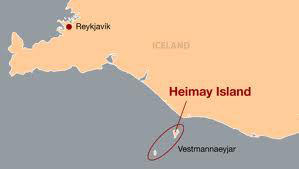
Guðmundur was born in 1825 in a farm town in Artun in the Rangarvalla district of the Oddi Parish in Iceland. He was baptized a member of the Lutheran Church a few months after he was born. He left Iceland as a teenager to be educated and pursue a career as a goldsmith in Denmark. While in Denmark he converted to Mormonism. Around the same time, Guðmundur’s childhood friend, Pórarinn Hafliðason, also converted in Denmark. The two friends reunited and were called to survive as missionaries for their new found faith in Iceland.  The new Icelandic converts were not very successful in the mainland of Iceland so they went to an Island called Vestmannaeyjbaer or Westman Island, southwest of the capital Reykjavik, .

Image result for vestmannaeyjarImage result for first icelandic plaque in spanish fork ut

The two missionaries were able to find many new converts in this part of Iceland but they did face a lot of opposition form the established church in the area. Samuel and Margret Bjarnason, along with Helga Jónsdóttir who were converted on the island by the two native missionaries  were the first Icelandic members to make the move to Utah. Samuel and Margret arrived in Utah on September 7, 1855 and were told by Brigham Young, the leader of the LDS Church to go and settle in Spanish Fork. Scandinavian saints were already in the area and so Brigham Young felt this would be a great place for the Icelandic saints to build a community. Hundreds of Icelandic Saints would eventually make their way to Utah in the following years until about 1914 when WWI began. During this same time the Icelandic Mission of the Church of Jesus Christ of Latter-day Saints was closed due to the war, and general immigration from Iceland ended.

Einar Eiríksson was the last missionary to serve in Iceland before the outbreak of World War I in 1914. Courtesy of the Icelandic Association of Utah

For the next fifty years the LDS Church did not exist in Iceland. In 1977 Iceland was again dedicated for Mormon missionary work to continue. Twenty years later in 1997 the president of Iceland and his wife were invited to celebrate Iceland Days marking the centennial of the first Icelandic members of the LDS Church to settle in Spanish Fork.

Finally on June 30, 2000 a monument was erected with the names of 410 Icelandic Mormons who made the journey from the Westman Islands to Utah Valley between 1857 and 1914.

Image result for icelandic monument spanish fork utah who put it there

This monument is a testimony of the faith and dedication of the Icelandic members of The Church of Jesus Christ of Latter-day Saints who sacrificed so much for their beliefs.

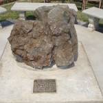
Image result for first icelandic plaque in spanish fork ut( This rock was transported from the Westman Island. It is significant because the first baptism for The Church of Jesus Christ of Latter-day Saints in Iceland was Performed in the Westman Island. The rock is a volcanic rock from the Westman Island. In 1973 the Eldfell Volcano on the island erupted and this almost lead to a permanent evacuation of the Westman Island.)

Primary Sources: 

Autobiography of Peter Gottfredson, Church History Library, Church of Jesus Christ of Latter-day Saints, Salt Lake City, Utah.

Letter from Charles R. Savage to John Taylor, Millennial Star 18, no. 13 (1856): 206.

Manuscript History of the Icelandic Mission, 1851–1914, Church History Library, Church of Jesus Christ of Latter-day Saints, Salt Lake City, Utah.

“Preaching in Iceland,” Millennial Star 64, no. 27 (1902): 427–28.

“The Icelanders,” Millennial Star 48, no. 32 (1886): 507.

“The Life of Einer Erickson,” 21—23, L. Tom Perry Special Collections, Brigham Young University, Provo, Utah.

Torgeirson, John.  “The People of Iceland,” Deseret Evening News, 24 January 1887, 2.

Secondary Sources

Carter, Kate.  “The First Icelandic Settlement in America,” Our Pioneer Heritage, (Salt Lake City: Daughters of Utah Pioneers, 1964), 7:477—556.

Mulder, William. Homeward to Zion. Minneapolis: University of Minnesota Press, 1957. 

Woods, Fred E. “Icelandic Conversion and Emigration: A Sesquicentennial Sketch,” in Regional Studies in Latter-day Saint Church History: Europe, ed. Donald Q. Cannon and Brent L. Top (Provo, UT: Religious Studies Center, Brigham Young University, 2003), 1–21.


Jacob Hamblin (#21), Fort Kanab (#151)

Published / by Lisa Barr / 5 Comments on Jacob Hamblin (#21), Fort Kanab (#151)

Written by Lisa Barr, US History/ Public History MA Student, University of Utah

Jacob Hamblin (#21)

Placed by: Utah Pioneer Trails and Landmark Association and citizens of Kanab Stake

GPS Coordinates:  37° 02.967’ N, -112° 32.114’ W

Located at the Levi Stewart Memorial in Kanab

Photograph by Lisa Barr, February 18, 2017

Historical Text: 

No. 21 Erected Sept. 2, 1933

Jacob Hamblin

Born April 2, 1819    Died August 21, 1886

The great Mormon frontiersman and Indian missionary settled in Tooele Valley, Utah in 1850 and began preaching negotiations with the red men. He was so successful that the officials of the Church of Jesus Christ of Latter-day Saints sent him to establish residence among the Indians at Santa Clara, Utah in 1854.

Frank Asahel Beckwith, Kanab Markers (2). February 1, 1941, Courtesy Willard Marriott Library

A fort was erected on this site in 1865 into which he moved in 1869. He assisted Maj. J.W. Powell and party 1869-72. He was transferred in 1878 to Arizona and later to New Mexico. He is buried in Alpine, Arizona. His friendship with the Indians saved many lives.

Extended Research:

Jacob Hamblin was born in 1819 in Salem, Ohio and baptized into the Church of Jesus Christ of Latter-day Saints in 1842. He helped to settled Tooele, Utah in 1850 before Brigham Young sent him on a mission to the Native Americans in southern Utah in 1854. Hamblin first came to the Kanab area in 1867 to form alliances with members of the Hopi, Southern Paiute, and Navajo tribes. Hamblin hoped to teach them to farm, and convert them to Mormonism.

Eventually, Hamblin and his family moved from Santa Clara to Kanab in 1869 so that he could try to improve Mormon-Navajo relations in northern Arizona. In 1870, Brigham Young assigned Levi Stewart to lead Kanab’s resettlement which freed Hamblin to accompany John Wesley Powell on his second Colorado River expedition in 1871 and 1872. Hamblin and his family moved to Milligan’s Fort in Northern Arizona in 1878, and then to Pleasanton, New Mexico in 1883. He died of malaria in 1886 and is buried in Alpine, Arizona.

Fort Kanab (#151)

Placed by: The descendants of Levi Stewart and Pioneer Trails and Landmarks Association

GPS Coordinates:  37° 02.967’ N,  -112° 32.114’ W

Historical Marker Text:

Photograph by Lisa Barr, February 18, 2017

No. 115 Erected April 11, 1950

Fort Kanab

On June, 14, 1870 Levi Stewart, who had been called from Salt Lake County by President Brigham Young to head a group of pioneers in settling this area, brought a party with seven wagons from Pipe Spring, where they had camped temporarily to Fort Kanab which had been built a year before by Jacob Hamblin and Indian missionaries.

Located at the Levi Stewart Memorial, Kanab, Utah Photograph by Lisa Barr, February 18, 2017

Kanab Ward was organized September 11, 1870 with Elder Stewart as bishop. Other settlers arrived, homes were built and plans were made for a permanent community. A fire in the fort on December 14, took the lives of Mrs. Margery Wilkerson Stewart and five sons.

Extended Research:

Kanab’s first settlers built Fort Kanab in stages between 1865 and 1869. The fort was vacated in 1866 due to increased Navajo and Southern Paiute raids that resulted from the Black Hawk War. In 1867, Jacob Hamblin traveled to the area to establish peace with Hopis and Southern Paiute Indians, however, Navajos continued to carryout raids throughout the region. Hamblin moved to Kanab from Santa Clara in 1869 and began to rebuild the fort which lasted until Brigham Young sent Levi Stewart to resettle the town of Kanab in 1870. The new settlers, including Stewart’s family, lived in the fort while they built homes in town. Southern Paiutes were also a part of Fort Kanab’s community and some lived in the fort and helped to farm the land in exchange for food.

Frank Asahel Beckwith, Kanab Markers (2). February 1, 1941, Courtesy Willard Marriott Library

Fort Kanab caught fire the night of December 14, 1870. Kerosene and turpentine that were stored in the fort exploded and collapsed the roof, killing Stewart’s wife Margery and five of their sons. Jacob Hamblin recalled the fire in his journal, stating that the fort was “in a moment enveloped in an intense flame which burst out from the only entrance, and that the scene could never be forgotten by those who witnessed it.”[1]

[1] Jacob Hamblin, Jacob Hamblin: His Life in His Own Words (New York: Paramount Books, 1995), 95.

For Further Reference:

Primary Sources:

Adams, John Q. Pioneer Personal History of John Q. Adams, Kanab, Utah. July, 16, 1938.  https://collections.lib.utah.edu/details?id=700963&q=fort+kanab&page

Beckwith, Frank Asahel.  Kanab Markers (2). February 1, 1941, Willard Marriott Library, Salt Lake City, Utah.  https://collections.lib.utah.edu/details?id=12525     https://collections.lib.utah.edu/details?id=442803&q=jacob+hamblin&page

https://collections.lib.utah.edu/details?id=442804&q=jacob+hamblin&page

Hamblin, Jacob. Jacob Hamblin: Life in His Own Words. New York: Paramount Books, 1995.

Secondary Sources:

Bradley, Martha Sonntag. A History of Kane County. Salt Lake City: Utah State Historical         Society, Kane County Commission, 1999.

Brooks, Juanita. Jacob Hamblin: Mormon Apostle to the Indians. Salt Lake City: Westwater       Press, 1980.

Compton, Todd. A Frontier Life: Jacob Hamblin, Explorer and Indian Missionary. Salt Lake City: University of Utah Press, 2013.


United Order Industries

Published / by Lisa Barr / 2 Comments on United Order Industries

Written by Lisa Barr, US History/Public History MA Student, University of Utah

Placed By: Daughter of Utah Pioneers

GPS Coordinates: 37° 16.555’ N, -112° 38.346’ W

Historical Marker Text:

Located on S Highway 89 in front of the Orderville LDS Church building. Photograph by Lisa Barr, February 18, 2017

No. 290 Erected 193

United Order Industries

Photograph by Lisa Barr, February 18, 2017

On March 20, 1874, The Church of Jesus Christ of Latter-Day Saints organized a modern Order of Enoch, called The United Order, Israel Hoyt, First President. A community dining hall with bakery was first constructed, also a garden house for seeds and tools.
They built a carpenter, blacksmith and shoe shop, tannery, gristmill, sawmill, molasses mill, bucket factory, a woolen and cotton factory: engaged in the silk industry, dairying, broom and hat making. The people planted farms, orchards and gardens, raised sheep and cattle. Cooperative ended in 1886.

Orderville Camp Kane County, Utah (This area is partially damaged. Two words are illegible.)

Extended Research:

In 1875, some residents of Mt. Carmel, Utah led an effort to organized a new town in a new location and to call their new settlement Orderville. Their vision for the new community centered on Mormon ideals of unity, order, and economic equality and were the result of their leader, Brigham Young’s recent encouragement to establish self-sustaining cooperatives throughout the Utah Territory. The movement was known as the United Order or the United Order of Enoch. Brigham Young hoped that such efforts would prod Mormons toward greater equality through shared labor, resources, and property as well as limit the negative repercussions from the cyclical economic downturns associated with capitalism.

Orderville, Utah p.1. Classified Photograph Collection, Courtesy Utah State History, Willard Marriott Library

Many Orderville  residents were originally from settlements along the Muddy River in Nevada, where they had previously attempted and failed to develop a cotton industry based on cooperative principles. Fortunately, Orderville’s fertile soil proved more conducive to farming and timber resources were also readily available. Order members built a tannery, dairy farm, sawmill, wool and cotton factory, molasses mill, bakery, school, ZCMI cooperative, and community dining hall. Emma Carroll Seegmiller, who was a child of the United Order, recalls how “everyone would eat at three large tables, pour molasses over bread and eat it like bread and milk, and that three-hundred pounds of flour was made into bread every day.”[1 Families lived in one and two room apartments called “shanties” that were joined together at the center of town. The Order also had a board of directors who assigned labor roles and determined how resources were used. Seegmiller and other children were in charge of distributing the divided goods to families and said that “it was a delightful priveledge to help the United Order.”[2]

United Orderville Woolen Mill p.1. Unknown date. Classified Photograph Collection, Courtesy Utah State History, Willard Marriott Library

Orderville began to decline in 1880 as southern Utah’s economy expanded and became more competitive. The United Order also started to use the wage labor and to divide cooperative property into private half acre lots. These factors hindered cooperation and Orderville’s United Order dissolved in 1885. Even still, the Order retained and leased out its wool factory and sheep company for another fifteen years. Although Orderville’s experiment in cooperation did not survive economic competition, it was the LDS Church’s most successful United Order effort and its most complete attempt at economic withdrawal.

[1] Emma Carroll Seegmiller, “Personal Memories of the United Order of Orderville, Utah,” Utah Historical Quarterly, v. 7 (1939): 177, 184.

[2] Seegmiller, 174.

For Further Reference:

Primary Sources:

Seegmiller, Emma Carroll. “Personal Memories of the United Order of Orderville, Utah.” Utah Historical Quarterly, v. 7 (1939): 160-200.

Orderville, Utah p.1. Classified Photograph Collection, Utah State History, Willard Marriott     Library, Salt Lake City, Utah.

United Orderville Woolen Mill p.1. Unknown date. Classified Photograph Collection, Utah State History, Willard Marriott Library, Salt Lake City, Utah.   https://collections.lib.utah.edu/details?id=444049&q=orderville&page

Secondary Sources:

Arrington, J. Leonard, Feramorz Y. Fox and Dean L. May. Building the City of God: Community and Cooperation Among Mormons. Champaign: University of Illinois Press, 1992.

Bradley, Martha Sonntag. A History of Kane County. Salt Lake City: Utah State Historical         Society, Kane County Commission, 1999.


1853 Holladay Fort

Published / by Ben Hopes / Leave a Comment

By Ben Hopes, Masters of Education Graduate Student

GPS Coordinates: 40˚ 37’ 4.84” N, 111˚ 49’ 36.21”

Holladay Historical Marker

Extended Research About Holladay:

In July of 1847, Holladay became the first village established independent of Salt Lake City. At the time, Latter Day Saints Prophet Brigham Young sent out members of his congregation to colonize different parts of Utah, particularly areas rich in natural resources. Led by John Brown, the pioneers of the Mississippi Company founded the village, flourishing with an abundance of natural resources. A free flowing stream fed through the Holladay area, and provided the rich and fertile lands for farming and planting[1]. The area was known as Cottonwood or the Mississippi Ward, but would be named Holladay after a particularly influential bishop, John D. Holladay. The settlement would grow to include schools, churches, and the creation of a fort in 1853, intended as protection against Native American raids but instead became a place for the settlers to gather.

Marker at Approximate Location of Southeast Corner of Holladay Fort

The Mississippi Company itself had known hardship; they had existed in the Southern States Mission, where they were often met with vitriol and physical harm[2]. They had moved west nearly a full year before the Mormon exodus of 1847, wintering at Pueblo, Colorado. Many of its members volunteered to join the Mormon Battalion, formed to aid the United States’ incursion into Mexico: The men and their families knew sacrifice. The struggles that they encountered in trying to fulfill their Prophet’s, and ultimately their God’s, vision created in them a firm belief that they were truly a chosen people destined for eternal greatness. According to various accounts, the Saints of this era met each challenge with the strength of their convictions and the willingness to work together, united in their goals[3]. Pioneers saw obstacles, such as hunger or physical hardship on the trail, as trials to be conquered with the aid of an almighty God. The Mississippi Company acted admirably in much the same way.

The Mormon colonization efforts were remarkable. Because of their strong, central leadership and the complete cooperation of their congregations, a community infrastructure could be quickly established that led to economically competent planning, ensuring a town’s immediate survival. One can see the precision of the Mormon colonization machine in the fact that Holladay was founded only a month after the Brigham Young’s famous incursion into the Salt Lake Valley. The tenacity of their efforts would further be reflected in the founding of the San Bernadino Mission in California (1851) by some of the members of the Mississippi Company.

Six years after the Mormon migration of 1847, Chief Walker of the Ute tribe declared war on the Mormons in the valley, in immediate retaliation for the death of a Ute Indian in a small conflict in Utah Valley, and for the larger reason that the Mormon people had encroached on his tribe’s lands and did not seem to have any intention of letting up in their colonization efforts. While this is called the Walker War, there was not much conflict: it was mainly a series of Indian raids and small Mormon reprisals. There were no great battles and a peace would be declared in May of 1854, with few conciliatory negotiations to resolve the ideological conflicts between the two groups.[4]

About the Holladay Fort:

However, the fear of Indian attacks led to the creation of the Holladay Fort in 1853 (it is very likely that it was never completely finished). Built from adobe mud and straw, it provided some protection but the Indian threat (the attacks were focused mainly in central Utah) was not enough to convince Holladay’s 161 inhabitants to move in. A house within its walls would serve as the meeting place for school and church functions in the area, until a new school/church would be built on the fort grounds in 1861.

In 1873, a new church, separate from the school, was built on the grounds. This church would serve LDS needs until 1972. In 1876, a new school was constructed on the fort site, accommodating school children until 1893, when another school was constructed just south. This 2-story, 4-room school would become a gymnasium for the 3-story, newly renamed Irving Junior High School, created in 1905. Irving Junior High was built to the west of the 1893 building (the gymnasium) and would be renamed Olympus Junior High in 1943.

Approximate Location of the 1853 Holladay Fort (Now a Field for Olympus Junior High)

Olympus Junior High would be torn down in 2002 to make way for a new school, moved slightly to the west of the original site. Today the grounds of the fort roughly encompass the entirety of the field used by the school, in addition to a small business and the LDS seminary building that Olympus Junior students regularly attend. Despite resistance to the westward move[5], the new building has become a community landmark and important facet of family life in Holladay itself.

The creation of the Holladay Fort in 1853, while not initially significant, set aside an area that would become culturally and socially important to the community for nearly the next 100 years. Out of regional fears, the fort was designed to keep raiding Utes out and yet it proved to be a joyful place where the community gathered to celebrate their own culture and to continually devote themselves to their religion. By housing the educational and spiritual centers of Holladay, the fort provided the means for Mormon culture to survive and grow, fed by Spring Creek in the shadow of Mount Olympus.

Marker Placed by: The City of Holladay, Jay M. Todd (constructed in July 1996), surveyed by Kate Wacker (Utah State Historical Society)

 Secondary Sources:

  • Arrington, Leonard J. “The Mississippi Mormons.” Ensign June 1977: N.p. Web. 29 Mar. 2017
  • Bigler, David L., and Bagley, Will.Army of Israel: Mormon Battalion Narratives. 2000. Print. Kingdom in the West ; v. 4.
  • Christy, Howard A.The Walker War: Defense and Conciliation as Strategy.  Print.
  • Parrish, William E. “The Mississippi Saints.”Historian 4 (1988): 489-506.
  • Van Leer, Twila. “School Construction Gets F From Residents.” Deseret News, 23 Aug. 2002. Web. 30 Mar. 2017.
  • “City of Holladay.” City of Holladay. N.p., 2016. Web. 29 Mar. 2017. http://cityofholladay.com/community/about/history/

Primary Sources:

  • Bullock, Thomas.The Pioneer Camp of the Saints: The 1846 and 1847 Mormon Trail Journals of Thomas Bullock. Vol. 1. Arthur H Clark, 1997. Print.
  • Olsen, Alice M., Olsen, R. L, and Lewis, Ira Allen. Mount Olympus & Holladay, Early Years (1920-30) : Featuring the Photographic Art Taken 1920-1930+ by Ira Allen Lewis (b. 1877 Holladay, Utah-d. 1948 Holladay, Utah), Some of the Old Homes of Holladay, Mount Olympus, Cottonwood Creek & Holladay (photographed from 1940-2010 by Alice McDonald Olsen). Print.

[1] “City of Holladay.” City of Holladay. N.p., 2016. Web. 29 Mar. 2017.

[2] Arrington, Leonard J. “The Mississippi Mormons.” Ensign June 1977: N.p. Web. 29 Mar. 2017

[3] Bullock, Thomas. The Pioneer Camp of the Saints: The 1846 and 1847 Mormon Trail Journals of Thomas Bullock. Vol. 1. Arthur H Clark, 1997.

[4] Christy, Howard A. The Walker War : Defense and Conciliation as Strategy. 1979. Web. 30 Mar. 2017.

[5] Van Leer, Twila. “School Construction Gets F From Residents.” Deseret News, 23 Aug. 2002. Web. 30 Mar. 2017.

Connor Statue at Historic Park

Published / by Zach Vayo / Leave a Comment

Connor Statue at Historic Park

Write-up by Zach Vayo

GPS Coordinates: 40.764399°N, 111.832891°W

Historical Marker Text:
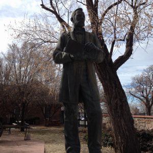
“PATRICK EDWARD CONNER BRIGADIER GENERAL AND BREVET MAJOR GENERAL UNITED STATES VOLUNTEERS 1820-1891

Born in County Kerry, Ireland. Emigrated as a child to the United States. Enlisted in the army at age 19. Attained rank of Captain in the Mexican War. As Colonel, commanding the Volunteers, established Camp Douglas on Oct. 26, 1862. A soldier-statesman of great energy and vision, he was the “father of Utah mining”, published the first daily newspaper in Utah Territory, and founded Stockton, Utah. * * * * This park presented to the United States Army by the Fort Douglas Museum Association on the 124th Anniversary of the founding of Fort Douglas. Oct 26, 1986.”

Extended Research:

Aside from Brigham Young, perhaps no individual played a larger role in shaping nineteenth century Utah than Patrick Connor. Indeed, prominent Utah historian Dean May has hailed these men as the two founding fathers of modern Utah.[1] Today, Connor’s statue in Fort Douglas quietly rivals Young’s much grander memorialization across Salt Lake in Temple Square – a silent reenactment of what was in its day a bitter public rivalry between these two men and their competing visions. Young sought to establish Utah as the Kingdom of God on Earth according to the unique sensibilities of the LDS Church. Connor, meanwhile, aimed to bring Utah into the American mainstream by conquering the land’s indigenous peoples and opening the door for white settlers like himself, looking to make their fortunes out West. Intensely distrustful of Utah’s Mormon population, Connor was himself an immigrant who, having undergone a process of Americanization, now sought to “Americanize” Utah along the same lines as the rest of the West. Portrayed as everything from hero to murderous plunderer, Connor has been sweepingly characterized as “the archetypal nineteenth century man”, who was “representative of all that was good and bad in that age.”[2]

The man who would come to identify himself as P. Edward Connor was born Patrick Edward (“Paddy”) O’Connor in County Kerry, Ireland. Very little information exists on Connor’s early life; he claimed to have been born on St. Patrick’s Day, 1820.[3] Economic stagnation in Ireland drove his family to emigrate to New York when he was perhaps sixteen. Connor spent several years working odd jobs as a laborer before beginning his military career by volunteering for the First Dragoons in 1839. It is possible the young Irishman viewed military service as a useful means to “Americanize” himself in an era animated by nativism and anti-Catholicism.[4]

Connor’s five year tour with the Dragoons took him to the lands in and around the newly-created Iowa Territory to maintain relations with the region’s native peoples. This fledgling military presence in the trans-Mississippi West, with the US fresh off the Jacksonian ethnic cleansing of native peoples in the East, would foreshadow atrocious military violence against the indigenous peoples of the West during and after the Civil War, in which Connor himself was to play a leading role.

While relatively uneventful, Connor’s tour with the Dragoons gave him valuable experience as a soldier. More importantly, he appeared to become enamored with the West, where he would spend almost all of the remainder of his life. Following the end of his tour of duty, he returned to New York for several years, engaging in “mercantile business” and becoming a naturalized citizen (a process no doubt made easier by his military record).[5] Also around this time, he removed some of the conspicuous Irish-ness from his name by dropping the O’ in his surname and shortening Patrick to an initial, becoming P. Edward Connor. With the outbreak of war with Mexico in 1846, Connor headed west again, joining a company of Texas Volunteers. He participated in the US victory at the Battle of Buena Vista, receiving praise for his bravery.[6]
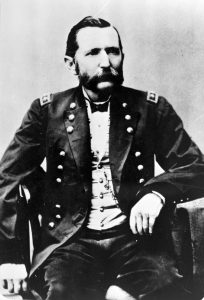
Connor ca. 1860s

The war resulted in the US seizure of a vast swath of land claimed by Mexico. Connor was among many who viewed these lands as a place to make it big, travelling to California in 1850 on the heels of the Gold Rush. After an ill-fated attempt to establish a community on the Trinity River, he settled in Stockton. Over the next decade, his numerous entrepreneurial ventures, particularly a gravel quarry on his property, resulted in Connor accumulating a degree of wealth. He emerged as a leading citizen of Stockton and came to head its militia, the Stockton Blues. In 1854, he married Johanna Connor, another emigrant from Kerry County.[7] The couple would raise five children to adulthood, enduring the loss of two sons who died in childhood.

This relatively peaceful period of Connor’s life came to an end in 1861 with the outbreak of the Civil War. Eager to serve his adopted country once more, he took the lead in recruiting several companies of California Volunteers to serve under his command. In spite of his (and his troops’) desire to fight the Confederacy in the East, he found himself assigned to protect overland mail routes in Utah, as the Lincoln administration sought to preserve California’s tenuous connection to the Union.[8] In Utah, Connor’s troops were to serve as an occupying force to both native peoples such as the Shoshone and to the territory’s Mormon population, practitioners of an enigmatic and fanatical religion in the eyes of many, whose loyalty to the country seemed particularly dubious, particularly in light of the 1857 Mountain Meadows Massacre.

During the journey across Nevada, Connor began to hone his reputation as an Indian fighter, launching attacks that killed several dozen Shoshones. Reaching Salt Lake City in 1862, Connor remarked with disgust on the apparent un-Americanness of the Mormons, calling them “a community of traitors, murderers, fanatics, and whores,” claiming “the people publicly rejoice at reverses to our arms,” and “Brigham Young rules with despotic sway.”[9] For their part, the Mormons had good reason to fear federal troops due to the “Utah War” of 1856-58. As such, they were none too happy when Connor, despairing of the state of the old Camp Crittenden (Camp Floyd) in Utah Valley, planted his troops directly above their capital, establishing Camp Douglas on an eastern bench of the Salt Lake Valley on October 26, 1862. Connor cited this new location as all the better to “say to the Saints of Utah, enough of your treason.”[10] Connor’s troops thus became the most visible symbol of “Gentile” (non-Mormon) presence in the territory, sparking a war of words between the two groups lasting for decades.
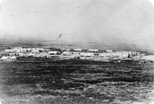
Camp Douglas (later Fort Douglas) ca. 1865. Connor named the fort for Lincoln’s great political rival, Stephen Douglas.

The year 1863 was a critical one for Connor. Denied the chance to fight in the East, he seized on a chance to “chastise” the Northwestern Shoshone instead. Increased Anglo-American incursions into what is today southern Idaho had strained relationships with the Shoshone, producing intermittent fighting and claims of kidnapping. In the bitter cold of January, Connor marched his troops from Camp Douglas to a Shoshone encampment on the Bear River. One California newspaper offered a telling insight into the attitudes of the day by publishing a gleeful letter from a Salt Lake correspondent, stating that “before [Connor’s troops] quit the entertainment Mr. Redskin is to be well thrashed, and, if possible, ‘wiped out.’”[11]

Arriving at the encampment, Connor’s troops launched an attack on the 29th of January. What began as a battle became a bloodbath as Connor’s troops flanked the Shoshones, trapping them in a ravine. The troops proceeded to massacre anyone within reach, including women and children. The death toll may well have exceeded four hundred, making it the largest massacre in the history of the American West. Connor’s troops destroyed homes and food supplies, murdering dozens more women who refused to submit to rape by the soldiers.[12] His actions would make him one of the most despised figures in Shoshone memory, with one survivor, Sagwitch, later recalling the bitter irony of “that merciless battle, when women and suckling babes met their death at the hands of civilization.”[13] Those same actions, however, made Connor a hero to white colonizers in the West, and earned him a promotion to brigadier-general.
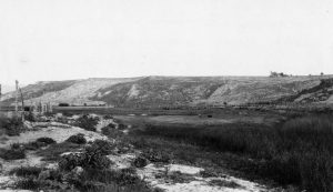
Bear River Massacre site.

Back in Salt Lake, Connor became fixated on the notion of publicizing Utah’s mineral wealth so as to draw non-Mormons into the territory, contending that “inducements … to the teeming population of the East and West, seeking new fields of exploration and prosperity” would spell political and social doom for the Mormonism that he saw as “not only subversive of morals, in conflict with the civilization of the present age, and oppressive on the people, but also deeply and boldly in contravention of the laws and best interests of the nation.”[14] To that end, he founded the Daily Union Vedette, a staunchly non-Mormon newspaper that wrote extensively on the wealth to be had in Utah. Connor helped to establish and personally invested in numerous mining districts, including what would become Bingham Canyon, earning the honorific “father of Utah mining.” In 1863, Connor also established the town of Stockton, near Tooele, named for his former home in California. Connor intended Stockton as a hub for non-Mormon settlement, though his grand visions could never elevate it beyond a minor settlement on the fringes of Brigham Young’s Mormon kingdom. Of course, Young and his disciples were none too happy to see these capitalistic incursions into their Zion. After Young petitioned unsuccessfully to have Connor and his troops removed from Utah,[15] he was spared of the general for a time when Connor was sent to present Wyoming for the Powder River expedition in 1865.

Connor thus departed Utah to crush resistance from the Cheyenne, Sioux, and Arapaho in response to a mining boom that had drawn a wave of white colonizers into Montana. While Connor’s campaigns failed to win any “victories” as decisive as that at Bear River, he nonetheless killed several hundred indigenous persons in a series of battles and skirmishes such as Tongue River (at times fighting alongside indigenous allies such as the Omaha). Such militancy undermined the capacity of indigenous communities to sustain themselves, leaving little recourse to federal economic dependency and reservations (with poverty ironically reinforcing white perceptions of indigenous nations as primitive and backwards). The Powder River endeavor was largely regarded as a failure, in part due to negative publicity surrounding another event to the south: namely, the army’s 1864 Sand Creek Massacre against the Cheyenne and Arapaho, which had soured the nation for a time on war with native nations.[16] Reflecting this shift in attitude, the Salt Lake Tribune expressed desire for “some sensible plan” regarding “the poor Indian race.”[17]Nonetheless, the expedition cemented Connor’s status as to hero to white colonizers in the West. This would be Connor’s last major military mission, as he resigned his commission in 1866.

After a brief return to Utah (and a trip to Washington DC to testify against the evils of the Mormons), Connor returned to California with his family. By 1869, however, the looming completion of the transcontinental railroad brought him back to Utah. This time, his family stayed in California, establishing a permanent residence in Redwood City. Over the next decades, Connor would become increasingly estranged from his family as he bounced between various mining and railroad endeavors in Utah and Nevada in largely unsuccessful attempts to amass his fortune, made all the more difficult by the market instabilities laid bare in the Panic of 1873. Johanna Connor would eventually die in 1889, making no mention of her oft-absent husband in her will.

In Utah, the railroad spelled doom for Brigham Young’s bucolic conception of an economically isolated Zion. Anticipating an economic and demographic influx to the territory, Connor took an interest in the town of Corinne, near the mouth of the Bear River, which emerged in the wake of the railroad’s completion as Utah’s leading non-Mormon community. His assessment of this emerging landscape proved somewhat overly optimistic, with his vision of a steamboat service across the Great Salt Lake connecting Corinne to Stockton never truly materializing. As the most esteemed non-Mormon in the territory, Connor became the symbolic leader of Utah’s anti-Mormon Liberal Party, which denounced polygamy and sought to block statehood for fear of losing federal leverage against the dominant religion. Speaking at an 1880 Liberal rally, Connor declared his intention of “taking up the fight with renewed vigor,” and “helping forward the good work of regulating and Americanizing Utah.”[18] This symbolic leadership notwithstanding, Connor proved unsuccessful in parlaying his notoriety into political office, losing a bid even for the modest office of Salt Lake County Recorder. He died in Salt Lake in 1891 with much prestige and little wealth, and was buried in the Fort Douglas Cemetery.[19]
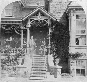
Connor with President Hayes during the latter’s visit to Fort Douglas, 1880.

The decades after his death saw Patrick Connor’s vision of an Americanized Utah come to fruition to a remarkable degree. Booming mining industries throughout the new state in regions such as Carbon County and Bingham Canyon attracted waves of non-Mormon immigration from countries including Greece and Italy, and, to a lesser extent, Japan and China. Mining in particular signified Utah’s increasing integration into the national economy; while providing economic opportunity, this new colonial economy also spawned appalling working conditions and environmental degradation. Connor would no doubt also have been pleased to see the LDS church, the object of his perpetual contempt, take a firmer stance against polygamy and recede from the political sphere in the first decades of the twentieth century (though the latter change did not prove permanent). Furthermore, the twentieth century also saw emphasis on Brigham Young’s model of economic cooperation decline as many Mormons made their peace with Connor’s capitalist vision. Indeed, while not abandoning their distinct identities, Mormon communities have undergone a noteworthy degree of Americanization since Connor’s time.[20] Connor himself practiced what he preached with regards to Americanization: the Irish-born immigrant epitomized the self-made man of fame and fortune. While this rugged, romantic image has become iconic in conceptions of the West, Connor’s case also illustrates its shortcomings. Never truly successful in making his fortune later in life, his obsessive quest for wealth resulted in considerable alienation from his family. Underpinning all of this is Connor’s darkest legacy (and one that is conspicuously absent from his historical marker): the brutalization of indigenous nations, on whose dispossessed land the processes of “Americanization” played out. Particularly for the Northwestern Shoshones, the impacts and bitter memories of Colonel Connor’s atrocious actions on the Bear River echo into the twenty-first century.

For Further Reference:

Primary Sources:

P. Edward Connor, Official Report on the Bear River Massacre, February 6, 1863.

Secondary Sources:

Madsen, Brigham. Glory Hunter: A Biography of Patrick Edward Connor. Salt Lake: University of Utah Press, 1990.

May, Dean. Utah: A People’s History. Salt Lake: University of Utah Press, 1987.

Varley, James. Brigham and the Brigadier: General Patrick Connor and His California Volunteers in Utah and Along the Overland Trail. . Tucson: Westernlore Press, 1989.

[1] Dean L. May, Utah: A People’s History (Salt Lake: University of Utah Press, 1987), 194.

[2] James Varley, Brigham and the Brigadier: General Patrick Connor and His California Volunteers in Utah and Along the Overland Trail. (Tucson: Westernlore Press, 1989), x.

[3] Brigham Madsen, Glory Hunter: A Biography of Patrick Edward Connor (Salt Lake: University of Utah Press, 1990), 3-5.

[4] James Varley, Brigham and the Brigadier, 2.

[5] Brigham Madsen, Glory Hunter, 18-19.

[6] James Varley, Brigham and the Brigadier, 4.

[7] Brigham Madsen, Glory Hunter, 30.

[8] Ibid, 48.

[9] P. Edward Connor, letter to Major R. C. Drum, September 14, 1862.

[10] Ibid.

[11] “A Big Expedition – Connor and the Volunteers after the Indians,” Sacramento Daily Union (Sacramento, CA), Feb. 7, 1863

[12] Scott Christensen, Sagwitch: Shoshone Chieftain, Mormon Elder, 1822-1887 (Logan: Utah State University Press, 1999), 52.

[13] F.W. Warner (Sagwitch), “Sagwitch Writes The Citizen About New Monument,” Franklin County Citizen (Preston, ID), Jul. 11, 1918.

[14] P. Edward Connor, letter to Major E. McGarry, October 26, 1863.

[15] Brigham Madsen, Glory Hunter, 114.

[16] Ibid, 121.

[17] James Varley, Brigham and the Brigadier, 258.

[18] Brigham Madsen, Glory Hunter, 237.

[19] Brigham Madsen, Glory Hunter, 271.

[20] Dean L. May, Utah: A People’s History, 190, 194-198.
Utah’s First Capitol

Published / by Benjamin Bartholomew / Leave a Comment

Utah Historical Site Marker

Placed by: Daughters of the Utah Pioneers, No. 7

GPS Coordinates: 38.9676° N, 112.3251° W

Historical Marker Text (1):

Erected Aug. 3, 1935

Utah’s First Capitol

Creating Fillmore City and Millard County, the Territorial Legislature of Utah, selected Pauvan Valley as the capitol site Oct. 29, 1851. This spot was selected by Gov. Brigham Young. Construction work began in 1852. Truman O. Angell, Architect, and Anson Call, Supervisor. This South Wing was used by the 5th Territorial Legislature Oct. 10, 1856. In 1856 the seat of government was moved to Salt Lake City. Later used as Court House and County Headquarters. Restored in 1928 and dedicated as state museum July 24, 1930

Custodians: Daughters of the Utah Pioneers Millard County Company

National Register Marker

 Historical Marker Text (2):

The National Register of Historic Places

Utah Historic Site

Territorial Capitol

Built: 1852-1855

Architect: Truman O. Angell

Used by 5th (1855), 6th (1856),

and 8th (1858) State Legislatures

Division of State History N-9

Extended Research:

Establishing Fillmore:

Governor Young

The Compromise of 1850 admitted California into the Union as a free state and established New Mexico and Utah as territories. U.S. President Millard Fillmore appointed Brigham Young as the first Governor of Utah, and requested a capital city be established. To accomplish this, Young recruited a man by the name of Anson Call. Call joined the Mormon Church in 1843, and immigrated with his family in 1848 to Bountiful, Utah. At 41 years-old, Call received a “calling,” or religiously appointed duty, from Brigham Young to explore central Utah.

In May of 1851, Call waited in Parowan to receive word from Young as to where he should go next. Young sent a letter to Call saying “to go a distance of about one hundred miles north and explore Pah-Van Valley”  and directed him to find “a suitable place to make a settlement.”[1]

Anson Call

After exploring, Call concluded that the area near Chalk Creek would be the best spot to settle. Young then requested Call to gather fifty families and to establish a colony. From multiple records, it appears that the families Call recruited were generally poor and new immigrants from England.

Meanwhile, in Salt Lake City, the territorial legislature met to decide on a location for the capital city. Legislators concluded that it should be placed at the geographic center of Utah Territory. Following their decision, Young assembled his own wagon company and then headed south to officially dedicate the site as the capital.  The Deseret News reported that on October 21, 1851, Young and other leaders left Great Salt Lake City for the purpose of locating the site for the seat of government.[2]

Samuel P. Hoyt

Bishop Bartholomew

One week later, on October 28th, Brigham Young arrived in what he then named Fillmore, and placed his cane to the earth declaring it the cornerstone of the new territorial statehouse. On October 29, 1851, Jesse W. Fox began surveying the city after Joseph Smith’s “city of God” method.  Young later described the events this way:

“We found an excellent situation near the ford of Chalk Creek and selected the site for the State House on the south side of that creek on the heights about 3/4 of a Mile up it.  Exceedingly beautiful are the numerous cedars in that vicinity which are included in the city plot. . . . The location of the seat of Government at that point will unquestionably prove highly satisfactory to the People of the Territory having a more central position than Great Salt Lake County and the most susceptible of maintaining a large and dense population of any other valley intervening. . . .”[3]

Building the Statehouse:

Replicas of what houses in the Fort looked like.

During the Winter of 1851 the population of Fillmore grew and settlers continued to build Fort Fillmore. They additionally began preparations to build the statehouse. In the Spring of 1852, LDS Bishop Noah Bartholomew sent multiple letters indicating that the population was growing as builders began to arrive. Brigham Young then appointed his brother in law, Truman O. Angell, to be the architect of the project. He assigned Samuel P. Hoyt as the foreman responsible for reporting updates to LDS leader, George A. Smith.

Settlers at Fillmore established a trade based economy as they struggled to build a community and provide the labor necessary to construct the new state house. In 1853 and 1854, tensions between Mormons and Ute Indians erupted into the Walker War which frequently interrupted or halted altogether construction on the building. At the end of the Walker War, Chief Kanosh was able to strike peace, and even settled his band near Fillmore in hopes of learning advanced agriculture. Despite these disruptions, workers completed the south wing of the state house in 1855.

Fillmore as a Capital:

The Statehouse

After completion of the south wing, the State Legislature convened in the House of Representatives’ Chamber. The United States District Court and Territorial Probate Courts were also able to utilize the second floor which also housed the Governor’s Office. The Deseret News used the basement of the new building as its headquarters.

The Statehouse after 1858:

By 1858, legislators complained that Fillmore was too small and too sparse in resources to continue as the capital city. Thus, they moved the capital to Salt Lake City for convenience and because Utah’s main population lived along the Wasatch Front. The statehouse at Fillmore was abandoned with only the south wing ever constructed. The south wing’s white trimmings and empty halls stand as the only remnant of the old capital at Fillmore. After the legislature vacated the city, the building was used as both a music hall and a schoolhouse. This lasted until 1930 when it was then made into a museum. The building was dedicated as a historic site in 1935.

References

[1] Brigham Young, 1851 in “Journal History of the Church of Jesus Christ of Latter-day Saints,” as cited in A History of Millard County, by Edward Leo Lyman and Linda King Newell (Salt Lake City: Utah State Historical Society), 39-40.

[2] “President’s Visit South,” Deseret News, 29 November 1851.

[3]Brigham Young to Jedediah M. Grant, 26 November 1851, Brigham Young Collection, DR1234/1, box 16, folder 22 (reel 25), Church History Library, The Church of Jesus Christ of Latter-day Saints, Salt Lake City, Utah.

Primary Sources

Brigham Young to Jedediah M. Grant, 26 November 1851, Brigham Young Collection, DR1234/1, box 16, folder 22 (reel 25), Church History Library, The Church of Jesus Christ of Latter-day Saints, Salt Lake City, Utah.

LDS Church Historians Office Journal, 8 January 1856, LDS Church History Library, Salt Lake City, Utah.

“President’s Visit South, Deseret News, 29 November 1851.

Secondary Sources

Day, Stella H. , ed.  Milestones of Millard: A Century of History of Millard County, 1851-1951.  Springville, UT: Art City Publishing Co., 1951.

Lyman, Edward Leo, and Linda King Newell, A History of Millard County. Salt Lake City: Utah State Historical Society, 1996.


Big Mountain

Published / by Grace Fahey / Leave a Comment

-Write up by: Grace Fahey

Placed By: Sons of Utah Pioneers

GPS Coordinates:  N 40° 49.683 W 111° 39.217

Historical Marker Text 1:

“On 19 July 1847, scouts Orson Pratt and John Brown climbed the mountain and became the first Latter-Day Saints to see the Salt Lake Valley. Due to illness, the pioneer camp had divided into three small companies. On 23 July, the last party led by Brigham Young reached the Big Mountain. By this time most of the first companies were already in the valley and planting crops. Mormons were not the first immigrant group to use this route into the Salt Lake Valley. The ill-fated Donner Party blazed the original trail one year earlier. They spent thirteen days cutting the trails from present day Henefer into the valley. That delay proved disastrous later on when the party was caught in a severe winter storm in the Sierra Nevada Mountains. The Mormons traveled the same distance in only six days. Until 1861, this trail was also the route of California gold seekers, Overland Stage, Pony Express, original telegraph line, and the other Mormon immigrant companies, after which Parley’s Canyon was used. This monument, erected and dedicated 25 August 1984, by South Davis Chapter, Sons of Utah Pioneers, replaces the original plaque erected 23 July 1933, by Utah Pioneer Trails and Landmarks Association and the Vanguard Association of the Salt Lake County, Boy Scouts of America”.

Nearby Markers: Little Mountain

Historical Marker Text 2:

“This is the last summit in the Wasatch Mountains along the pioneer trail. From this point the trail descends northwest until it reaches Emigration Creek. As William Clayton’s emigrants guide warns, “The descent is very steep all the way.”

The Donner Party passed over the summit August 21, 1846 and the Mormons on July 21, 1847.

Salt Lake City Chapter Son of Utah Pioneers

Extended Research:

Big Mountain is a landmark on the Utah section of the Mormon trail. The journey from Nauvoo, Illinois to Salt Lake City, Utah is now known as The Great Mormon Migration[1]. The Mormons embarked on this journey after facing violent religious persecution in both Missouri and Illinois. After their prophet and leader, Joseph Smith was killed in 1844, Brigham Young became the new leader of the main body of Saints and decided to flee persecution and seek a new home in the West.[2] As early as September 1845, Young favored the Salt Lake Valley as a potential new home for his followers.[3]

The Great Basin was attractive to the Mormons because of its isolation. At the time it was still a part of Mexico and largely unsettled. The Great Basin presented an opportunity for the Mormons to escape the religious persecution which they had endured in the United States. Brigham Young liked the idea that it was isolated and not under firm Mexican control, because he hoped no one else would want to settle there. The Mormon migration was thus a journey to escape persecution and find religious freedom.[4]

The Mormon migration began in February of 1846. During the first leg of the journey, Mormons suffered a loss of over 400 people. In response, they decided to stop in Omaha, Nebraska, for the winter. Then, in April 1847, the Mormons continued to the Rocky Mountains. Brigham Young led 142 men, 3 women, 2 children, 72 wagons, and cattle into the Great Basin. The steep, rocky conditions of the last portion of the trail made the migration treacherous.[5] At Fort Bridger, the Mormons took the Donner-Reed trail through the Rocky Mountains and into the Great Basin. The final leg of the trek was the most challenging yet. [6]

After months of climbing steep and rocky terrain, the journey soon came to an end. On 21 July, pioneers Orson Pratt and John Brown saw the Salt Lake Valley for the first time. Orson Pratt was enthusiastic in his assessment:

“After issuing from the mountains among which we had been shut up for many days, and beholding in a moment such an extensive scenery open before us, we could not refrain from a shout of joy which almost involuntarily escaped from our lips the moment this grand and lovely scenery was within our view.”[7]

One day later, after months of hardship and traveling, the advanced party of Mormon pioneers finally looked out over the Great Basin from atop what is now called, Big Mountain. Pioneer Thomas Bullock wrote that they viewed

“the Salt Lake in the distance with its bold hills on its islands towering up in bold relief behind the silvery lake —a very extensive valley burst upon our view, dotted in 3 or 4 places with Timber. I should expect the valley to be about 30 miles long & 20 miles wide. I could not help shouting ‘hurra, hurra, hurra, heres my home at last’—the Sky is very clear, the air delightful & altogether looks glorious; the only drawback appearing to be the absence of timber—but there is an Ocean of Stone in the mountains, to build Stone houses, & Walls for fencing. if we can only find a bed of Coal we can do well; & be hidden up in the Mountains unto the Lord.”[8]

On July 22nd 1847, after a final trek down the canyon, the first emigrant group camped in the Salt Lake Valley.[9]

Brigham Young, sick from Mountain Fever, followed behind and reached Big Mountain the next day. On July 23, his history records,

“I ascended and crossed over the Big Mountain, when on its summit I directed Elder Woodruff, who had kindly tendered me the use of his carriage, to turn the same half way round so that I could have a view of a portion of Salt Lake Valley. The spirit of light rested upon me and hovered over the valley, and I felt that there the Saints would find protection and safety. We descended and encamped at the foot of the Little Mountain.”[10]

Young and his group entered the valley on July 24th and joined the members of the advanced camp who were already plowing the land and planting crops.

Big Mountain is more than just a landmark on the Mormon Trail. Big Mountain marks the first time that the Mormon pioneers witnessed their destination stretched out before them.

Photo of Emigration Canyon from Big Mountain, 2017, by Grace Fahey

[1] “Mormon Trail History” Utah.com, accessed March 27, 2017.

[2] “Brigham Young; 1801-1877” PBS.org; New Perspectives on the West, accessed March 27th, 2017.

[3] Council of Fifty, Minutes, Sep. 9, 1845, in Matthew J. Grow, Ronald K. Esplin, Mark Ashurst-McGee, Gerrit J. Dirkmaat, and Jeffrey D. Mahas, eds., Council of Fifty, Minutes, March 1844–January 1846, first volume of the Administrative Records series of The Joseph Smith Papers, ed. Ronald K. Esplin, Matthew J. Grow, and Matthew C. Godfrey (Salt Lake City: Church Historian’s Press, 2016), 472.

[4] “‘This is the place’: The Mormon Pioneers” National Historic Trails Auto Tour Route Interpretive Guide; Utah- Crossroads of the West, National Park Services, Salt Lake City, UT, September 2010.

[5] “Mormon Pioneer” National Parks Service, accessed March 29, 2017.

[6] Stanley B, Kimball, “The Mormon Pioneer Trail, 1846-1847”. The Church of Jesus Christ of Latter-day Saints. Accessed March 27, 2017

[7] Orson Pratt, “Interesting Items Concerning the Journeying of the Latter-day Saints from the City of Nauvoo, Until Their Location in the Valley of the Great Salt Lake (Extracted from the Private Journal of Orson Pratt),” digital copy, LDS Church History Library, Church of Jesus Christ of Latter-day Saints, Salt Lake City, Utah.

[8] Thomas Bullock Journals, Vol. 4, 1843-1849, LDS Church History Library, digital copy, Church of Jesus Christ of Latter-day Saints, Salt Lake City, Utah.

[9] “‘This is the place’: The Mormon Pioneers” National Historic Trails Auto Tour Route Interpretive Guide; Utah- Crossroads of the West, National Park Services, Salt Lake City, UT, September 2010

[10] Brigham Young history, 23 July 1847, in Richard E. Turley Jr. and Lael Littke, Wagons West: Brigham Young and the First Pioneers (Salt Lake City: Deseret Book, 2016), 142.

For Further Research:

Primary Sources:

LDS Overland Trails Datatbase: Brigham Young Pioneer Company 

Thomas Bullocks Journal Entry 

Orson Pratt’s Journal Entry 

Secondary Sources:

“Mormon Trail History” Utah.com, accessed March 27, 2017.

“Brigham Young; 1801-1877” PBS; New Persectives on the West, accessed March 27th, 2017.

“Mormon Pioneer” NationalParksService, accessed March 29, 2017.

“‘This is the place’: The Mormon Pioneers” National Historic Trails Auto Tour Route Interpretive Guide; Utah- Crossroads of the West, National Park Services, Salt Lake City, UT, September 2010

Will Bagley, The Pioneer Camp of the Saints: The 1846 and 1847 Mormon Trail Journals of Thomas Bullock (Logan: Utah State University Press, 2001).

Richard E. Turley Jr. and Lael Littke, Wagons West: Brigham Young and the First Pioneers (Salt Lake City: Deseret Book, 2016).