Category Archives: late 19th century

Simpson Springs Pony Express Station

Published / by Paul McKnight / 1 Comment on Simpson Springs Pony Express Station

Simpson Springs Pony Express Station

Write up by Paul McKnight

Placed by enrollees U.S. grazing division C.C.C camp 8-184, Company 2517, No. 87

GPS coordinates: 40°2′16″N 112°47′11″W.


Historical Marker Text (1):

NO. 87

                        Erected AUG 23, 1940

Simpson’s Spring- Pony Express Station

            One of the important desert stations on the Pony Express and overland stage route between ST. Joseph, Missouri and Sacramento, California. From this point, water was carried for west-bound travelers and animals. The Spring was discovered by Captain J.H. Simpson, U.S. Army. In 1858, the first east-bound Pony Express courier halted here about 5 P.M. April 7, and west-bound about 2 A.M. April 10, 1860. The Last riders passed about October 22,1861. The coming of the overland telegram made it inadvisable to continue the Pony Express.

            This monument constructed by enrollees U.S. grazing division C.C.C camp 8-184, Company 2517.


Historical Marker Text (2):

The Station

A number of structures have been built and destroyed in the vicinity of Simpson Springs over the years, and it isn’t known for sure which served as the station for the mail route and the Pony Express. The nearby restored cabin is located at the approximate site of the original station and closely resembles the original.

George Chorpenning did not benefit from the effort and money spent in building the mail stations. In 1859 financial troubles struck. Chorpenning’s government mail contracts were suddenly reduced; no money reached route employees during the fall. Chorpenning’s animals were “attached” and sold for back wages. William Russel acquired the new mail contract. Chorpenning notes that Russel “stepped in, took possession of my stations, provisions, improvements…” Thanks to Chorpenning, the Pony Express was in business.

Historical Marker Text (3):

Stone Cabin

Alvin Anderson used stone from the abandoned Pony Express station when he built this cabin in 1893. It was intended for his wife, who died in childbirth before she could live in it.

Extended Research:

The Pony Express was established in April of 1860. The idea behind the Pony Express was to establish an overland mail route between Joseph Missouri and Sacramento California. During this time, transporting mail and information from one side of the U.S. to the other proved too time consuming. The mail and other information was placed on a boat which sailed around to California. This could take weeks if not months. By the time the news arrived, it was too old to even matter. Therefore, the Pony Express was considered to be a better alternative to a long voyage.

William H. Russel, Alexander Majors and William B. Waddell started what at the time was known as the Leavenworth & Pike’s Peak Express Company. The postmaster general, Joseph Holt requested their services. The people who rode the Pony Express could achieve 1800 miles between Joseph, Missouri and Sacramento, California in just ten days. This definitely cut down the time it took for a ship to sail around the world. While the information transported was still not very current, it sure was more up to date than the news which came to California by ship.

Travel for many of the riders on the trail was often hazardous. As can be illustrated by this first-hand account by Buffalo Bill Cody, who was most famous for his Wild West Show. When Buffalo Bill joined the Pony Express, he was only 15 years old. This was not uncommon to see in the Pony Express at this time. Buffalo Bill shared his account of some of the events which happened to him while on the trail with these words:


“. . .The next day he [Mr Slade,the manger of Cody’s Pony Express station] assigned me to duty on the road from Red Buttes on the North Platte, to the Three Crossings of the Sweetwater – a distance of seventy-six miles – and I began riding at once.

One day when I galloped into Three Crossings, my home station, I found that the rider who was expected to take the trip out on my arrival had got into a drunken row the night before and had been killed; and that there was no one to fill his place. I did not hesitate for a moment to undertake an extra ride of eighty-five miles to Rocky Ridge, and I arrived at the latter place on time. I then turned back and rode to Red Buttes, my starting place, accomplishing on the round trip a distance of 322 miles.

Slade heard of this feat of mine, and one day as he was passing on a coach he sang out to me, ‘My boy, you’re a brick, and no mistake. That was a good run you made when you rode your own and Miller’s routes, and I’ll see that you get extra pay for it.’

Slade, although rough at times and always a dangerous character – having killed many a man – was always kind to me. During the two years that I worked for him as pony-express-rider and stage-driver, he never spoke an angry word to me.

As I was leaving Horse Creek one day, a party of fifteen Indians ‘jumped me’ in a sand ravine about a mile west of the station. They fired at me repeatedly, but missed their mark. I was mounted on a roan California horse – the fleetest steed I had. Putting spurs and whip to him, and lying flat on his back, I kept straight on for Sweetwater Bridge – eleven miles distant – instead of trying to turn back to Horse Creek. The Indians came on in hot pursuit, but my horse soon got away from them, and ran into the station two miles ahead of them. The stock-tender had been killed there that morning, and all the stock had been driven off by the Indians, and as I was therefore unable to change horses, I continued on to Ploutz’s Station – twelve miles further – thus making twenty-four miles straight run with one horse. I told the people at Ploutz’s what had happened at Sweetwater Bridge, and with a fresh horse went on and finished the trip without any further adventure.”

On June 16, 1860 congress approved the construction of a telegraph line which would connect the west coast with other lines in Missouri. Thus, in October of 1861 the Pony Express was deemed obsolete and unnecessary. The travel was dangerous, the rides were long. The Pony Express station at Simpson Springs was just one of many stations along the route to California. Riders would arrive at this station and either another rider would continue the ride or the same rider would switch horses and continue riding to the next station. The arrival of the telegraph put an end to the hazardous transfer of information. This station at Simpson Springs served as one of many stations used by members of the Pony Express such as Buffalo Bill. Such stations provided security, food, and fresh horses for incoming riders.

Primary Source:

  • “Pony Express Rider, 1861” EyeWitness to History, www.eyewitnesstohistory.com (2008).

Secondary source:

https://www.nps.gov/poex/learn/historyculture/index.htm


Lone Cedar Tree

Published / by Sam Florence / Leave a Comment

By Sam Florence

Placed By: Daughters of Utah Pioneers, 1930.

Latitude/Longitude: 40.7625˚N, 111.873889˚ W

Plaque A: “LONE CEDAR TREE Although willows grew along the banks of the streams a Lone Cedar Tree near this spot became Utah’s first famous landmark. Someone in a moment of thoughtlessness cut it down, leaving only the stump which is a part of this monument. ‘In the glory of my prime I was the pioneer’s friend.’”

Plaque B: “THE CEDAR TREE SHRINE Erected July 24, 1933 by Daughters of Salt Lake County The street to the north was originally Emigration Road- the only approach from the east. Over this road the pioneers of 1847 and subsequent years entered the valley of the Great Salt Sea. They found growing near this site a lone cedar and paused beneath its shade. Songs were sung and prayers of gratitude offered by those early pilgrims. Later the cedar tree became a meeting place for the loggers going to the canyons. Children played beneath its branches. Lovers made it a trysting place. Because of its friendly influence on the lives of these early men and women we dedicate this site to their memory.”

Extended Research: According to Utah lore, Mormon pioneers arrived in the summer of 1847 to find the Salt Lake valley completely devoid of trees, save for one cedar tree toward the very north end of the valley. This legend is indeed interesting, but the controversy surrounding the tree (which was likely a juniper tree rather than a cedar tree) that arose during the twentieth and twenty-first centuries are perhaps more intriguing than the remains of the tree itself.

From the outset, it seems highly unlikely that this tree was the only one in the valley; in an extract from letters written by John R. Young, pioneer of 1847, to his grandson, the former writes: “From our cabin in the mouth of City Creek canyon, in 1847, one could see a lone cedar tree on the plain southeast of us, and on the south fork of the creek, about where Main and Third South Streets intersect, stood seven, wind swept, scraggy cottonwood trees. On the north side of City Creek stood a large oak tree. No other trees were visible in the valley.”[1] Here it seems that while there may not have been many trees in the valley, there were at least a handful in the central area of what would become downtown Salt Lake City. The tree stood alive in its original spot, serving as a meeting place and welcome shelter from the high desert sun, until it eventually died and was moved to the middle of 600 East by the Daughters of Utah Pioneers in 1933. On July 4 of that year, the Daughters built a monument to the tree with a protective structure over it; the monument originally included a large portion of the trunk of the tree. Plaque B is the original plaque that was laid in 1933 by the Daughters. On September 21, 1958, vandals chopped down and stole a considerable portion of the tree from the monument, leaving only the stump of the Lone Cedar Tree remaining. The vandals were never found, and there was no extensive effort to search for the stolen remains of the tree.[2] In 1960, the existing memorial was expanded upon and plaque A was added to explain the vandalism and why there was a monument to a tree that didn’t really exist anymore.

Though the narrative of a lone cedar tree sheltering the pioneers and offering a signal from God that they had finally arrived at the right spot is compelling, the majority of available evidence suggests that the legend was fabricated. As mentioned above, several pioneers noted in journal entries the existence of other trees not just in the valley, but in the general vicinity of Lone Cedar tree. In his article “One Hundred Years at the Utah State Historical Society,” historian and author Gary Topping takes a critical view of the Lone Cedar tree myth, raising several points contradictory to some of the assertions made on the plaques at the location. Topping notes “it is botanically unreasonable, in view of the stands of box elder and cottonwood trees along modern stream banks, that only one lone juniper would have existed there in 1847.” He also remarks that if the tree had actually been the only one in the valley, it would have been a rather conspicuous place for ‘trysting lovers’ to meet.[3]

Topping also explores the consequences that belittling the Lone Cedar Tree myth had on the former director of the Utah Historical Society, Russ Mortensen. Shortly after the trunk of the tree was cut down by vandals, a Deseret News reporter phoned Mortensen to ask for his thoughts on the vandalism, then changed the tone of the conversation by asking if Mortensen believed that the tree was the only one in the valley in pioneer times. Mortensen sealed his fate by confidently responding “Hell no, do you?” The reporter responded by publishing an excoriating article about Mortensen, claiming that the tree “symbolized the willingness of the pioneers ‘to suffer, even to die, for the accomplishment of holy purposes,’ the editor added that the tree ‘represented kindness, shelter, hospitality—all given freely and withheld from none, redmen or white.’”[4] This excerpt seems to generally sum up the justifications provided for the myth of the Cedar Tree: regardless of the veracity of the myth, the tree is a symbol of pioneer heritage and proof that the Salt Lake valley was God’s chosen habitat for the Mormons.

We need not view the story of the tree as inscribed on the plaque as literal truth, but an idyllic metaphor for the hardships endured by the pioneers as they foraged their way out west. The original plaque laid by the Daughters of Utah Pioneers showcases the tree as a welcome reprieve from the hardships of pioneer life, and a meeting point where happy memories were made – and that is how the tree should be remembered.


[1] Young, John R. “Reminiscences of John R. Young.”

[2] Dates and account of vandalism from archive.sltrib.com

[3] Topping, Gary. “The Lone Cedar Tree Controversy.”

[4] Topping, Gary. “The Lone Cedar Tree Controversy.”


Secondary Sources

Jeffries, Paula N. “Monument to Lone Tree Keeps Memory of Pioneers Alive.” The Salt Lake   Tribune. N.p., 27 Oct. 2005. Web. 20 Feb. 2017. <http://archive.sltrib.com/article.php?   id=3157525&itype=NGPSID>.

Thayne, Dawna D. “My View: ‘Lone Cedar Tree’ Is Not a Myth.” DeseretNews.com. Deseret       News, 24 July 2006. Web. 20 Feb. 2017. <http://www.deseretnews.com/article/640196952/Lone-Cedar-Tree-is-not-a-myth.html>.

Topping, Gary. “The Lone Cedar Tree Controversy.” Utah Historical Quarterly 65, no. 3 (Summer 1997): 199-315. Accessed March 20, 2017. http://digitallibrary.utah.gov/awweb/awarchive?type=file&item=34957.

Primary Sources

Bullock, Thomas. “Bullock, Thomas, Journals 1843-1849, Fd. 1-4.” Mormon Pioneer Overland Travel (1849): n. pag. Church of Jesus Christ of Latter Day Saints. Web. 20 Feb. 2017. <https://history.lds.org/overlandtravel/sources/4546/bullock-thomas-journals-1843-1849-fd-1-4>.

Young, John R. “Reminiscences of John R. Young.” Utah Historical Quarterly 3, no. 3 (July 1930): 63-96. Accessed March 20, 2017. https://www.google.com/url?sa=t&rct=j&q=&esrc=s&source=web&cd=5&cad=rja&uact=8&ved=0ahUKEwiwtq7mjf3SAhVKz2MKHc2hBTUQFggvMAQ&url=http%3A%2F%2Futahhistory.sdlhost.com%2Fapi%2F000000009000017%2Fasset%2F000000011020147%2Foriginal%2Ffile&usg=AFQjCNFcw1eDZn2aKoM42NeKWE3ZO3YUwQ&sig2=VwUlpn_GWL-v4FbF4hiUcg.

Garfield and Lake Point Resorts

Published / by Ben Kiser / 2 Comments on Garfield and Lake Point Resorts

Written by Benjamin Kiser, MA History Student, University of Utah

Placed By:  Daughters of Utah Pioneers Tooele County Company

GPS Coordinates:  40°42’57.0″N 112°14’21.9″W

Historical Marker Text:

Garfield and Lake Point Resorts Marker

DAUGHTERS OF UTAH PIONEERS No. 115

ERECTED 1954

GARFIELD & LAKE POINT RESORTS

            From 1881 to 1893 Garfield Beach was the most famous and finest recreation resort on the shores of the Great Salt Lake, with its railroad station, lunch stand, restaurant, bath houses and pier leading to the dance pavilion, and with the pioneer steamboat “City of Corinne” exhibited at anchor.  Lake Point was located 1 miles west.  A three story hotel erected there by Dr. Jeter Clinton became a stopping place for overland stages.  The boulder used for this shaft was taken from “Old Buffalo Ranch” one half mile west.

TOOELE COUNTY

Extended Research:

Marker with Great Salt Lake on Right, I-80 and Oquirrh Mountains on Left

From the beginning of Euro-American settlement in Utah, Utahns have enjoyed recreation.  Before the rise of Wasatch Mountain ski resorts, hiking, and biking trails, residents turned to the Great Salt Lake for their recreational pursuits.[1]  The late 1800s were the heyday of Great Salt Lake resorts.  Two of the earliest resorts were at Garfield Beach and Lake Point.  Dr. Jeter F. Clinton, Mormon physician and Salt Lake City alderman turned resort promoter, founded Lake Point resort, also known as Clinton’s Landing, in 1870, building a large “Lake House” near the beach at the northwest point of the Oquirrh Mountains.  The resort remained small until 1875 when the Utah Western railroad completed a branch out to the area.  Expansion began leading to the construction of a multitude of bathhouses along the beach.[2]  Bathers came to Lake Point to experience the Great Salt Lake’s saline water, described by one local booster as “so buoyant; never chilling, it is so warm, free from danger, recreating and invigorating, a tonic for all, a healing for many ills, health restoring and strength renewing.”[3]  Lake Point was also a hub for the renowned steamboat “City of Corinne” which would transport passengers across the lake to Corinne, a railroad town on the Bear River.  Eventually, Black Rock and Garfield Resorts would eclipse Lake Point in grandeur and visitation.[4]

Lake Point Illustration from the Great Salt Lake
Courtesy Utah State Historical Society

Lake Point also served as a backdrop to an interesting incidence in the Utah Territory.  A breakaway from Mormonism, a group called the Morrisites under leader Joseph Morris, formed in the early 1860s.  Conflict quickly ensued between the dominant Mormon population and the newly formed sect.  In 1862, the territorial militia was called out to subdue the Morrisites, ultimately leading to the death of Joseph Morris.  A member of the Morrisite presidency, John Banks, was mortally wounded in the skirmish.  Dr. Jeter Clinton attended to Banks but he ultimately succumbed to his injuries.  Shortly after Banks’s death, some Morrisites began spreading rumors that Clinton killed Banks while tending to him.  Authorities largely left the rumors unheeded until 1877 when they arrested Clinton at his Lake Point home, indicting him for the murder of John Banks.  While ultimately exonerated of the crime, the Deseret News reported the 1877 case as an example of “shameful abuse” of a “prominent Mormon” in which “the bigotry, intolerance and persecuting spirit of our opponents…have been among the bitterest and most unprincipled.”[5]  Taken in the context of increased federal weakening of Mormon control over the territory through the 1874 Poland Act, the Clinton case provides a curious commentary on how Mormons perceived one instance of judicial persecution in the territory.

Garfield Beach Resort Pavilion and Bathers
Courtesy Utah State Historical Society

Garfield Beach resort, located approximately 1.5 miles to the east of Lake Point, opened its doors in 1875, remaining the premier Great Salt Lake destination until the opening of Saltair in 1893.  A product of the Utah Western Railway’s expansion into Tooele County, Garfield Beach wowed visitors with a 165 by 62 feet dance pavilion over the lake.  The resort cost $70,000.  Six trains a day serviced Garfield bringing 80,000 people to the beach in 1888.  The “City of Corinne” docked at Garfield, as well, where it furnished steamboat rides on the lake for 25 cents.[6]  The great resort dwindled after Saltair’s opening, as it experienced a reduction in visitors and beach degradation due to the pesky nature of the Great Salt Lake’s fluctuating levels.  Garfield Beach resort ultimately succumbed to a fire in 1904.[7]

Garfield Beach Advertisement
Courtesy Utah State Historical Society

A 2017 trip to the southern shores of the Great Salt Lake reveals a landscape greatly changed from the high point of lake recreation from the 1870s to the 1890s.  An interstate highway runs where both resorts once stood.  Little evidence remains of the great pavilions, lunch bars, railroad stations, and dance halls that were the highlight of a trip to Utah in the late nineteenth century.  Though a reconstructed Saltair remains, the specters of Lake Point and Garfield are long gone, eclipsed in a recreational shift from the Great Salt Lake to the Wasatch Mountains.

Garfield Beach from the Foothills of the Oquirrh Mountains
Courtesy Utah State Historical Society

[1] Jared Farmer, On Zion’s Mount: Mormons, Indians, and the American Landscape (Cambridge, MA: Harvard University Press, 2009).

[2] Dale L. Morgan, The Great Salt Lake (Albuquerque: University of New Mexico Press, 1973 [1949]), 355-356.

[3] Ovando James Hollister, The Resources and Attractions of the Territory of Utah (Omaha: Omaha Republican Publishing House, 1879), 66, accessed March 29, 2017, https://archive.org/details/resourcesattract00holl.

[4] Tooele County Daughters of Utah Pioneers, History of Utah’s Tooele County: From the Edge of the Great Basin Frontier (Tooele, UT: Transcript Bulletin Publishing, 2012), 177-179.

[5] “The Infamous Proceedings against Dr. Clinton,” Deseret News, April 30, 1879, retrieved on February 16, 2017, https://newspapers.lib.utah.edu/details?id=2661652&q=jeter+clinton&page=3&rows=50&fd=title_t%2Cpaper_t%2Cdate_tdt%2Ctype_t&sort=date_tdt+asc&gallery=0&facet_paper=%22Deseret+News%22#t_2661652.

[6] Marcus E. Jones, Resources and Attractions of Salt Lake City (Salt Lake City: Salt Lake Real Estate Board, 1889), 46-48, accessed on March 29, 2017, https://archive.org/details/saltlakecity1889eng.

[7] Ouida Blanthorn, comp., A History of Tooele County (Salt Lake City: Utah State Historical Society, 1998), 154-158.

For Further Reference:

Primary Sources

Ovando James Hollister, The Resources and Attractions of the Territory of Utah (Omaha: Omaha Republican Publishing House, 1879), accessed March 29, 2017, https://archive.org/details/resourcesattract00holl.

“The Infamous Proceedings against Dr. Clinton,” Deseret News, April 30, 1879, retrieved on February 16, 2017, https://newspapers.lib.utah.edu/details?id=2661652&q=jeter+clinton&page=3&rows=50&fd=title_t%2Cpaper_t%2Cdate_tdt%2Ctype_t&sort=date_tdt+asc&gallery=0&facet_paper=%22Deseret+News%22#t_2661652.

Marcus E. Jones, Resources and Attractions of Salt Lake City (Salt Lake City: Salt Lake Real Estate Board, 1889), accessed on March 29, 2017, https://archive.org/details/saltlakecity1889eng.

Secondary Sources

Jared Farmer, On Zion’s Mount: Mormons, Indians, and the American Landscape (Cambridge, MA: Harvard University Press, 2009.)

Dale L. Morgan, The Great Salt Lake (Albuquerque: University of New Mexico Press, 1973 [1949].)

Tooele County Daughters of Utah Pioneers, History of Utah’s Tooele County: From the Edge of the Great Basin Frontier (Tooele, UT: Transcript Bulletin Publishing, 2012.)

Ouida Blanthorn, comp., A History of Tooele County (Salt Lake City: Utah State Historical Society, 1998.)

St. George Tabernacle

Published / by admin / 2 Comments on St. George Tabernacle

write-up by Alan Johnson

Placed by: Daughters of the Utah Pioneers, No. 97

GPS Coordinates: 37° 6′ 29″ N, 113° 34′ 58″ W

Historical Marker Text (1):

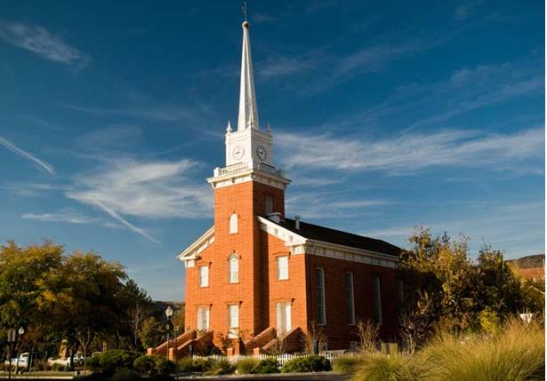
 In 1863, Orson Pratt, Amasa M. Lyman, Erastus Snow, apostles of the Church of Jesus Christ of Latter-day Saints, laid the cornerstones 18 months after pioneers arrived in St. George. Truman O. Angell, Sr., Architect. Miles Romney, Supt. Of Construction, assisted by Edw. L. Parry, Archibald McNeil, Samuel Judd, Wm. Burt, David Milne and many others. Peter Neilson gave $600 cash. Tower capstone laid Dec. 1871. Costing over $110,000, it was dedicated 14 May 1876 by Brigham Young Jr.

Historical Marker Text (2):

Brigham Young’s purpose in building this tabernacle was to provide an ornament to the city. It’s 3 foot thick basement walls of hand-cut limestone bear individual stonecutter marks. Roof trusses were hand-hewn and the twin spiral staircases with balust-rades were also hand-carved. The ceiling and cornice work were locally cast, but the 4-faced clock was made in London. Started in 1863, the building was completed in 1871.

Photo Credit: LDS.org (accessed on 9.19.16)

Extended Research:

 In the fall of 1862, Brigham Young asked the settlers of southern Utah to build a tabernacle, stating that it “will be not only useful but also an ornament to your city and a credit to your energy and enterprise.”[1] Asking the settlers of St. George to begin building a tabernacle within a year of their arrival meant that President Young intended this settlement to be permanent. Brigham Young remained intimately involved in the planning and construction of the St. George Tabernacle until its completion and provided encouragement and needed resources to the workers. St. George residents built the tabernacle while they were living in tents, sleeping on the ground, and trying to establish their own farms and businesses.

Brigham Young served as the initial architect of the building, in collaboration with Erastus Snow, leader of the St. George settlement. The two exchanged several letters in 1862 and 1863 discussing the type of building to be constructed, materials, dimensions, and general style. The decision to construct the building from sandstone came from these letters.

Main Hall Ceiling.

In form, the St. George Tabernacle is a typical New England meetinghouse in the Colonial-Georgian style. What makes it different from other New England meetinghouses is its monumental size and sandstone exterior. The St. George Tabernacle construction was primarily a public works project rather than being financed by individuals or private companies. Workers were paid with Church tithing funds and settlers from all over southern Utah Territory either worked on the building or provided goods to aid in its construction. The tabernacle was a public works project in part to stimulate the local economy. There were not very many business opportunities in early St. George, and many of the tabernacle construction workers were also farmers struggling to raise enough crops to support a family.

Ceiling trusses.

St. George residents began meeting in the tabernacle as soon as the building was sufficiently completed. Starting in 1869, many meetings were held in the basement as work continued on the main floor. Meetings were then held on the main floor while finishing work was completed in the basement. Meetings then moved back to the basement while finishing work was done on the main floor. The Saints met regularly in the unfinished building and were overjoyed when it was finally completed and dedicated on May 14, 1876, just a year before the completion of the St. George Temple. The St. George Tabernacle was used as a meeting place for St. George Stake meetings, ward functions, and community events through the 1970s. The Church undertook a restoration and preservation project on the tabernacle in 1992, which solidified the tabernacle’s place as a Church historic landmark.[2]

Interior Wall.

[1] Brigham Young to Erastus Snow, Oct. 1, 1862, St. George Stake Manuscript History, Church History Library.

[2] This content is pulled largely from internal training materials produced by the Church History Department of The Church of Jesus Christ of Latter-day Saints.

For Further Reference:

Primary Sources:

Minutes of meetings held in the upper room of St. George Tabernacle, 1872 December 28-29, Brigham Young office files; Journals, 1832-1877; Journals, Minutes, and Itineraries, 1844- 1877, Church History Library, The Church of Jesus Christ of Latter-day Saints., Call Number: CR 1234 1.

Brigham Young to Erastus Snow, Oct. 1, 1862, St. George Stake Manuscript History, Church History Library.

Secondary Sources:

West, Ester. Counting on faith: the story of the St. George Tabernacle windows /retold and illustrated by Ester West. Church History Library, The Church of Jesus Christ of Latter-day Saints, Call Number: M287.2 W516c 2015.

http://www.thespectrum.com/story/life/faith/2016/05/27/final-concert-fireside-st-george-tabernacle/85047148/

https://www.lds.org/locations/st-george-tabernacle?lang=eng&_r=1

https://en.wikipedia.org/wiki/St._George_Tabernacle

http://www.deseretnews.com/top/3727/10/St-George-Tabernacle-From-Spring-City-to-St-George-12-historic-LDS-sites-for-families-to-visit.html

Pine Valley Chapel

Published / by admin / 1 Comment on Pine Valley Chapel

write-up by Alan Johnson

Placed by: Division of State History, N-20

GPS Coordinates: 37° 23′ 39″ N, 113° 30′ 56″ W

Historical Marker Text:

Built in 1868. Designed after the New England Chapel pattern by Ebenezer Bryce, a ship builder, who said he was building it like a ship.

Extended Research:

In response to a call from Brigham Young, President of the Church of Jesus Christ of Latter-day Saints, a group of pioneer settlers made their way to southern Utah to colonize and serve as missionaries to the Native Americans in the area. Jacob Hamblin, William Hamblin, Isaac Riddle, and their families were part of this group. In the summer of 1855, while out herding cattle, Isaac Riddle came upon Pine Valley.  In just a few years, Pine Valley became home to an operating lumber mill that supplied some of the needed building materials for the St. George Temple and Tabernacle.

After some time, those in Pine Valley desired a permanent church building. President Brigham Young and the local church leaders, Erastus Snow and his brother William Snow supported the idea and Ebenezer Bryce was asked to plan and construct the chapel. Bryce worked out the final plans with the local church leaders and with a group of faithful workers the chapel was constructed, which is still in use today, making it one of the longest continuously operated chapels in the Church of Jesus Christ of Latter-day Saints.

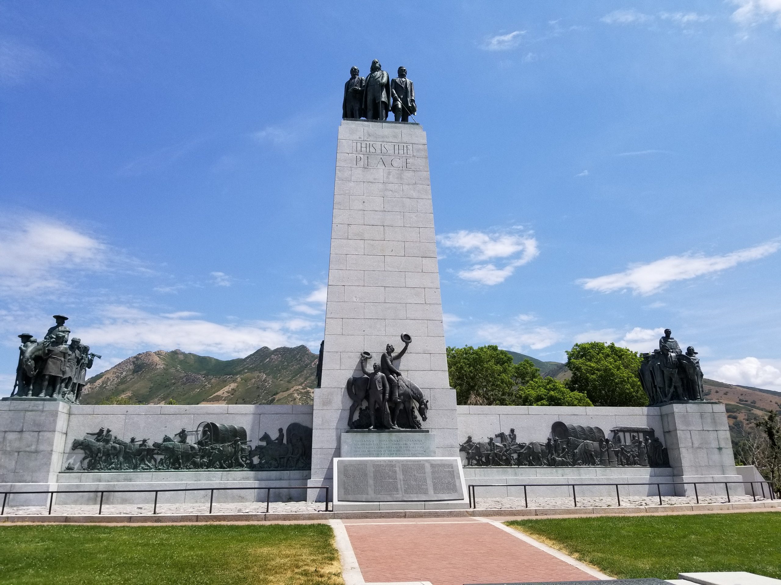
The building was rewired for electricity in the 1960s, and bathrooms were installed in the area under the exterior staircase. The small attic room (commonly called “The Prayer Room”) was also completed. In 1971, the Pine Valley Chapel was listed on the U.S. National Register of Historic Places. In 1998, a replica of the Meetinghouse was built and is found at This is the Place Heritage Park.

Additional information at the site.

The chapel received a seismic upgrade from 2000 to 2004, in which all of the windows, siding, roof and exterior siding were replaced. There were also some interior cosmetic fixes. The chapel was dedicated on May 15, 2005 by Elder Jeffrey R. Holland.

For Further Reference:

Secondary Sources:

Elder Jeffery R. Holland rededicates a chapel in Pine Valley, Utah. Spectrum (St. George, Utah), 2005 May 16.

Jensen, Cory. Ebenezer Bryce served an apprenticeship in shipyards in his native Scotland. After joining the Church and emigrating to Utah, he began construction on the chapel in Pine Valley, completing the building in 1867. Folklore about the building states that Bryce built the building like a ship. No documentation has been found to support this folklore. Heritage (Utah Heritage Foundation Newsletter). Vol. 35: No. 1 (Winter 2001), page(s) 16-17.

Utt, Emily. Pine Valley Meetinghouse and Tithing Office Statement of Significance, (2010).

Deseret News Publishing Company (2016). Beautiful little chapel. Retrieved from http://www.ldschurchnewsarchive.com/articles/47348/Beautiful-little-chapel.html

National Park Service (n.d.). National Register of Historic Places. Retrieved from http://npgallery.nps.gov/nrhp/AssetDetail?assetID=77dc0603-6087-4f56-a4bc-7b5d4508b730

Pine Valley Record. Records. Church History Library, Salt Lake City, Utah [LR 6941 2 FILMING 2]

This is the Place Heritage Park (2016). Pine Valley Chapel. Retrieved from http://www.thisistheplace.org/heritage-village/buildings/pine-valley-chapel.html

 http://loc.gov/pictures/item/md1633/

https://en.wikipedia.org/wiki/Pine_Valley_Chapel_and_Tithing_Office

Additional photos:

Interior view of the rafters.

Inside the chapel, ceiling fixtures.

Winter Home of Brigham Young

Published / by admin / 2 Comments on Winter Home of Brigham Young

write-up by Alan Johnson

Placed by: Daughters of the Utah Pioneers, No. 98
GPS Coordinates: 37°6′41″ N, 113°35′6″ W

Historical Marker Text: During construction of the St. George Temple, pres. Brigham Young found the climate in this facility beneficial to his health, and decided to have a winter home built in St. George. On December 15, 1873 he arrived from the north and moved into his new house, though still unfinished. Later he had an office built east of his home where he took care of his various duties both here and in the north. The winters which followed until his death in 1877 were enjoyed in this winter home.

Photo Credit: LDS.org (accessed on 9.19.16)

Extended Research:

 In March 1872 Brigham Young purchased the home that came to be known as the Brigham Young Winter Home. The back portion of the home was built by James Chesney in about 1866 and sold to Henry W. Lawrence in about 1868. Lawrence sold the home to Brigham Young Jr. in 1871, and Brigham Jr. then sold it to his father. The home was remodeled, more than doubling it in size to better serve President Young’s needs. Joseph W. Young, nephew of Brigham Young, was the first building contractor on the remodel. He corresponded frequently with Brigham about progress on the house, as Brigham was in Salt Lake City during most of the remodeling project. Unfortunately, Joseph died in June 1873 in the midst of the home remodel.

Brigham Young’s winter home was completed in 1874. The architect of the original structure was Miles Romney. His son, Miles P. Romney, designed the addition. The roofs are gabled and the cornices are bracketed, a style common in Utah and apparently related to the architectural style popular in Nauvoo period in Illinois during the early 1840’s. Much of the original wood remains in the home. Skilled artisans took pine, hardened it and grained it to look like oak. The local description is “Brigham Oak.”[1]

After Brigham Young’s death, members of the Young family owned the Winter Home until 1892, when it was sold to Jedediah Morgan Gates. Gates was a dentist and operated a successful practice from the home for many years. The home underwent major renovation to accommodate Gates’ family and practice. In 1955, Gates’s daughters sold the home to the Brigham Young Memorial Association. The association hoped to restore the home but found it a larger task than they could handle. Subsequently, the family association sold it to the state of Utah in 1959. The state completed the first of several restoration projects and operated the home as a state historic site for a number of years. The structure at the back of the property, now used for storage and restrooms, was completed in 1971. In 1974, The Church of Jesus Christ of Latter-day Saints acquired the home for use as a Church historic site. The home was dedicated as a Church historic site May 29, 1976, by Elder L. Tom Perry. Since that time, the home has undergone additional restorations, including efforts to bring paint colors and furnishings from Brigham Young’s time into the home.[2]

Because he headed South and managed to avoid the cold of the North during the winter months, it could be said that Brigham Young was one of Utah’s first snowbirds.

[1] http://focus.nps.gov/pdfhost/docs/NRHP/Text/71000863.pdf. Accessed on 9.19.16

[2] Some of this content comes from internal training materials produced by the Church History Department of The Church of Jesus Christ of Latter-day Saints.


For Further Reference:

Primary Sources:

Brigham Young Winter Home and Jacob Hamblin Home: Dedicatory Services, Church History Library, The Church of Jesus Christ of Latter-day Saints, M255.88 C561b 1976.

Secondary Sources:

Spencer, Clarissa Young, with Mabel Harmer. Brigham Young at Home. Salt Lake City: Deseret Book, 1940. A delightful account of life in Brigham Young’s Salt Lake household as seen through the eyes of a daughter.

http://www.deseretnews.com/article/765617684/Brigham-Youngs-winter-home-Residence-offers-visitors-glimpse-into-the-life-of-the-American-Moses.html?pg=all

http://utah.com/mormon/brigham-young-winter-home

https://en.wikipedia.org/wiki/Brigham_Young_Winter_Home_and_Office