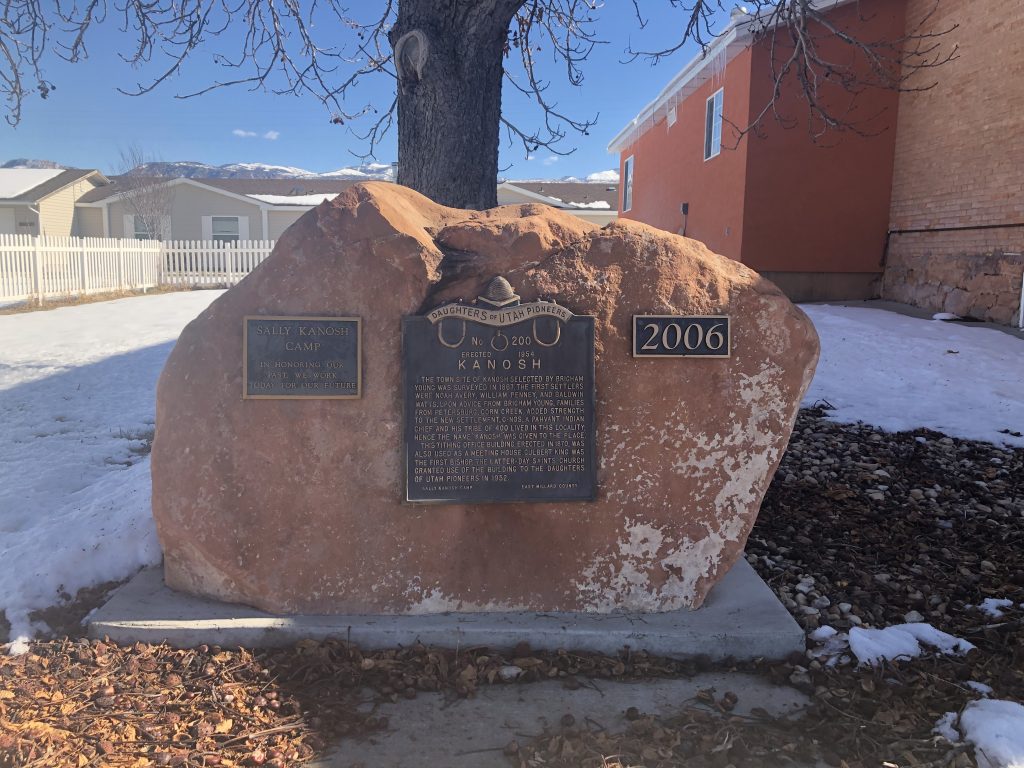
Placed By: Daughters of the Utah Pioneers, Sally Kanosh Camp, 1954
GPSCoordinates: 43°38’19.39″N 116°14’28.86″W
Historical Marker Text:
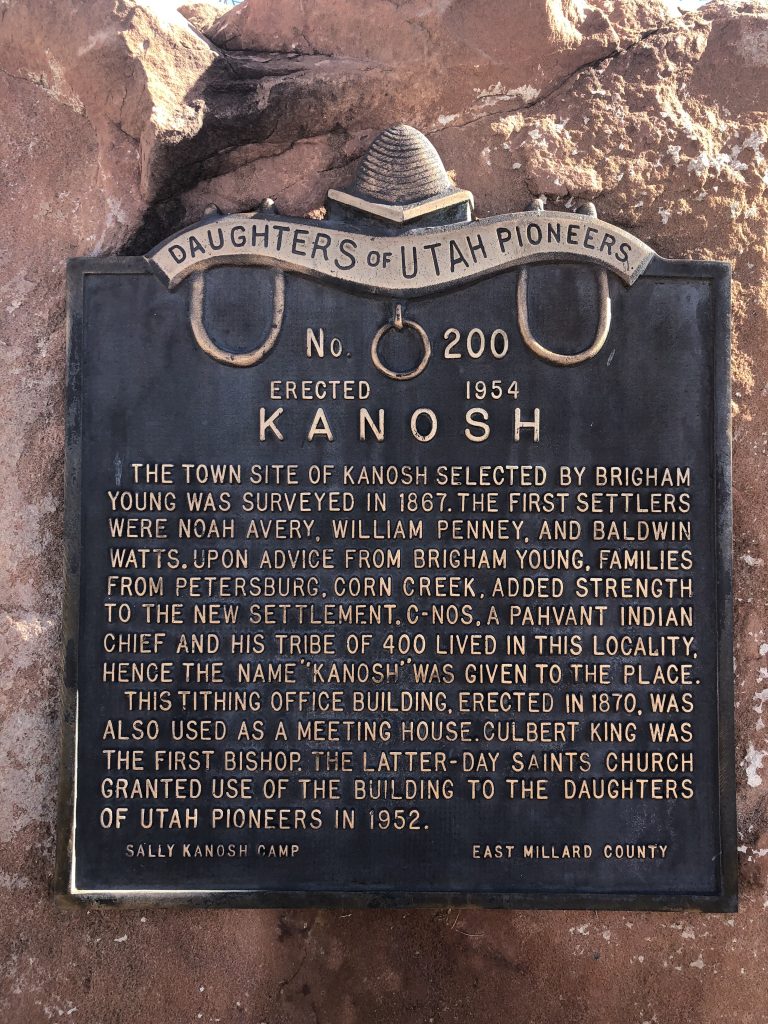
The town site of Kanosh selected by Brigham Young was surveyed in 1867. The first settlers were Noah Avery, William Penney, and Baldwin Watts. Upon advice from Brigham Young, families from Petersburg, Corn Creek, added strength to the new settlement. C-nos, a Pahvant Indian chief and his tribe of 400 lived in this locality, hence the name “Kanosh” was given to the place. This tithing office building, erected in 1870, was also used as a meeting house. Culbert King was the first bishop. The Latter-Day Saints Church granted use of the building to the Daughters of the Utah Pioneers in 1952
Extended Research:
In 1849 Brigham Young dispatched the Southern Expedition under LDS Apostle Parley P. Pratt to explore Southern Utah and investigate possible settlement locations. The expedition spent time in the Pahvant Valley in Southern Utah and there likely met Chief Kanosh, the young leader of the Pahvant Indians who occupied Corn Creek, named for the corn cultivated by the Indians along the creek. Pratt reported an extremely friendly reception from the Native Americans in the area, news which encouraged Brigham Young to establish settlements in Southern Utah.[1]
Chief Kanosh was born around 1828 to one of the wives of Kash-ee-bats, a Timpanogos Ute chief. Kash-ee-bats was assassinated in the early 1840s while Kanosh was wintering in California with his mother. Kanosh returned to Utah and over the next few years rose to the position of head chief of the Pavahnt Ute band.[2]
From his earliest contact with the Mormons, Chief Kanosh was interested in maintaining peace and fostering friendly relations. Kanosh adopted some aspects of European attire in the late 1850s and was baptized into the LDS church in 1858, though after his conversion he continued to practice many aspects of his native religion, like Shamanism and ritual hunts.[3]
Kanosh’s people had practiced horticulture long before white settlers arrived in the Pahvant Valley, growing “corn, beans, pumpkins, squashes, potatoes, &c” and showed interest in permanently adopting a settled, agricultural lifestyle. A Deseret News article from December 1851 recounts the Pahavant Chief’s desire to stop “roaming,” preferring “to be instructed in tilling the soil.”[4] In the 1850s Brigham Young established a farm for the Pahvant Indians at Upper Corn Creek.
Fillmore (18 miles northeast of present-day Kanosh) was established in 1852. In 1859 two Fillmore residents, Peter Robison and Peter Boyce, left Fillmore and established Petersburg at Lower Corn Creek, three miles southwest of the Kanosh Indian village. They were joined by Charles Hopkins, a member of the 1849 Southern Expedition party. Petersburg grew steadily until 1867 when Brigham Young spoke at a Sunday meeting on April 28 encouraging those in Petersburg to move to Upper Corn Creek, to the site that would come to be called Kanosh.[5]
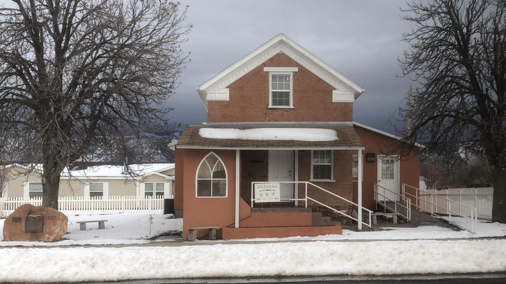
Originally the Kanosh Ward Tithing Office, now the Kanosh DUP Museum.
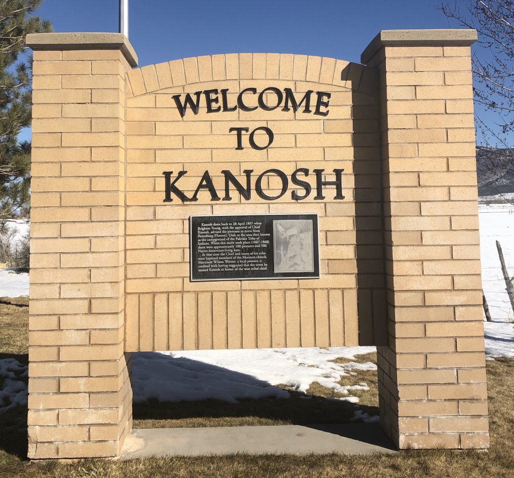
Unlike many towns, the townsite of Kanosh was surveyed in 1867 and completely plotted out before settlement began. Families received plots of land through a lottery system. By 1869 about 100 families lived in Kanosh. Mortimer W. Warner is credited with suggesting the town be named after Chief Kanosh.[6] Most families in Kanosh had small farms where they grew wheat, alfalfa, and sugar cane (processed into molasses) for family consumption. Families kept pigs and chickens, and many ran summer dairy operations in nearby canyons. The main sources of income were beef, wool and mutton.[7]
Upper Corn Creek had been occupied by Chief Kanosh and his people, but they had moved toward Meadow by the time Mormons began settling the area. In 1869 (after grasshoppers destroyed their crop in 1868) Kanosh would temporarily relocate his people to the Uintah Reservation, which had been created by President Abraham Lincoln in 1861.[8] Up until this point Kanosh had resisted relocating his people to the reservation.
Chief Kanosh married four times. His first wife was thought to be possessed by an evil spirit and executed. His third wife was executed after murdering his second wife. Finally, Chief Kanosh married Sally Young Kanosh, a Bannock Indian woman who had been raised in the home of Brigham Young’s wife, Clara Decker Young. Sally, the daughter of a chief, had been taken captive as a child by a rival Indian group and tortured before being sold to Charles Decker, Brigham Young’s brother-in-law. [9]
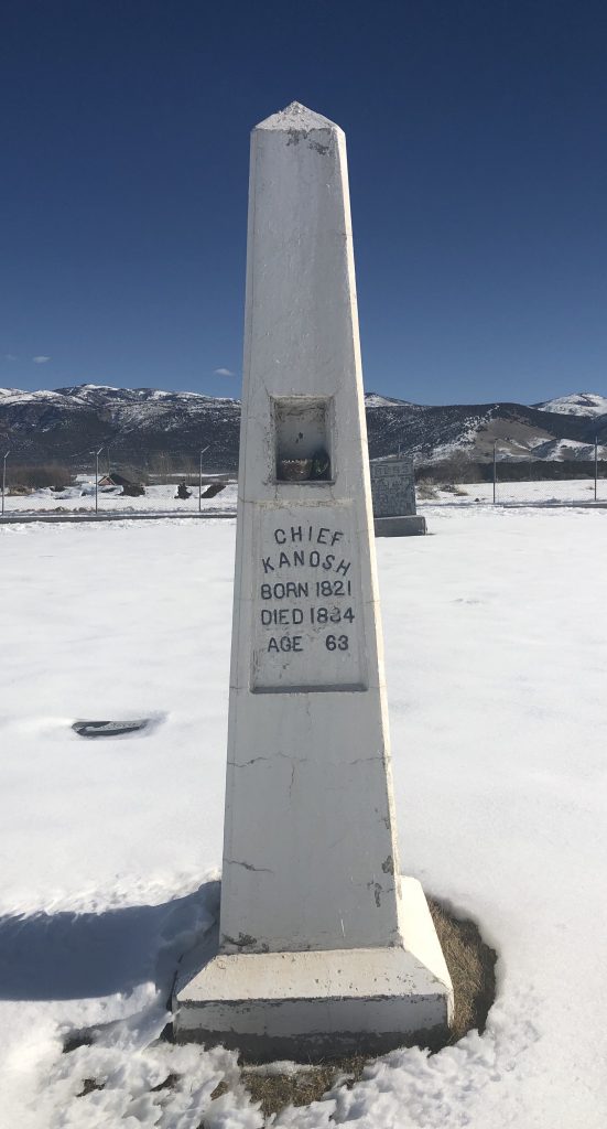
Chief Kanosh grave marker in Kanosh Cemetery.
In his final years, Chief Kanosh lived with his wife Sally in a log house in Kanosh that had been gifted to him. He died in December of 1881 and was buried in the first Kanosh cemetery, which site is now lost. Sally Young Kanosh died two years later. In 1934 the Sally Kanosh Camp of the DUP worked with the Civilian Conservation Corps camp stationed in Kanosh to erect a monument to Chief Kanosh in the city’s new cemetery.[10] The Kanosh Reservation was organized in 1929, expanded in 1935 and 1937, and would be the last reservation established in Utah until 1984.[11]
Chief Kanosh was revered by Mormons and Indians alike, and the harmony that existed between Mormon settlers and Native Americans in the area was due in large part to Kanosh. Chief Kanosh consistently chose a path of compromise with the white Mormon settlers. This willingness to be flexible allowed Kanosh and his band to foster good relations with the incoming settlers while still maintaining autonomy and independence.[12]
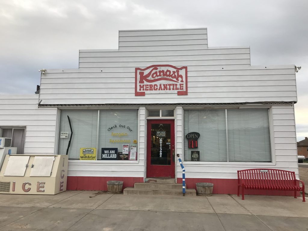
Kanosh Mercantile.
The earliest route between Salt Lake City and Los Angeles wound through the town of Kanosh. In the early 20th century, as traffic increased and the automobile became popular, this route became known as the Arrowhead Trail. In the 1920s the Arrowhead Trail became U.S. Highway 91, Southern Utah’s first paved interstate. This artery brought traffic to Kanosh, and businesses flourished. Then, in 1973, Interstate-15 replaced Highway 91. Though it followed some sections of 91, I-15 bypassed Kanosh. The rerouting of the freeway brought about the end of most businesses in Kanosh. The business sector has never recovered. The only remaining supplier of general groceries in town is Kanosh Mercantile. Most residents travel to Fillmore for necessary services and shopping.[13]
Kanosh remains a predominantly agricultural community. According to the 2010 census, the population of Kanosh was 474 and the estimated population for 2017 was 548.
[1] Edward Leo Lyman, Linda King Newell, and Utah State Historical Society, A History of Millard County, (Utah Centennial County History Series, 1999), 34-38.
[2] Edward Leo Lyman, “Chief Kanosh: Champion of Peace and Forbearance.” Journal of Mormon History 35, no. 1 (2009): 161.
[3] Hyrum S. Lewis, “Kanosh and Ute Identity in Territorial Utah,” Utah Historical Society, Volume 71, Number 1-4, (2003): 340.
[4] “Sketch of a trip to Pauvan [sic] Valley.” Deseret (Weekly) News. December, 13, 1851, 3
[5] Leavitt Christensen, Birth of Kanosh (1996), 15.
[6] Edward Leo Lyman, Linda King Newell, and Utah State Historical Society, A History of Millard County (Utah Centennial County History Series. 1999), 115.
[8] Forrest S. Cuch, David Begay, Utah State Historical Society, and Utah. Division of Indian Affairs, A History of Utah’s American Indians (Salt Lake City: Utah State Division of Indian Affairs : Utah State Division of History, 2000), 192.
[9] E. L. Black, “Life Story of Indian Chief Kanosh,” 1-2.
[11] “An Act To reserve nine hundred and twenty acres on the public domain for the use and benefit of the Kanosh Band of Indians residing in the vicinity of Kanosh, Utah” (1929); “An act to reserve eighty acres on the public domain for the use and benefit of the Kanosh Band of Indians in the State of Utah” (1935); “An Act To reserve certain lands in the State of Utah for the Kanosh Band of Paiute Indians” (1937); Cuch, Begay, Utah State Historical Society, and Utah. Division of Indian Affairs, A History of Utah’s American Indians,142.
Cuch, Forrest S., Begay, David, Utah State Historical Society, and Utah. Division of Indian Affairs. A History of Utah’s American Indians. Pbk. ed. Salt Lake City: Utah State Division of Indian Affairs : Utah State Division of History, 2000.
Lewis, Hyrum S. “Kanosh and Ute Identity in Territorial Utah.” Utah Historical Society, Volume 71, Number 1-4, (2003): 332-347
Lyman, Edward Leo. “Chief Kanosh: Champion of Peace and Forbearance.” Journal of Mormon History 35, no. 1 (2009): 157-207.
Lyman, Edward Leo, Newell, Linda King, and Utah State Historical Society. A History of Millard County. Utah Centennial County History Series. 1999.F
For more information on roads, environment, and memory, see Rogers, Jedediah Smart. Roads in the Wilderness : Conflict in Canyon Country. 2013.
Primary Sources:
“An Act To reserve nine hundred and twenty acres on the public domain for the use and benefit of the Kanosh Band of Indians residing in the vicinity of Kanosh, Utah” (1929)
“An act to reserve eighty acres on the public domain for the use and benefit of the Kanosh Band of Indians in the State of Utah” (1935)
“An Act To reserve certain lands in the State of Utah for the Kanosh Band of Paiute Indians” (1937)
Black, E. L. “Chief Kanosh and Kanosh Town.” Utah Humanities Research Foundation 1905-04-13
Black, E. L. “Life Story of Indian Chief Kanosh.” Utah Humanities Research Foundation. 1945.
The Relief Society – Woman’s Benevolent Organization of the Church of Jesus Christ of Latter – Day Saints
Latitude: 40.76996655
Longitude: -111.89330947
Historical Marker Text (1) – Sign:
The Nauvoo Bell originally hung in the temple that Church members built in Nauvoo, Illinois, in the 1840’s. The Saints removed the bell in 1846 when they were forced to leave Illinois because of persecution. Following instructions from Brigham Young, the second company of pioneers carried the bell to the Salt Lake Valley. During their journey, they rang the bell to signal daybreak and departure and to warn that night sentries were on duty. The bell is now rung hourly as a symbol of religious freedom and is heard on KSL Radio.
This monument honors the Relief Society, an organization founded on 17 March 1842 for women of the Church. The bell tower was built with donations from Relief Society members to mark the organization’s centennial.
Historical Marker Text (2) – East Side: RELIEF SOCIETY CENTENNIAL MEMORIAL
Here in the shadow of the temple, on this spot hallowed by the tread of pioneer feet, the Relief Society – woman’s benevolent organization of the Church of Jesus Christ of Latter-day Saints erects this monument.
It stands as an expression of appreciation for the wondrous opportunities for soul growth that have come to womankind since the time one hundred years ago when in 1842 the Relief Society was organized in Nauvoo, Illinois, by the prophet Joseph Smith, who said :
“I now turn the key in your behalf in the name of the Lord and this society shall rejoice, and knowledge and intelligence shall flow down from this time henceforth… let kindness charity and love crown your works.”
In this tower hangs the famed Nauvoo temple bell whose lifetime spans a century of church history. A sentinel in the sacred temple at Nauvoo, the bell in vibrant tones rang out the changing moods of faithful saints as they experienced first peace and joy, and later the anguish of parting from all that they had toiled to build. Immediately following the original pioneers with Brigham Young at their head, came the second company in the great exodus to the west. Heading this veritable host of Israel, the bell played well its part in the westward trek. It awakened the herdsman at dawn, called the Saints from their wagons to kneel in morning prayer, rang again to start the day’s march, and in the solemn stretches of the night, it quieted the fears of the people as it warned stray Indians that the sentry was at his post.
It is with gratitude that this monument is dedicated to the thousands of unsung Relief Society heroines who over a period of one hundred years have stimulated intellectual development and given compassionate service without thought of honor or reward. These valiant women have nourished the hungry, clothed the needy, nursed the sick, buoyed up the discouraged and disconsolate, and tenderly prepared the dead for burial.
Relief Society General Presidents
1842 – 1942
Emma Smith Emmeline B. Wells
Eliza R. Snow Clarissa S. Williams
Zina D. H. Young Louise Y. Robinson
Bathsheba W. Smith Amy Brown Lyman
Historical Marker Text (3) – South Side:
BENEVOLENCE
Through Love Serve One Another
Historical Marker Text (4) – North Side: EDUCATION
The Glory of God is Intelligence
Historical Marker Text (5) – West Side:
PIONEERING
No Toil Nor Labor Fear
Extended Research:
In July of 1845, a letter from Brigham Young was published in the Millennial Star, asking the saints in Britain to donate money that would fund the making of a bell to be placed in the Nauvoo temple. Wilford Woodruff, who was the president of the British Mission was charged with encouraging the Saints to raise the funds and collect the money.1 The British Saints raised 535 pounds.2
There is some confusion as to whether the bell was purchased in England or America. Due to a letter to Woodruff, from Young which states, “I wrote you in my last letter that we intended to purchase the bell in this country and desired you to transmit the money collected for that purpose by the first safe opportunity,” it is believed that the bell must have been bought and constructed in America. However, there are accounts from others recalling “a large bell some of the brethren (missionaries) had sent from England by ship to New Orleans, thence by river steamer up the Mississippi River to Nauvoo, where it was hung, with some difficulty, in the steeple of the Temple.” There are no records of the bell’s purchase to back up either account.3
The Nauvoo Bell. Courtesy of LDS Historical Dept.
It is believed that the bell was completed and arrived in the city of Nauvoo in early June of 1846, where it was hung for a short time in the belfry of the Nauvoo Temple. In the time it was there, the bell was used to sound the alarm for anti-Mormon mob attacks. One such attack was the Battle of Nauvoo which took place in June 1846, when Hancock County settlers drove remaining Mormons from their homes at Nauvoo. The temple was eventually surrendered to the mobs, and the Saints were forced to flee. It is reported that as the mob marched through the temple, they rang the bell as a preacher shouted “Peace, Peace, Peace to all the inhabitants of the earth, now the Mormons are driven.” One man, John R. Young, as he and the other Saints were fleeing, stopped to write:
“The silvery notes of the temple bell
That we loved so deep and well;
And a pang of grief would swell the heart,
And the scalding tears in anguish start
As we silently gazed on our dear old homes” 4
It is here that the history of the Nauvoo Bell becomes murky. According to Edith Smith Eliot, the great-granddaughter of Wilford Woodruff, the bell was stolen from the temple and taken to a protestant church, where the Lamoreaux family stole it back for the LDS Church. The tale goes that “one stormy night the men gathered in secret and without horses pulled the wagon to the Church and lowered the Bell, pushed and pulled the wagon by hand to the edge of the Mississippi River and carefully concealed it in the water. Andrew Lamoreaux and his brother, David, were chosen to bring the Bell to Utah with their families, concealing the Bell in their wagon with their provisions.”5 This story, however, is most likely not about the Nauvoo Bell but actually about Hummer’s Bell, a bell made for a Presbyterian church under the direction of Michael Hummer in 1844. Somehow the history of these two bells have gotten mixed up.6
What is actually believed to have happened to the Nauvoo Bell is that in September, when Brigham Young heard that the Saints were forced out of their homes in Nauvoo, he wrote to the trustees of the Church property saying, “Since you will have no further use of the Temple Bell, we wish you to forward it to us by the first possible chance, we have much need of it at this place.” Reports from Joshua Hawkes tell us that he and a Latter-day Saint by the name of James Houton then took the bell across the Mississippi River, where it fell under the charge of Joseph P. Heywood. Heywood then took the bell to Winter Quarters.7
It is believed that the bell arrived in Winter Quarters in Nebraska Territory in December of 1846. Here, the bell was placed in the public square and was used to call members to worship services and other meetings.8
Then, in June of 1847, a wagon company led by Charles C. Rich transported the bell to the Salt Lake Valley.1 During the journey, it was attached to a wagon so that it could be rung to awaken the company each morning, signal morning prayer, to start each day’s march, and to warn the company of any Indian attacks.9
The company arrived in Salt Lake in September of 1847. The bell was then placed in a fort in the city for a short time until it was moved to the bowery on Temple Square. It remained there until the winter of 1849 -1850 when it cracked. This resulted in the bell being melted down and recast.10 The recast bell measures 23 1/2 inches tall, 33 inches wide at its base, and 2 1/2 inches thick.11 It was then placed in Brigham Young’s schoolhouse located just east of the Beehive house, in 1860.12 It remained there until 1902 when it was presented to the Utah State Historical Society, and placed in the LDS Church museum. It remained on display there for many years.13
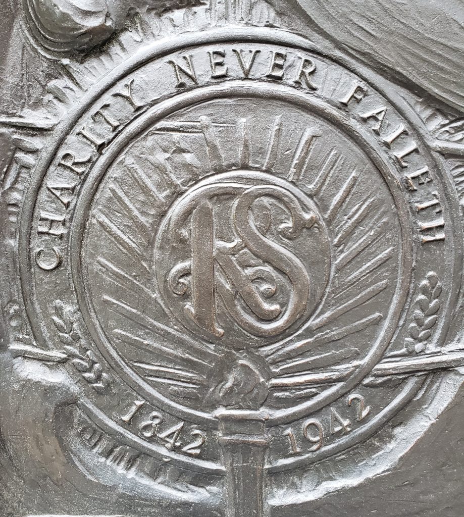
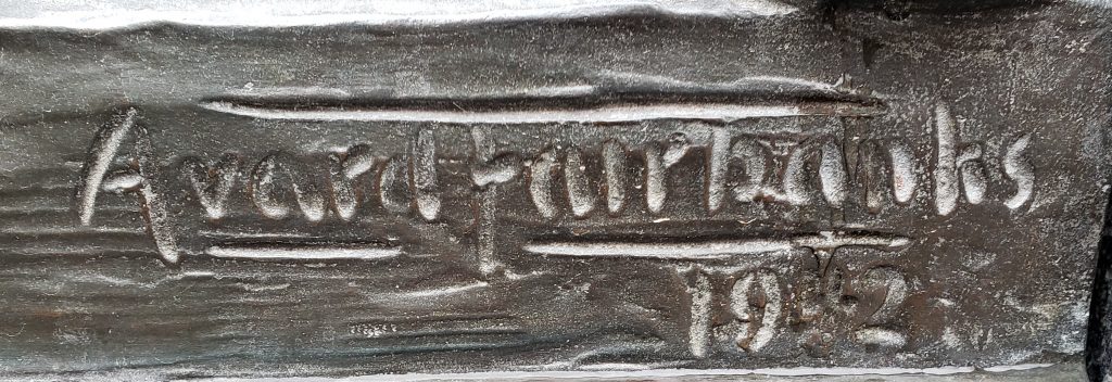
In 1941, John Taylor announced that the bell would be permanently placed in a tower on the grounds of the Tabernacle before the observance of the centennial of the National Relief Society, in 1942.14 However, due to World War II breaking out, the tower’s erection was postponed to 1966. The tower was designed by Lorenzo S. Young, grandson of Brigham Young.15 It stands 35 feet high and is located between the Assembly Hall and Tabernacle on Temple Square.16 The bronze artwork at the base of the tower was done by renowned sculptor Avard T. Fairbanks.17 The first sculpture is of the monogram RS (for Relief Society) and a picture of the Nauvoo temple. The next two sides depict the twofold work of the Relief society, education, and benevolence. And the last sculpture commemorates the Church’s pioneering spirit.18
It is believed by some that the Nauvoo Bell Tower is a response to a prophecy made by Brigham Young in which he said: “Right west of the temple … we shall build a tower and put a bell on it. … This plan was shown to me in a vision when I first came onto the ground.”
Today, the Nauvoo Bell serves as an hourly time signal for KSL TV and radio. This began in 1961 with President of the LDS church, David O. McKay presiding at the ceremonies at KSL TV.19 The tolling of the bell marks the top of each hour on KSL by use of a microphone on Temple Square. There is a 7-second delay from the sounding of the bell to the listener’s ear on the radio.20
Placed by: Daughters of the Utah Pioneers, No. 467
GPS Coordinates:
Long/Lat: N 40.71121° , W 112.09832°
MGRS: 12T VL 07224 07278
Elevation 4293 ft
Historical Marker Text:
Settlers came to this part of the valley around 1850 to farm and stock range. It was known as Pleasant Green and was part of the Brighton Ward of the Salt Lake Stake.
Traveling so far to meetings presented a problem, so members met in private homes. The Pleasant Green Branch was organized July 29, 1877, with John Hirst as presiding elder. A small adobe chapel, 40 feet by 24 feet, was built on this site, and the first meeting was held December 30, 1877. The building also served as a public school. Hirst died September 7, 1878, and Levi Nephi Hardman became presiding elder.
The Pleasant Green Ward was organized October 1, 1882, with Hardman as the first bishop. The ward also included the Hunter Precinct within its boundaries. A much larger chapel, 60 feet by 30 feet, was built in 1897, with Hiram T. Spencer as bishop. Later the small adobe chapel was dismantled. In 1898 the ward had 70 families with 340 members.
In 1904 the ward became part of Pioneer Stake. An amusement hall with spring wooden floor was begun in 1912. Oquirrh Stake was organized from Pioneer Stake in 1923, and this building also served as its stake house for thirty-two years. In 1961 a new building was completed, and this building was no longer used by The Church of Jesus Christ of Latter-day Saints.
Pleasant Green is the mother ward of all the wards in this area.
The information that exists today on the Pleasant Green Ward has been preserved because of the forethought of the Church of Jesus Christ of Latter-day Saints.
“Elder Andrew Jensen visited Pleasant Green Nov. 23, 1894, in the interest of Church history, and met in a special meeting with the following residents of the ward, who imparted historical information: Bishop Hiram T. Spencer, John Hirst Jr., Peter LeCheminant, William Jenkins, George W. Perkins, Samuel B Taylor, James Bertoch, Lehi N. Hardman, George A. Heid and Edward Lambert.”[2]
The information preserved by Elder Jensen’s notes and the Pleasant Green Ward’s minutes are the main sources of knowledge on the historic Pleasant Green Ward.
The eventual construction of a chapel for members of the Church of Jesus Christ of Latter-day Saints in the Pleasant Green area was an outgrowth of settlement in the western part of the Salt Lake Valley beginning in the 1850s. The area around the Pleasant Green Ward building was first settled in 1853 by William G. Young who located a ranch about 2.5 miles northwest of the current building’s location.[3]
Initially settlers traveled considerable distances on Sundays to attend worship services. Attending meetings with the Brighton congregation proved difficult for people from Pleasant Green due to its distance, roughly twelve miles away. In 1872, after John Hirst settled in the Pleasant Green area, the Bishop of the Brighton Ward, Alonzo H. Raleigh, granted Hirst permission to hold meetings in Pleasant Green. These Latter-day Saint meetings were initially held in people’s homes. As time went on the meetings became more frequent and were held about once a month in a small log home built by Josiah Lees. Regular sabbath meetings were held in Lees’ log home until 1877 when the Pleasant Green meeting house was built.[4]
On July 29th, 1877 local LDS leaders reorganized the Brighton Ward and created the Pleasant Green Branch to better serve the needs of Pleasant Green settlers. John Hirst was ordained a High Priest at the same time. Later that year residents built a roughly 1,000 square foot meeting house, at a cost of $1,000. On October 1, 1882, Brigham Young Jr, an apostle of the Church of Jesus Christ of Latter-day Saints, attended meetings at Pleasant Green and organized the branch as a ward. Lehi H. Hardman was selected as the first bishop of the ward.[5]
The Pleasant Green Ward building would serve as the meeting house in Pleasant Green until 1897. With continued growth in the area the LDS Church built another chapel directly east of the meeting house. The new building was bigger, roughly 1,800 square feet, was made of brick, and could hold up to 350 people. It cost about $2,400 to build and provided additional room for the burgeoning congregation.[7]
The area surrounding Pleasant Green Ward continued to grow with new settlers; by December 31, 1900 the ward had 383 members. With rapid settlement the ward had to divide several times to better accommodate larger groups. On February 27, 1916 the ward was divided into the Pleasant Green Ward and the Magna Ward. With continued growth, the Pleasant Green Ward split into Pleasant Green 1st Ward and Pleasant Green 2nd Ward, on March 16, 1952. The Church would eventually divide the ward once again and relocate to a larger chapel. The old Peasant Green building still stands as a place of worship, but it is now under the ownership of Christ Presbyterian Church.[8]
Pleasant Green Ward, Oquirrh Stake. Pleasant Green Ward General Minutes, 1867-1951, microfilm, LR 6996 11 reel 1,Church History Library, The Church of Jesus Christ of Latter-Day Saints, Salt Lake City, Utah.
Pleasant Green Ward, Oquirrh Stake. Pleasant Green Ward Manuscript History and Historical Reports, 1855-1951, microfilm,LR 6996 2 reel 1, Church History Library, The Church of Jesus Christ of Latter-Day Saints, Salt Lake City, Utah.
Pleasant Green Ward, Oquirrh Stake. Pleasant Green Ward Manuscript History and Historical Reports, 1855-1951, microfilm,LR 6996 2 reel 2, Church History Library, The Church of Jesus Christ of Latter-Day Saints, Salt Lake City, Utah.
[1] Barbara G. Fellows, Pleasant Green Meeting House p.1. Feb. 1941. Utah State Historical Society Classified Photo Collection, Utah State Historical Society, Magna, Utah.
[2] Oquirrh Stake Pleasant Green Ward, Pleasant Green Ward Manuscript History and Historical Reports, 1894, microfilm, LR 6996 2, reel 1,Church History Library, The Church of Jesus Christ of Latter-Day Saints, Salt Lake City, Utah.
[3] Oquirrh Stake, Pleasant Green Ward Manuscript History and Historical Reports, LR 6996 2 reel 1
[4] Oquirrh Stake, Pleasant Green Ward Manuscript History and Historical Reports, LR 6996 2 reel 1
[5] Oquirrh Stake, Pleasant Green Ward Manuscript History and Historical Reports, LR 6996 2 reel 1
[6] Oquirrh Stake, Pleasant Green Ward Manuscript History and Historical Reports, LR 6996 2 reel 1
[7] Oquirrh Stake, Pleasant Green Ward, Pleasant Green Ward General Minutes, microfilm, LR 6996 11 reel 1, Church History Library, The Church of Jesus Christ of Latter-Day Saints, Salt Lake City, Utah.
[8] Oquirrh Stake Pleasant Green Ward, Pleasant Green Ward Manuscript History and Historical Reports, microfilm, LR 6996 2 reel 2, Church History Library, The Church of Jesus Christ of Latter-Day Saints, Salt Lake City, Utah.
Placed by: Daughters of Utah Pioneers, No. 84, Utah American Revolution Bicentennial Commission and Tooele City Corporation, and The National Register of Historic Places
Erected in 1867 as a county court house. Active in construction were James Hammond, William Broad, Isaac Lee, W.C. Gollaher, John Gillespie, George Atkin and John Gordon. The building was used for court house, city hall and amusement center, until 1941, when the new city hall on Main Street was completed. Later the building was turned over to the daughters of Utah pioneers for use as an amusement and meeting hall. Rock used in building was taken from settlement canyon in Tooele County.
Historical Marker Text (2):
Dedicated to the Two Hundredth Anniversary of the United States of America and sponsored by the Utah American Revolution Bicentennial Commission and Tooele City Corporation. Built in 1867 as a meeting hall, this building also served as County Courthouse and City Hall, with a jail in the rear. In 1941, the building was given to the Daughters of Utah Pioneers who have maintained it as a museum. They and Tooele City have renovated the building.
Historical Marker Text (3):
This Greek Revival temple-form building was constructed in 1867 using local stone. The belfry, added sometime after 1874, is picturesque in style and has lathe-turned posts accentuated by scroll brackets, a distinctive spindle band, and a slightly bellcast pyramid roof. The hall was built, according to a newspaper article of the time, by the citizens of Tooele “for a dancing hall, for dramatic representations and other social and intellectual purposes.” It was leased to William C. Foster and Thomas Craft but was also used for holding court and other city and country business. Live entertainment, however, proved financially unsuccessful, and by 1871 the hall was utilized primarily as a courthouse. In 1899 a new courthouse was constructed, and the building became solely the city hall. In 1942, with the construction of a new city hall, it was authorized for use as a museum by the Daughters of the Utah Pioneers. Marker placed in 1991.
Extended research:
The Tooele County Courthouse and City Hall was constructed in 1867 thanks to the combined efforts and planning of James Hammond, William Broad, Isaac Lee, William Culbertson Gollaher, John Gillespie, George Atkin, and John Gordon (Atkin and Gillespie would later serve on one of Tooele City’s first city councils; see image). Using stone sourced from nearby Settlement Canyon, they constructed the only extant temple-form city hall in Utah (and the oldest known to date)¹ with the total cost for the initial construction and furnishing of the hall adding up to $600² ($10,884.91 adjusted for the 2018 inflation rate).³
Tooele City council featuring George Atkin and John Gillespie (3rd and 6th from the right) (Photo credit: Utah State Historical Society)
The hall was meant to be used as both a social and governmental space, but due to the lack of money in the territory⁴, few Tooele residents were able to scrape together the necessary $400 to rent out the building. The hall’s managers soon found themselves unable to make ends meet and they were forced to use the building and its furnishings as collateral to pay off overdue rent to the city, in April of 1871. From then on, it was used predominantly as the county’s city hall, jail, and courthouse⁵ and was used as such until the county built a new courthouse in 1899 and a new city hall in 1941.⁶
After city officials moved to the new city hall in 1942, they granted the Daughters of Utah Pioneers a 50-year lease on the property, which they converted into a museum of local history.⁷ An addition to the building in 1975 connected it to the adjacent Sons of Utah Pioneers Museum (formerly Carnegie library), creating what is today known as Pioneer Plaza. These two museums possess a wide array of artifacts from local history, including an entire log cabin (originally built in 1855) which occupies the lot next door to the courthouse where a fire station formerly stood.⁸
[1]National Register of Historic Places Inventory-Nomination Form page 2
[2]Information from an interview I conducted on site with one of the Hall’s current docents, Judy Schneider
Placed by: The Church of Jesus Christ of Latter-day Saints.
Geographic Coordinates: 40°46’14” N 111°53’29” W
Marker Transcription:
“The temple is used by Church members for marriages and other sacred ordinances designed to strengthen families, both now and for eternity. Begun in 1853, it was completed 40 years later. Granite rock used in its construction was hauled 23 miles by ox-drawn wagons from Little Cottonwood Canyon. The walls are nine feet thick at the ground level and narrow to six feet thick at the top. The east center tower is 210 feet high and is topped by the statue of an angel heralding the restoration to earth of the gospel of Jesus Christ in the latter days.”
Extended Research
Photo Credit: Church History Library. Wilford Woodruff Journal page dated July 28th 1847.
Four days after Brigham Young entered the Salt Lake Valley, he took members of the church’s governing Quorum of Twelve Apostles with him to a site for a new temple. The original idea for a temple block included forty acres, perfectly placed so the city would grow and develop in all directions from its central location: North, South, East, and West. The location of the temple was not merely a religious center, but as Young envisioned it. It would serve as the geographic center for the entire Salt Lake Valley.[1]
The construction of the Salt Lake Temple also parallels the events that led to the development of the territory and eventually to statehood for Utah. The Salt Lake Temple’s long forty year construction process reflects the political strain that developed between The Church of Jesus Christ of Latter-day Saints and the U.S government.
Beginning of Construction
After the initial selection of a temple block in 1847 the actual construction of the temple began in 1852 when workers completed a wall surrounding ten square acres, a scaled down version of the forty acres Young originally envisioned. The groundbreaking and eventual cornerstone ceremony took place on 6 April 1853. The temple cornerstones were cut out of what is now known as Red Butte Canyon, located just east of the University of Utah.[2]
Design of the temple had started long before the actual dedication of the cornerstones. Truman O. Angell was the chief architect on the temple under the supervision of Church leaders including, Brigham Young, John Taylor, and Wilford Woodruff.[3] Young would often visit Angell and give instruction on how the temple should be constructed but would leave the interpretation of what he said up to Angell and the other architects. One of Young’s visits was documented as follows:
Sketch of temple spires.
“Brigham Young drew upon a slate in the architect’s office a sketch, and said to Truman O, Angell: “there will be three towers on the east, representing the President and his two counselors; also three towers on the west representing the Presiding Bishop and his two counselors; the towers on the east, the Melchizedek Priesthood, those on the west the Aaronic Priesthood. The centre towers will be higher than those on the sides, and the west towers a little lower than those on the east end. The body of the building will be between these and pillars will be necessary to support the floors.”[4]
Photo Credit: Church History Library. Truman Angell journal page of payments for workers.
The Romanesque and Gothic design can be attributed to Brigham Young and his missions to England. Young, served missions in England from 1839-1841 and fell in love and even obsessed over English history and architecture.[5] Young was especially enamored with Westminster Abbey in London. He even purchased an architectural guide to the Abbey itself.[6] Young sent Angell to Europe to study English and European architecture. Angell eventually returned with a negative attitude toward European architecture, but he used what he learned from his trip and developed his own style. Angell, for example, relied more on the design of the Nauvoo Temple than what he had learned in England and Europe.[7] Upon returning, Angell became more and more involved in the temple construction process. Angell kept meticulous details of the dimensions of each room, as well as the payments to each stonecutter who worked on the temple.[8] His journals reveal the commitment that Angell had to the construction process of the temple. A similar devotion was found among all of the workers of the temple.
The Utah War
The construction of the temple came to a halt in 1857 when word reached Salt Lake City that the U.S military was on their way to “subdue an alleged rebellion” in the territory of Utah.[9] In response the workers buried the foundation of the temple so as to keep the sacred ground from becoming desecrated by the incoming army. Young also charged all Latter-day Saints to evacuate the city and to be prepared to burn it to the ground if the army invaded.[10] Fortunately the army marched peacefully through an abandoned city in 1858, and construction on the temple resumed thereafter. After uncovering the buried foundation the workers discovered that the sandstone cornerstones had cracked under the weight of the dirt of the reburial. The workers thus knew that stronger cornerstones needed to be found and the old sandstone cornerstones needed to be completely replaced.
Post War Construction
Photo Credit: churchofjesuschrist.org
Heber C. Kimball, first councilor to Brigham Young, asked his fellow Saints after the discovery of the cracked sandstone: “Shall we have the Temple built of stone from Red Butte, adobes, rock or the best stone the mountains afford?” He insisted that the Latter-day Saints “build a Temple of the best materials that can be obtained in the mountains of North America.”[11] The ‘best material’ was found in the Cottonwood canyons located nineteen miles southeast of the city center, where large caches of granite rock were located and were the perfect stone from which to build a temple.[12] By 1860 teams were hauling large granite stones from little Cottonwood canyon to the temple block.[13] The granite blocks were so large and heavy a team of four oxen took three to four days to travel from the canyon to the city center with one large boulder. The construction process thus took longer than expected.[14] The first showings of the walls from the deep foundation of the temple were not seen above ground until the end of the 1867 building season.
The Transcontinental Railroad
Photo Credit: templesquare.com
The completion of the transcontinental railroad in May 1869 both delayed construction on the temple and hastened its completion. Brigham Young initially asked that all able men, even those who were working on the temple, stop and help complete the transcontinental railroad. The railroad offered paying jobs and proved a boost to Utah’s economy.[15] Young also recognized that with the development of the main rail line, smaller lines would eventually reach the Salt Lake valley and from there they would extend towards Little Cottonwood Canyon where large amounts of granite could be loaded and brought back to the temple block. The first railroad branches reached Cottonwood canyon in 1873.[16]
The Capstone
Photo Credit: chruchofjesuschrist.org
After the passing of Brigham Young in 1877, his successors oversaw the slow pace of temple construction. By the time Wilford Woodruff became Church president in 1887, the temple walls were still being built. By 1892 the three spires on the West and the East ends of the temple were completed and the famous golden statue of the Angel Moroni was set in place. The Angel Moroni is an important figure in Mormonism, believed by members of the Church of Jesus Christ of Latter-day Saints, to be the messenger sent from God to the faith’s founder, Joseph Smith to direct him where to find the golden plates, which Smith then claimed to translate into the Book of Mormon.The angel Moroni statue measures twelve and a half feet high, and was designed and sculpted by C.E. Dallin.[17]
Following the addition of the angel, Woodruff announced that the interior of the temple would be completed in one year’s time. The dedication date for the completed structure was then set for the 6th of April 1893, making it forty years to the day of the original cornerstone dedication in 1853.
The Dedication, April 6th 1893
Just as promised, the first dedicatory session of the Salt Lake Temple started on Wednesday, 6 April 1893. The interior paint of the temple must have still been drying when the first session began, given that the interior workers finished the day before the dedication. The first session was attended by the First Presidency, Quorum of the Twelve Apostles, and other authorities of the Church and their families. Within the Church of Jesus Christ of Latter-day Saints all temple dedications involve a prayer to sanctify and protect the temple.[18] After the dedicatory prayer the temple becomes operational for religious ceremonies and practices only for members of the faith who meet given requirements.[19]
The Exterior
The gothic look of the Salt Lake temple has made it one of the most unique and noticeable buildings in the city and state. Millions of people flock to Temple Square each year to see the temple for themselves. Temple architects wanted to make sure that visitors recognized that the temple was a different kind of building. The exterior was to be “widely different” from “cathedral, tabernacle, mosque or synagogue.”[20]
On the walls of the temple there are found carvings of the earth, moon, sun, stars, and clouds, all designed to remind worshipers that the work that goes on inside the temple is to lift thoughts and actions away from the world and towards deity. Also the constellation of Ursa Major is found on the West side on the center spire. The symbolism behind the constellation most commonly found in the Northern Hemisphere is meant to suggest to those that might have lost their way that the temple is a constant guiding beacon just like Ursa Major.[21] An “All seeing eye” and an opened scroll with the statement “I am Alpha and Omega” along with another carving of hands grasped together in fellowship are also found on the exterior walls of the temple, all meant to symbolize the nature of the worship performed within the walls.[22] All of these carvings were handmade out of granite stone and placed on the exterior of the temple.[23] The entirety of the Temple building is symbolic of a fortress ready to defend those who enter into the building – a fortress to protect the beliefs and to help them separate themselves from the busy city. The temple block also serves as another barrier from the world.[24]
The Salt Lake Temple is a religious building completed in the 19th century and still used today in the 21st century. Weddings and other sacred rituals are performed inside to help members of the faith to remember their God and how to return back to his presence. Being able to go inside is a sacred responsibility that members of the Church of Jesus Christ of Latter-day Saints are asked to take seriously. Visitors are welcome to visit and learn more about the temple at the visitor centers located on Temple Square.
[9] James Talmage, The House of the Lord: A Study of Holy Sanctuaries Ancient and Modern (Salt Lake City: The Church of Jesus Christ of Latter-day Saints, 1912), 126.
[10] Richard Poll, and William MacKinnon, “Causes of the Utah War Reconsidered,” Journal of Mormon History 20 No. 2 (Fall 1994): 42.
[15] Thomas Stevens, “The Union Pacific Railroad and the Mormon Church, 1868-1871: An in Depth Study of the Financial Aspects of Brigham Young’s Grading Contract and its Ultimate Settlement” (MA Thes., Brigham Young University, 1972), 102-106.
[21] Richard Oman, “Exterior Symbolism of the Salt Lake Temple: Reflecting the Faith That Called the Place into Being.” BYU Studies Quarterly 36, Iss. 4. (1996): 12.
Brown, Samuel. “A Sacred Code: Mormon Temple Dedication Prayers, 1836-2000.” Journal of Mormon History 32, no. 2 (Summer 2006): 173-196.
Hamilton, Charles Mark. 1979. “The Salt Lake Temple: An Architectural Monograph.” PhD diss., Ohio State University, 1979.
Oman, Richard G. “Exterior Symbolism of the Salt Lake Temple: Reflecting the Faith That Called the Place into Being.” BYU Studies Quarterly: Vol. 36: Iss. 4, Article 2 (1996): 7-68.
Poll, Richard D, and William P. MacKinnon. “Causes of the Utah War Reconsidered.” Journal of Mormon History 20, no. 2 (1994): 16-44.
Richards, Paul C. “The Salt Lake Temple Infrastructure: Studying It Out in Their Minds.” In BYU Studies Quarterly 36, no 2 (1996): 203-221.
Stevens, Thomas M. “The Union Pacific Railroad and the Mormon Church, 1868-1871: An in Depth Study of the Financial Aspects of Brigham Young’s Grading Contract and Its Ultimate Settlement.” MA Thesis., Brigham Young University, 1972.
Talmage, James E. The House of the Lord: A Study of Holy Sanctuaries Ancient and Modern. Salt Lake City: The Church of Jesus Christ of Latter-day Saints. 1912
Oman, Richard G. 1996. “Exterior Symbolism of the Slat Lake Temple: Reflecting the Faith That Called the Plance into Being.” BYU Studies Quarterly: Vol. 36 : Iss. 4, Article 2. 7-68.
Richards, Paul C. 1996. “The Salt Lake Temple Infrastructure: Studying It Out in Their Minds.” In BYU Studies Quarterly, 203-221. Provo, Utah: Brigham Young University.
Young Men’s and Young Women’s Mutual Improvement Associations and Utah Pioneer Trails and Landmarks Association
GPS Coordinates:
40°46’9” N 111°53’23”W
Transcript of marker:
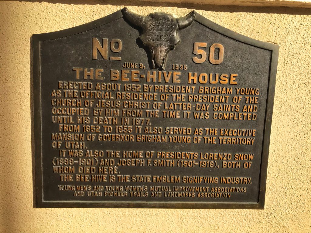
No 50 June 9, 1935 The Bee-Hive House Erected about 1852 by President Brigham Young as the official residence of the President of the Church of Jesus Christ of Latter-day Saints and occupied by him from the time it was completed until his death in 1877. From 1852 to 1855 it also served as the executive mansion of Governor Brigham Young of the Territory of Utah. It was also the home of Presidents Lorenzo Snow (1898-1901) and Joseph F. Smith (1901-1918), both of whom died here. The bee-hive is the state emblem signifying industry.
Extended Research:
The Beehive House was built in 1854 as the primary residence of Brigham Young as the first territorial governor of Utah and President of the Church of Jesus Christ of Latter-day Saints. It is located in the heart of downtown Salt Lake City at the intersection of State Street and South Temple (during the time of the home’s construction it was called Brigham Street).[1] It is a two-story building with cement coating, large wrap-around porches, and topped with a large gilded beehive which inspired its official name: the Beehive House.[2]
Figure 1: Beehive House and Eagle Gate (“Courtesy of the Church History Library, The Church of Jesus Christ of Latter-Day-Saints.”
Figure 2: Truman Osborn Angell (Courtesy of Temple Square Hospitality, The Church of Jesus Christ of Latter-Day-Saints.”)
The LDS architect of the Beehive House was Truman Osborn Angell. He was the LDS church’s resident architect and designed many of the prominent buildings in Utah Territory. His projects included but are not limited to the Salt Lake and St. George Temples; The Council House; the Social Hall; the Old Tabernacle; several meeting houses; the Utah Territorial Statehouse located in Fillmore; Brigham Young’s first grand residence, the White House; and the later addition to the Beehive house, the Lion House. Angell was a finish carpenter by trade and gained valuable experience working on various projects for The Church of Jesus Christ of Latter-day Saints, including the Kirtland and Nauvoo temples. He was called on a European mission and in addition to preaching the LDS gospel, Angell was assigned to study architecture. While Angell had close relationships with many church leaders throughout his life, the most influential was Brigham Young who married his sister Mary Ann. He enjoyed a close relationship with Brigham Young and looked up to him as a father figure.[3]
Figure 3: Interior Room of Beehive House by Michael McConkie, (Courtesy of the Church History Library, The Church of Jesus Christ of Latter-Day-Saints).
The primary function of the Beehive House was to serve as an official residence of Brigham Young in his role as both President of The Church of Jesus Christ of Latter-day Saints as well as the territorial governor. It housed a small number of his family, out of town visitors, and provided a place to entertain visiting dignitaries and celebrities. Notable visitors included President Ulysses S. Grant, William T. Sherman, Ralph Waldo Emerson, Mark Twain, Horace Greely, and Tom Thumb.[4]
Figure 4: Brigham Young’s homes, Salt Lake City (Courtesy of the Church History Library, The Church of Jesus Christ of Latter-Day-Saints.)
Brigham Young had several residences in the Salt Lake Valley as well as throughout the Utah Territory. In 1856, two years after the Beehive House was complete, he constructed the Lion House that served as housing for several of his wives and children.[5] The Beehive House however, was home to second wife (nonplural at marriage), Mary Ann Angell. She lived in the Beehive house on and off until 1860 when she moved into what was referred to as the White House (or Mansion House), a few blocks away.[6] She tended to enjoy a more secluded life and the hustle and bustle of the Beehive House did not suit her. Upon Mary Ann’s relocation, Lucy Decker, Brigham’s third wife moved in with her seven children and assumed the role of managing the home. Near this time, Brigham deeded the Beehive House to Decker.[7] She lived there until she sold it to John W. Young, a son of Brigham and Mary Ann Young.[8]
Figure 5: Beehive House (Courtesy of the Church History Library, The Church of Jesus Christ of Latter-Day-Saints.)
Brigham Young wore many figurative hats. He was a business man, provider and patriarch to twenty-seven wives (although sealed to fifty-six, only twenty-seven were a part of his households) and fifty-seven children, politician and religious leader.[9] It was his style to be all of these at all times. It was common for Brigham Young to bring up secular matters in religious sermons and vice versa. He would preach to his children and discuss politics with various family members. His finances were similarly difficult to separate. Young trusted his bookkeeper to keep clear books, but his various accounts would borrow from one another.[10] This resulted in a level of uncertainty about who actually owned his various properties. For example, who was the owner of the Beehive House? Was it Brigham Young’s family home, an official state home, or was it church property where the president resided? The answer was that it was all of these. Since Brigham Young deeded it to Lucy Decker, it can be assumed he saw it as a personal family home. This issue however did cause some disagreements after Young’s death in 1877.
Figure 6: Beehive House and Eagle Gate with Cobblestone Wall (Courtesy of the Church History Library, The Church of Jesus Christ of Latter-Day-Saints.)
Living in the home was a communal experience. Despite the fact that the Beehive House served as the official residence of only a single family, it was also considered a home of last resort for newly arriving young people from Europe that had no family or friends to stay with. Young men were given jobs and young women, much to Lucy’s chagrin became students of the art of domesticity.[11] Nearly every morning Brigham Young would eat breakfast at the Beehive House with Lucy and her children. He would then go to the office located between the Lion and Beehive Houses. He would eat dinner with nearly fifty family members at the Lion House in the evenings followed by a family prayer. This tradition was faithfully observed regardless of what was on his agenda. He would frequently put meetings on hold and join his family.[12]
Figure 7: Deseret New Clipping January 20, 1893
During the time Brigham Young lived there, the Beehive House also served as a form of refuge and security from unfriendly forces. Several times when a flag was raised above the Beehive on top of the house, hundreds of men would come and surround the house to protect Brother Brigham. To further protect the residential compound, a nine-foot cobblestone wall was built. In addition to protecting his family, it provided work for the aforementioned young men arriving from abroad.[13]
In 1888, John W. Young purchased the property from Lucy Decker. During the period of his ownership the home underwent major renovations and nearly doubled in size. In 1893, Young lost the home to pay off debts incurred in a lawsuit. The home was auctioned off and purchased by The Church of Jesus Christ of Latter-day Saints. It then served as the official residence of the President of the Church.[14] In 1900, LDS President Lorenzo Snow moved into the Beehive House and lived there until his death. His successor Joseph F. Smith lived there until is death in 1918. Heber J. Grant, Smith’s successor, chose not to reside in the Beehive House. The home remained vacant for a couple of years and underwent some minor renovations.
Figure 8: David A. Smith on porch of Beehive House (Courtesy of the Church History Library, The Church of Jesus Christ of Latter-Day-Saints.)Figure 9: President Joseph F. Smith in automobile in front of Beehive House (Courtesy of the Church History Library, The Church of Jesus Christ of Latter-Day-Saints.)
In 1920, following trends set in other cities, the Church decided to transform the Beehive House into a boarding home of sorts for women working or attending school in the city. Most young women living in the Beehive House either worked at the Church Office Building or attended LDS University. This use continued into the late 1950s.
In 1959, the Church decided to restore the Beehive House to what it was like in its original form. A group was created, mostly comprised of Brigham Young’s descendants, to discover the original structure, assemble original furniture and furnishing and design a layout using a variety of written descriptions. In 1970, The Beehive House became a part of the National Register of Historic Places. Since that time, it has been open to the public for tours.[15]
[1] Leonard J. Arrington, Brigham Young: American Moses. (Chicago, Illinois: University of Illinois Press, 1985), 169.
[2] Arrington, Brigham Young: American Moses, 170.
[3] Paul L. Anderson, “Truman O. Angell” Architect and Saint,” Supporting Saints: Life Stories of Nineteenth-Century Mormons (Provo, UT: Religious Studies Center, Brigham Young University, 1985), 133–73.
[6] John G. Turner, Brigham Young: Pioneer Prophet. (Cambridge, Massachusetts and London, England: The Belknap Press of Harvard University Press, 2012), 236.
[7] Arrington, Brigham Young: American Moses, 329.
[8] Arrington, Brigham Young: American Moses, 329; John G. Turner, Brigham Young: Pioneer Prophet, 236.
[10] Leonard J. Arrington and Ronald K. Esplin, “Building a Commonwealth: The Secular Leadership of Brigham Young,” Utah Historical Quarterly 45, no. 3 (1977): 216-232; Arrington, Brigham Young: American Moses, 178-182.
[11] Arrington, Brigham Young: American Moses, 330.
[12] Arrington, Brigham Young: American Moses, 329; John G. Turner, Brigham Young: Pioneer Prophet, 236.
Anderson, Paul L. “Truman O. Angell” Architect and Saint,” Supporting Saints: Life Stories of Nineteenth-Century Mormons. Provo: Religious Studies Center, Brigham Young University, 1985.
Arrington, Leonard J., Brigham Young: American Moses. Chicago: University of Illinois Press, 1985.
Arrington, Leonard J. and Ronald K. Esplin, “Building a Commonwealth: The Secular Leadership of Brigham Young”, Utah Historical Quarterly 45, no. 3 (1977): 216-232.
Lloyd, R. Scott. “Lecture at Church History Symposium discusses the Beehive House, the Lion House and the young women of the Church”, Deseret News, 10 March 2016.
Turner, John G. Brigham Young: Pioneer Prophet. Cambridge: The Belknap Press of Harvard University Press, 2012.
Placed by: Murray Chapter of the Utah
Sons of the Pioneers
GPS Coordinates: 40°39’25” N 111°52’36” W
Historical Marker Text:
Gold, silver, copper, lead and
zinc were found at Alta, Park City and Tintic in the years 1834 to 1869. Since no smelting was done in
the state or the surrounding area, smelters had to be built. Billy Moran built
the first smelter at 5189 South State Street on American Hill in 1869. The
Woodhall Brothers built the first furnace on State Street by Big Cottonwood
Creek June 1870. In 1871 the Germania Refinery & Wasatch Smelter were
erected west of State Street on opposite sides of Little Cottonwood Creek. The
Hanauer Smelter was built in 1872. The Horn Silver Smelter at 200 West 4800
South and the Highland Boy Plant 800 West Bullion came on stream 1880-1886.
American Smelting and Refining Company took over the Germania Plant operations
and later built a plant at 5200 South State St. which began operations in 1902.
Smelting and ore refining grew
from 0 tons to thousands of tons of ore per day. The need for smelting
eventually decreased and in November 1950, the great smelting operation at
Murray faded into History. Smelting in Murray had directly employed 10,000
people and indirectly thousands more, many of these people were pioneers who
settled in the Murray community prior to the coming of the railroad.
Extended Research:
The smelting industry developed in Murray, Utah, to extract metals from the ores produced by the mines of the Utah Territory. The arrival of the railroad in Utah greatly facilitated the development of smelting in Murray, which enabled miners to ship ore from mines such as Bingham Canyon and Camp Floyd to smelters in Murray. After the ore had been smelted into bars of metal, the smelters could ship the finished bars out on the transcontinental railroad. In the 1870’s and 1880’s, industrialists built several smelters in Murray, including the American Hill, Woodhull Brothers, Germania, Wasatch, Franklyn, and the Hanauer smelters.[1] Many of these smelters were very unprofitable in the early years. In a report to the federal government, U.S. Commissioner of Mining Rossiter W. Raymond, commented on the smelters in Murray, when he wrote, “fortunes were there lost in slags, dust, and matte.” However, technological improvements were soon able to increase the efficiency and profitability of the smelters.[2] American Smelting and Refining Company (ASARCO) bought many of Murray’s smelters as part of its efforts to consolidate the smelting industry in Murray.[3] ASARCO built its own smelter in Murray in 1902, which became the largest and most modern lead smelter in the State of Utah and became a major landmark in the city of Murray.[4]The ASARCO smelter could handle 1200 tons of ore per day through its eight blast furnaces and employed nearly one thousand five hundred people.[5]
The ASARCO smelter attracted many immigrant workers from Southern and Eastern Europe to Murray. Many of these immigrant workers lived in slum-like dwellings near the railroads and around the smelter. Most of these homes lacked running water, and indoor toilets.[6] ASARCO tried to alleviate this housing problem in 1911 by building houses for some workers, and some Greek immigrants built boarding houses for the many workers employed at the smelters.[7] Smelter workers in Murray unionized in 1900 as part of the Western Federation of Miners and went on strike three times, in 1900, 1909, and 1912.[8] The 1912 strike in particular wracked the city with intense violence as some rogue strikers attempted to dynamite the smelter and assassinate one of the company supervisors.[9] These strikes generally failed to win the workers’ demands, and after the 1912 strike, the Murray local of the Western Federation of Miners disbanded.[10]
The smelters
also made an environmental impact on the valley. In the early twentieth
century, critics of the smelters, mainly farmers, complained that pollution
from the smelters was damaging their crops. In October 1904, farmers met in
Murray to decide whether to take legal action against the smelters. One local
farmer named George Gardner stated, “If we do not fight the smelters, they will
impoverish us and kill us off. This valley will be desolated if the smelter
smoke is not stopped. I believe we should go into court and fight them to the
last ditch.”[11] The farmers won several court
cases against the smelters which resulted in the closure of the Bingham
Consolidated Smelter in 1907 and the Highland Boy smelter in 1908, but the
ASARCO smelter was able to continue operations after paying a $60,000 fine. [12]
From 1902 to 1931 the ASARCO smelter in Murray operated at near peak capacity, but as the Bingham, Park City, and Tintic mines began to run out of ore, the smelter in Murray declined. In 1931 the smelter shut down for seven months as a result of a shortage of ore. During the Great Depression, the smelter experienced many more temporary shutdowns. Production picked up during World War II, but in 1949, ASARCO announced the impending closure of the smelter, which was closed completely by November 1950.[13] The giant smokestacks of the smelter continued to stand in Murray for another half century. After voters rejected a $3.4 million bond to preserve the stacks in 1998, the city of Murray approved the demolition of the smokestacks of the smelter in August 2000.[14] The site of the old ASARCO smelter is now occupied by Intermountain Healthcare’s Intermountain Medical Center.
[1] Brian P. Winterowd, “Murray Smelters,” in The History of
Murray City, Utah, ed. Edna Mae Wilkinson (Murray, Utah: Murray City Corporation,
1976), 251-253.
[2]
Thomas G. Alexander, “Generating Wealth from the Earth 1847-2000,” in From the Ground Up: The History of Mining in
Utah, ed. Colleen Whitley (Logan, Utah: Utah State University Press, 2006),
41.
[3] David L. Schirer, The
Cultural Dynamics of Urbanization: Murray City, Utah, 1897-1919 (Salt Lake
City, Utah: University of Utah, 1991), 81-84.
This monument is dedicated to Carbon County’s proud immigrant heritage. In the early part of this century, Thirty Two nationalities lived in Carbon County. Most of them came here to mine the coal. Carbon County is Utah’s melting pot. Because of its polyglot population, refined and tempered in the melting process, the religious, social, and cultural life of Carbon County has a broader, more tolerant, cosmopolitan type of lifestyle that sets it apart from the rest of Utah. These immigrants, together with the Native Americans, have left their imprint as part of this rough, often cruel, yet proud heritage.
Extended Research
“The Biggest Little City on
Earth”
In the fall of 1914,
contractors working for Italian immigrants Charles Bonomo and Frank Viglia broke
ground on a large, two-story building on Main Street in Price, Utah.[1] Large enough for their own
grocery store and several tenants, the Viglia-Bonomo building symbolized a
tangible and permanent presence for the former miners. For Charles, who spent his
first thirteen years in America in the shallow, back-breaking coal fields of
Kankakee, Illinois, it must have been satisfying to see another man swinging a
shovel instead of him.
Near an Italian bakery, a Greek saloon, a Russian mercantile, and a French farm store, the Viglia-Bonomo building was home to a multitude of religious, ethnic, and national identities that earned Price the title of “the biggest little city on earth.”[2] Called “Utah’s Ellis Island” by historian Philip F. Notarianni, Carbon County was the gathering point for not just the Bonomo and Viglia families, but the gateway through which thirty-two different nationalities entered.[3] A jewel of diversity amidst the largely homogeneous landscape of Utah’s pioneer settlements, Carbon County’s distinct immigrant identity reveals a history that is both exemplary and cautionary. The experiences of the Viglia and Bonomo families are illustrative of both the trials and triumphs experienced by immigrants of Carbon County in the early 20th century; their photos and records—generously provided by the descendants of Charles Bonomo—will be shared in this essay.[4]
Margaret Corigliano with Charles Bonomo in 1901
The First Immigrants
In 1882, rail workers searching
for a route from Denver to Salt Lake City discovered coal in what is now Carbon
County, transforming the sparsely-settled Price river from a scenic canyon into
a worldwide labor destination. Immigrants, eager to fill the demand for cheap
mine labor, poured in from Europe, Scandinavia, and Asia. By 1900 Castle Gate
became a floodgate, with immigrants from fourteen countries laboring in coal
camps in Winter Quarters, Castle Gate, Sunnyside, and Clear Creek.
Bound together by cultural, social, and economic ties, immigrants initially lived and worked in communities that reflected their countries of origin. Slovenians initially arrived as railroad workers, then switched to coal mining to fill in the labor gap. South Slavs moved to Helper to grow their business ventures, and Finnish immigrants settled Pleasant Valley in the 1890s to work the mines in Winter Quarters and Clear Creek. At the same time, Northern Italians worked the Castle Gate mine, after which the Greeks immigrated in 1904 to replace the striking Italians. French from the Hautes-Alpes and Pyrenees prospered as sheep and goat herders. Japanese laborers, who initially arrived to work the railroads, also found success as coal miners and farmers.
The earliest of Carbon County’s mining immigrants were most vulnerable to poverty, discrimination, and poor working conditions. Language and cultural barriers inhibited immigrants from effectively advocating for improved conditions and fair labor practice. Desperate for shelter, some miners converted rail cars into homes and built hastily constructed enclosures made of tar and paper. Italians lived in “Rag Town,” a tent community in Sunnyside, and until 1915, most mining camps lacked water and electricity.
Most early immigrants to Carbon County arrived as recruits of labor agents seeking workers within their home countries. Many families of these first immigrants eventually followed, creating a ragged chain of relocation that spanned many years. Other paths to Carbon County, like those of Charles Bonomo and Greek immigrant Yoryis Zisimopoulos, took a more circuitous route. Their paths convey the often fluid, transient nature of immigrant life that many experienced before finally calling Carbon County their home.
Corigliano family with Charles Bonomo (front right)
“Pleased with Price”
When the coal seam in Kankakee, Illinois ran out in 1900, Charles migrated west to the mines in Las Animas County, Colorado, where he married Trinidad resident Margaret Corigliano. Over the ensuing years, Charles abandoned mining and entered the saloon business in Rock Springs, Wyoming where his mother and siblings immigrated. In 1908, Margaret separated from Charles and moved to Price, Utah. Charles, now the owner of a successful saloon on Front Street, sought further investments and like many in the intermountain region, he had his eye on Price, Utah.[5]
Frank Viglia with wife Anna Bernardi on July 14, 1914
In early 1914, two Italian
businessmen drove from Rock Springs to Price, Utah on an entrepreneurial
mission.[6] Price residents and
first-generation Italian merchants Frank Grosso and Frank Viglia hosted the
visitors, and procured the help of Lars Anderson, a local contractor, to
chauffeur the visitors around Price. The businessmen returned to Rock Springs
with favorable reports, and a short time later, Charles Bonomo moved to Price
and established a partnership with Frank Viglia, a relative through marriage
and a former resident of Rock Springs. With his move to Price, Charles was also
reunified with his wife and daughter Mary. It was a triumphant, if not tenuous,
fresh start.
Greek immigrant Yoryis Zisimopoulos (George Zeese) held fifteen jobs in over ten locales across the U.S. before settling in Helper, Utah. Photo courtesy of Ancestry.
The story of Greek
immigrant Yoryis Zisimopoulos is likewise a series of dead ends and new
beginnings.[7] After unknowingly taking a
job as a strikebreaker in Pawtucket, Rhode Island, he quit and moved to
Oklahoma City, then to Pueblo to work for Colorado Fuel and Iron Company. After
several miners were killed, and with more Italians, Greeks, and Slavs ready to
take their place, Yoryis, now calling himself George Zeese, crisscrossed the
nation over the next several years working in mines, farms, railroads and coffeehouses.
Suffering from corrupt labor agents, lack of work, and bad luck, he had yet to
find lasting success. Ten years and fifteen jobs later, he finally found a home
for his wife and growing family in Helper, Utah, where he and his business
partner purchased the first of eleven Success Markets. Carbon County, at last,
was the right place.
A
Connected Journey
The paths of immigrants like Charles Bonomo and Yoryis Zisimopoulos suggest the interconnected nature of the broader intermountain region that relied heavily on family and social networks. Many immigrants entered Carbon County not as fresh-faced coal miners, but as seasoned entrepreneurs who opened restaurants, purchased property, or managed stores. As Elliott Barkan suggests, “the fact that many persons were migrating not only from outside the region but also crisscrossing and resettling within the West suggest that such persons could well have established bonds that threaded the different parts of the region together, along with the many economic connections that were materializing.”[8]
For enterprising immigrants
in Carbon County, family and social ties were vital in generating opportunities
for collaboration and business partnerships. Postcards from Hiawatha, cards
from New Mexico, and photos from Trinidad and Rock Springs that survive from
the Bonomo family give evidence of strong immigrant family networks of which
Carbon County was a part.
A postcard from Katherine Corigliano De Fillippe of Starkville, Colorado to her sister Magaret Corigliano Bonomo in Rock Springs in 1909. Pictured is likely Katherine’s son Charles. Katherine’s husband, Bartholomeo De Fillippe, died the following year.
A postcard from Frank Grosso of Price, Utah to his friend Charles Bonomo a few months prior to Bonomo’s relocation to Price. Frank’s Austrian wife, Augusta Guarlenti Grosso, is pictured standing on the porch of her home in Price. Grosso, a successful investor and businessman in his own right, arrived in the United States in 1900 .
Identity and Integration
Beyond family ties,
immigrants in Carbon County found strength and unity in forming fraternal
organizations, labor unions, bands, and sports teams that identified with their
home countries. These groups functioned to foster national pride, ensure
security, and ensure cultural maintenance.[9] Gathering places like
coffeehouses, restaurants, pool houses, saloons, and saunas, strengthened
social ties both within and beyond their national identities. The relocation of
religion to houses of worship was especially vital to the Italian and Greek
communities in reestablishing ritual as a public, communal event.[10]
Frank Vigia with his brothers, wife, and children in 1914, a few years after they left the camp town of Sunnyside where Frank worked as a delivery man for a dry goods store. This portrait was taken on 15 July 1914, the same month Frank Viglia and Charles Bonomo purchased the lot for their new grocery building. Rear left to right: Frank, Peter, Alex, and Sam Viglia. Front left to right: Lotta, Anna Bernardi Viglia, Albert, and Mary Viglia. From the Viglia-Bonomo Papers.
While language barriers
confined many immigrants to their own neighborhoods, school, social events, and
even funerals encouraged intermingling beyond their immediate communities. Some
immigrant children attended Mormon Primary classes despite their religion or
nationality, while other immigrant adults preferred the familiarity of their
own religions. Most mining camps welcomed regular visits from Catholic and
Greek priests who performed ad hoc mass services in amusement halls. Castle
Gate built their own Catholic church and Sunnyside welcomed a Catholic mission.
Charles Bonomo’s niece Violet Morgando pictured in her communion dress. Rock Springs, Wyoming, 1927.
It took Charles Bonomo several years to pay off his alto saxophone from Consolidated Music Company.
Mary Viglia (2nd row, left) with her classmates in Price, Utah c. 1915. As second-generation immigrants attended school, assimilation into American culture became easier for the entire family.
Despite these advances,
mining work—and the society that came with it—often undercut immigrants’
ability to be recognized as first-class citizens. Long-time residents were
concerned about the outflow of money
to foreign countries, and the foreign influences that were flowing in. While
many were welcomed, many residents resented the instability that the labor
agents and mine owners generated.
Mine owners themselves
contributed to this tension by showing a preference for unorganized, uneducated
labor and willingness to exploit nationalities and regions against one another.
With the help of private employment agencies or independent labor contractors,
a steady stream of cheap, unorganized migrant labor could always be ensured. As
Frank Van Nuys explains, “agents [were not] averse to exploiting inter- and
intraethnic antagonisms on behalf of management, for instance when a labor
contractor imported mainland Greeks to break a Carbon County, Utah copper
strike led by islanders from Crete in 1912. The influx of different groups, in
Utah for example, frequently began with strike-breaking: Finns, Italians, and
Slavs for English, Welsh, Irish, and Americans in the 1890s, Greeks for the
Italians and Yugoslavians in 1903, and Mexicans for the Greeks in 1922.”[11] For many immigrants like
Charles Bonomo and George Zeese, the answer was to leave mining behind and
integrate themselves into the business community.
The Grocer Next Door
The respect and acceptance
Carbon County immigrants could not obtain through coal became achievable with
brick and mortar. The arrival of women to establish households, the growth of
second-generation immigrants, and the abandonment of mine labor all contributed
to greater integration of immigrants within their communities. The town of
Helper was especially welcoming to immigrant merchants. In 1903, the Helper
Gazetteer listed five foreign merchants, but by 1919, that number had grown to
thirty-five—over half of all businesses listed.[12] Compelled to engage with
all residents of Carbon County through business transactions, immigrants
transformed from the temporary foreign worker to the grocer next door.
Sam Viglia delivering groceries on a snowy day in Price, Utah.
Unidentified Italian relatives working at a service station.
Not every business was
welcome, however. The same year Charles Bonomo moved to Price, E.A. Horsley,
President of the Carbon County Stake of the Church of Jesus Christ of
Latter-day Saints decried the influence of saloons in Helper and Price, saying,
“I saw men [in Helper] on the Sabbath Day lying around in a drunken
condition…Conditions in Price may not be of the best, but in the language of
the street Helper ‘had us skinned seven blocks’ …So much unfavorable
notoriety has been published from this town that when I go into Salt Lake and
people ask me where I am from and I say Price, they exclaim, ‘Oh, for Lord’s
sake!’”[13] In the end, Horsley was
not successful in convincing Carbon County to become “dry”.
Charles Bonomo’s in-laws in the saloon business in Trinidad, Colorado. The Corigliano brothers c1910.
Becoming “American”
Stuck between maintaining
cultural ties and adapting to their American environment, immigrants in Carbon
County struggled to identify and achieve what was becoming the moving target of
Americanism. As Philip Notorianni explains,
“The desire for cultural maintenance
was natural, but the realities of the new environment often produced irony in
the attempt. In trying to maintain and foster cultural ties, immigrants altered
or adapted to new conditions, customs, traditions, and beliefs; thus their
practices were assuming new meaning and form. Gradual change occurred as
immigrants came into contact with American institutions and ideas, but those
who favored 100 percent “Americanization” of the new immigrants sought to
expedite the process by the abrupt stripping away of cultural differences.”[14]
The Greeks and Italians were especially nationalistic and saw themselves as emissaries of their native culture. Mark I. Choate explains the nature of Italian emigration as an expansion of Italy itself: “For the Italian state, emigration represented not just physical movement beyond the Italian peninsula, but a cultural and economic enlargement of Italy worldwide….At the high point of Italian migration from 1880 to World War I, the Italian state viewed migration as a form of colonialism…”.[15] This competing nationalism suggests that the Italians not only wanted to become American, they sought to make America more Italian. With each passing generation, however, immigrant families inevitably adapted while their native identities diminished over time.
Through the lens of clothing and aesthetics, the following photos from the Viglia Bonomo Papers suggest a hybrid of both Italian and American identities.
The Price Boys
Despite significant strides by many immigrants in Carbon County, many still received criticism for not being “American” enough. The advent of World War I further amplified this rhetoric as concerns over loyalty emerged. By 1917, the move toward Americanization merged with the war effort, amplifying expectations that immigrants should display their loyalty to America through war service. As nativist sentiment grew across America, the pressure of war emphasized the responsibility of the foreign-born to do all of the melting in the melting pot.[16]
A postcard from Camp Kearney from Alex Viglia to Mary Bonomo. Above is evidence that many of their family and associates served in the armed forces.
Immigrant enlistment in World War I was one avenue that instantly silenced calls for immigrant Americanization. Brothers Sam and Alex Viglia were among many Carbon County residents to enlist, earning them credibility and admiration among Price’s citizens. Carbon County newspapers gave updates on their war service, including family members in Price who shared postcards and letters with the local papers.
Following World War I,
nativist sentiment increased dramatically, resulting in a more restrictive
immigration policy, mandated “Americanization” classes, and greater hostility
toward minority groups—especially southern European immigrants. For many
immigrants of Carbon County, it was a time of contingency. By the 1920’s
Charles Bonomo was a successful merchant and real estate investor. His family
chose to remain in Price. Following some legal challenges related to the
Viglia-Bonomo building, Frank Viglia and his family moved to San Francisco in
1924. Two of Frank’s brothers returned to Italy, married, and raised families.
Another branch of the Viglia family moved to Mexico to escape the
discrimination they faced in the New Mexico mines.
Charles Bonomo’s path to
Carbon County was not a simple one: the
currents that guided him to settle in Price were a mix of family dynamics,
economic opportunity geography, and connectedness to their Italian relations
and friends. His story—like stories of most Carbon County immigrants—has
elements both unique and typical to the immigrant experience. In the end, Carbon
County largely embraced immigrants like Charles and gave space to the complex
and diverse identities that exist today. Historian Sarka B. Hrbkova
acknowledges this complexity, writing, “It is indeed a problem to make
Americans of these surging, ebbing, responsive, sullen, singing, cursing,
sorrowing, carousing, harmonious, disputatious elements, some coming from lands
of liberal thought, others from age-old autocracies—all of them with dreams of
a more or less realizable Utopia, which the magic word ‘America’ spells to
them.”[17] The tolerant and
progressive nature found in Carbon County was that sort of Utopia for many, setting
it apart from the rest of Utah in its broad embrace of what it means to be a
Utahn.
Notes
[1] The Carbon County News, “City and County,” November 11, 1914.
https://www.newspapers.com/clip/31022342/the_carbon_county_news
[2] Carbon County News,
“Why You Should Invest Your Money in and Live in Price, Utah” November 11 1913,
8. https://www.newspapers.com/clip/31020374. The phrase “biggest little city on the earth”
began to appear in Carbon County newspapers in 1913, and was added to the
masthead of the Eastern Utah Advocate on 3 July 1913 when the newspaper came
under new ownership.
[3] Philip F. Notarianni, “Utah’s Ellis Island: The
Difficult Americanization of Carbon County,” Utah Historical Quarterly
Vol 47, no. 2 (Spring 1979), 178-192.
[4] Except where noted, all images are from the Viglia-Bonomo Archive, Kindex, https://bonomo.kindex.org/. Original owner, Kay Cafarelli, granddaughter of Charles Bonomo. Original papers in possession of family friend Christina Mickleson. Digitized and archived by Cathy Gilmore, owner Kindex LLC. For further information on these families see their family tree on Ancestry: https://www.ancestry.com/family-tree/tree/120287259/family.
[5] Carbon County News, “Our Reasons Why You Should Invest Your Money in and Live in Price,
Utah”. The article touts its progressive citizens, schools and religious
institutions, business savvy, and rich natural resources as reasons to invest
in Carbon County.
[15] Mark I. Choate, “The Frontier Thesis in Transnational
Migration: The U.S. West in the Making of Italy Abroad” in Immigrants of the
Far West: Historical Identities and Experiences, Ed. by Jessie L. Embry and
Brian Q. Cannon. (Salt Lake City: University of Utah Press, 2015), 365.
Viglia-Bonomo Papers,
private collection of Kay Cafarelli, loaned by Christina Micklesen, Salt Lake
City, Utah. Digital images hosted courtesy of Kindex at viglia.kindex.org.
Secondary Sources
Alexander, Thomas G. “From Dearth to Deluge, Utah’s Coal Industry,” Utah Historical Quarterly 31 (1963).
Bapis, Elaine M. “In the Hands of Women: Home Altar Tradition
in Utah’s Greek Orthodox Homes.” Utah Historical
Quarterly 65 (1997): 312-34.
Barkan, Elliot. From All Points:
America’s Immigrant West, 1870s–1952. Bloomington: University of Indiana
Press, 2007.
Carbon County Commission Company. “Our Reasons Why You Should Invest Your
Money in and Live in Price, Utah.” Carbon
County News. November 11 1913. https://www.newspapers.com/clip/31020374.
Choate, Mark I. “The Frontier Thesis in Transnational Migration: The U.S.
West in the Making of Italy Abroad” in Immigrants
of the Far West: Historical Identities and Experiences, edited by Jessie L.
Embry and Brian Q. Cannon. Salt Lake City: University of Utah Press, 2015.
“City and County.” The Carbon
County News. October 1 1914.
https://www.newspapers.com/clip/31022342/the_carbon_county_news/.
Eastern Utah Advocate. “President Horsley Wants Closed Town.”
Newspapers.com. March 12 1914. Accessed April 26, 2019. https://www.newspapers.com/clip/30976950/eastern_utah_advocate.
Guglielmo, Thomas A. White on
Arrival: Italians, Race, Color, and Power in Chicago, 1890-1945. New York: Oxford
University Press, 2004.
Notarianni. Philip F. “Italianita in Utah: The Immigrant Experience,” in
Helen Papanikolas, The Peoples of Utah,
Salt Lake City, UT: Utah State Historical Society, 1976.
Notarianni, Philip F. “Utah’s Ellis Island: The Difficult Americanization
of Carbon County.” Utah Historical
Quarterly, Winter 1979.
Orsi, Robert Anthony. The Madonna
of 115th Street: Faith and Community in Italian Harlem, 1880-1950. New
Haven: Yale University Press, 1985.
“Pleased with Price.” The Carbon
County News. April 9 1914.
https://www.newspapers.com/clip/30288569/the_carbon_county_news.
Van Nuys, Frank. Americanizing the
West: Race, Immigrants, and Citizenship, 1890-1930. Lawrence: University
Press of Kansas, 2002.
Vecali, Rudolph J. “European Americans: From Immigrants to
Ethnics,” in William H. Cartwright and Richard L. Watson, Jr., eds., The Reinterpretation of American History and
Culture. Washington, D.C: National Council for the Social Studies, 1973.
Watt, Ronald G. A History of Carbon County. Salt Lake City: Utah State Historical Society, 1997.
Marker originally placed by: Jared Warburton, 1997
Battle Creek monument text
Marker Text:
“This monument is in memory of the first armed engagement between the Mormon pioneers and the Native Americans that inhabited Utah Valley, and serves as a reminder of the extreme sacrifice given by both people. This skirmish at the mouth of Battle Creek Canyon gave it its name.”
Extended Research
Kiwanis Park at Battle Creek
Battle Creek, which is now known as Pleasant Grove, was the site of the first battle between Native Americans and Utah pioneers. Mormon (LDS) leaders in Salt Lake City ordered militiamen to investigate reports in Utah Valley that Indians were killing cattle and that they had stolen Brigham Young’s horses. The accusation of horse theft proved untrue. As a result, the militiamen received new orders from Salt Lake City “stating that as the horses were not stolen . . . we need not spend any more time in search of them.” They were, however, directed to continue the expedition to investigate the killing of cattle. As Hosea Stout, one of the militiamen recalled, “the nature of our expedition was not in the least changed.”(1).
Battle Creek Marker
After a few days of travel, the militiamen made it to what is now American Fork and rested over night with a band of Ute Indians. Hosea Stout wrote, “the Company [got] an early start and traveled south to the Provo, a fine large stream and well timbered in the valley. This is a beautiful farming country. Here we found the Utahs, who . . . received us friendly but were much excited being evidently afraid of us. After spending an hour or so with them and learning what we could, respecting those we were in pursuit of and also explaining the object of our visit we traveled on. Little Chief accompanied us about three miles up the Provo where we encamped for the night”(1).
The militiamen split into two groups after they came upon a few Native Americans at Battle Creek Canyon who were still sleeping. When the Indians awoke and saw that they were surrounded by white men they tried to flee farther up the canyon, only to find another group of militiamen waiting for them. Before fighting began, an interpreter from among the militia tried to get the Native Americans to surrender.
As Hosea Stout recalled: “Our interpreters talked to them and told them our errand, and asked them to give themselves up. They refused. Our guide talked to them and reasoned with them, but all to no purpose, fight they would unless we went away, then they said they would come out. The guide told them they must come out then or die. . . . The first one shot was their leader. Then such a howling and crying, I think white men never heard before” (1).
After fighting broke out there were several casualties according to Oliver B. Huntington:
“All the bodies we could find were carried together to one place for burial: seven great, fat stout men. . . . When we got back to where we left the dead, there was neither dead nor living anywhere to be found. We did not think them worth hunting for anymore, and started home.” (2).
Mormon pioneers soon settled the land in Utah Valley because of the richness of the soil that militiamen witnessed on this expedition. Brigham Young had already planned to expand further south. As one history of Provo recounted, “Initial Mormon settlement thus was on the site of Salt Lake City. Nevertheless, Young planned to explore all valleys, and, when opportunity permitted, establish settlements in those sufficiently well-watered” (3). Mormon leaders selected Utah Valley as one area for settlement which led to further conflict with Ute Indians in the region.
Battle Creek falls
Battle Creek remained the name of the area until years later when Mormon pioneers decided to change it to Pleasant Grove. The monument that is left at the base of Battle Creek Canyon, which leads to Battle Creek Falls, stands as a reminder of the first battle fought between Mormon pioneers and Native Americans. It also serves as a reminder that Mormon settlement came at a significant cost to Native Americans, in loss of life, land, and culture.
SOURCES
On the Mormon Frontier, The Diary of Hosea Stout, 1844–1861, Vol. 2, Edited by Juanita Brooks, (Salt Lake City: University of Utah Press, 1964), 344-347.
Diary of Oliver B. Huntington, 1847–1900, Vol. 2, L. Tom Perry Special Collections, Harold B. Lee Library, Brigham Young University, Provo, Utah, 47–55, 331-341.
First Icelandic Settlement Monument, Spanish Fork, Utah
Write up by Charles O. Wolfgramm
Placed By: Daughters of Utah Pioneers
GPS Coordinates: N 40° 06.280 W 111° 38.458
Historical Marker Text: First Settlement of Icelanders in the United States. Leif Eiriksson, an Icelander, discovered America in 1000 a.d. Eight centuries later 1855-1860 sixteen pioneers from Iceland established in Spanish Fork the first permanent Icelandic settlement in the United States. They were Samuel Bjarnason & wife Margaret; Thordur Didriksson & wife Helga; Gudmundur Gudmundsson; Loftur Jonsson & wife Gudrun; Jon Jonsson & wife Anna; Gudrun Jonsdottir; Magnus Bjarnason & wife Thuridur; Vigdis Bjarnadottir (Holt); Gudny E. Halfidiason; Ragnhildur S. Hanson and Mary H. Sherwood.
Mt. Flonette Camp & the Icelandic Association
Extended Research:
On September 7, 1855 the first immigrants from Iceland arrived in Utah Territory, and between 1855 and 1914 there was a total of 410 Icelandic immigrants that made this journey. All of the Icelandic immigrants that came to Utah Territory were converts to the Church of Jesus Christ of Latter-day Saints, and they were sent by the leaders of the church to Spanish Fork. This was a perfect community for these new Icelandic immigrants because it was already home to immigrants from Scandinavian countries, so they were able to share some common cultural values. The Icelandic marker was placed in Spanish Fork on August 1, 1938 by the Daughters of the Utah Pioneers and the Icelandic Association of Utah. The monument is a lighthouse with a viking ship on top of the lighthouse. There are sixteen names listed as the first Icelandic immigrants to arrive in Utah. Lighthouses are located all over Iceland because of its location in the middle of the northern Atlantic Ocean, so this is an appropriate monument to remember the Icelandic members of the Church of Jesus Christ of Latter-day Saints.
Iceland is geographically isolated from other Scandinavian countries, but similarities between Iceland and Scandinavia still exist. Religion is one example. The Lutheran Church dominates in most Scandinavian countries and this is also true for Iceland where eighty percent of the population are members of the Lutheran Church. Other religions can have a difficult time gaining converts because of the popularity of the Lutheran Church in Iceland. Icelandic citizens might even have to leave the country in order to be exposed to other religious beliefs. This is how Guðmundur Guðmundsson, the first Icelander to join the Church of Jesus Christ of Latter-day Saints, learned of the upstart American born faith. He was born in Iceland, but his conversion happened in Denmark.
Guðmundur was born in 1825 in a farm town in Artun in the Rangarvalla district of the Oddi Parish in Iceland. He was baptized a member of the Lutheran Church a few months after he was born. He left Iceland as a teenager to be educated and pursue a career as a goldsmith in Denmark. While in Denmark he converted to Mormonism. Around the same time, Guðmundur’s childhood friend, Pórarinn Hafliðason, also converted in Denmark. The two friends reunited and were called to survive as missionaries for their new found faith in Iceland. The new Icelandic converts were not very successful in the mainland of Iceland so they went to an Island called Vestmannaeyjbaer or Westman Island, southwest of the capital Reykjavik, .
The two missionaries were able to find many new converts in this part of Iceland but they did face a lot of opposition form the established church in the area. Samuel and Margret Bjarnason, along with Helga Jónsdóttir who were converted on the island by the two native missionaries were the first Icelandic members to make the move to Utah. Samuel and Margret arrived in Utah on September 7, 1855 and were told by Brigham Young, the leader of the LDS Church to go and settle in Spanish Fork. Scandinavian saints were already in the area and so Brigham Young felt this would be a great place for the Icelandic saints to build a community. Hundreds of Icelandic Saints would eventually make their way to Utah in the following years until about 1914 when WWI began. During this same time the Icelandic Mission of the Church of Jesus Christ of Latter-day Saints was closed due to the war, and general immigration from Iceland ended.
Einar Eiríksson was the last missionary to serve in Iceland before the outbreak of World War I in 1914. Courtesy of the Icelandic Association of Utah
For the next fifty years the LDS Church did not exist in Iceland. In 1977 Iceland was again dedicated for Mormon missionary work to continue. Twenty years later in 1997 the president of Iceland and his wife were invited to celebrate Iceland Days marking the centennial of the first Icelandic members of the LDS Church to settle in Spanish Fork.
Finally on June 30, 2000 a monument was erected with the names of 410 Icelandic Mormons who made the journey from the Westman Islands to Utah Valley between 1857 and 1914.
This monument is a testimony of the faith and dedication of the Icelandic members of The Church of Jesus Christ of Latter-day Saints who sacrificed so much for their beliefs.
( This rock was transported from the Westman Island. It is significant because the first baptism for The Church of Jesus Christ of Latter-day Saints in Iceland was Performed in the Westman Island. The rock is a volcanic rock from the Westman Island. In 1973 the Eldfell Volcano on the island erupted and this almost lead to a permanent evacuation of the Westman Island.)
Primary Sources:
Autobiography of Peter Gottfredson, Church History Library, Church of Jesus Christ of Latter-day Saints, Salt Lake City, Utah.
Letter from Charles R. Savage to John Taylor, Millennial Star 18, no. 13 (1856): 206.
Manuscript History of the Icelandic Mission, 1851–1914, Church History Library, Church of Jesus Christ of Latter-day Saints, Salt Lake City, Utah.
“Preaching in Iceland,” Millennial Star 64, no. 27 (1902): 427–28.
“The Icelanders,” Millennial Star 48, no. 32 (1886): 507.
“The Life of Einer Erickson,” 21—23, L. Tom Perry Special Collections, Brigham Young University, Provo, Utah.
Torgeirson, John. “The People of Iceland,” Deseret Evening News, 24 January 1887, 2.
Secondary Sources
Carter, Kate. “The First Icelandic Settlement in America,”Our Pioneer Heritage, (Salt Lake City: Daughters of Utah Pioneers, 1964), 7:477—556.
Mulder, William. Homeward to Zion. Minneapolis: University of Minnesota Press, 1957.
Woods, Fred E. “Icelandic Conversion and Emigration: A Sesquicentennial Sketch,” in Regional Studies in Latter-day Saint Church History: Europe, ed. Donald Q. Cannon and Brent L. Top (Provo, UT: Religious Studies Center, Brigham Young University, 2003), 1–21.
Warning: Attempt to read property "comment_ID" on null in /home/wpaulree/UtahHistoricalMarkers.org/wp-content/plugins/subscribe-to-comments/subscribe-to-comments.php on line 81
Warning: Attempt to read property "comment_ID" on null in /home/wpaulree/UtahHistoricalMarkers.org/wp-content/plugins/subscribe-to-comments/subscribe-to-comments.php on line 81
Warning: Attempt to read property "comment_ID" on null in /home/wpaulree/UtahHistoricalMarkers.org/wp-content/plugins/subscribe-to-comments/subscribe-to-comments.php on line 81
Warning: Attempt to read property "comment_ID" on null in /home/wpaulree/UtahHistoricalMarkers.org/wp-content/plugins/subscribe-to-comments/subscribe-to-comments.php on line 81
Warning: Attempt to read property "comment_ID" on null in /home/wpaulree/UtahHistoricalMarkers.org/wp-content/plugins/subscribe-to-comments/subscribe-to-comments.php on line 81